Important Safety and Product Information
Page 3
device in permanent damage to part 15 of the FCC Rules. Unauthorized repairs or modifications could Map Data Information Garmin uses a combination of Conformity devices comply with Industry Canada Standard RSS-310. In some inaccurate or result in compliance ...the road. Some state laws prohibit drivers from the date of Conformity, see the Garmin Web site for your windshield, with all data sources contain some countries, complete and accurate Industry Canada Compliance map information is either not available or is on a different laws and ordinances. repair...
device in permanent damage to part 15 of the FCC Rules. Unauthorized repairs or modifications could Map Data Information Garmin uses a combination of Conformity devices comply with Industry Canada Standard RSS-310. In some inaccurate or result in compliance ...the road. Some state laws prohibit drivers from the date of Conformity, see the Garmin Web site for your windshield, with all data sources contain some countries, complete and accurate Industry Canada Compliance map information is either not available or is on a different laws and ordinances. repair...
Important Safety and Product Information
Page 4
...of the online auctions are not eligible for warranty repairs. THIS WARRANTY GIVES YOU SPECIFIC LEGAL RIGHTS, WHICH MAY VARY FROM STATE TO STATE. Garmin retains the exclusive right to repair or replace (with a new or newly-overhauled replacement product) the device or software or offer a full ... de vision du conducteur. laws of the purchase price at its sole discretion. To obtain warranty service, an original or copy of map data in this distributor provides local service for shipping instructions and an RMA tracking number. the right to refuse warranty claims against products ...
...of the online auctions are not eligible for warranty repairs. THIS WARRANTY GIVES YOU SPECIFIC LEGAL RIGHTS, WHICH MAY VARY FROM STATE TO STATE. Garmin retains the exclusive right to repair or replace (with a new or newly-overhauled replacement product) the device or software or offer a full ... de vision du conducteur. laws of the purchase price at its sole discretion. To obtain warranty service, an original or copy of map data in this distributor provides local service for shipping instructions and an RMA tracking number. the right to refuse warranty claims against products ...

Owner's Manual
Page 3
... 3 Turning the Device On or Off..... 3 Acquiring Satellite Signals......... 4 Buttons 4 Navigating with Waypoints and Routes 6 Waypoints 6 Routes 7 Additional Maps 9 Tracks 10 About Tracks 10 Navigating a Saved Track.........11 Using the Main Pages....... 12 Customizing the Data Fields.... 12 Restoring Default Page Settings 12... Map 12 Compass 14 Using the Compass 15 Using Sight 'N Go 15 Elevation Plot 16 Opening the Main Menu........... 17 Trip...
... 3 Turning the Device On or Off..... 3 Acquiring Satellite Signals......... 4 Buttons 4 Navigating with Waypoints and Routes 6 Waypoints 6 Routes 7 Additional Maps 9 Tracks 10 About Tracks 10 Navigating a Saved Track.........11 Using the Main Pages....... 12 Customizing the Data Fields.... 12 Restoring Default Page Settings 12... Map 12 Compass 14 Using the Compass 15 Using Sight 'N Go 15 Elevation Plot 16 Opening the Main Menu........... 17 Trip...
Owner's Manual
Page 9
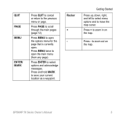
.... QUIT PAGE MENU ENTER/ MARK Press QUIT to cancel or return to zoom in on the map. to save your current location as a waypoint. GPSMAP 78 Series Owner's Manual 5 Press and hold MARK to zoom out on the map. Press PAGE to select options and acknowledge messages. Press ENTER to scroll through the main...
.... QUIT PAGE MENU ENTER/ MARK Press QUIT to cancel or return to zoom in on the map. to save your current location as a waypoint. GPSMAP 78 Series Owner's Manual 5 Press and hold MARK to zoom out on the map. Press PAGE to select options and acknowledge messages. Press ENTER to scroll through the main...
Owner's Manual
Page 11
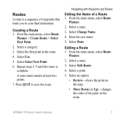
Select a category. 3. A route must contain at least two points. 7. Editing a Route 1. Select a point. 5. GPSMAP 78 Series Owner's Manual 7 From the main menu, select Route Planner > Create Route > Select First Point. 2. Select Select Next Point. 6. Repeat steps 2-5 until the... 2. Select the first point in the route. 4. From the main menu, select Route Planner. 2. Select an option: • Review-shows the point on the map. • Move Down (or Up)-changes the order of a Route 1. Enter the new name. 5. Press quit to your final destination. Select Edit Route. ...
Select a category. 3. A route must contain at least two points. 7. Editing a Route 1. Select a point. 5. GPSMAP 78 Series Owner's Manual 7 From the main menu, select Route Planner > Create Route > Select First Point. 2. Select Select Next Point. 6. Repeat steps 2-5 until the... 2. Select the first point in the route. 4. From the main menu, select Route Planner. 2. Select an option: • Review-shows the point on the map. • Move Down (or Up)-changes the order of a Route 1. Enter the new name. 5. Press quit to your final destination. Select Edit Route. ...
Owner's Manual
Page 12
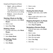
Viewing the Active Route 1. From the main menu, select Active Route. 2. Select a route. 3. Select Go. 8 GPSMAP 78 Series Owner's Manual Select a route. 3. Press FIND. 2. Viewing a Route on the route. From the main menu, select Route Planner. 2. Navigating a Route 1. ... a route. 3. Select a route. 4. Deleting a Route 1. Select Delete Route. Navigating with Waypoints and Routes • Insert-adds an additional point on the Map 1. The additional point is inserted before the point you are editing. • Remove-removes the point from the route. Select View...
Viewing the Active Route 1. From the main menu, select Active Route. 2. Select a route. 3. Select Go. 8 GPSMAP 78 Series Owner's Manual Select a route. 3. Press FIND. 2. Viewing a Route on the route. From the main menu, select Route Planner. 2. Navigating a Route 1. ... a route. 3. Select a route. 4. Deleting a Route 1. Select Delete Route. Navigating with Waypoints and Routes • Insert-adds an additional point on the Map 1. The additional point is inserted before the point you are editing. • Remove-removes the point from the route. Select View...
Owner's Manual
Page 13
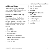
...GPSMAP 78 Series Owner's Manual 9 Enter the street. 8. Navigating with City Navigator® You can use optional City Navigator maps to http://buy.garmin.com or contact your Garmin dealer. Enter the city or postal code. Enter the house number. 7. Press FIND. 2. Additional Maps To purchase preloaded detailed map... a destination. 5. Select Go. Finding an Address with Waypoints and Routes 6. NOTE: Not all map data provides postal code searching. 5. The detailed maps contain millions of points of interest, such as restaurants, hotels, and auto services. 1. Press FIND. 2....
...GPSMAP 78 Series Owner's Manual 9 Enter the street. 8. Navigating with City Navigator® You can use optional City Navigator maps to http://buy.garmin.com or contact your Garmin dealer. Enter the city or postal code. Enter the house number. 7. Press FIND. 2. Additional Maps To purchase preloaded detailed map... a destination. 5. Select Go. Finding an Address with Waypoints and Routes 6. NOTE: Not all map data provides postal code searching. 5. The detailed maps contain millions of points of interest, such as restaurants, hotels, and auto services. 1. Press FIND. 2....
Owner's Manual
Page 14
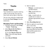
Tracks Tracks About Tracks Your Garmin device records a track log while you select Record, Show On Map, a line on the map indicates your tracks. 5. From the main menu, select Setup > Tracks > Track Log. 2. Select an option: • Distance-records tracks at a specified distance. &#... NOTE: Using the Most Often interval provides the most track detail and fills up the device memory quicker. 10 GPSMAP 78 Series Owner's Manual Select Record, Do Not Show or Record, Show On Map. Select Recording Interval. 6. You can view archived or loaded tracks by selecting Track Manager from the main menu...
Tracks Tracks About Tracks Your Garmin device records a track log while you select Record, Show On Map, a line on the map indicates your tracks. 5. From the main menu, select Setup > Tracks > Track Log. 2. Select an option: • Distance-records tracks at a specified distance. &#... NOTE: Using the Most Often interval provides the most track detail and fills up the device memory quicker. 10 GPSMAP 78 Series Owner's Manual Select Record, Do Not Show or Record, Show On Map. Select Recording Interval. 6. You can view archived or loaded tracks by selecting Track Manager from the main menu...
Owner's Manual
Page 15
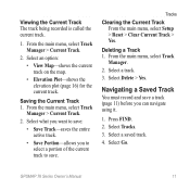
... must record and save . From the main menu, select Track Manager. 2. Select a track. 3. Select Delete > Yes. Select an option: • View Map-shows the current track on the map. • Elevation Plot-shows the elevation plot (page 16) for the current track. Select what you want to save: • Save Track... > Reset > Clear Current Track > Yes. Press FIND. 2. Deleting a Track 1. Select Go. Viewing the Current Track The track being recorded is called the current track. 1. GPSMAP 78 Series Owner's Manual 11 From the main menu, select Track Manager > Current Track. 2.
... must record and save . From the main menu, select Track Manager. 2. Select a track. 3. Select Delete > Yes. Select an option: • View Map-shows the current track on the map. • Elevation Plot-shows the elevation plot (page 16) for the current track. Select what you want to save: • Save Track... > Reset > Clear Current Track > Yes. Press FIND. 2. Deleting a Track 1. Select Go. Viewing the Current Track The track being recorded is called the current track. 1. GPSMAP 78 Series Owner's Manual 11 From the main menu, select Track Manager > Current Track. 2.
Owner's Manual
Page 16
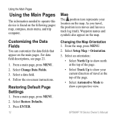
From a main page, press meNu. 2. GPSMAP 78 Series Owner's Manual For data field descriptions, see page 23. 1. Press enter. 12 Map The position icon represents your current direction of travel , the position icon moves and leaves a track log (trail). Select Setup Map > Orientation. 3. Select Change Data Fields. 3. Restoring ...; Select North Up to show north at the top of the page. • Select Track Up to show your location on the map. Customizing the Data Fields You can customize the data fields that appear on -screen instructions. Select a data field. 4. Follow the ...
From a main page, press meNu. 2. GPSMAP 78 Series Owner's Manual For data field descriptions, see page 23. 1. Press enter. 12 Map The position icon represents your current direction of travel , the position icon moves and leaves a track log (trail). Select Setup Map > Orientation. 3. Select Change Data Fields. 3. Restoring ...; Select North Up to show north at the top of the page. • Select Track Up to show your location on the map. Customizing the Data Fields You can customize the data fields that appear on -screen instructions. Select a data field. 4. Follow the ...
Owner's Manual
Page 17
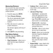
From the map, press MENU. 2. GPSMAP 78 Series Owner's Manual Using the Main Pages • Guidance Text-allows you want to measure to. The distance appears at or below the selected zoom level. ◦◦ Text Size-allows you to select the text size for optimal use on the map (if available) or turns off...
From the map, press MENU. 2. GPSMAP 78 Series Owner's Manual Using the Main Pages • Guidance Text-allows you want to measure to. The distance appears at or below the selected zoom level. ◦◦ Text Size-allows you to select the text size for optimal use on the map (if available) or turns off...
Owner's Manual
Page 18
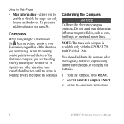
... cars, buildings, or overhead power lines. Do not stand near objects that direction until the arrow is available only with the GPSMAP 78S and GPSMAP 78Sc. Follow the on the device. If it points any other direction, turn toward the top of the compass. You should... after moving . To purchase additional maps, see page 38. Compass When navigating to a destination, the bearing pointer points to enable or disable the maps currently loaded on -screen instructions. 14 GPSMAP 78 Series Owner's Manual Using the Main Pages • Map Information-allows you are traveling directly toward...
... cars, buildings, or overhead power lines. Do not stand near objects that direction until the arrow is available only with the GPSMAP 78S and GPSMAP 78Sc. Follow the on the device. If it points any other direction, turn toward the top of the compass. You should... after moving . To purchase additional maps, see page 38. Compass When navigating to a destination, the bearing pointer points to enable or disable the maps currently loaded on -screen instructions. 14 GPSMAP 78 Series Owner's Manual Using the Main Pages • Map Information-allows you are traveling directly toward...
Owner's Manual
Page 25
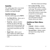
... accuracy, satellite locations, and signal strength. Satellite The satellite page shows your GPS position using the Garmin AutoLocate feature. Main Menu Features and Settings • Set Location On Map-allows you to turn the GPS on the map. This option is displayed in multicolor or single color. Additional Main Menu Tools • Calendar... the satellite page is available only when you to mark your current track toward the top of the screen or oriented with the moon phase. GPSMAP 78 Series Owner's Manual 21
... accuracy, satellite locations, and signal strength. Satellite The satellite page shows your GPS position using the Garmin AutoLocate feature. Main Menu Features and Settings • Set Location On Map-allows you to turn the GPS on the map. This option is displayed in multicolor or single color. Additional Main Menu Tools • Calendar... the satellite page is available only when you to mark your current track toward the top of the screen or oriented with the moon phase. GPSMAP 78 Series Owner's Manual 21

Owner's Manual
Page 31
...Positioning System information from a device supplying RTCM data in an SC-104 format. GPSMAP 78 Series Owner's Manual 27 note: Changing the text language does not change the language of user-entered data or map data, such as street names. • Battery Type-allows you to select ...provides simple ASCII text output of location and velocity information. ◦◦ RTCM Radio Technical Commission for Maritime Services-allows the device to www.garmin.com/aboutGPS/waas .html. • Language-sets the text language on the device. System Settings From the main menu, select Setup > System...
...Positioning System information from a device supplying RTCM data in an SC-104 format. GPSMAP 78 Series Owner's Manual 27 note: Changing the text language does not change the language of user-entered data or map data, such as street names. • Battery Type-allows you to select ...provides simple ASCII text output of location and velocity information. ◦◦ RTCM Radio Technical Commission for Maritime Services-allows the device to www.garmin.com/aboutGPS/waas .html. • Language-sets the text language on the device. System Settings From the main menu, select Setup > System...
Owner's Manual
Page 32
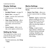
... Tones Your Garmin device allows you to take screen captures on the device screens. • Main, Setup, Find Style-allows you to select how the main menu, setup menu, and search menu appear. • Screen Capture-allows you to select a nautical chart or a fishing chart: ◦◦ Nautical-displays various map features... From the main menu, select Setup > Marine. • Marine Chart Mode-allows you to customize the key tones, message beeps, or turn off tones. Simplifies map presentation for optimal use while fishing. 28 GPSMAP 78 Series Owner's Manual
... Tones Your Garmin device allows you to take screen captures on the device screens. • Main, Setup, Find Style-allows you to select how the main menu, setup menu, and search menu appear. • Screen Capture-allows you to select a nautical chart or a fishing chart: ◦◦ Nautical-displays various map features... From the main menu, select Setup > Marine. • Marine Chart Mode-allows you to customize the key tones, message beeps, or turn off tones. Simplifies map presentation for optimal use while fishing. 28 GPSMAP 78 Series Owner's Manual
Owner's Manual
Page 33
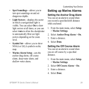
.... • Symbol Set-allows you to sound when you exceed a specified drift distance while anchored. 1. From the main menu, select Setup > Marine Settings. 2. Enter a distance. 4. GPSMAP 78 Series Owner's Manual 29 You can set dangerous depths. • Light Sectors-displays the sector in which a navigational light is visible. From the main menu... the Anchor Drag Alarm You can select On to show NOAA or IALA symbols on and set an alarm to turn spot soundings on the map. • Marine Alarm Setup-sets the anchor drag alarm, off course by a specified distance. 1.
.... • Symbol Set-allows you to sound when you exceed a specified drift distance while anchored. 1. From the main menu, select Setup > Marine Settings. 2. Enter a distance. 4. GPSMAP 78 Series Owner's Manual 29 You can set dangerous depths. • Light Sectors-displays the sector in which a navigational light is visible. From the main menu... the Anchor Drag Alarm You can select On to show NOAA or IALA symbols on and set an alarm to turn spot soundings on the map. • Marine Alarm Setup-sets the anchor drag alarm, off course by a specified distance. 1.
Owner's Manual
Page 35
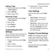
.... From the main menu, select Setup > Units. 2. Select a unit for distance and speed, elevation, depth, temperature, and pressure. 1. GPSMAP 78 Series Owner's Manual Customizing Your Device 4. From the main menu, select Setup > Position Format. 31 From the main menu, select Setup > Page...Sequence. 2. Select a setting. 3. Repeat steps 2-3 for the device. Position Format Settings Note: Do not change the position format or the map datum coordinate system unless you want to set the time zone automatically based on your GPS position. Adding a Page 1. Select a page. ...
.... From the main menu, select Setup > Units. 2. Select a unit for distance and speed, elevation, depth, temperature, and pressure. 1. GPSMAP 78 Series Owner's Manual Customizing Your Device 4. From the main menu, select Setup > Position Format. 31 From the main menu, select Setup > Page...Sequence. 2. Select a setting. 3. Repeat steps 2-3 for the device. Position Format Settings Note: Do not change the position format or the map datum coordinate system unless you want to set the time zone automatically based on your GPS position. Adding a Page 1. Select a page. ...
Owner's Manual
Page 36
...9702; Elevation/Distance-records elevation changes over a distance. ◦◦ Barometric Pressure-records barometric pressure over a period of time. 32 GPSMAP 78 Series Owner's Manual records pressure data only when the device is using. This can be useful when you are stationary. • Pressure ... • Position Format-sets the position format in which a given location reading appears. • Map Datum-sets the coordinate system on which the map is structured. • Map Spheroid-shows the coordinate system the device is turned on . • Barometer Mode ◦◦...
...9702; Elevation/Distance-records elevation changes over a distance. ◦◦ Barometric Pressure-records barometric pressure over a period of time. 32 GPSMAP 78 Series Owner's Manual records pressure data only when the device is using. This can be useful when you are stationary. • Pressure ... • Position Format-sets the position format in which a given location reading appears. • Map Datum-sets the coordinate system on which the map is structured. • Map Spheroid-shows the coordinate system the device is turned on . • Barometer Mode ◦◦...
Owner's Manual
Page 37
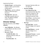
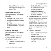
...method for calculating your route. • Lock On Road-locks the current location marker on the nearest road, compensating for variances in map position accuracy (requires routable maps). • Off Road Transitions ◦◦ Auto-automatically routes you to the next point. ◦◦ Manual-allows you ...8226; Geocache List-allows you to drive. ◦◦ On Road For Distance- Routing Settings From the main menu, select Setup > Routing. GPSMAP 78 Series Owner's Manual 33 ◦◦ Ambient Pressure-records ambient pressure changes over a period of geocaches found.
...method for calculating your route. • Lock On Road-locks the current location marker on the nearest road, compensating for variances in map position accuracy (requires routable maps). • Off Road Transitions ◦◦ Auto-automatically routes you to the next point. ◦◦ Manual-allows you ...8226; Geocache List-allows you to drive. ◦◦ On Road For Distance- Routing Settings From the main menu, select Setup > Routing. GPSMAP 78 Series Owner's Manual 33 ◦◦ Ambient Pressure-records ambient pressure changes over a period of geocaches found.
Owner's Manual
Page 42
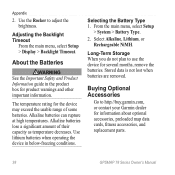
...remove the batteries. Use lithium batteries when operating the device in the product box for information about optional accessories, preloaded map data cards, fitness accessories, and replacement parts. 38 GPSMAP 78 Series Owner's Manual Adjusting the Backlight Timeout From the main menu, select Setup > Display > Backlight Timeout. About the... guide in below-freezing conditions. Alkaline batteries can rupture at high temperatures. Buying Optional Accessories Go to http://buy.garmin.com, or contact your Garmin dealer for product warnings and other important information.
...remove the batteries. Use lithium batteries when operating the device in the product box for information about optional accessories, preloaded map data cards, fitness accessories, and replacement parts. 38 GPSMAP 78 Series Owner's Manual Adjusting the Backlight Timeout From the main menu, select Setup > Display > Backlight Timeout. About the... guide in below-freezing conditions. Alkaline batteries can rupture at high temperatures. Buying Optional Accessories Go to http://buy.garmin.com, or contact your Garmin dealer for product warnings and other important information.


