
Owner's Manual
Page 4
...Adjusting the Backlight 4 Using the GPSMAP 292/298 Keypad 5 Entering Data and Selecting Options 6 Using the Map Pointer 7 Creating and Using Waypoints 8 Man OverBoard (MOB 10 Reviewing and Editing Waypoints 11 Navigating to a Destination 12 Routes 17 Find 19 Additional Information 21 DSC 21 AIS 25 Main Pages 26 Map Page... 27 Compass Page 32 3D Highway Page 33 Active Route Page 36 Main Menu 37 GPS Tab 37 Tide Tab 40 Trip Tab 44 Celes (Celestial) Tab 45 ...
...Adjusting the Backlight 4 Using the GPSMAP 292/298 Keypad 5 Entering Data and Selecting Options 6 Using the Map Pointer 7 Creating and Using Waypoints 8 Man OverBoard (MOB 10 Reviewing and Editing Waypoints 11 Navigating to a Destination 12 Routes 17 Find 19 Additional Information 21 DSC 21 AIS 25 Main Pages 26 Map Page... 27 Compass Page 32 3D Highway Page 33 Active Route Page 36 Main Menu 37 GPS Tab 37 Tide Tab 40 Trip Tab 44 Celes (Celestial) Tab 45 ...
Owner's Manual
Page 31
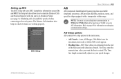
...situational awareness. Refer to extend. For Time, enter the numeric time value you to the real system. GPSMAP 292/298 Owner's Manual 25 The Distress Call simulator also helps to receive AIS information. NOTE: You must set your speed changes. Setting up DSC The DSC Setup tab turns DSC... chartplotter information screen On and Off. AIS provides ship IDs, position, course, and speed for practice before ...
...situational awareness. Refer to extend. For Time, enter the numeric time value you to the real system. GPSMAP 292/298 Owner's Manual 25 The Distress Call simulator also helps to receive AIS information. NOTE: You must set your speed changes. Setting up DSC The DSC Setup tab turns DSC... chartplotter information screen On and Off. AIS provides ship IDs, position, course, and speed for practice before ...

Owner's Manual
Page 68
... based on EPE, DOP, and basemap quality. You can choose from the end of the boat icon in the direction of data only show up . AIS Sub Tab Refer to a north heading. Nav Sub Tab • AutoZoom-On, Off: when On the map automatically adjusts the map zoom range to Auto..., Services, Saved Tracks, Track Log, and Lat/Lon Grid-Auto, Off, 120 ft-800 mi: sets the maximum zoom range the feature should appear on AIS. 62 GPSMAP 292/298 Owner's Manual Track Up: fixes the top of the listed feature. Features that points to the current track heading.
... based on EPE, DOP, and basemap quality. You can choose from the end of the boat icon in the direction of data only show up . AIS Sub Tab Refer to a north heading. Nav Sub Tab • AutoZoom-On, Off: when On the map automatically adjusts the map zoom range to Auto..., Services, Saved Tracks, Track Log, and Lat/Lon Grid-Auto, Off, 120 ft-800 mi: sets the maximum zoom range the feature should appear on AIS. 62 GPSMAP 292/298 Owner's Manual Track Up: fixes the top of the listed feature. Features that points to the current track heading.


