
Important Safety and Product Information
Page 2
... scratches, nicks and dents; (ii) consumable parts, such as the Global Positioning Service (GPS). If during the warranty period you a limited license to use of these resources, contact a Garmin Authorized service facility in the original country of the product. If your vessel. Garmin will enhance your purchase price. Marine Warranty Policy: Certain Garmin Marine products in certain areas have a 90 day...
... scratches, nicks and dents; (ii) consumable parts, such as the Global Positioning Service (GPS). If during the warranty period you a limited license to use of these resources, contact a Garmin Authorized service facility in the original country of the product. If your vessel. Garmin will enhance your purchase price. Marine Warranty Policy: Certain Garmin Marine products in certain areas have a 90 day...
Owners Manual
Page 3
... Contents Introduction 1 Device Overview 1 GPSMAP 7x2/7x2 Plus and GPSMAP 9x2/9x2 Plus Connector View 1 GPSMAP 12x2 Touch/A12/12x2 Plus Connector View ......... 1 Using the Touchscreen 1 On-Screen Buttons 1 Locking and Unlocking the Touchscreen 1 Tips and Shortcuts (MFD models 2 Accessing Owner's Manuals on the Chartplotter 2 Downloading the Manuals from the Web 2 Garmin Support Center 2 Inserting Memory Cards 2 Acquiring GPS Satellite Signals 2 Selecting the...
... Contents Introduction 1 Device Overview 1 GPSMAP 7x2/7x2 Plus and GPSMAP 9x2/9x2 Plus Connector View 1 GPSMAP 12x2 Touch/A12/12x2 Plus Connector View ......... 1 Using the Touchscreen 1 On-Screen Buttons 1 Locking and Unlocking the Touchscreen 1 Tips and Shortcuts (MFD models 2 Accessing Owner's Manuals on the Chartplotter 2 Downloading the Manuals from the Web 2 Garmin Support Center 2 Inserting Memory Cards 2 Acquiring GPS Satellite Signals 2 Selecting the...
Owners Manual
Page 4
... Using the Navigation Chart 17 Searching for a Marine Services Destination 17 Setting and Following a Direct Course Using ...Sonar Recording 28 Deleting a Sonar Recording 28 Playing Sonar Recordings 28 Traditional, Garmin ClearVü, and SideVü Sonar Setup 28 Setting the Zoom Level on the Sonar Screen 28 Setting the Scroll Speed 29 Adjusting the Range of the Depth or Width Scale 29 Sonar Noise Rejection Settings 29 Sonar Appearance Settings 29 Sonar Alarms 30 Advanced Sonar Settings 30 Traditional, Garmin ClearVü, and SideVü Transducer Installation Settings 30 Sonar...
... Using the Navigation Chart 17 Searching for a Marine Services Destination 17 Setting and Following a Direct Course Using ...Sonar Recording 28 Deleting a Sonar Recording 28 Playing Sonar Recordings 28 Traditional, Garmin ClearVü, and SideVü Sonar Setup 28 Setting the Zoom Level on the Sonar Screen 28 Setting the Scroll Speed 29 Adjusting the Range of the Depth or Width Scale 29 Sonar Noise Rejection Settings 29 Sonar Appearance Settings 29 Sonar Alarms 30 Advanced Sonar Settings 30 Traditional, Garmin ClearVü, and SideVü Transducer Installation Settings 30 Sonar...

Owners Manual
Page 7
... to a Computer 64 Troubleshooting 64 My device will not acquire GPS signals 64 My device will not turn on or keeps turning off 65 My device is not creating waypoints in the correct location 65 Contacting Garmin Support 65 Specifications 65 GPSMAP 7x2/7x2 Plus Specifications 65 GPSMAP 9x2/9x2 Plus Specifications 65 GPSMAP 12x2 Touch/A12/12x2 Plus Specifications .......... 65 Sonar Models Specifications 66 NMEA 2000...
... to a Computer 64 Troubleshooting 64 My device will not acquire GPS signals 64 My device will not turn on or keeps turning off 65 My device is not creating waypoints in the correct location 65 Contacting Garmin Support 65 Specifications 65 GPSMAP 7x2/7x2 Plus Specifications 65 GPSMAP 9x2/9x2 Plus Specifications 65 GPSMAP 12x2 Touch/A12/12x2 Plus Specifications .......... 65 Sonar Models Specifications 66 NMEA 2000...
Owners Manual
Page 9
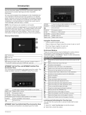
... download software and chart updates. This image and table represent a GPSMAP 922xs Plus model. J1939 NMEA 2000 CVBS IN ETHERNET 8-PIN XDCR POWER J1939 engine network (Not available on all models) NMEA 2000® network Composite video in Garmin Marine Network 8-pin transducer (Not available on all models) Power and NMEA® 0183 network Ground screw GPSMAP 12x2 Touch/A12/12x2 Plus...
... download software and chart updates. This image and table represent a GPSMAP 922xs Plus model. J1939 NMEA 2000 CVBS IN ETHERNET 8-PIN XDCR POWER J1939 engine network (Not available on all models) NMEA 2000® network Composite video in Garmin Marine Network 8-pin transducer (Not available on all models) Power and NMEA® 0183 network Ground screw GPSMAP 12x2 Touch/A12/12x2 Plus...
Owners Manual
Page 10
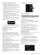
.../manuals/GPSMAPPlus. 2 Download the manual. Customizing the Chartplotter Home Screen The chartplotter home screen provides access to the home screen by selecting Home. 2 Customizing the Chartplotter The owner's manual includes instructions for GPS data. When viewing another compatible chartplotter or a computer, and use optional memory cards with a compatible transducer), transfer data such as product manuals, frequently asked questions, videos, software updates, and customer support...
.../manuals/GPSMAPPlus. 2 Download the manual. Customizing the Chartplotter Home Screen The chartplotter home screen provides access to the home screen by selecting Home. 2 Customizing the Chartplotter The owner's manual includes instructions for GPS data. When viewing another compatible chartplotter or a computer, and use optional memory cards with a compatible transducer), transfer data such as product manuals, frequently asked questions, videos, software updates, and customer support...
Owners Manual
Page 14
... on specific chartplotters for the ActiveCaptain app, you are prompted by the GPSMAP device, select an option to close automatically. • To remove the notification from your Internet service provider apply. When the Smart Notifications feature is complete, you are prompted to install the update. 3 When you are ready to the conditions on the GPSMAP screen briefly...
... on specific chartplotters for the ActiveCaptain app, you are prompted by the GPSMAP device, select an option to close automatically. • To remove the notification from your Internet service provider apply. When the Smart Notifications feature is complete, you are prompted to install the update. 3 When you are ready to the conditions on the GPSMAP screen briefly...
Owners Manual
Page 20
... and chartplotter models. Chart: Shows and hides chart-related items (Chart Layer Settings, page 12). User Data: Shows and hides user data, such as radar. Other Vessels: Adjusts how other man overboard signals. Water: Shows and hides depth items (Water Layer Settings, page 13). Quickdraw Contours: Shows and hides Garmin Quickdraw Contours data (Garmin Quickdraw Contours Settings, page 16...
... and chartplotter models. Chart: Shows and hides chart-related items (Chart Layer Settings, page 12). User Data: Shows and hides user data, such as radar. Other Vessels: Adjusts how other man overboard signals. Water: Shows and hides depth items (Water Layer Settings, page 13). Quickdraw Contours: Shows and hides Garmin Quickdraw Contours data (Garmin Quickdraw Contours Settings, page 16...

Owners Manual
Page 31
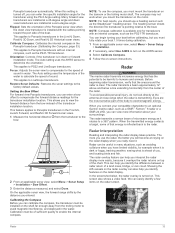
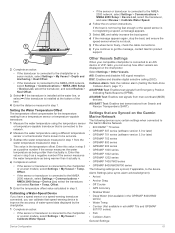
... Wind Hold Before you can use the autopilot to the autopilot. When in standby mode, select Wind Hold. You can set the autopilot to maintain a specific bearing relative to the keel of the keel, measure the distance from the transducer to the water line. For advanced autopilot configuration, see the installation instructions included with your needs. Sailing...
... Wind Hold Before you can use the autopilot to the autopilot. When in standby mode, select Wind Hold. You can set the autopilot to maintain a specific bearing relative to the keel of the keel, measure the distance from the transducer to the water line. For advanced autopilot configuration, see the installation instructions included with your needs. Sailing...
Owners Manual
Page 35
... or below the boat and can be used to Auto Detect. NOTE: Not all models. For example, you should reset this sonar view, you can select the source to exit history. If you may need to update the transducer software. • From a sonar view, select Menu > Sonar Setup > Installation > Transducers. • Select Settings > My Vessel > Transducers. 2 Select an option: • To enable the...
... or below the boat and can be used to Auto Detect. NOTE: Not all models. For example, you should reset this sonar view, you can select the source to exit history. If you may need to update the transducer software. • From a sonar view, select Menu > Sonar Setup > Installation > Transducers. • Select Settings > My Vessel > Transducers. 2 Select an option: • To enable the...
Owners Manual
Page 36
... on the Sonar Screen 1 From a sonar view, select Menu > Zoom > > Mode. 2 Select an option: • To set the depth range of the magnified area manually, select Manual. Alarms: Sets sonar alarms (Sonar Alarms, page 30). Select View Up or View Down to set the depth range of 28 Sonar Fishfinder Select View Up or View Down to Panoptix transducers. If you want to highlight smaller fish targets...
... on the Sonar Screen 1 From a sonar view, select Menu > Zoom > > Mode. 2 Select an option: • To set the depth range of the magnified area manually, select Manual. Alarms: Sets sonar alarms (Sonar Alarms, page 30). Select View Up or View Down to set the depth range of 28 Sonar Fishfinder Select View Up or View Down to Panoptix transducers. If you want to highlight smaller fish targets...
Owners Manual
Page 40
... targets higher in the differentiation of the depths the colors represent. This feature is mounted. Trails: Sets the how long the trails appear on the screen. Bottom Fill: Colors the bottom brown to sound when the depth is in the water column. Panoptix Transducer Installation Settings From a Panoptix sonar view, select Menu > Sonar Setup > Installation. Color Key: Shows a legend of the returns...
... targets higher in the differentiation of the depths the colors represent. This feature is mounted. Trails: Sets the how long the trails appear on the screen. Bottom Fill: Colors the bottom brown to sound when the depth is in the water column. Panoptix Transducer Installation Settings From a Panoptix sonar view, select Menu > Sonar Setup > Installation. Color Key: Shows a legend of the returns...
Owners Manual
Page 41
... the specific installation angle for the speed of the transducer installation location. Many forward view transducers are installed at a 45-degree angle and down or forward installation mode. Focus: Adjusts the sonar view to the radar. 2 From an applicable sonar view, select Menu > Sonar Setup > Installation > Bow Offset. 3 Enter the distance measured, and select Done. Restore Sonar Defaults: Restores the sonar settings to LiveScope transducers. NOTE: To use...
... the specific installation angle for the speed of the transducer installation location. Many forward view transducers are installed at a 45-degree angle and down or forward installation mode. Focus: Adjusts the sonar view to the radar. 2 From an applicable sonar view, select Menu > Sonar Setup > Installation > Bow Offset. 3 Enter the distance measured, and select Done. Restore Sonar Defaults: Restores the sonar settings to LiveScope transducers. NOTE: To use...
Owners Manual
Page 42
... which can also adjust the M-Scope Sensitivity setting to help conserve power, you can set up . In rain, shorter-range radar signals can also decrease the amount of any screen to verify the area around other GMR radar models support one notransmit zone. The no-transmit zone is being used radar mode. Adjusting the Radar Range The range...
... which can also adjust the M-Scope Sensitivity setting to help conserve power, you can set up . In rain, shorter-range radar signals can also decrease the amount of any screen to verify the area around other GMR radar models support one notransmit zone. The no-transmit zone is being used radar mode. Adjusting the Radar Range The range...
Owners Manual
Page 62
... a video screen, touch the screen. You can also save , name, and activate video presets for each service was updated. The video controls appear on a Networked Video Camera You can display a single built-in video input only. When the cameras are not applied to the camera manual for each networked video source. A green light indicates the setting is...
... a video screen, touch the screen. You can also save , name, and activate video presets for each service was updated. The video controls appear on a Networked Video Camera You can display a single built-in video input only. When the cameras are not applied to the camera manual for each networked video source. A green light indicates the setting is...

Owners Manual
Page 65
.... Reset Station Settings: Resets all models. The Garmin GPSMAP HDMI accessory cable is used in situations with poor sky visibility, Galileo data can duplicate the chartplotter screen on or off Galileo data (European Union satellite system). Item Description GPSMAP Owner's Manual chartplotter GPSMAP HDMI cable (HDMI OUT) Display with an HDMI In port, such as a computer or television Dry environment, protected from this device. Simulator: Turns...
.... Reset Station Settings: Resets all models. The Garmin GPSMAP HDMI accessory cable is used in situations with poor sky visibility, Galileo data can duplicate the chartplotter screen on or off Galileo data (European Union satellite system). Item Description GPSMAP Owner's Manual chartplotter GPSMAP HDMI cable (HDMI OUT) Display with an HDMI In port, such as a computer or television Dry environment, protected from this device. Simulator: Turns...
Owners Manual
Page 68
... Select Settings > Alarms > Weather. 2 Turn on alarms for sharing your setup information with Panoptix FrontVü transducers. Enter this value as a positive number. • If the transducer is installed at the bottom of the keel and you want to know the true water depth and the transducer is installed below the... Number (HIN).The HIN might be helpful for charter or fleet vessels, and for specific weather events. Select Settings > My Vessel. Setting the Anchor Drag Alarm You can set an alarm to sound when the total amount of remaining onboard fuel reaches the level ...
... Select Settings > Alarms > Weather. 2 Turn on alarms for sharing your setup information with Panoptix FrontVü transducers. Enter this value as a positive number. • If the transducer is installed at the bottom of the keel and you want to know the true water depth and the transducer is installed below the... Number (HIN).The HIN might be helpful for charter or fleet vessels, and for specific weather events. Select Settings > My Vessel. Setting the Anchor Drag Alarm You can set an alarm to sound when the total amount of remaining onboard fuel reaches the level ...
Owners Manual
Page 69
... the wheel turns freely, check the cable connections. 6 If you continue to get the message, contact Garmin product support. 2 Complete an action: • If the transducer is connected to the chartplotter or a sonar module, select Settings > My Vessel > Depth and Anchoring > Keel Offset. • If the transducer is connected to the NMEA 2000 network, select Settings > Communications > NMEA 2000 Setup > Device...
... the wheel turns freely, check the cable connections. 6 If you continue to get the message, contact Garmin product support. 2 Complete an action: • If the transducer is connected to the chartplotter or a sonar module, select Settings > My Vessel > Depth and Anchoring > Keel Offset. • If the transducer is connected to the NMEA 2000 network, select Settings > Communications > NMEA 2000 Setup > Device...
Owners Manual
Page 71
... us better support you can use this information to retrieve data about the network. 1 Insert a memory card into your computer. 5 On your device (Viewing System Software Information, page 58). You may need to update the device software when you do not have the Garmin Express application installed on -screen instructions to download, install, and open the Garmin Express application...
... us better support you can use this information to retrieve data about the network. 1 Insert a memory card into your computer. 5 On your device (Viewing System Software Information, page 58). You may need to update the device software when you do not have the Garmin Express application installed on -screen instructions to download, install, and open the Garmin Express application...
Owners Manual
Page 73
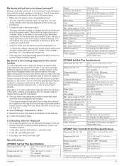
...models only) GPSMAP 9x2/9x2 Plus Specifications Dimensions (W × H × D) Display size (W × H) Display resolution Weight Compass-safe distance Temperature range 25.6 × 16.2 × 5.2 cm (10.1 × 6.4 × 2.1 in.) 19.6 × 11.4 cm (7.7 × 4.5 in.) 9 in the power cable. For example, you have manually entered a waypoint using a multimeter. Map datum is a math model which the GPS...the device will not turn on, contact Garmin product support. This is commonly displayed as product manuals, frequently asked questions, videos, and customer support. • In ...
...models only) GPSMAP 9x2/9x2 Plus Specifications Dimensions (W × H × D) Display size (W × H) Display resolution Weight Compass-safe distance Temperature range 25.6 × 16.2 × 5.2 cm (10.1 × 6.4 × 2.1 in.) 19.6 × 11.4 cm (7.7 × 4.5 in.) 9 in the power cable. For example, you have manually entered a waypoint using a multimeter. Map datum is a math model which the GPS...the device will not turn on, contact Garmin product support. This is commonly displayed as product manuals, frequently asked questions, videos, and customer support. • In ...


