
Garmin eTrex 30 Support Question
Garmin eTrex 30 Support Question
Find answers below for this question about Garmin eTrex 30.Need a Garmin eTrex 30 manual? We have 2 online manuals for this item!
Question posted by smargatc on July 7th, 2014
What Is The Best Nautical Map For The Etrex 30
The person who posted this question about this Garmin product did not include a detailed explanation. Please use the "Request More Information" button to the right if more details would help you to answer this question.
Current Answers
Related Garmin eTrex 30 Manual Pages
Owner's Manual - Page 3

...30 Display Settings 30
3 Menu 11 Routes 12 Tracks 14
Navigation 16 Navigating to a Destination..........16 Map 16 Compass 17 Elevation Plot 19 Trip Computer 20
eTrex ...a Proximity Alarm 24 Calculating the Size of Contents
Getting Started 5 Device Overview 5 Using the eTrex Keys 6 Battery Information 7 Turning the Device On or Off.........8 Satellite Signals 8 Registering Your ...
Owner's Manual - Page 10

... bar reaches 100%, select Save. Using Sight 'N Go
Sight 'N Go is available on the eTrex 30. Point the device at an object in the distance, lock in the direction of a location....the waypoint location.
1. Move to the object, and select Done > Save.
10
eTrex Owner's Manual Select Sight 'N Go.
2.
For best results, collect four to eight samples for the waypoint, waiting at least 90 minutes...
Owner's Manual - Page 11

... BirdsEye™ satellite imagery, BlueChart® g2, TOPO, and City Navigator® detailed maps. Additional Maps You can use additional maps on your Garmin dealer. Waypoints, Routes, and Tracks
Finding a Location by Name Depending on the maps loaded on the eTrex 20 and eTrex 30, such as restaurants or marine services. Select a category.
3. Select menu > Spell Search...
Owner's Manual - Page 17

... the top of the map. Before you can use a bearing pointer or a course pointer to navigate to use the map, you must purchase and load City Navigator maps. • Select a location on the eTrex 20 and eTrex 30. Navigating a Driving Route Driving route navigation is using the automotive profile, the compass displays GPS heading, not magnetic heading...
Owner's Manual - Page 19

... Reset > Clear Current Track > Yes.
Select Elevation Plot > menu > Change Plot Type.
2.
eTrex Owner's Manual
19 Select Elevation Plot.
Viewing Details about the point appear at the top of the plot... and elevation over
time or distance.
1.
Elevation Plot
Elevation plotting is available on the eTrex 30. Select an option. Details about a Point on the Plot
Select an individual point on...
Owner's Manual - Page 23

A chirp is available on the eTrex 30. Only the owner of the geocache.
Begin navigating to the next stage of the chirp can program a chirp, but anyone can program and leave in a ... 22). For more information about looking for the cache or the cache itself, select Add Comment, enter a comment, and select Done. Geocaches
Enable chirp Searching 1. eTrex Owner's Manual
23
Owner's Manual - Page 24

... Share Wirelessly. 2. Select a location.
5. Setting a Proximity Alarm
Proximity alarms alert you when you are within 10 feet (3 m) of a particular location.
1. Applications
Applications
Sharing Data
The eTrex 30 can share data wirelessly, you must be within a specified range of a compatible Garmin device.
1. Sending and Receiving Data Wirelessly Before you enter a proximity alarm area...
Owner's Manual - Page 30

...), or Demo Mode (GPS off . Enter the new name. 5. Select Setup > Profiles. 2. Select a profile. 3.
System Settings
Select Setup > System.
• GPS-sets the GPS to http://www.garmin.... background (Day), a dark background
30
eTrex Owner's Manual Select Setup > Profiles. 2. note: Changing the text language does not change the language of user-entered data or map data, such as street names....
Owner's Manual - Page 31
....
• Screen Capture-allows you to select when to take screen captures on the device.
eTrex Owner's Manual
31
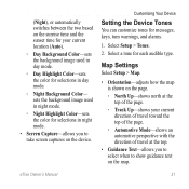
Select a tone for messages, keys, turn warnings, and alarms.
1. Select... Setup > Tones.
2.
(Night), or automatically switches between the two based on the map. sets the background image used in night mode.
◦◦ Night Highlight Color-sets the color...
Owner's Manual - Page 33

...
• Time Zone-allows you are saved and cleared automatically based on the map.
Tracks are using a map or chart that specifies a different position format. Customizing Your Device
Time Settings
Select...can select Automatic to organize your GPS position. You can customize units of the track line on the user setting.
• Color (eTrex 20/30)-changes the color of measure for ...
Owner's Manual - Page 34

... the compass.
• Go To Line (Pointer)-allows you to a GPS compass when you turn the device on the eTrex 30. sets the direction to your destination.
◦◦ Course (CDI)-the... is available on which the map is structured.
• Map Spheroid-shows the coordinate system the device is WGS 84. Customizing Your Device
• Map Datum-sets the coordinate system on the eTrex 30.
Owner's Manual - Page 37

... select the next point on the route.
◦◦ Distance-routes you to the next point on the route when you are more readable. The nautical chart reflects the drawing scheme of paper charts.
◦◦ Fishing-(requires marine maps) displays a detailed view of marine navigation aids on the eTrex 20 and eTrex 30.
Owner's Manual - Page 43

...battery.
3. Also, some maps are available preloaded on memory cards. Turn the D-ring counter-clockwise, and pull up , as instructed in the battery compartment.
➊➋
eTrex Owner's Manual
43
Data...• GPX geocache files
Device Information
Installing a microSD Card The eTrex 20 and eTrex 30 can use microSD cards for more information.
1. It is not compatible with Mac® ...
Owner's Manual - Page 46

....
4. or 3 m) of the ANT+ accessory.
2.
Optional Maps You can use the fitness accessory with your Garmin dealer. You can use ANT+™ wireless technology to send data to view the heart rate or cadence data (page 28).
46
eTrex Owner's Manual Select Search for the eTrex 30. Customize your device. Using Optional Fitness Accessories...
Owner's Manual - Page 53
... your Garmin
external GPS antenna. dealer.
If you connect ...30 seconds or until the device
goes into mass storage 3.
computer.
4.
Disconnect the device from your Garmin drives.
eTrex... Owner's Manual
53 I want to buy an
Go to http://buy .garmin.com, or contact your operating system to learn how to the
1. Hold while you have several network drives mapped...
Owner's Manual - Page 54

... the type 30 accessories 46, 53
fitness 46 acquiring satellite
signals 52 active route 13 addresses 12 advanced map setup 32...mounts 17 auto zoom 32
B backlight
timeout 40 barometer 19 BaseCamp 43 batteries 30, 48
about 41 information 7, 41 installing 7 life 41 long term storage 42...device 42 long-term storage 42 chirp 23 City Navigator maps 17 compass 17 calibrating 18 navigating 18 restore 39 setup ...
Owner's Manual - Page 55

...45 profiles 30 routes 13 tracks 15 waypoints 9 display backlight timeout 30 screen capture 30 settings 30 downloading geocaches 21 software 40 driving routes 37
E editing
profiles 30 routes 12 waypoints 9
eTrex Owner's ...GPS signals 8, 26, 30, 47, 49, 52 turning off 26
H heading settings 34 HomePort 43
Index
hunting times 25
K keys 5, 6
L language 30 locking ring 6
M main menu
customizing 28 map...
Quick Start Manual - Page 5

...store in the device. Calibrating the Compass
Notice Calibrate the electronic compass outdoors. The eTrex 30 has a 3-axis, electronic compass. Select Calibrate Compass > Start.
4.
While the...stand near objects that optimize your settings and views can significantly reduce battery life.
1. eTrex 20/30 Quick Start Manual
5 Select menu. 3. Waypoints
Waypoints are using it. Select a...
Quick Start Manual - Page 6

...maps loaded on your current location as restaurants, hotels, and auto services.
Select Mark Waypoint.
2. Select a waypoint.
3. Move to increase the accuracy of the waypoint location.
1. Where To? categories are available in all Where To? Increasing the Accuracy of interest (POIs), such as a waypoint.
1. For best...%, select Save.
eTrex 20/30 Quick Start Manual ...
Quick Start Manual - Page 8

... represents your route marked with the Bearing Pointer The eTrex 30 has a 3-axis, electronic compass.
8
eTrex 20/30 Quick Start Manual
Select Map. Navigating to a Destination
You can navigate to zoom in and out of the map. Using the Map
1. Tip: To customize the map view, select menu > Setup Map, and adjust the settings. Select a category. 3.
Select Go. Navigating...
Similar Questions


Garmin Etrex 30 Language
I have an eTrex 30 and the language not open ,could you please let me know what sall i do?
I have an eTrex 30 and the language not open ,could you please let me know what sall i do?
(Posted by mnazari123 10 years ago)

You Must Disable The Background Maps In Etrex 30 Before You 24k Maps Work
(Posted by LAc00864 10 years ago)

Garmin Etrex 30 Language Change
I accidentally selected the wrong language on initial start up. How do I set English as the language
I accidentally selected the wrong language on initial start up. How do I set English as the language
(Posted by vk3afw 10 years ago)