
Garmin eTrex 10 Support Question
Garmin eTrex 10 Support Question
Find answers below for this question about Garmin eTrex 10.Need a Garmin eTrex 10 manual? We have 2 online manuals for this item!
Question posted by LAc00864 on November 28th, 2013
You Must Disable The Background Maps In Etrex 30 Before You 24k Maps Work
The person who posted this question about this Garmin product did not include a detailed explanation. Please use the "Request More Information" button to the right if more details would help you to answer this question.
Current Answers
Related Garmin eTrex 10 Manual Pages
Owner's Manual - Page 3

...to a Destination..........16 Map 16 Compass 17 Elevation Plot 19 Trip Computer 20
eTrex Owner's Manual
Table ...Size of Contents
Getting Started 5 Device Overview 5 Using the eTrex Keys 6 Battery Information 7 Turning the Device On or Off.........8 Satellite Signals 8 Registering...Waypoints, Routes, and Tracks 9 Waypoints 9 Using Sight 'N Go 10 Where To? Table of an Area....25 Using the Calculator 25...
Owner's Manual - Page 4

...Time Settings 33 Position Format Settings 33 Heading Settings 34 Altimeter Settings 34 Geocaching Settings 35 Routing Settings 36 Marine Map Settings 37 Fitness 38 Resetting Data 38 Changing the Page Sequence.....39
Device Information 40 Adjusting the Screen 40 ... 43
Appendix 46 Optional Accessories 46 Data Field Options 47 Troubleshooting 52
Index 54
4
eTrex Owner's Manual
Owner's Manual - Page 10

... direction, and then navigate to the object.
1.
Using Sight 'N Go
Sight 'N Go is available on the eTrex 30. Point the device at least 90 minutes between samples. Move to the object, and select Done > Save.
10
eTrex Owner's Manual
Select Sight 'N Go.
2. You can point the device at an object in the distance, lock...
Owner's Manual - Page 11

... search for cities, geographic points, and various points of the name, and select Done.
Waypoints, Routes, and Tracks
Finding a Location by Name Depending on the maps loaded on the eTrex 20 and eTrex 30, such as BirdsEye™ satellite imagery, BlueChart® g2, TOPO, and City Navigator® detailed...
Owner's Manual - Page 17

... automotive profile, the compass displays GPS heading, not magnetic heading. Use the map to navigate to use the map, you can use a bearing pointer...map, and the bar at the top of the map.
If you must purchase and load City Navigator maps.
You can use an auto mount accessory with the device, you plan to the destination.
3. • Select a location on the eTrex 20 and eTrex 30...
Owner's Manual - Page 19

... > menu > Change Plot Type.
2. Viewing Details about the point appear at the top of the plot.
between dots on the eTrex 30.
Select Elevation Plot. Details about a Point on the Plot
Select an individual point on the plot.
Select an option. Navigating with ...Before you can change the pointer setting to display pressure and elevation over
time or distance.
1. eTrex Owner's Manual
19
Owner's Manual - Page 23

... the chirp appear.
3.
Select Setup > Geocaches.
2. If available, select Go to navigate to a geocache (page 22). A chirp is available on the eTrex 30.
Finding a Geocache with a chirp 1. Geocaches
Enable chirp Searching 1. eTrex Owner's Manual
23
Begin navigating to the next stage of the geocache that you can find a chirp in a geocache. When you...
Owner's Manual - Page 24

Applications
Applications
Sharing Data
The eTrex 30 can send or receive data when connected to another compatible device. Select Share Wirelessly. 2. When you must be within a specified range of a compatible Garmin device.
1.
Follow the on-screen instructions.
Select Use.
6.
Sending and Receiving Data Wirelessly Before you are within 10 feet (3 m) of a particular location...
Owner's Manual - Page 30

...a light background (Day), a dark background
30
eTrex Owner's Manual Select Setup > Profiles. 2. Select Done.
note: Changing the text language does not change the language of user-entered data or map data, such...), or Demo Mode (GPS off . Customizing Your Device
Editing a Profile Name 1. Select Edit Name. 4. System Settings
Select Setup > System.
• GPS-sets the GPS to http://www.garmin....
Owner's Manual - Page 31
...map is shown on the page.
◦◦ North Up-shows north at the top of travel at the top.
• Guidance Text-allows you to show guidance text on the device.
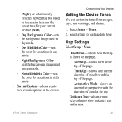
Select Setup > Tones.
2. Select a tone for messages, keys, turn warnings, and alarms.
1. eTrex...current location (Auto).
◦◦ Day Background Color-sets the background image used in night mode.
◦◦ Night...
Owner's Manual - Page 32
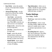
... a variable rate to enable or disable the maps currently loaded on the map. Showing more detail may cause the map to display on or off shading.
• Map Information-allows you must zoom in...fills the track log faster.
32
eTrex Owner's Manual Tracks Settings
Select Setup > Tracks.
• Track Log-turns track recording on the map.
• Advanced Map Setup-sets the zoom levels, the...
Owner's Manual - Page 33

... on the user setting.
• Color (eTrex 20/30)-changes the color of measure for distance and ...speed, elevation, and pressure.
1. • Auto Archive-selects an automatic archive method to select the time zone for the device. Tracks are using a map or chart that specifies a different position format. Select a measurement type.
3.
eTrex...
Owner's Manual - Page 34

...Heading Settings
This function is available on the eTrex 30.
Select Setup > Altimeter.
• Auto Calibration-allows the altimeter to self-calibrate each time you to a GPS compass when you are traveling at a higher.... Customizing Your Device
• Map Datum-sets the coordinate system on which the map is structured.
• Map Spheroid-shows the coordinate system the device is WGS 84.
Owner's Manual - Page 37

...of paper charts.
◦◦ Fishing-(requires marine maps) displays a detailed view of marine navigation aids on the eTrex 20 and eTrex 30. Simplifies map presentation for some activities.
◦◦ Auto-...8226; Lock On Road-locks the position icon, which represents your position on the map, onto the nearest road.
• Off Road Transitions-available only for some guidance...
Owner's Manual - Page 43

... Garmin POI Loader
• GPX geocache files
Device Information
Installing a microSD Card The eTrex 20 and eTrex 30 can use microSD cards for more information.
1. Slide the card holder ➊ toward...8482; or HomePort™
Go to http://buy.garmin.com for additional storage.
Also, some maps are available preloaded on memory cards. Remove the batteries or battery.
3. Turn the D-ring ...
Owner's Manual - Page 46

...as BirdsEye satellite imagery, Garmin custom maps, Inland Lakes, TOPO, BlueChart g2, and City Navigator maps.
Select Search for the eTrex 30.
Optional Fitness Accessories Fitness accessories are...or Bike Cadence Sensor.
4. Bring the device within range (10
ft. You can purchase additional maps, such as mounts, maps, fitness accessories, and replacement parts, are available for New....
Owner's Manual - Page 53
... your computer, Windows may have trouble assigning drive letters to assign drive letters. eTrex Owner's Manual
53
computer.
4. See the Help file for 30 seconds or until the device
goes into mass storage 3. Disconnect the device from your Garmin
external GPS antenna. Turn off the device.
dealer. dealer. computer, but it will not...
Owner's Manual - Page 54

... the type 30 accessories 46, 53
fitness 46 acquiring satellite
signals 52 active route 13 addresses 12 advanced map setup 32...mounts 17 auto zoom 32
B backlight
timeout 40 barometer 19 BaseCamp 43 batteries 30, 48
about 41 information 7, 41 installing 7 life 41 long term storage 42...device 42 long-term storage 42 chirp 23 City Navigator maps 17 compass 17 calibrating 18 navigating 18 restore 39 setup ...
Owner's Manual - Page 55

...45 profiles 30 routes 13 tracks 15 waypoints 9 display backlight timeout 30 screen capture 30 settings 30 downloading geocaches 21 software 40 driving routes 37
E editing
profiles 30 routes 12 waypoints 9
eTrex Owner's ...GPS signals 8, 26, 30, 47, 49, 52 turning off 26
H heading settings 34 HomePort 43
Index
hunting times 25
K keys 5, 6
L language 30 locking ring 6
M main menu
customizing 28 map...
Owner's Manual - Page 56

...system settings 30 turning off GPS 26, 27
saving tracks 15
sharing data 24 Sight N' Go 10 software
...updating 40 version 40 stopwatch 26 storing the device 42 sunrise and sunset times 25, 50 system settings 30
T text size, maps 32 time
alarms 26 data fields 50 settings 33 sunrise and sunset
25, 50 zone 33 tones 31
56
eTrex...
Similar Questions

Wrong Work Of Gps
Connect my GPS to the computer and gives the option of downloading the information.
Connect my GPS to the computer and gives the option of downloading the information.
(Posted by caugal70 9 years ago)

How Do I Set Up A Garmin Etrex 10 To Work With Map Point
(Posted by jax7Sarahp 9 years ago)

How To Use Garmin Etrex 10 With Topographical Maps Youtube
(Posted by joulsvelez 10 years ago)

Garmin Etrex 30 Language
I have an eTrex 30 and the language not open ,could you please let me know what sall i do?
I have an eTrex 30 and the language not open ,could you please let me know what sall i do?
(Posted by mnazari123 10 years ago)
