Owner's Manual
Page 20
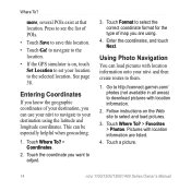
... Go! Touch Format to select the correct coordinate format for the type of POIs. • Touch Save to the selected location. Go to http://connect.garmin.com/ photos (not available in all areas) to them. 1. to navigate to the location. • If the GPS simulator is on the Web site to... then create routes to download pictures with location information are using the latitude and longitude coordinates. Using Photo Navigation You can be especially helpful when geocaching. 1. Where To? Touch Where To? > Coordinates. 2. Enter the coordinates, and touch Next.
... Go! Touch Format to select the correct coordinate format for the type of POIs. • Touch Save to the selected location. Go to http://connect.garmin.com/ photos (not available in all areas) to them. 1. to navigate to the location. • If the GPS simulator is on the Web site to... then create routes to download pictures with location information are using the latitude and longitude coordinates. Using Photo Navigation You can be especially helpful when geocaching. 1. Where To? Touch Where To? > Coordinates. 2. Enter the coordinates, and touch Next.
Owner's Manual
Page 67
... 12 feedback on nüvi models iv using photos 14-15 free map update 49 fuel price, adjusting 30 fuel report 30 fuse, changing 48 G Garmin Lock 41, 46 Garmin Travel Guide 52 geocaching 14 Go! ites) 12 using 15 61
... 12 feedback on nüvi models iv using photos 14-15 free map update 49 fuel price, adjusting 30 fuel report 30 fuse, changing 48 G Garmin Lock 41, 46 Garmin Travel Guide 52 geocaching 14 Go! ites) 12 using 15 61


