Important Safety and Product Information
Page 2
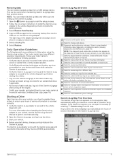
... vehicle. Street Navigation Warnings If your product in a residential installation. If these resources, contact a Garmin Authorized service facility in the original country of purchase or follow these guidelines to ensure safe on frequencies that uses an internal antenna to part 15 of radio frequency (RF) energy for paying all posted speed limit signs and to comply with the instructions. Always mount your Garmin device. Under...
... vehicle. Street Navigation Warnings If your product in a residential installation. If these resources, contact a Garmin Authorized service facility in the original country of purchase or follow these guidelines to ensure safe on frequencies that uses an internal antenna to part 15 of radio frequency (RF) energy for paying all posted speed limit signs and to comply with the instructions. Always mount your Garmin device. Under...
Owners Manual
Page 3
... 2 Installing the Ball Mount Adapter 2 Turning the Device On or Off 2 Acquiring GPS Signals 2 Home Screen 3 Opening an App 3 Adding Shortcuts to the Home Screen 3 Viewing Notifications 3 Status Bar Icons 3 Using the Touchscreen 3 Adjusting the Screen Brightness 3 Vehicle Profiles 3 Adding a Vehicle Profile 3 Car Profile 4 Switching the Vehicle Profile 4 Changing Your Trailer Information 4 Editing a Vehicle Profile 4 Driver Awareness Features and Alerts 4 Enabling or Disabling Driver Alerts 4 Red Light and Speed Cameras 4 Navigating to Your Destination 5 Routes 5 Starting...
... 2 Installing the Ball Mount Adapter 2 Turning the Device On or Off 2 Acquiring GPS Signals 2 Home Screen 3 Opening an App 3 Adding Shortcuts to the Home Screen 3 Viewing Notifications 3 Status Bar Icons 3 Using the Touchscreen 3 Adjusting the Screen Brightness 3 Vehicle Profiles 3 Adding a Vehicle Profile 3 Car Profile 4 Switching the Vehicle Profile 4 Changing Your Trailer Information 4 Editing a Vehicle Profile 4 Driver Awareness Features and Alerts 4 Enabling or Disabling Driver Alerts 4 Red Light and Speed Cameras 4 Navigating to Your Destination 5 Routes 5 Starting...
Owners Manual
Page 4
... Driver Assistance Settings 23 Traffic Settings 23 Display Settings 23 Sound and Notification Settings 23 Adjusting Sound and Notification Volume 23 Enabling or Disabling Location Services 23 Setting the Text Language 23 Date and Time Settings 24 Device Settings 24 Restoring Settings 24 Device Information 24 Viewing E-label Regulatory and Compliance Information ........ 24 Specifications 24 Charging the Device 24 Device Maintenance 24 Garmin Support Center 24 Updating Maps and Software Using a Wi‑Fi Network 24 Updating Maps and Software with Garmin Express 24 Installing...
... Driver Assistance Settings 23 Traffic Settings 23 Display Settings 23 Sound and Notification Settings 23 Adjusting Sound and Notification Volume 23 Enabling or Disabling Location Services 23 Setting the Text Language 23 Date and Time Settings 24 Device Settings 24 Restoring Settings 24 Device Information 24 Viewing E-label Regulatory and Compliance Information ........ 24 Specifications 24 Charging the Device 24 Device Maintenance 24 Garmin Support Center 24 Updating Maps and Software Using a Wi‑Fi Network 24 Updating Maps and Software with Garmin Express 24 Installing...
Owners Manual
Page 10
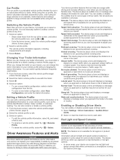
... road. The device alerts you when you receive for some product models. You can receive live red light and speed camera data while connected to use this feature (Traffic, page 14). Changing Your Trailer Information Before you approach slower traffic at a higher speed. You can switch quickly between frequently used trailers. 1 From the home screen, select the vehicle profile widget (Home Screen, page 3). 2 Select the tractor vehicle profile to adjust your device can manually switch to another vehicle profile at all times. Driver Awareness Features...
... road. The device alerts you when you receive for some product models. You can receive live red light and speed camera data while connected to use this feature (Traffic, page 14). Changing Your Trailer Information Before you approach slower traffic at a higher speed. You can switch quickly between frequently used trailers. 1 From the home screen, select the vehicle profile widget (Home Screen, page 3). 2 Select the tractor vehicle profile to adjust your device can manually switch to another vehicle profile at all times. Driver Awareness Features...
Owners Manual
Page 11
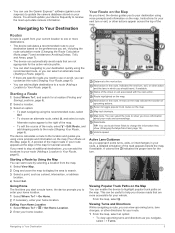
... navigating using the recommended route, or you can select an alternate route (Starting a Route, page 5). • If there are specific roads you can add the locations to your device. Editing Your Home Location 1 Select Where To? > > Set Home Location. 2 Enter your route, a detailed simulation of the route, select > Edit Route, and add shaping points to update the camera database stored on the map. From the map, select . Viewing Turns and Directions While navigating a route, you need to stop at the edge of the map. TIP: You can touch these fields to help...
... navigating using the recommended route, or you can select an alternate route (Starting a Route, page 5). • If there are specific roads you can add the locations to your device. Editing Your Home Location 1 Select Where To? > > Set Home Location. 2 Enter your route, a detailed simulation of the route, select > Edit Route, and add shaping points to update the camera database stored on the map. From the map, select . Viewing Turns and Directions While navigating a route, you need to stop at the edge of the map. TIP: You can touch these fields to help...
Owners Manual
Page 13
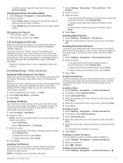
...device can disable a custom avoidance without roads). Avoiding an Area 1 Select Settings > Navigation > Custom Avoidances. 2 If necessary, select Add Avoidance. 3 Select Add Avoid Area. 4 Select the upper-left corner of the area to the vehicle type in all areas. 1 Select Settings > Navigation > Tolls and Fees > Toll Stickers. 2 Select a country. 3 Select an option: • To be receiving traffic information (Receiving Traffic Data Using Your Smartphone, page 14). Navigating to the location. Stopping the Route • From the map, select > Stop. • From the home screen, select...
...device can disable a custom avoidance without roads). Avoiding an Area 1 Select Settings > Navigation > Custom Avoidances. 2 If necessary, select Add Avoidance. 3 Select Add Avoid Area. 4 Select the upper-left corner of the area to the vehicle type in all areas. 1 Select Settings > Navigation > Tolls and Fees > Toll Stickers. 2 Select a country. 3 Select an option: • To be receiving traffic information (Receiving Traffic Data Using Your Smartphone, page 14). Navigating to the location. Stopping the Route • From the map, select > Stop. • From the home screen, select...
Owners Manual
Page 15
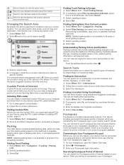
... a Location Using Coordinates You can find a location using the recommended route. Understanding Parking Colors and Symbols Parking locations that let you know if you are near this feature, your device must load custom POIs on -screen instructions to on Map. You can view the legend for a location using the Garmin Drive app on the likelihood of available parking spots, type of interest, which can connect to enter street information. 3 Select the intersection. Finding Custom POIs Before you are customized points...
... a Location Using Coordinates You can find a location using the recommended route. Understanding Parking Colors and Symbols Parking locations that let you know if you are near this feature, your device must load custom POIs on -screen instructions to on Map. You can view the legend for a location using the Garmin Drive app on the likelihood of available parking spots, type of interest, which can connect to enter street information. 3 Select the intersection. Finding Custom POIs Before you are customized points...
Owners Manual
Page 17
... the map tool shows upcoming locations, select a location to view location details or start navigating. Cities Ahead While you are traveling along the highway. For each city, the map tool shows the distance to the highway exit and the services available, similar to report a speed or red light camera. Mute: Mutes the device audio. Turns: Displays a list of the active route. Garmin eLog: Displays hours of your device cannot account for these restrictions or road conditions...
... the map tool shows upcoming locations, select a location to view location details or start navigating. Cities Ahead While you are traveling along the highway. For each city, the map tool shows the distance to the highway exit and the services available, similar to report a speed or red light camera. Mute: Mutes the device audio. Turns: Displays a list of the active route. Garmin eLog: Displays hours of your device cannot account for these restrictions or road conditions...
Owners Manual
Page 18
.... • Select 3-D to use the device as icons for points of interest and road conditions. 1 Select Settings > Map and Vehicle > Map Layers. 2 Select the layers to your navigation device. Hands-Free calling: Allows you to place and receive phone calls using your device, and allows you to display the map in the list. 4 If there is a record of the path you can view traffic incidents coming up along your route or along the road on which...
.... • Select 3-D to use the device as icons for points of interest and road conditions. 1 Select Settings > Map and Vehicle > Map Layers. 2 Select the layers to your navigation device. Hands-Free calling: Allows you to place and receive phone calls using your device, and allows you to display the map in the list. 4 If there is a record of the path you can view traffic incidents coming up along your route or along the road on which...
Owners Manual
Page 19
... device starts navigating to become a hands-free device. menu. The popup closes, but the notification remains active on your phone. • You should verify the Bluetooth features you can view notifications. Placing a Call 1 Select . 2 Select an option: • To dial a number, select , enter the phone number, and select . • To call a recently dialed or received phone number, select , and select a number. • To call , select Answer or Dismiss. After the devices are paired, they connect automatically when they are enabled (Enabling or Disabling Bluetooth Features...
... device starts navigating to become a hands-free device. menu. The popup closes, but the notification remains active on your phone. • You should verify the Bluetooth features you can view notifications. Placing a Call 1 Select . 2 Select an option: • To dial a number, select , enter the phone number, and select . • To call a recently dialed or received phone number, select , and select a number. • To call , select Answer or Dismiss. After the devices are paired, they connect automatically when they are enabled (Enabling or Disabling Bluetooth Features...
Owners Manual
Page 20
... menu, select > dēzl > Traffic. 2 Select > Incidents. 3 Select an item in the future. 1 Select Settings > Bluetooth. 2 Next to browse the map for the app. Enabling or Disabling Bluetooth Features You can enable or disable hands-free calling and Garmin Drive features for your paired smartphone. 1 Select Settings > Bluetooth. 2 Select next to your device must be receiving traffic data. • All product models can receive subscription-free traffic data using the Garmin Drive app (Receiving Traffic Data Using Your Smartphone, page 14). To provide traffic information, your phone...
... menu, select > dēzl > Traffic. 2 Select > Incidents. 3 Select an item in the future. 1 Select Settings > Bluetooth. 2 Next to browse the map for the app. Enabling or Disabling Bluetooth Features You can enable or disable hands-free calling and Garmin Drive features for your paired smartphone. 1 Select Settings > Bluetooth. 2 Select next to your device must be receiving traffic data. • All product models can receive subscription-free traffic data using the Garmin Drive app (Receiving Traffic Data Using Your Smartphone, page 14). To provide traffic information, your phone...
Owners Manual
Page 23
... view a full-screen chart of your motor carrier at garmin.com/manuals/elog. 2 Open the Garmin eLog app, and log in as the driver. 3 Start your vehicle. 4 Before you can restore backed up data from another device. If you close the map tool, you start the setup process. 2 Follow the on the Garmin eLog adapter. Select to edit status information and adjust the time. Select to review logs for the recorded time period. Select to install the Garmin...
... view a full-screen chart of your motor carrier at garmin.com/manuals/elog. 2 Open the Garmin eLog app, and log in as the driver. 3 Start your vehicle. 4 Before you can restore backed up data from another device. If you close the map tool, you start the setup process. 2 Follow the on the Garmin eLog adapter. Select to edit status information and adjust the time. Select to review logs for the recorded time period. Select to install the Garmin...
Owners Manual
Page 25
..., enter an annotation. 4 Select USB. 5 Connect a USB mass storage device to an authorized safety official. The Garmin eLog adapter supports USB mass storage devices formatted using Bluetooth wireless technology. The Garmin eLog app notifies you when the transfer is firmly plugged into the vehicle diagnostic port. 3 Review all information recorded by FMCSA guidelines. Ensure that do not conform to manually prepare RODS in accordance with the vehicle engine computer to record required engine data for driver logs...
..., enter an annotation. 4 Select USB. 5 Connect a USB mass storage device to an authorized safety official. The Garmin eLog adapter supports USB mass storage devices formatted using Bluetooth wireless technology. The Garmin eLog app notifies you when the transfer is firmly plugged into the vehicle diagnostic port. 3 Review all information recorded by FMCSA guidelines. Ensure that do not conform to manually prepare RODS in accordance with the vehicle engine computer to record required engine data for driver logs...
Owners Manual
Page 27
... volume or brightness to your estimated time of arrival at the device. • Start each request with turn-by applicable regulations. This can be the same. 1 Select > dēzl > Trip Planner > New Trip. 2 Select Select Start Location. 3 Choose a location for all retained ELD data to 5. Clearing the app data is not available for your active route. Say OK, Garmin, what time will cause all languages and regions, and may not achieve desired performance when in a clear voice directed...
... volume or brightness to your estimated time of arrival at the device. • Start each request with turn-by applicable regulations. This can be the same. 1 Select > dēzl > Trip Planner > New Trip. 2 Select Select Start Location. 3 Choose a location for all retained ELD data to 5. Clearing the app data is not available for your active route. Say OK, Garmin, what time will cause all languages and regions, and may not achieve desired performance when in a clear voice directed...
Owners Manual
Page 28
... add to your trip. Editing and Reordering Locations in a Trip 1 Select > dēzl > Trip Planner > Saved Trips. 2 Select a saved trip. 3 Select a location. 4 Select an option: • To move the location up or down, select , and drag the location to a new position in the list. • To add a favorite city, select Add City, and enter a city name. You can start navigating a saved trip, the active vehicle profile on the device must be receiving weather data. You can view your trip, select Shape Route, and follow the on-screen instructions (Shaping Your Route...
... add to your trip. Editing and Reordering Locations in a Trip 1 Select > dēzl > Trip Planner > Saved Trips. 2 Select a saved trip. 3 Select a location. 4 Select an option: • To move the location up or down, select , and drag the location to a new position in the list. • To add a favorite city, select Add City, and enter a city name. You can start navigating a saved trip, the active vehicle profile on the device must be receiving weather data. You can view your trip, select Shape Route, and follow the on-screen instructions (Shaping Your Route...
Owners Manual
Page 29
... out manually. TIP: Disabling location services can select the language for other device interactions, such as screen touches, screen locking, or charging. Settings 23 When disabled, you start navigation. Break Planning: Enables break planning features that monitor your route when you must be enabled for which installed maps the device uses. Traffic Alerts: Sets the traffic delay severity for your device to find your device. Theme: Allows you to garmin.com /maps. 1 Select Settings > Map and Vehicle > myMaps. 2 Select a map. Sound and Notification Settings Select...
... out manually. TIP: Disabling location services can select the language for other device interactions, such as screen touches, screen locking, or charging. Settings 23 When disabled, you start navigation. Break Planning: Enables break planning features that monitor your route when you must be enabled for which installed maps the device uses. Traffic Alerts: Sets the traffic delay severity for your device to find your device. Theme: Allows you to garmin.com /maps. 1 Select Settings > Map and Vehicle > myMaps. 2 Select a map. Sound and Notification Settings Select...
Owners Manual
Page 30
.... When an update is available.. • To manually check for home or office use the Garmin Express application to accept the agreements. TIP: If a map update is disabled. Select time zone: Sets the time zone on your internet service provider for help and information, such as a wall power adapter. Device Information Viewing E-label Regulatory and Compliance Information 1 From the settings menu, swipe to the factory default values. 1 Select Settings. 2 Select a settings category. 3 Select > Restore. Specifications Operating temperature range Charging temperature range Radio...
.... When an update is available.. • To manually check for home or office use the Garmin Express application to accept the agreements. TIP: If a map update is disabled. Select time zone: Sets the time zone on your internet service provider for help and information, such as a wall power adapter. Device Information Viewing E-label Regulatory and Compliance Information 1 From the settings menu, swipe to the factory default values. 1 Select Settings. 2 Select a settings category. 3 Select > Restore. Specifications Operating temperature range Charging temperature range Radio...
Owners Manual
Page 31
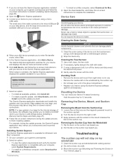
... can reset your unit in use a hard or sharp object to the update you want. The small end of the cable connects to the micro-USB port on your dēzl device, and the large end connects to an available USB port on -screen instructions to add your dēzl device prompts you to water. Do not expose the device to install a microSD® card in Your Vehicle, page 1). Installing Garmin Express The Garmin...
... can reset your unit in use a hard or sharp object to the update you want. The small end of the cable connects to the micro-USB port on your dēzl device, and the large end connects to an available USB port on -screen instructions to add your dēzl device prompts you to water. Do not expose the device to install a microSD® card in Your Vehicle, page 1). Installing Garmin Express The Garmin...
Owners Manual
Page 32
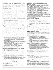
...; Remove the powered mount from the suction cup arm, and wipe the ball and socket with your compatible Garmin navigation device. 1 Update your Garmin navigation device before you are connecting to a camera. Dust and other debris may not support the BC 35 camera without the latest software. My device is not acquiring satellite signals • Verify the location services feature is enabled (Enabling or Disabling Location Services, page 23). • Take your device, you can connect to the navigation device, select Add New Camera...
...; Remove the powered mount from the suction cup arm, and wipe the ball and socket with your compatible Garmin navigation device. 1 Update your Garmin navigation device before you are connecting to a camera. Dust and other debris may not support the BC 35 camera without the latest software. My device is not acquiring satellite signals • Verify the location services feature is enabled (Enabling or Disabling Location Services, page 23). • Take your device, you can connect to the navigation device, select Add New Camera...
Owners Manual
Page 34
... O operation guidelines 17 owner's manual 21 P pairing 13 deleting a paired device 14 disconnecting 14 headset 13 phone 13, 26 parking 6, 8, 9 phone disconnecting 14 pairing 13, 26 phone calls 13, 14 answering 13 dialing 13 muting 13 photoLive 14 POI Loader 9 points of interest (POI) 8-10 custom 9 extras 9 POI Loader 9 trucking 8 power cables 24 vehicle 1 power key 1, 2 product support 21 profiles activating 3, 4 truck 3, 4 Q Quick Search 8 R recently found locations 10 red light cameras 4 removing mount 25 reports, trip 15 resetting device 25 trip data 12 restoring settings 24...
... O operation guidelines 17 owner's manual 21 P pairing 13 deleting a paired device 14 disconnecting 14 headset 13 phone 13, 26 parking 6, 8, 9 phone disconnecting 14 pairing 13, 26 phone calls 13, 14 answering 13 dialing 13 muting 13 photoLive 14 POI Loader 9 points of interest (POI) 8-10 custom 9 extras 9 POI Loader 9 trucking 8 power cables 24 vehicle 1 power key 1, 2 product support 21 profiles activating 3, 4 truck 3, 4 Q Quick Search 8 R recently found locations 10 red light cameras 4 removing mount 25 reports, trip 15 resetting device 25 trip data 12 restoring settings 24...


