
Pilot's Guide
Page 99
... the map pointer. If METAR data is available for an airport, a color-coded flag is only displayed within the installed aviation database service area. Touching the Map Feature...Flight Planning Hazard Avoidance Additional Features Hazard Avoidance Storm Cell Data (Map) METARS AND TAFS Additional Storm Cell Information NOTE: METAR information ... significant weather changes, temporary changes, probable changes, and expected changes in weather conditions. A Garmin aera 795/796 Pilot's Guide 85 METARs typically contain information about the temperature, dewpoint, wind, precipitation, cloud...
... the map pointer. If METAR data is available for an airport, a color-coded flag is only displayed within the installed aviation database service area. Touching the Map Feature...Flight Planning Hazard Avoidance Additional Features Hazard Avoidance Storm Cell Data (Map) METARS AND TAFS Additional Storm Cell Information NOTE: METAR information ... significant weather changes, temporary changes, probable changes, and expected changes in weather conditions. A Garmin aera 795/796 Pilot's Guide 85 METARs typically contain information about the temperature, dewpoint, wind, precipitation, cloud...

Pilot's Guide
Page 150
... provided by accurately displaying the aircraft position on the map in the obstacle database. SafeTaxi The SafeTaxi database contains detailed airport diagrams for the United States only. Appendix C Overview GARMIN DATABASE INFORMATION The following ground control instructions by Garmin: • Worldwide Basemap • • Worldwide... obstacle database contains data for obstacles, such as rivers, lakes, and towns. This database is updated on a 28-day cycle. This database is updated on a 56-day cycle. 136 Garmin aera 795/796 Pilot's Guide 190-01194-00 Rev.
... provided by accurately displaying the aircraft position on the map in the obstacle database. SafeTaxi The SafeTaxi database contains detailed airport diagrams for the United States only. Appendix C Overview GARMIN DATABASE INFORMATION The following ground control instructions by Garmin: • Worldwide Basemap • • Worldwide... obstacle database contains data for obstacles, such as rivers, lakes, and towns. This database is updated on a 28-day cycle. This database is updated on a 56-day cycle. 136 Garmin aera 795/796 Pilot's Guide 190-01194-00 Rev.
Pilot's Guide
Page 167
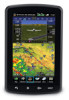
...to generate traffic notification. TIS should not be considered to provide a five-second update rate. The TIS ground sensor uses real-time track reports to TIS. TIS...Map. While TIS is not intended to be used by TIS is neither better nor more accurate than the information used for visual traffic avoidance, system limitations must be used by ATC. The aera 795/796...traffic targets within the coverage volume. TIS and TAS/TCAS have similar ranges. A Garmin aera 795/796 Pilot's Guide 153 Appendices Index TAS/TCAS The main difference between the Traffic Information ...
...to generate traffic notification. TIS should not be considered to provide a five-second update rate. The TIS ground sensor uses real-time track reports to TIS. TIS...Map. While TIS is not intended to be used by TIS is neither better nor more accurate than the information used for visual traffic avoidance, system limitations must be used by ATC. The aera 795/796...traffic targets within the coverage volume. TIS and TAS/TCAS have similar ranges. A Garmin aera 795/796 Pilot's Guide 153 Appendices Index TAS/TCAS The main difference between the Traffic Information ...

Pilot's Guide
Page 180
... The unit can save up to select cruising speed, maximum speed, fuel flow, and map symbol. For most aircraft, this figure. Total Air Temperature is the temperature reading on ...outside air including the heating effect caused by speed. NOTE: If True North is automatically updated if you exceed this is the temperature of the outside air temperature gauge.) The calculated .... Accessing the aircraft profile: From the Main Menu, touch Tools > Profile Appendices Index 166 Garmin aera 795/796 Pilot's Guide 190-01194-00 Rev. Calculating winds aloft: 1) From the Main Menu, touch...
... The unit can save up to select cruising speed, maximum speed, fuel flow, and map symbol. For most aircraft, this figure. Total Air Temperature is the temperature reading on ...outside air including the heating effect caused by speed. NOTE: If True North is automatically updated if you exceed this is the temperature of the outside air temperature gauge.) The calculated .... Accessing the aircraft profile: From the Main Menu, touch Tools > Profile Appendices Index 166 Garmin aera 795/796 Pilot's Guide 190-01194-00 Rev. Calculating winds aloft: 1) From the Main Menu, touch...


