
User Guide
Page 3
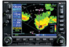
... and be misused or misinterpreted and therefore become unsafe. Updates are inherent in VMC. CAUTION: The Jeppesen database incorporated in the 400W/500W Pilot's Guide. CAUTION: The Weather Data Link, TIS, TAWS, HTAWS, and TERRAIN information contained in order to ensure that must know how... is not able to determine aircraft altitude. The GPS altitude format calculated by the Garmin 400W/500W Series units is intended only to actual use . Garmin is current. Terrain data must not be displayed on TFR times and locations. CAUTION: The Global Positioning System...
... and be misused or misinterpreted and therefore become unsafe. Updates are inherent in VMC. CAUTION: The Jeppesen database incorporated in the 400W/500W Pilot's Guide. CAUTION: The Weather Data Link, TIS, TAWS, HTAWS, and TERRAIN information contained in order to ensure that must know how... is not able to determine aircraft altitude. The GPS altitude format calculated by the Garmin 400W/500W Series units is intended only to actual use . Garmin is current. Terrain data must not be displayed on TFR times and locations. CAUTION: The Global Positioning System...
User Guide
Page 4
... Section 2: TAWS Operation 32 TAWS Alerting 32 Baro-Corrected Altitude 32 Power Up 32 TAWS Page 32 Inhibit Mode 34 External TAWS Inhibit Control 34 TAWS Manual Test 34 TAWS Symbols 35 General Database Information 36 Database Versions 36 Database Updates 37 Terrain/Obstacle Database ...Control and Display 5 TIS Traffic Display Status and Pilot Response 5 Traffic Page 6 Traffic Page Display Range 6 Map Page 7 Configuring TIS Traffic Data on the Map Page 7 Highlighting TIS Traffic Using Map Page Panning 8 Section 3: TIS Operational Procedures 9 Introduction 9 Power-Up Test 9 ...
... Section 2: TAWS Operation 32 TAWS Alerting 32 Baro-Corrected Altitude 32 Power Up 32 TAWS Page 32 Inhibit Mode 34 External TAWS Inhibit Control 34 TAWS Manual Test 34 TAWS Symbols 35 General Database Information 36 Database Versions 36 Database Updates 37 Terrain/Obstacle Database ...Control and Display 5 TIS Traffic Display Status and Pilot Response 5 Traffic Page 6 Traffic Page Display Range 6 Map Page 7 Configuring TIS Traffic Data on the Map Page 7 Highlighting TIS Traffic Using Map Page Panning 8 Section 3: TIS Operational Procedures 9 Introduction 9 Power-Up Test 9 ...
User Guide
Page 43
... and verify that not all obstacles are updated periodically with the latest terrain and obstacle data. Regional definitions may change without notice. Contact Garmin at 800-800-1020 or at www.garmin.com for newer versions of Canada, Mexico, Caribbean, and the Pacific. Part Three: Section 2 TAWS Operation Database Updates Terrain/obstacle databases are necessarily charted and therefore...
... and verify that not all obstacles are updated periodically with the latest terrain and obstacle data. Regional definitions may change without notice. Contact Garmin at 800-800-1020 or at www.garmin.com for newer versions of Canada, Mexico, Caribbean, and the Pacific. Part Three: Section 2 TAWS Operation Database Updates Terrain/obstacle databases are necessarily charted and therefore...


