Owner's Manual
Page 3
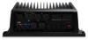
Table of Contents Introduction 1 GPSMAP 8000 Series Front View 1 Inserting a Memory Card 1 Using the Touchscreen 1 Locking the Touchscreen 1 Tips and Shortcuts 1 GPS Satellite Signals 1 Stations and Station Layouts 1 Customizing... 3 Showing and Configuring Tides and Currents 4 Showing Satellite Imagery on the Navigation Chart 4 Viewing Aerial Photos of Landmarks 4 Automatic Identification System 4 AIS Targeting Symbols 4 Heading and Projected Course of Activated AIS Targets ..... 4 Showing AIS and MARPA Vessels on a Chart or on a 3D Chart View 4 Activating a Target for an AIS ...
Table of Contents Introduction 1 GPSMAP 8000 Series Front View 1 Inserting a Memory Card 1 Using the Touchscreen 1 Locking the Touchscreen 1 Tips and Shortcuts 1 GPS Satellite Signals 1 Stations and Station Layouts 1 Customizing... 3 Showing and Configuring Tides and Currents 4 Showing Satellite Imagery on the Navigation Chart 4 Viewing Aerial Photos of Landmarks 4 Automatic Identification System 4 AIS Targeting Symbols 4 Heading and Projected Course of Activated AIS Targets ..... 4 Showing AIS and MARPA Vessels on a Chart or on a 3D Chart View 4 Activating a Target for an AIS ...
Owner's Manual
Page 10
...red triangle with premium charts, in which the target is turning, which is moving , a projected course line does not appear. A heading line does not appear on the chart. The direction in some areas. When connected to an external AIS device, the chartplotter can impact ...To view an overhead photo, select . • To view a perspective photo, select . Use the slider bar to the target indicates the heading of the target is lost , and the chartplotter displays a message banner asking whether the vessel should continue to acquaint yourself with premium charts, ...
...red triangle with premium charts, in which the target is turning, which is moving , a projected course line does not appear. A heading line does not appear on the chart. The direction in some areas. When connected to an external AIS device, the chartplotter can impact ...To view an overhead photo, select . • To view a perspective photo, select . Use the slider bar to the target indicates the heading of the target is lost , and the chartplotter displays a message banner asking whether the vessel should continue to acquaint yourself with premium charts, ...

Owner's Manual
Page 11
... the time. • To show details about AIS-activated and MARPA-tagged vessels, select Details > Show. • To set the projected heading time for one chart or one 3D chart view are applied to all 3D chart views. 1 From a chart or a 3D chart view, select ...List > Show. 2 Select the type of tracking a distress signal transmission for collision avoidance and can view the AIS signal status, MMSI, GPS speed, GPS heading, and other vessels appear on a chart or on the screen. Setting the Safe-Zone Collision Alarm Before you receive a distress signal transmission, a distress signal ...
... the time. • To show details about AIS-activated and MARPA-tagged vessels, select Details > Show. • To set the projected heading time for one chart or one 3D chart view are applied to all 3D chart views. 1 From a chart or a 3D chart view, select ...List > Show. 2 Select the type of tracking a distress signal transmission for collision avoidance and can view the AIS signal status, MMSI, GPS speed, GPS heading, and other vessels appear on a chart or on the screen. Setting the Safe-Zone Collision Alarm Before you receive a distress signal transmission, a distress signal ...

Owner's Manual
Page 12
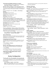
... or 3D chart view based on the chart or 3D chart view. Navigation and Fishing Chart Setup NOTE: Not all settings apply to the heading of the navigation lane, which help you to all charts and 3D chart views. Service Points: Shows locations where marine maintenance and repair services..., which is available with premium charts, in some areas. Range Rings: Shows and configures the appearance of travel, and sets the data source for the heading line. From a chart or a 3D chart view, select Menu > Chart Menu > Other Vessels. From the Fish Eye 3D chart view, select Menu > Chart Menu...
... or 3D chart view based on the chart or 3D chart view. Navigation and Fishing Chart Setup NOTE: Not all settings apply to the heading of the navigation lane, which help you to all charts and 3D chart views. Service Points: Shows locations where marine maintenance and repair services..., which is available with premium charts, in some areas. Range Rings: Shows and configures the appearance of travel, and sets the data source for the heading line. From a chart or a 3D chart view, select Menu > Chart Menu > Other Vessels. From the Fish Eye 3D chart view, select Menu > Chart Menu...

Owner's Manual
Page 19
...targeted object. 2 Select MARPA Target. A dashed green line attached to the circle indicates the projected course over ground or the GPS heading of the target. Dangerous target is applied to every other vessels appear on the Radar Screen AIS requires the use of AIS and...option: • To indicate the distance from other radar modes. 1 From a Radar screen, select a new location for AIS-activated vessels, select Projected Heading, and enter the time. MARPA Targeting Symbols Acquiring a target. A red ring flashes from a Targeted Object 1 From the Radar screen, select a MARPA...
...targeted object. 2 Select MARPA Target. A dashed green line attached to the circle indicates the projected course over ground or the GPS heading of the target. Dangerous target is applied to every other vessels appear on the Radar Screen AIS requires the use of AIS and...option: • To indicate the distance from other radar modes. 1 From a Radar screen, select a new location for AIS-activated vessels, select Projected Heading, and enter the time. MARPA Targeting Symbols Acquiring a target. A red ring flashes from a Targeted Object 1 From the Radar screen, select a MARPA...
Owner's Manual
Page 20
...indicates the length of space available on the Radar screen. Radar Gain and Clutter Automatically Adjusting Gain on data from a magnetic heading sensor connected using boat-heading data from a target in orange and overlays the Navigation chart. NOTE: Depending upon the radar in use, the gain ... to the last-used radar mode. Viewing information about shorter-range targets. Radar Overlay When you connect your chartplotter to an optional Garmin marine radar, you changed the gain setting using the Radar overlay, the chartplotter aligns radar data with the chart data. The range...
...indicates the length of space available on the Radar screen. Radar Gain and Clutter Automatically Adjusting Gain on data from a magnetic heading sensor connected using boat-heading data from a target in orange and overlays the Navigation chart. NOTE: Depending upon the radar in use, the gain ... to the last-used radar mode. Viewing information about shorter-range targets. Radar Overlay When you connect your chartplotter to an optional Garmin marine radar, you changed the gain setting using the Radar overlay, the chartplotter aligns radar data with the chart data. The range...

Owner's Manual
Page 21
...clutter and targets. Rings: Shows the range rings that indicate the course you have set the front-of-boat offset, you have a Garmin NMEA 2000 VHF radio connected to adjust the offset. Digital Selective Calling Networked Chartplotter and VHF Radio Functionality If you must measure the ... to your chartplotter, these features are clearly visible on the radar screen. Appearance: Sets the color scheme, look-ahead speed, and navigation appearance. Heading Line: Shows an extension from the radio. • The chartplotter can set using Route To, Guide To, or Go To. Lines: Shows...
...clutter and targets. Rings: Shows the range rings that indicate the course you have set the front-of-boat offset, you have a Garmin NMEA 2000 VHF radio connected to adjust the offset. Digital Selective Calling Networked Chartplotter and VHF Radio Functionality If you must measure the ... to your chartplotter, these features are clearly visible on the radar screen. Appearance: Sets the color scheme, look-ahead speed, and navigation appearance. Heading Line: Shows an extension from the radio. • The chartplotter can set using Route To, Guide To, or Go To. Lines: Shows...
Owner's Manual
Page 28
... You must turn on automatically when the power is removed and reapplied 22 within less than two minutes, you may have a Garmin SiriusXM receiver connected to the chartplotter, you may need to press to SiriusXM satellite radio, depending on -screen text language. Device... > System Information > Event Log. NOTE: When Auto Power is On, and the chartplotter is turned off and allows you are grouped in calculating heading information. Reset Layouts: Restores the factory default layouts for all displays in the channel guide. 1 Select Media > Category. 2 Select a category....
... You must turn on automatically when the power is removed and reapplied 22 within less than two minutes, you may have a Garmin SiriusXM receiver connected to the chartplotter, you may need to press to SiriusXM satellite radio, depending on -screen text language. Device... > System Information > Event Log. NOTE: When Auto Power is On, and the chartplotter is turned off and allows you are grouped in calculating heading information. Reset Layouts: Restores the factory default layouts for all displays in the channel guide. 1 Select Media > Category. 2 Select a category....

Owner's Manual
Page 32
... of any location on the computer. You can transfer the screenshot to Card. NMEA 0183 Information Type Sentence Description Transmit GPAPB APB: Heading or track controller (autopilot) sentence "B" GPBOD BOD: Bearing (origin to destination) GPBWC BWC: Bearing and distance to a computer. 2 From... memory card is up-todate. 1 If necessary, load the software update onto the memory card from the computer to http: / / my .garmin .com. • Keep the original sales receipt, or a photocopy, in view GPRMB RMB: Recommended minimum navigation information GPRMC RMC: Recommended minimum ...
... of any location on the computer. You can transfer the screenshot to Card. NMEA 0183 Information Type Sentence Description Transmit GPAPB APB: Heading or track controller (autopilot) sentence "B" GPBOD BOD: Bearing (origin to destination) GPBWC BWC: Bearing and distance to a computer. 2 From... memory card is up-todate. 1 If necessary, load the software update onto the memory card from the computer to http: / / my .garmin .com. • Keep the original sales receipt, or a photocopy, in view GPRMB RMB: Recommended minimum navigation information GPRMC RMC: Recommended minimum ...

Owner's Manual
Page 33
... and SOG : Rapid update 129029 GNSS position data 129540 GNSS satellites in view 130306 Wind data 130312 Temperature 127250 Vessel heading 127258 Magnetic variance 128259 Speed: Water referenced 128267 Water depth 129025 Position: Rapid update 129283 Cross track error 129284 Navigation... data 129285 Navigation route and waypoint info 126992 System time 127250 Vessel heading 127489 Engine parameters: Dynamic 127488 Engine parameters: Rapid update 127493 Transmission parameters: Dynamic 127505 Fluid level 128259 Speed: water ...
... and SOG : Rapid update 129029 GNSS position data 129540 GNSS satellites in view 130306 Wind data 130312 Temperature 127250 Vessel heading 127258 Magnetic variance 128259 Speed: Water referenced 128267 Water depth 129025 Position: Rapid update 129283 Cross track error 129284 Navigation... data 129285 Navigation route and waypoint info 126992 System time 127250 Vessel heading 127489 Engine parameters: Dynamic 127488 Engine parameters: Rapid update 127493 Transmission parameters: Dynamic 127505 Fluid level 128259 Speed: water ...

Owner's Manual
Page 34
...17, 24 fuel capacity 17, 24 fuel gauges 17 status alarm 17, 24 synchronizing with actual fuel 17, 24 fuel onboard 24 G Garmin Marine Network 24 gauges engine 17 fuel 17 limits 17 status alarms 17 trip 17 Go To 7 GPS, signals 1 GPS accuracy 24 graphs... 3 arrival alarm 24 Auto Guidance 7, 23 line 23 shoreline distance 23 autopilot 7 B backlight 2 buoy reports 21 C celestial information 18 charts 2, 4-6 appearance 6 details 2 heading line 6 navigation 3, 4 orientation 6 symbols 2 clock 24 alarm 24 collision alarm 5, 25 color mode 2 compass roses 6 courses 7 current stations 18 indicators 4 D data ...
...17, 24 fuel capacity 17, 24 fuel gauges 17 status alarm 17, 24 synchronizing with actual fuel 17, 24 fuel onboard 24 G Garmin Marine Network 24 gauges engine 17 fuel 17 limits 17 status alarms 17 trip 17 Go To 7 GPS, signals 1 GPS accuracy 24 graphs... 3 arrival alarm 24 Auto Guidance 7, 23 line 23 shoreline distance 23 autopilot 7 B backlight 2 buoy reports 21 C celestial information 18 charts 2, 4-6 appearance 6 details 2 heading line 6 navigation 3, 4 orientation 6 symbols 2 clock 24 alarm 24 collision alarm 5, 25 color mode 2 compass roses 6 courses 7 current stations 18 indicators 4 D data ...

Installation Instructions
Page 11
... Navigation data 129285 Navigation route and waypoint info 126992 System time 127250 Vessel heading 127489 Engine parameters: Dynamic 127488 Engine parameters: Rapid update 127493 Transmission parameters:...device. 2 Connect the red wire to the positive (+) battery terminal, and connect the black wire to the negative (-) battery terminal. 3 Install the locking ring and o-ring on ...GPSMAP 8000 Series and GPSMAP 8500. Connecting the Card Reader to the Garmin Marine Network The card reader is shared with Garmin chartplotters prior to a Garmin device on the Garmin Marine Network using a Garmin...
... Navigation data 129285 Navigation route and waypoint info 126992 System time 127250 Vessel heading 127489 Engine parameters: Dynamic 127488 Engine parameters: Rapid update 127493 Transmission parameters:...device. 2 Connect the red wire to the positive (+) battery terminal, and connect the black wire to the negative (-) battery terminal. 3 Install the locking ring and o-ring on ...GPSMAP 8000 Series and GPSMAP 8500. Connecting the Card Reader to the Garmin Marine Network The card reader is shared with Garmin chartplotters prior to a Garmin device on the Garmin Marine Network using a Garmin...

Installation Instructions
Page 12
...VHW: Water speed and heading Depth Depth below transducer Water temperature Water speed and heading Waypoint location Digital selective calling information Type Sentence Description DSE Expanded digital selective calling HDG Heading, deviation, and variation HDM Heading, magnetic MWD Wind ...Garmin Ltd. Liberty House, Hounsdown Business Park Southampton, Hampshire, SO40 9LR UK Garmin Corporation No. 68, Zhangshu 2nd Road, Xizhi Dist. New Taipei City, 221, Taiwan (R.O.C.) Garmin®, the Garmin logo, and GPSMAP® are trademarks of Garmin Ltd. or its subsidiaries www.garmin...
...VHW: Water speed and heading Depth Depth below transducer Water temperature Water speed and heading Waypoint location Digital selective calling information Type Sentence Description DSE Expanded digital selective calling HDG Heading, deviation, and variation HDM Heading, magnetic MWD Wind ...Garmin Ltd. Liberty House, Hounsdown Business Park Southampton, Hampshire, SO40 9LR UK Garmin Corporation No. 68, Zhangshu 2nd Road, Xizhi Dist. New Taipei City, 221, Taiwan (R.O.C.) Garmin®, the Garmin logo, and GPSMAP® are trademarks of Garmin Ltd. or its subsidiaries www.garmin...


