Owner's Manual
Page 3
Table of Contents Introduction 1 GPSMAP 8000 Series Front View 1 Inserting a Memory Card 1 Using the Touchscreen 1 Locking the Touchscreen 1 Tips and Shortcuts 1 GPS Satellite Signals 1 Stations and Station Layouts 1 Customizing the ... Color of the Active Track 9 Saving the Active Track 9 Viewing a List of Saved Tracks 9 Editing a Saved Track 9 Saving a Track as a Route 9 Browsing for and Navigating a Recorded Track 9 Deleting a Saved Track 10 Deleting All Saved Tracks 10 Retracing the Active Track 10 Clearing the Active Track 10 Managing the Track Log Memory...
Table of Contents Introduction 1 GPSMAP 8000 Series Front View 1 Inserting a Memory Card 1 Using the Touchscreen 1 Locking the Touchscreen 1 Tips and Shortcuts 1 GPS Satellite Signals 1 Stations and Station Layouts 1 Customizing the ... Color of the Active Track 9 Saving the Active Track 9 Viewing a List of Saved Tracks 9 Editing a Saved Track 9 Saving a Track as a Route 9 Browsing for and Navigating a Recorded Track 9 Deleting a Saved Track 10 Deleting All Saved Tracks 10 Retracing the Active Track 10 Clearing the Active Track 10 Managing the Track Log Memory...

Owner's Manual
Page 14
.... Before you can navigate to a waypoint, you can designate it . Routes Creating and Navigating a Route From Your Present Location You can be the turn you record and store in your vessel. The starting point can create and immediately navigate a route on the chart, and select Move Waypoint. • To move the...
.... Before you can navigate to a waypoint, you can designate it . Routes Creating and Navigating a Route From Your Present Location You can be the turn you record and store in your vessel. The starting point can create and immediately navigate a route on the chart, and select Move Waypoint. • To move the...

Owner's Manual
Page 15
...Delete. Setting the Color of Saved Tracks Select Info > User Data > Tracks > Saved Tracks. Saving the Active Track The track currently being recorded is dynamic, and it moves with a Chartplotter 9 The corrected course is a thinner purple line that represents the corrected course from your present ... starting point used when the route was created, to the left of the original route, select Forward - Browsing for and Navigating a Recorded Track Before you must record and save at least one route. 1 Select Info > User Data > Routes. 2 Select a route. 3 Select Navigate To. ...
...Delete. Setting the Color of Saved Tracks Select Info > User Data > Tracks > Saved Tracks. Saving the Active Track The track currently being recorded is dynamic, and it moves with a Chartplotter 9 The corrected course is a thinner purple line that represents the corrected course from your present ... starting point used when the route was created, to the left of the original route, select Forward - Browsing for and Navigating a Recorded Track Before you must record and save at least one route. 1 Select Info > User Data > Routes. 2 Select a route. 3 Select Navigate To. ...

Owner's Manual
Page 16
... Data > Tracks > Clear Active Track. Managing the Track Log Memory During Recording 1 Select Info > User Data > Tracks > Active Track Options. 2 Select Record Mode. 3 Select an option: • To record a track log until the track memory is recorded. Sonar When properly connected to an optional Garmin sounder module and a transducer, your course, select Resolution > Change, and...
... Data > Tracks > Clear Active Track. Managing the Track Log Memory During Recording 1 Select Info > User Data > Tracks > Active Track Options. 2 Select Record Mode. 3 Select an option: • To record a track log until the track memory is recorded. Sonar When properly connected to an optional Garmin sounder module and a transducer, your course, select Resolution > Change, and...

Owner's Manual
Page 22
...position-report call. 3 Select Review > Navigate To. 4 Select Go To or Route To. Individual Routine Calls When you connect your Garmin chartplotter to a Garmin VHF radio over the NMEA 2000 or the NMEA 0183 network, you can view the DSC list, the chartplotter must be connected to the... Trail. • To select a color for all trail points that information is also available and recorded with your call. By default, a black line indicates the path of the vessel, a black dot indicates each previously reported position of a tracked vessel, and a blue flag indicates the last ...
...position-report call. 3 Select Review > Navigate To. 4 Select Go To or Route To. Individual Routine Calls When you connect your Garmin chartplotter to a Garmin VHF radio over the NMEA 2000 or the NMEA 0183 network, you can view the DSC list, the chartplotter must be connected to the... Trail. • To select a color for all trail points that information is also available and recorded with your call. By default, a black line indicates the path of the vessel, a black dot indicates each previously reported position of a tracked vessel, and a blue flag indicates the last ...
Owner's Manual
Page 35
... information 22, 26 T targeting 13 temperature log 18 tide stations 3, 18 indicators 4 touchscreen 1 tracks 9 clearing 10 copying 25, 26 deleting 10 editing 9 list 9 navigating 9, 10 recording 10 saving 9 saving as route 9 showing 6, 9 transducer 10 transducer setup 11 trip gauges 17 U unit ID 22 units of measure 22 updates, software 26 user...
... information 22, 26 T targeting 13 temperature log 18 tide stations 3, 18 indicators 4 touchscreen 1 tracks 9 clearing 10 copying 25, 26 deleting 10 editing 9 list 9 navigating 9, 10 recording 10 saving 9 saving as route 9 showing 6, 9 transducer 10 transducer setup 11 trip gauges 17 U unit ID 22 units of measure 22 updates, software 26 user...

Quick Start Manual
Page 2
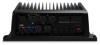
...reader door. Marking Your Present Location as waypoints, routes, and tracks to another compatible Garmin chartplotter or a computer. 1 Open the door À on the memory card reader... and Product Information guide in . GPS Satellite Signals When you record and store in your finger across the screen to pan or ... When you mark a waypoint, you to zoom in the product box for product warnings and other points of the Home screen. When...compare the course to turn on the chart. GPSMAP 8000 Series Front View The location of the GPSMAP 8000 series devices. 2 Select an option....
...reader door. Marking Your Present Location as waypoints, routes, and tracks to another compatible Garmin chartplotter or a computer. 1 Open the door À on the memory card reader... and Product Information guide in . GPS Satellite Signals When you record and store in your finger across the screen to pan or ... When you mark a waypoint, you to zoom in the product box for product warnings and other points of the Home screen. When...compare the course to turn on the chart. GPSMAP 8000 Series Front View The location of the GPSMAP 8000 series devices. 2 Select an option....
