Owner's Manual
Page 20
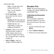
... to a destination. • Compass-allows you to switch from an electronic compass to select how the course is available only with the GPSMAP 78S and GPSMAP 78Sc. Select Calibrate Altimeter. 3. From the elevation plot, press menu. 2. Using the Main Pages ◦◦ Grid-sets grid north as... the heading reference (0°). ◦◦ User-sets the magnetic variation value. • Go To Line/Pointer-allows you to a GPS compass ...
... to a destination. • Compass-allows you to switch from an electronic compass to select how the course is available only with the GPSMAP 78S and GPSMAP 78Sc. Select Calibrate Altimeter. 3. From the elevation plot, press menu. 2. Using the Main Pages ◦◦ Grid-sets grid north as... the heading reference (0°). ◦◦ User-sets the magnetic variation value. • Go To Line/Pointer-allows you to a GPS compass ...
Owner's Manual
Page 23
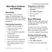
... Select Send or Receive. 3. Go to www.garmin.com/geocache. 6. Select Find a Geocache. 3. Select Go. Go to www.garmin.com/products /communicator. 4. Your device can send or receive data when connected to a Geocache 1. GPSMAP 78 Series Owner's Manual 19 Downloading Geocaches 1. You ... device. Main Menu Features and Settings Geocaches Geocaching is available only with the GPSMAP 78S and GPSMAP 78Sc. Download the Garmin Communicator plug in which geocachers seek hidden treasures using GPS coordinates posted on the Internet by those hiding the geocache. Follow the on ...
... Select Send or Receive. 3. Go to www.garmin.com/geocache. 6. Select Find a Geocache. 3. Select Go. Go to www.garmin.com/products /communicator. 4. Your device can send or receive data when connected to a Geocache 1. GPSMAP 78 Series Owner's Manual 19 Downloading Geocaches 1. You ... device. Main Menu Features and Settings Geocaches Geocaching is available only with the GPSMAP 78S and GPSMAP 78Sc. Download the Garmin Communicator plug in which geocachers seek hidden treasures using GPS coordinates posted on the Internet by those hiding the geocache. Follow the on ...
Owner's Manual
Page 27
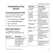
... Bearing **Cadence (cadence accessory required) Course Customizing Your Device Description The uncalibrated environmental pressure. The direction from your GPS location is accurate to a destination. GPSMAP 78 Series Owner's Manual 23 The remaining battery power. Revolutions of ascent. The total elevation distance ascended. Customizing Your.... From a main page, press meNu. 2. Select a data field. 4. Data Field Options ** Available only with the GPSMAP 78S and GPSMAP 78Sc. For example, your starting location to within +/- 12 feet. The direction from your exact location.
... Bearing **Cadence (cadence accessory required) Course Customizing Your Device Description The uncalibrated environmental pressure. The direction from your GPS location is accurate to a destination. GPSMAP 78 Series Owner's Manual 23 The remaining battery power. Revolutions of ascent. The total elevation distance ascended. Customizing Your.... From a main page, press meNu. 2. Select a data field. 4. Data Field Options ** Available only with the GPSMAP 78S and GPSMAP 78Sc. For example, your starting location to within +/- 12 feet. The direction from your exact location.


