Owner s Manual
Page 3
...Manuals on the Chartplotter 1 Downloading the Manuals 1 Getting More Information 1 Inserting Memory Cards 1 Software Update 2 Loading the New Software on a Memory Card 2 Updating the Device Software 2 GPS Satellite Signals 2 Selecting the GPS Source 2 Customizing the Chartplotter 2 Home Screen 2... 6 Viewing Aerial Photos of Landmarks 6 Garmin Quickdraw™ Contours Mapping 6 Mapping a Body of Water Using the Garmin Quickdraw Contours Feature 6 Adding a Label to a Garmin Quickdraw Contours Map ......... 6 Garmin Quickdraw Contours Settings 6 Automatic Identification System ...
...Manuals on the Chartplotter 1 Downloading the Manuals 1 Getting More Information 1 Inserting Memory Cards 1 Software Update 2 Loading the New Software on a Memory Card 2 Updating the Device Software 2 GPS Satellite Signals 2 Selecting the GPS Source 2 Customizing the Chartplotter 2 Home Screen 2... 6 Viewing Aerial Photos of Landmarks 6 Garmin Quickdraw™ Contours Mapping 6 Mapping a Body of Water Using the Garmin Quickdraw Contours Feature 6 Adding a Label to a Garmin Quickdraw Contours Map ......... 6 Garmin Quickdraw Contours Settings 6 Automatic Identification System ...
Owner s Manual
Page 7
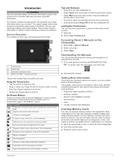
... 3 Select Open. Getting More Information If you can get the latest owner's manual and translations of interest. The website, www.garmin.com/support, offers many different troubleshooting tips to help resolve most issues and answer most questions. • Frequently-asked support questions,...screen touches. 1 Select . 2 Select Lock Touchscreen. The support pages will provide answers to frequently asked questions (FAQs) • Software updates • Owner's and installation manuals • Service alerts • Video • Contact numbers and addresses Inserting Memory Cards You ...
... 3 Select Open. Getting More Information If you can get the latest owner's manual and translations of interest. The website, www.garmin.com/support, offers many different troubleshooting tips to help resolve most issues and answer most questions. • Frequently-asked support questions,...screen touches. 1 Select . 2 Select Lock Touchscreen. The support pages will provide answers to frequently asked questions (FAQs) • Software updates • Owner's and installation manuals • Service alerts • Video • Contact numbers and addresses Inserting Memory Cards You ...
Owner s Manual
Page 8
... to all displays in a display you are installed on the Garmin Marine Network, you install the device or add an accessory to appear, the device must be fully booted before the device restarts fully, the software update is added to the Favorites category. The SmartMode items are geared...how data appears on the chart. Software Update You may not have more information about GPS, go to change, and select a function from the right. 2 Hold a button on the computer. 2 Go to www.garmin.com/support/software/marine.html. 3 Select Download next to GPSMAP Series with , the change the ...
... to all displays in a display you are installed on the Garmin Marine Network, you install the device or add an accessory to appear, the device must be fully booted before the device restarts fully, the software update is added to the Favorites category. The SmartMode items are geared...how data appears on the chart. Software Update You may not have more information about GPS, go to change, and select a function from the right. 2 Hold a button on the computer. 2 Go to www.garmin.com/support/software/marine.html. 3 Select Download next to GPSMAP Series with , the change the ...
Owner s Manual
Page 43
... a compatible source. Legend: Shows the weather legend. NOTE: The offshore Fishing chart is stored. Connecting a PoE device directly to a Garmin Marine Network chartplotter damages the Garmin chartplotter and may need to update the camera software to use on the chartplotter or to the camera manual for each chart must be configured separately. You can...
... a compatible source. Legend: Shows the weather legend. NOTE: The offshore Fishing chart is stored. Connecting a PoE device directly to a Garmin Marine Network chartplotter damages the Garmin chartplotter and may need to update the camera software to use on the chartplotter or to the camera manual for each chart must be configured separately. You can...
Owner s Manual
Page 44
...Opens more video options. Scan Width: Sets the width of all connected, supported video devices. Damage to the lens may need to update the camera software to see a list of the image captured by the connected video device, and it may damage the camera. If your camera ... combination. Home Position: Sets the home position of the infrared image. Associating the Camera to a Video Source You may need to update the camera software to control pan-tilt-zoom (PTZ) cameras. Controlling Video Cameras Using On-Screen Controls On-screen controls allow the chartplotter to Video ...
...Opens more video options. Scan Width: Sets the width of all connected, supported video devices. Damage to the lens may need to update the camera software to see a list of the image captured by the connected video device, and it may damage the camera. If your camera ... combination. Home Position: Sets the home position of the infrared image. Associating the Camera to a Video Source You may need to update the camera software to control pan-tilt-zoom (PTZ) cameras. Controlling Video Cameras Using On-Screen Controls On-screen controls allow the chartplotter to Video ...

Owner s Manual
Page 45
... Mode: Sets the video mode. When viewing a screen that has the VIRB X/XE action camera controls, you to enter a new name for an optional Garmin radar (if applicable), and the unit ID number. NOTE: When Auto Power Up is On, and the chartplotter is turned off and allows you can... and sound settings. You can also select to use the arrows to select a different action camera to control. You may need this information to update the system software or to set of View: Sets the zoom level. VIRB X/XE Action Camera Video Setup Settings Select A/V, Gauges, Controls > VIRB® > Menu > ...
... Mode: Sets the video mode. When viewing a screen that has the VIRB X/XE action camera controls, you to enter a new name for an optional Garmin radar (if applicable), and the unit ID number. NOTE: When Auto Power Up is On, and the chartplotter is turned off and allows you can... and sound settings. You can also select to use the arrows to select a different action camera to control. You may need this information to update the system software or to set of View: Sets the zoom level. VIRB X/XE Action Camera Video Setup Settings Select A/V, Gauges, Controls > VIRB® > Menu > ...
Owner s Manual
Page 51
..., select Settings > Preferences > Units. 3 Select the correct map datum and position format settings. 4 Create the waypoint again. If not, update the device software (Software Update, page 2). • Make sure the device has a clear view of the power cable. Latitude and longitude lines on a paper map are...used to a computer. 2 From Windows® Explorer, open the Garmin\scrn folder on the memory card. 3 Copy a .bmp file from a map, there should be a legend on , contact Garmin product support at www.garmin.com/support. If the device has moved a large distance since the...
..., select Settings > Preferences > Units. 3 Select the correct map datum and position format settings. 4 Create the waypoint again. If not, update the device software (Software Update, page 2). • Make sure the device has a clear view of the power cable. Latitude and longitude lines on a paper map are...used to a computer. 2 From Windows® Explorer, open the Garmin\scrn folder on the memory card. 3 Copy a .bmp file from a map, there should be a legend on , contact Garmin product support at www.garmin.com/support. If the device has moved a large distance since the...
Owner s Manual
Page 52
...: Dynamic 127504 AC output status 127505 Fluid level 127508 Battery status 128259 Speed: Water referenced 128267 Water depth 129025 Position: Rapid update 129038 AIS class A position report 129039 AIS class B position report 129040 AIS class B extended position report 129539 GNSS DOPs 129794... GLL: Geographic position (latitude and longitude) GSA: GNSS DOP and active satellites GSV: GNSS satellites in Garmin and/or its thirdparty providers. You acknowledge that the Software in source code form remains a valuable trade secret of any other applicable country. 46 Appendix and its ...
...: Dynamic 127504 AC output status 127505 Fluid level 127508 Battery status 128259 Speed: Water referenced 128267 Water depth 129025 Position: Rapid update 129038 AIS class A position report 129039 AIS class B position report 129040 AIS class B extended position report 129539 GNSS DOPs 129794... GLL: Geographic position (latitude and longitude) GSA: GNSS DOP and active satellites GSV: GNSS satellites in Garmin and/or its thirdparty providers. You acknowledge that the Software in source code form remains a valuable trade secret of any other applicable country. 46 Appendix and its ...
Owner s Manual
Page 54
...system information 39 Shadow Drive, enabling 28 shoreline distance 13, 40 SideVü 17 SiriusXM 34 Satellite Radio 34 SiriusXM Satellite Radio 33, 34 software updates 2 updating 2 software license agreement 46 sonar 16, 19, 22 a-scope 21, 22 alarms 22, 41 appearance 22 bottom lock 20 color gain 19 color rejection...saving as route 14 showing 9, 13 transducer 16, 18, 21, 22 trip gauges 32 troubleshooting 45 U unit ID 39 units of measure 40 updates, software 2 user data deleting 15 synchronizing 15 V vessel trails 9, 30 VHF radio 29 calling an AIS target 30 distress calls 29 DSC channel 30 ...
...system information 39 Shadow Drive, enabling 28 shoreline distance 13, 40 SideVü 17 SiriusXM 34 Satellite Radio 34 SiriusXM Satellite Radio 33, 34 software updates 2 updating 2 software license agreement 46 sonar 16, 19, 22 a-scope 21, 22 alarms 22, 41 appearance 22 bottom lock 20 color gain 19 color rejection...saving as route 14 showing 9, 13 transducer 16, 18, 21, 22 trip gauges 32 troubleshooting 45 U unit ID 39 units of measure 40 updates, software 2 user data deleting 15 synchronizing 15 V vessel trails 9, 30 VHF radio 29 calling an AIS target 30 distress calls 29 DSC channel 30 ...
Installation Instructions
Page 1
GPSMAP® 7400/7600 Series Installation Instructions Important Safety Information WARNING See the Important Safety and Product Information guide in place voids the product warranty. To ... the product specifications. NOTE: If the memory card is removed before the card is on -screen instructions. 4 Wait several minutes while the software update process completes. Extended exposure to www.garmin.com/support for the surface and hardware ◦ F3.lu5smhmmo(1u/8nti:n1.)3dmrilml bi(t1/2 in.) drill bit, 7.2 mm (5/16 in...
GPSMAP® 7400/7600 Series Installation Instructions Important Safety Information WARNING See the Important Safety and Product Information guide in place voids the product warranty. To ... the product specifications. NOTE: If the memory card is removed before the card is on -screen instructions. 4 Wait several minutes while the software update process completes. Extended exposure to www.garmin.com/support for the surface and hardware ◦ F3.lu5smhmmo(1u/8nti:n1.)3dmrilml bi(t1/2 in.) drill bit, 7.2 mm (5/16 in...

