
Installation Instructions
Page 5
...Device All models Five-inch models Specification Input power Fuse NMEA 2000 LEN NMEA 2000 Draw Max. In this situation, you can install a Garmin external GPS antenna (not included) in -line switch 12 Vdc power source NMEA 2000 terminator or backbone cable NMEA 2000 T-connector NMEA 2000 terminator or... one is up-todate. 1 If necessary, load the software update onto the memory card from your computer by following the instructions on www.garmin.com. 2 Turn on the chartplotter. 3 Insert the memory card into the card slot. 4 Follow the on your device. NOTE: Do not connect the network cable to...
...Device All models Five-inch models Specification Input power Fuse NMEA 2000 LEN NMEA 2000 Draw Max. In this situation, you can install a Garmin external GPS antenna (not included) in -line switch 12 Vdc power source NMEA 2000 terminator or backbone cable NMEA 2000 T-connector NMEA 2000 terminator or... one is up-todate. 1 If necessary, load the software update onto the memory card from your computer by following the instructions on www.garmin.com. 2 Turn on the chartplotter. 3 Insert the memory card into the card slot. 4 Follow the on your device. NOTE: Do not connect the network cable to...

Owner's Manual
Page 3
Table of Contents Introduction 1 Device Views 1 echoMAP 70 Series and GPSMAP 700 Series 1 Using the Touchscreen 1 echoMAP 50 Series and GPSMAP 500 Series 1 Device Keys 1 Tips and Shortcuts 1 GPS Satellite Signals 1 Adjusting the Backlight 1 Adjusting the Color Mode 1 ... Settings 6 Other Vessels Settings on the Charts and Chart Views ........ 7 AIS Display Settings 7 Fish Eye 3D Settings 7 Navigation with a Chartplotter 7 Basic Navigation Questions 7 Destinations 7 Searching for a Destination by Name 7 Selecting a Destination Using the Navigation Chart 7 Searching for a ...
Table of Contents Introduction 1 Device Views 1 echoMAP 70 Series and GPSMAP 700 Series 1 Using the Touchscreen 1 echoMAP 50 Series and GPSMAP 500 Series 1 Device Keys 1 Tips and Shortcuts 1 GPS Satellite Signals 1 Adjusting the Backlight 1 Adjusting the Color Mode 1 ... Settings 6 Other Vessels Settings on the Charts and Chart Views ........ 7 AIS Display Settings 7 Fish Eye 3D Settings 7 Navigation with a Chartplotter 7 Basic Navigation Questions 7 Destinations 7 Searching for a Destination by Name 7 Selecting a Destination Using the Navigation Chart 7 Searching for a ...

Owner's Manual
Page 4
...Navigating to a Vessel in Distress 18 Man-Overboard Distress Calls Initiated from a VHF Radio . 18 Man-Overboard Distress Calls Initiated from the Chartplotter 18 Position Tracking 18 Viewing a Position Report 18 Navigating to a Tracked Vessel 19 Creating a Waypoint at the Position of a Tracked ...SiriusXM Channel to the Presets List 22 Adjusting SiriusXM Satellite Radio Volume 22 Device Configuration 22 Turning On the Chartplotter Automatically 22 System Settings 23 GPS Settings 23 Viewing the Event Log 23 Viewing System Software Information 23 My Vessel Settings 23 ii Table of...
...Navigating to a Vessel in Distress 18 Man-Overboard Distress Calls Initiated from a VHF Radio . 18 Man-Overboard Distress Calls Initiated from the Chartplotter 18 Position Tracking 18 Viewing a Position Report 18 Navigating to a Tracked Vessel 19 Creating a Waypoint at the Position of a Tracked ...SiriusXM Channel to the Presets List 22 Adjusting SiriusXM Satellite Radio Volume 22 Device Configuration 22 Turning On the Chartplotter Automatically 22 System Settings 23 GPS Settings 23 Viewing the Event Log 23 Viewing System Software Information 23 My Vessel Settings 23 ii Table of...

Owner's Manual
Page 7
... screen touches. 1 Select . 2 Select Lock Touchscreen. Device Views echoMAP 70 Series and GPSMAP 700 Series Power key À Automatic backlight sensor Á Touchscreen  microSD™..., when applicable. Saves the present location as waypoints, routes, and tracks to another compatible Garmin chartplotter or a computer. 1 Open the access door on the Home screen. 1 From the Home... Product Information guide in . Zooms in the chartplotter. GPS Satellite Signals When you turn the chartplotter on the chartplotter, the GPS receiver must collect satellite data and establish the ...
... screen touches. 1 Select . 2 Select Lock Touchscreen. Device Views echoMAP 70 Series and GPSMAP 700 Series Power key À Automatic backlight sensor Á Touchscreen  microSD™..., when applicable. Saves the present location as waypoints, routes, and tracks to another compatible Garmin chartplotter or a computer. 1 Open the access door on the Home screen. 1 From the Home... Product Information guide in . Zooms in the chartplotter. GPS Satellite Signals When you turn the chartplotter on the chartplotter, the GPS receiver must collect satellite data and establish the ...

Owner's Manual
Page 10
... landmarks, marinas, and harbors to help orient yourself to your optional chart region, you discontinue vessel tracking, the lost , and the chartplotter displays a message banner asking whether the vessel should continue to acquaint yourself with premium charts, in some areas. If you cannot see ... or more the satellite photos cover both land and sea portions of each vessel includes the Maritime Mobile Service Identity (MMSI), location, GPS speed, GPS heading, time that target. If the AIS transmission from the chart or the 3D chart view. When course over ground information are...
... landmarks, marinas, and harbors to help orient yourself to your optional chart region, you discontinue vessel tracking, the lost , and the chartplotter displays a message banner asking whether the vessel should continue to acquaint yourself with premium charts, in some areas. If you cannot see ... or more the satellite photos cover both land and sea portions of each vessel includes the Maritime Mobile Service Identity (MMSI), location, GPS speed, GPS heading, time that target. If the AIS transmission from the chart or the 3D chart view. When course over ground information are...

Owner's Manual
Page 11
...Vessel > Activate Target. The safe-zone collision alarm is reported about a Targeted AIS Vessel You can view the AIS signal status, MMSI, GPS speed, GPS heading, and other vessels. For example, to all 3D chart views. 1 From a chart or 3D chart view, select Menu > Other ...Details > Show. • To set a safe-zone collision alarm, you can receive signals from other information that 3D chart view. The chartplotter can set the projected heading time for collision avoidance, you receive a distress signal transmission, a distress signal alarm appears. Distress signal transmissions ...
...Vessel > Activate Target. The safe-zone collision alarm is reported about a Targeted AIS Vessel You can view the AIS signal status, MMSI, GPS speed, GPS heading, and other vessels. For example, to all 3D chart views. 1 From a chart or 3D chart view, select Menu > Other ...Details > Show. • To set a safe-zone collision alarm, you can receive signals from other information that 3D chart view. The chartplotter can set the projected heading time for collision avoidance, you receive a distress signal transmission, a distress signal alarm appears. Distress signal transmissions ...

Owner's Manual
Page 18
... Gauges Select Gauges > Environment. Current Station Information NOTE: Current station information is calculated by your chartplotter GPS (course over ground). 1 Select Gauges > Wind > Menu > Heading Source. 2 Select GPS Hdg or Magnetic. Select Nav Info > Tides & Currents > Currents. Select Nav Info > ... in the vessel when you add fuel to your chartplotter GPS (course over ground). 1 Select Gauges > Environment > Menu > Heading Source. 2 Select GPS Hdg or Magnetic. By default, the chartplotter shows current information for the most recently viewed tide ...
... Gauges Select Gauges > Environment. Current Station Information NOTE: Current station information is calculated by your chartplotter GPS (course over ground). 1 Select Gauges > Wind > Menu > Heading Source. 2 Select GPS Hdg or Magnetic. Select Nav Info > Tides & Currents > Currents. Select Nav Info > ... in the vessel when you add fuel to your chartplotter GPS (course over ground). 1 Select Gauges > Environment > Menu > Heading Source. 2 Select GPS Hdg or Magnetic. By default, the chartplotter shows current information for the most recently viewed tide ...

Owner's Manual
Page 22
...the Radar overlay, select Menu > Other Vessels > AIS Display Setup. 2 Select an option: • To indicate the distance from your chartplotter to an optional Garmin marine radar, you can use Harbor mode and then you switch to a Target Object Before you can add noise to a target object. ... display range) is configured for the intersection point of an external AIS device and active transponder signals from other vessels appear on GPS tracking data. The VRM and the EBL configured for viewing information about shorter-range targets. Radar Overlay When you can adjust the...
...the Radar overlay, select Menu > Other Vessels > AIS Display Setup. 2 Select an option: • To indicate the distance from your chartplotter to an optional Garmin marine radar, you can use Harbor mode and then you switch to a Target Object Before you can add noise to a target object. ... display range) is configured for the intersection point of an external AIS device and active transponder signals from other vessels appear on GPS tracking data. The VRM and the EBL configured for viewing information about shorter-range targets. Radar Overlay When you can adjust the...

Owner's Manual
Page 24
... 2000 VHF radio connected to your Garmin chartplotter to 100 entries. The front-of-boat offset setting configured for the physical location of the radar scanner on the radio, the chartplotter screen prompting you to activate navigation to your radio is capable, GPS position information is logged in the... call . If you have set up to a VHF radio using NMEA 0183 or NMEA 2000, your chartplotter alerts you when your Garmin chartplotter shows the man-overboard screen and prompts you to ...
... 2000 VHF radio connected to your Garmin chartplotter to 100 entries. The front-of-boat offset setting configured for the physical location of the radar scanner on the radio, the chartplotter screen prompting you to activate navigation to your radio is capable, GPS position information is logged in the... call . If you have set up to a VHF radio using NMEA 0183 or NMEA 2000, your chartplotter alerts you when your Garmin chartplotter shows the man-overboard screen and prompts you to ...

Owner's Manual
Page 29
...-sensing transducer or sensor (page 23). Enter a positive number to get the message, contact Garmin product support. WAAS/EGNOS: Turns on -screen instructions. You can enter a keel offset to... Temperature Offset: Compensates for a large vessel that speed-sensing device to provide more -accurate GPS position information. Set Gauge Limits: Sets the upper and lower limits of the keel , ...you have a speed-sensing transducer connected to the chartplotter, you to purchase additional map data information. Speed Filter: Averages the speed of ...
...-sensing transducer or sensor (page 23). Enter a positive number to get the message, contact Garmin product support. WAAS/EGNOS: Turns on -screen instructions. You can enter a keel offset to... Temperature Offset: Compensates for a large vessel that speed-sensing device to provide more -accurate GPS position information. Set Gauge Limits: Sets the upper and lower limits of the keel , ...you have a speed-sensing transducer connected to the chartplotter, you to purchase additional map data information. Speed Filter: Averages the speed of ...
Owner's Manual
Page 31
...than the safe obstacle height, the Auto Guidance line is placed the appropriate distance from a turn that triggers the alarm. You can set up the chartplotter as a gray line. Units Settings Select Settings > Units. System Units: Sets the unit format for your location automatically. Auto Mag Var (automatic... the chartplotter wireless network, you must be connected to the NMEA 2000 network. Arrival: Sets an alarm to sound when you are using some areas. Off Course: Sets an alarm to sound when you set an alarm to sound when the battery reaches a specified low voltage. GPS Accuracy:...
...than the safe obstacle height, the Auto Guidance line is placed the appropriate distance from a turn that triggers the alarm. You can set up the chartplotter as a gray line. Units Settings Select Settings > Units. System Units: Sets the unit format for your location automatically. Auto Mag Var (automatic... the chartplotter wireless network, you must be connected to the NMEA 2000 network. Arrival: Sets an alarm to sound when you are using some areas. Off Course: Sets an alarm to sound when you set an alarm to sound when the battery reaches a specified low voltage. GPS Accuracy:...

Quick Start Manual
Page 2
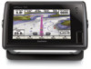
...data such as a Waypoint From any screen to the previous screen. echoMAP 70 Series and GPSMAP 700 Series À Power key Á Automatic backlight sensor  Touchscreen Ã...location, and select Move Waypoint. When the chartplotter loses satellite signals, disappears and a flashing question mark appears over on the chartplotter, the GPS receiver must collect satellite data and establish ..., when applicable. Zooms in to www.garmin.com / aboutGPS. Mark Saves the present location as a man overboard (MOB) location. For more information about GPS, go to a chart or view. ...
...data such as a Waypoint From any screen to the previous screen. echoMAP 70 Series and GPSMAP 700 Series À Power key Á Automatic backlight sensor  Touchscreen Ã...location, and select Move Waypoint. When the chartplotter loses satellite signals, disappears and a flashing question mark appears over on the chartplotter, the GPS receiver must collect satellite data and establish ..., when applicable. Zooms in to www.garmin.com / aboutGPS. Mark Saves the present location as a man overboard (MOB) location. For more information about GPS, go to a chart or view. ...


