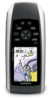
Garmin GPSMAP 78sc Support Question
Garmin GPSMAP 78sc Support Question
Find answers below for this question about Garmin GPSMAP 78sc.Need a Garmin GPSMAP 78sc manual? We have 3 online manuals for this item!
Question posted by vitawyler on January 2nd, 2017
Not Acquiring Satellite Garmin Gps 78
What do i do if my Garmin GPS 78 does not acquire any sattelites?
Current Answers
Answer #1: Posted by waelsaidani1 on January 2nd, 2017 10:38 PM
waelsaidani1

Member since:
May 12th, 2013 Points: 19,501,797

Member since:
May 12th, 2013 Points: 19,501,797
It could be that the unit is in the "GPS OFF" mode. Get into the main menu--go to "Set Up" hit "Enter" --go "System" and under GPS make sure it is on.
Also take out the SD card and use without it, see if it does not work,
If the above did not help, find out the version and get the latest update from Garmin website.
Related Garmin GPSMAP 78sc Manual Pages
Owner's Manual - Page 3

Table of Contents
Getting Started 1 Manual Conventions 1 Device Overview 2 Battery Information 3 Installing the Batteries 3 Turning the Device On or Off..... 3 Acquiring Satellite Signals......... 4 Buttons 4
Navigating with Waypoints and Routes 6 Waypoints 6 Routes 7 Additional Maps 9
Tracks 10 About Tracks 10 Navigating a Saved Track.........11
Using the Main Pages....... 12 ...
Owner's Manual - Page 5
... device (page 3). 3. When using your device the first time, you should select a series of items in a list, and then press ENTER. Install the batteries (page 3). 2. Acquire satellites (page 4). 4. Calibrate the compass (page 14).
Navigate a route (page 8). 6. GPSMAP 78 Series Owner's Manual
1
Owner's Manual - Page 6

Getting Started
Device Overview
Internal antenna
Buttons
Display
2
MCX connector for external GPS antenna (under weather cap)
Serial port (under weather cap)
mini-USB port (under weather cap)
Battery compartment
microSD™ card slot (under batteries)
GPSMAP 78 Series Owner's Manual
Owner's Manual - Page 8

... mark flashes while the device determines your current location as a waypoint and begin navigation to acquire signals. 1.
The GPS bars indicate satellite strength. Press and hold to open the backlight status page.
GPSMAP 78 Series Owner's Manual Getting Started
Acquiring Satellite Signals
It may take 30 to 60 seconds to that point. If necessary, turn the device...
Owner's Manual - Page 13
... your Garmin dealer. Select Go. Select a category. 4. Select Addresses.
3.
Finding an Address with Waypoints and Routes
6. The detailed maps contain millions of points of interest, such as restaurants, hotels, and auto services.
1. NOTE: Not all map data provides postal code searching.
5. Finding Marine Services 1. Press FIND. 2. Select Marine Services. 3.
GPSMAP 78 Series Owner...
Owner's Manual - Page 20
...-sets the magnetic variation value.
• Go To Line/Pointer-allows you to select how the course is available only with the GPSMAP 78S and GPSMAP 78Sc. Follow the on-screen instructions.
16
GPSMAP 78 Series Owner's Manual Elevation Plot
note: The elevation plot page is displayed.
◦◦ Bearing (Small/Large) indicates the direction to...
Owner's Manual - Page 23
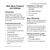
... only with the GPSMAP 78S and GPSMAP 78Sc. Downloading Geocaches 1. Follow the on-screen instructions to download geocaches to another compatible device. Your device can send or receive data when connected to your device to a Geocache 1.
Go to www.garmin.com/geocache.
6. Download the Garmin Communicator plug in which geocachers seek hidden treasures using GPS coordinates posted...
Owner's Manual - Page 25
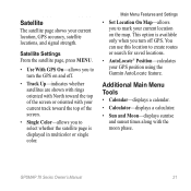
...; AutoLocate® Position-calculates your current location, GPS accuracy, satellite locations, and signal strength. Additional Main Menu Tools...Satellite Settings From the satellite page, press menu.
• Use With GPS On-allows you to mark your current location on and off GPS.
GPSMAP 78 Series Owner's Manual
21
Satellite
The satellite page shows your GPS position using the Garmin...
Owner's Manual - Page 28
...). GPS Signal Strength
The strength of horizontal distance traveled to Next
Elevation
**Elevation - The maximum descent rate in vertical distance.
required)
24
GPSMAP 78 Series... Owner's Manual
The total elevation distance descended. Customizing Your Device
Data Field Depth
**Descent - Glide Ratio
The ratio of the GPS signal. Average **...
Owner's Manual - Page 29
The distance to acquire data (page... the original path of travel.
Sunset
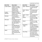
The time of sunset based on your GPS position. Data Field Location (lat/lon)
Location (selected) Odometer Off Course
...while moving since last reset.
Displays the current position in the selected position format. GPSMAP 78 Series Owner's Manual
Customizing Your Device
Data Field
Description
Speed - Speed - A running...
Owner's Manual - Page 31

...Overlay Service), or Demo Mode (GPS off). GPSMAP 78 Series Owner's Manual
27 System Settings
From the main menu, select Setup > System.
• GPS-sets the GPS to www.garmin.com/aboutGPS/waas .html.
... Interface-sets the format of the serial interface:
Customizing Your Device
◦◦ Garmin Serial-Garmin proprietary format used to provide PVT protocol data.
◦◦ NMEA In/Out-...
Owner's Manual - Page 32
... charts.
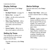
◦◦ Fishing-(requires marine maps) displays a detailed view of bottom contours and depth soundings. Marine Settings
From the main menu, select Setup > Marine.
• Marine Chart Mode-allows you to take screen...the key tones, message beeps, or turn off tones.
Setting Up Tones
Your Garmin device allows you to select a nautical chart or a fishing chart:
◦◦ Nautical-...
Owner's Manual - Page 35
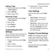
...Select Add Page. 3. Select a page to set the time zone automatically based on your GPS position. Position Format Settings
Note: Do not change the position format or the map datum ...map or chart that specifies a different position format. Adding a Page 1. Removing a Page 1.
GPSMAP 78 Series Owner's Manual
Customizing Your Device
4. You can customize units of measure for the setting. From...
Owner's Manual - Page 49
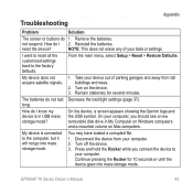
... the Rocker for several minutes. not respond.
On the device, a screen appears showing the Garmin logo and the USB symbol. GPSMAP 78 Series Owner's Manual
45
Disconnect the device from tall buildings and trees.
2. My device does not acquire satellite signals.
1. Turn on Mac computers. Press and hold the Rocker while you should see a new...
Owner's Manual - Page 50

or accessories. GPS antenna.
46
GPSMAP 78 Series Owner's Manual I need replacement parts Go to your Garmin drives. If you have several network drives mapped on your computer, Windows may have trouble assigning drive letters to http://buy.garmin.com, or contact your Garmin dealer.
See the Help file for your operating system to learn how to...
Owner's Manual - Page 51
... accessories 38, 46
fitness 39 microSD card 39 acquiring satellite signals 45 active route 8 alarms marine 29 proximity 20 time 22 altimeter calibrating 16 plot...38 compass calibrating 14 navigating 14 setup options 15 connecting USB cable 41 wireless accessories 39
GPSMAP 78 Series Owner's Manual
Index
wirelessly 19 creating
routes 7 waypoints 6 customizing data fields 12 device...
Owner's Manual - Page 52

... tracks 11 viewing routes 8 map datum coordinate system 31 marine settings 28-29 MARK button 5 MCX connector 2 measuring area 20 distance 13 MENU button 5, 12, 17, 23 microSD card 36, 39-41 MOB button 4 moonphase 21
N navigating
compass 14 routes 8 to geocaches 19 to waypoints 6 tracks 11
48
GPSMAP 78 Series Owner's Manual
Owner's Manual - Page 53

... route 8 avoidance 34 creating 7 deleting 8 editing 7 editing name 7 guidance method 33 navigating 8 settings 33
S satellite signals 4, 21, 23,
24, 37, 45 AutoLocate 21 system settings 27 turning off GPS 21 saving tracks 11 search menu 4, 6 Sight 'N Go 15
GPSMAP 78 Series Owner's Manual
Index
software updating 35 version 35
specifications 36 stopwatch 22 sun...
Quick Start Manual - Page 2

... features.
1. Installing the Batteries
1. More Information
You can go to www.garmin.com to verify that it operates correctly when the device is operating. Acquire satellites (page 3).
4. Battery Information
The device operates on the back of the device, and remove the battery cover.
GPSMAP 78 Quick Start Manual Navigate a route (page 9). Test your device the...
Quick Start Manual - Page 3
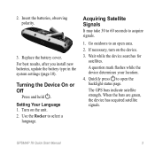
...unit. 2. Quickly press to acquire signals.
1. Insert the batteries, observing polarity.
3. The GPS bars indicate satellite strength. Acquiring Satellite Signals
It may take 30 to...satellites. When the bars are green, the device has acquired satellite signals.
For best results, after you install new batteries, update the battery type in the system settings (page 10).
GPSMAP 78...
Similar Questions

Garmin 498 Gps Will Not Acquire Satellites
(Posted by bturike 9 years ago)

Garmin 178c Wont Acquire Satellites
(Posted by sunnewscr 9 years ago)

Garmin 178c Sounder Won't Acquire Satellites
(Posted by plama 9 years ago)

Garmin 178c Does Not Acquire Satellites
(Posted by ccJOe 9 years ago)
