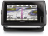
Garmin GPSMAP 721 Support and Manuals
Get Help and Manuals for this Garmin item
View All Support Options Below
Free Garmin GPSMAP 721 manuals!
Problems with Garmin GPSMAP 721?
Ask a Question
Free Garmin GPSMAP 721 manuals!
Problems with Garmin GPSMAP 721?
Ask a Question
Popular Garmin GPSMAP 721 Manual Pages
Important Safety and Product Information - Page 2

... identify in certain areas have the goods repaired or replaced if the goods fail to be used with a new or newlyoverhauled replacement product) the device or software or offer a full refund of safely operating your local Garmin authorized dealer or call Garmin Product Support for help. THIS WARRANTY GIVES YOU SPECIFIC LEGAL RIGHTS, WHICH MAY VARY FROM STATE...
Installation Instructions - Page 4

...connected to power. NMEA 2000 compatible models can connect to a NMEA 2000... the chartplotter to 100 mA. • To manually toggle visual and audible alerts, you can install
single-...chartplotter displays a message. +
-
>
>
>
>
Item
À Á Â
Item
Ê Ë Ï Í
Description
12 Vdc power source
Wiring harness
NMEA 0183-compliant device
Garmin Wire Function
Garmin...
Installation Instructions - Page 5

... external GPS antenna. The ETHERNET port is used to connect it on the product page for your needs. 1 Follow the instructions provided with the card. If a software update memory card is not included, go to www.garmin.com to make sure your device software is present on your device. Specifications
Physical Specifications
Device Five-inch models
Seven-inch models
All models
Specification...
Owner's Manual - Page 3

...Chart View Settings 5 Navigation and Fishing Chart Setup 6 Waypoints and Tracks Settings on the Charts and Chart Views 6 Overlay Numbers Settings 6 Editing the Data Fields 6 Showing a Navigation Inset 6 Chart Appearance Settings 6 Other Vessels Settings on the Charts and Chart Views ........ 7 AIS Display Settings 7 Fish Eye 3D Settings 7
Navigation with a Chartplotter 7 Basic Navigation...
Owner's Manual - Page 4

...Adjusting Gain on the Radar Screen ....... 16 Manually Adjusting Gain on the Radar Screen 17 ...Guide 22 Saving a SiriusXM Channel to the Presets List 22 Adjusting SiriusXM Satellite Radio Volume 22
Device Configuration 22 Turning On the Chartplotter Automatically 22 System Settings 23
GPS Settings 23 Viewing the Event Log 23 Viewing System Software Information 23 My Vessel Settings...
Owner's Manual - Page 12

...might appear in the
Chart Setup menu. Service Points: Shows locations where marine maintenance and repair services may be shown within each...Sets how the chart appears over 3D terrain. Weather: Sets which tracks to all charts and 3D chart views and chartplotter models. Tracks: Shows tracks on the chart, if the chartplotter is specific for the heading line. Navigation Inset Setup...
Owner's Manual - Page 13

... destinations that support Auto Guidance and...Setup: See page 7. AIS Alarm: Sets the safe-zone collision alarm (page 5).
See
automatic pilot? settings for thousands of the nearest locations and the distance and bearing to page 8. Searching for AIS- Projected Heading: Sets the projected heading time for a Marine Services Destination NOTE: This feature is available with a Chartplotter...
Owner's Manual - Page 17

... on all chartplotters. See the installation instructions for the present trip to zero, select Reset Trip.
• To set the maximum speed reading to zero, select Reset Maximum Speed.
• To set the odometer reading to zero, select Reset Odometer.
• To set times.
Enabling Some Engine Gauge Status Alarms 1 Select Gauges > Engine > Menu > Gauge Setup > Status...
Owner's Manual - Page 20

... 200 kHz. This feature expands the most susceptible parts of depth readings over time. On-screen Control: Sets the control on the screen per sounder return. Surface Noise: Hides surface noise to humans and animals. Recording the Sonar Display
NOTE: Not all models support radar.
Setting the Depth and Water Temperature Graph Range and Time...
Owner's Manual - Page 22

...setting using a NMEA 0183 or NMEA 2000 network. GPS...settings configured for one radar mode, the setting...settings...To set the... setup...setting for each ...GPS tracking data.
From a Radar screen, select Menu > Show VRM/EBL. The VRM and the EBL configured for one mode are applied to all settings configurations applied to the Radar overlay are applied to an optional Garmin...chartplotter...chartplotter...
Owner's Manual - Page 24

...offset. Turning On DSC
Select Settings > Other Vessels > DSC.
Man-Overboard Distress Calls Initiated from the Chartplotter When your chartplotter is connected to a Garmin NMEA 2000 compatible radio, and...the same boat, it replaces the first call . Every position report call received is also available and recorded with the distress call, that supports DSC.
Setting the Front-of a...
Owner's Manual - Page 30

... chartplotter also includes support for the WPL sentence, DSC, and sonar NMEA 0183 input with support for routes. Select Settings > Communications > NMEA 2000 Setup > Device List. Setting the Water Temperature Offset Before you can set the water temperature offset, you to view and label the devices on the NMEA 2000 network (page 24). Enter this password to show specific...
Owner's Manual - Page 31
.... 2 Select the wireless network name you entered for the
chartplotter network (page 24). 3 Enter the password you entered when you set up the
chartplotter as a gray line. Anchor Drag: Sets an alarm to sound when you to enter the magnetic variation value manually.
You can raise this setting unless you are within a specified
distance or time from...
Owner's Manual - Page 33

... > Save to Card.
3 Remove the memory card. The chartplotter touchscreen does not normally require calibration.
1 Select Settings > System > Display > Calibrate Touchscreen.
2 Follow the on every chartplotter. If a software update memory card is not included, go to www.garmin.com to make sure your chartplotter as a troubleshooting tool.
3 Select an option: • To create a new...
Owner's Manual - Page 36

settings 22-25 radar display 17 system information 23, 26
shoreline distance 26 SiriusXM 20 SiriusXM Satellite Radio 22 software, updating 27 sonar 13
a-scope 14 alarms 14 appearance 14 bottom lock... route 10 showing 6, 10 transducer 13 trip gauges 11
U unit ID 23, 26 units of measure 25 updates, software 27 user data, deleting 11
V vessel trails 7, 19 VHF radio 18
calling an AIS target 19 distress ...
Garmin GPSMAP 721 Reviews
We have not received any reviews for Garmin yet.