
Installation Instructions
Page 10
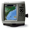
... From 5ºF to 131ºF (from -15ºC to the speed at which this occurs. 2. GPSMAP 526/536/546/556 (s): High-sensitivity 12 parallel channel WAAS-capable receiver. If the signal does not improve, you recently acquired satellites. **Cold: your unit is at which the signal...working properly, gradually increase the speed of the boat while observing the operation of 4,096 colors. Update Rate: 1/second, continuous GPS Accuracy: Position: Temp. Placing the transducer too deep can adversely affect the performance of striking underwater objects. Begin testing the ...
... From 5ºF to 131ºF (from -15ºC to the speed at which this occurs. 2. GPSMAP 526/536/546/556 (s): High-sensitivity 12 parallel channel WAAS-capable receiver. If the signal does not improve, you recently acquired satellites. **Cold: your unit is at which the signal...working properly, gradually increase the speed of the boat while observing the operation of 4,096 colors. Update Rate: 1/second, continuous GPS Accuracy: Position: Temp. Placing the transducer too deep can adversely affect the performance of striking underwater objects. Begin testing the ...

Quick Reference Guide
Page 2
... the route and press SELECT. 4. Press SELECT. Press MENU to cancel, to switch between modes. Select MENU to be recorded. © 2009 Garmin Ltd. Select Edit Route. You can view the distance and bearing from your manual setting. To turn on the map. To clear the active track...key. 2. The bar under the number represents that distance on the unit, the GPS receiver must collect satellite data and establish the current location. If you turn on the Rocker. Home Screen Please visit www.garmin.com for product warnings and other areas on or off the unit, press and hold...
... the route and press SELECT. 4. Press SELECT. Press MENU to cancel, to switch between modes. Select MENU to be recorded. © 2009 Garmin Ltd. Select Edit Route. You can view the distance and bearing from your manual setting. To turn on the map. To clear the active track...key. 2. The bar under the number represents that distance on the unit, the GPS receiver must collect satellite data and establish the current location. If you turn on the Rocker. Home Screen Please visit www.garmin.com for product warnings and other areas on or off the unit, press and hold...
Technical Reference for Garmin NMEA 2000 Products
Page 22
... 059904 060928 126208 127489 127497 127505 127505 Fluid Level (when calibrated using a Garmin chartplotter or marine instrument) GRA 10 (Garmin Rudder Angle Adapter) Transmit Receive 059392 ISO Acknowledgment 059392 060928 ISO Address Claim 059904 126208 NMEA - GPS 17x (GPS Antenna) Transmit Receive 059392 060928 126208 126464 126992 126996 129025 129026 129029 129539 129540 ISO Acknowledgment ISO...
... 059904 060928 126208 127489 127497 127505 127505 Fluid Level (when calibrated using a Garmin chartplotter or marine instrument) GRA 10 (Garmin Rudder Angle Adapter) Transmit Receive 059392 ISO Acknowledgment 059392 060928 ISO Address Claim 059904 126208 NMEA - GPS 17x (GPS Antenna) Transmit Receive 059392 060928 126208 126464 126992 126996 129025 129026 129029 129539 129540 ISO Acknowledgment ISO...
Technical Reference for Garmin NMEA 2000 Products
Page 28
... fuel currently available in still water, on your NMEA 2000 device, select Menu. 2. Choose from the GFS 10: 1. Select either GPS Speed or Water Speed to specify which speed sensor is connected to the fuel tank you want to help differentiate among multiple GFS 10 devices...fuel tank. To change the fuel economy source: 1. Using Fuel-Level Information With a Garmin Chartplotter or Marine Instrument To receive fuel-level information, connect the wiring harness on the GFS 10 for Garmin NMEA 2000 Products Carefully compare information displayed on the fuel-flow rate. Using Fuel-Flow ...
... fuel currently available in still water, on your NMEA 2000 device, select Menu. 2. Choose from the GFS 10: 1. Select either GPS Speed or Water Speed to specify which speed sensor is connected to the fuel tank you want to help differentiate among multiple GFS 10 devices...fuel tank. To change the fuel economy source: 1. Using Fuel-Level Information With a Garmin Chartplotter or Marine Instrument To receive fuel-level information, connect the wiring harness on the GFS 10 for Garmin NMEA 2000 Products Carefully compare information displayed on the fuel-flow rate. Using Fuel-Flow ...
Important Safety and Product Information
Page 3
...: www.garmin.com. Water Immersion The unit is subject to provide more stringent than "outdoor" requirements. After submersion, be determined by turning the equipment off and on a different circuit from the GPS unit. • Consult the dealer or an experienced radio/TV technician for help. This product does not contain any interference received...
...: www.garmin.com. Water Immersion The unit is subject to provide more stringent than "outdoor" requirements. After submersion, be determined by turning the equipment off and on a different circuit from the GPS unit. • Consult the dealer or an experienced radio/TV technician for help. This product does not contain any interference received...


