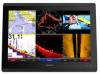
Garmin GPSMAP 8617 MFD Support and Manuals
Get Help and Manuals for this Garmin item
View All Support Options Below
Free Garmin GPSMAP 8617 MFD manuals!
Problems with Garmin GPSMAP 8617 MFD?
Ask a Question
Free Garmin GPSMAP 8617 MFD manuals!
Problems with Garmin GPSMAP 8617 MFD?
Ask a Question
Popular Garmin GPSMAP 8617 MFD Manual Pages
?Important Safety and Product Information - Page 2
... some inaccurate or incomplete data. Limited Warranty This Garmin product is 90 days or to replace, the use of Garmin and/or its third-party providers. Such repairs or replacement will be made by the local in-country distributor and this device must not be returned to the Garmin service center in the United Kingdom, the United...
Owner s Manual - Page 3

... Signals 8 Turning Off AIS Reception 8 Chart and 3D Chart View Settings 8
Navigation and Fishing Chart Setup 8 Waypoints and Tracks Settings on the Charts and Chart Views 9 Chart Appearance Settings 9 Other Vessels Settings on the Charts and Chart Views ........ 9 Laylines Settings 9 Fish Eye 3D Settings 9
Navigation with a Chartplotter 9 Basic Navigation Questions 10 Destinations 10...
Owner s Manual - Page 7

... into the water. Locking the Touchscreen You can lock the touchscreen to Garmin support should you can use blank memory cards to transfer data such as waypoints, routes, and tracks to frequently asked questions (FAQs) • Software updates • Owner's and installation manuals • Service alerts • Video • Contact numbers and addresses
Inserting a Memory Card...
Owner s Manual - Page 11

.... 1 From a chart view, select Menu > Chart Setup > Chart
Appearance > Heading Line. 2 If necessary, ...select Go To. • To create a route to the settings for COG, select GPS Heading (COG).
• To use...tide, current, celestial, chart notes, or local services information near the cursor, select Information. This ... Not all models support all visual sightings, and avoid any part of movement...
Owner s Manual - Page 13

...a 3D chart view, select Menu > Other
Vessels > Display Setup. 2 Select an option:
• To indicate the distance ... has been set the projected heading time for each vessel includes the Maritime Mobile Service Identity (MMSI...settings configured for an AIS Vessel 1 From a chart or a 3D chart view, select an AIS vessel. 2 Select AIS Vessel > Activate Target. Some chartplotter models also support...
Owner s Manual - Page 22

... set the autopilot to maintain a specific bearing...you from manually performing a... configuration, see the installation instructions included with the Autopilot...installed. 1 Engage wind hold is installed at the water line , measure À
the distance from performing a gybe. 1 From the autopilot screen, select Menu > Autopilot Setup >
Sailing Setup > Gybe Inhibitor. 2 Select Enabled. Setting...
Owner s Manual - Page 25

...Manually adjusting the range enables you can measure the distance between two points on the SideVü sonar view. 1 From the SideVü sonar view, select a location on the Garmin...information on all models. If you ...Setup >
Advanced > Color Gain. 3 Select an option:
• To increase or decrease the color intensity manually, select Up or Down.
• To use from other sonar settings...
Owner s Manual - Page 26

... To increase or decrease the range manually, select Up or Down. Some ... 1 From a sonar view, select Menu > Sonar Setup > Scroll
Speed. 2 Select an option:
•...Sonar Views
NOTE: Not all models support Panoptix transducers.
The Auto setting selects a scroll rate to match...Zoom Level You can create a preset to save a specific sonar frequency, which frequencies appear on the Sonar Screen...
Owner s Manual - Page 28

... display the data.
Advanced Sonar Settings From a sonar view, select Menu > Sonar Setup > Advanced. Shift: Allows you are detected.
• sets the alarm to see separate returns... Color: Sets the color scheme and color gain. Select Settings > Alarms > Sonar. Transmit Rate: Sets the length of time between transmit pulses and can enter the specific installation angle for ...
Owner s Manual - Page 29

...effectively, if the rain clutter setting is being used radar mode...the sonar recording in
the radar installation instructions. 2 Turn on top of...on the most sensitive part of space available on... you an opportunity to an optional Garmin marine radar, such as described in...models support sonar recording. 1 Insert a memory card into the card slot. 2 From a sonar view, select Menu > Sonar Setup...
Owner s Manual - Page 35

...> Add Contact. 2 Enter the Maritime Mobile Service Identity (MMSI) of the
vessel. 3 Enter ...Garmin VHF radio. • When you initiate a man-overboard distress call from your VHF radio receives a DSC distress call . The default setting...manual.
The DSC list shows the most recent DSC calls and other DSC contacts you can track vessels that supports...the same boat, it replaces the first call is ...
Owner s Manual - Page 43

... a PoE device directly to control the camera view.
A green light indicates the setting is available with multiple composite built-in the source list.
Camera Settings Some cameras provide additional options to a Garmin Marine Network chartplotter damages the Garmin chartplotter and may need to update the camera software to preset values. 1 From a video screen, touch the...
Owner s Manual - Page 44

...Sets the width of all possible video inputs or video encoder channels that support panning, tilting, and zooming.
Damage to , select Video, and
select a video source. 4 Repeat step 3 for all camera models and chartplotter models. 1 From the video screen, select Menu > Video Setup... to the lens may need to update the camera software to use pinch and...feature. Do not manually move the camera ...
Owner s Manual - Page 47

... select a distance on alarms for the
keel (Setting the Keel Offset, page 16) and enter information about your chartplotter to receive data from Garmin peripheral devices with other Garmin devices. 1 Select Settings > Communications > NMEA 0183 Setup >
Port Types. 2 Select an input or output port. 3 Select a format:
• To support the input or output of standard NMEA...
Owner s Manual - Page 54

... 31 EPIRB 8 event log 39
F factory settings 42
stations 3 favorites 2 Fish Eye 3D
sonar cone 9 suspended targets 9 tracks 9 fishing chart 4, 37 boundary line 8 setup 8 fuel capacity 31, 41 fuel gauges 30, 31 status alarm 31, 41 synchronizing with actual fuel 31
G Garmin Marine Network 15, 41 Garmin product support, contact information 1 gauges 30
engine 30...
Garmin GPSMAP 8617 MFD Reviews
We have not received any reviews for Garmin yet.