Garmin GPSMAP 540s Support Question
Garmin GPSMAP 540s Support Question
Find answers below for this question about Garmin GPSMAP 540s - Marine GPS Receiver.Need a Garmin GPSMAP 540s manual? We have 4 online manuals for this item!
Question posted by mweeks on March 25th, 2012
Data Bar Information
how do I change data bar information on 540s
Current Answers
Related Garmin GPSMAP 540s Manual Pages
Quick Reference Guide - Page 1

...more than one waypoint is in the vicinity.)
GPSMAP® 400/500 series
quick reference guide Select.... To move the waypoint on the screen to change (Name, Symbol, Depth, Water Temp,
Comment,...Marine Service and Navigating to select characters and spell at least a portion of the name of your
destination. 3. Select a destination. 4. From the Home screen, select Information > User Data...
Quick Reference Guide - Page 2

... waypoint on the unit, the GPS receiver must collect satellite data and establish the current location.
Repeat this step to mark a waypoint. From the Home screen, select Information > User Data > Routes > New Route. ... 3D, select MENU > Waypoints & Tracks > Active Tracks > Clear Active Track. The bar under the number represents that distance on the unit, press and release the Power key....
Owner's Manual - Page 3
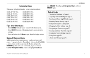
...8226; Changing the Chart Settings: page 12. • Navigating to select an item, small arrows (>) appear in the text. Manual Conventions
In this manual, when you should highlight Charts, and
Introduction
press SELECT.
Introduction
This manual includes information for the following products:
GPSMAP® 430/430s GPSMAP 431/431s GPSMAP 530/530s GPSMAP 531/531s GPSMAP 540/540s GPSMAP 541...
Owner's Manual - Page 4
... GPS Satellite Signals 5 Using Simulator Mode 6 Viewing System Information ...Changing the Navigation Chart Settings 12 Using the Split Navigation Chart 15 Using Perspective 3D 15
ii
Using Mariner's Eye 3D 16 Using Fish Eye 3D 18 Using Fishing Charts 19 Enabling High Resolution Satellite Imagery 19 Viewing Aerial Photos 20 Viewing Current-station Information 21 Detailed Road and POI Data...
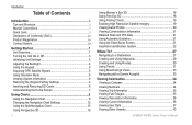
Owner's Manual - Page 11
...GPS receiver must collect satellite data and establish the current location.
SELECT-Press to select highlighted items.
HOME-Press to return to mark a waypoint at the top of the sonar. Acquiring GPS Satellite Signals
When you turn the unit on or off.
GPSMAP... options. When the unit loses satellite signals, the green bars disappear and the position icon displays a flashing question mark....
Owner's Manual - Page 12
... from the chartplotter.
GPSMAP 400/500 Series Owner's Manual
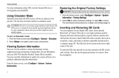
CAUTION: Do not try to set speed, track control, and position. Select Setup to navigate using simulator mode because the GPS receiver is located on Simulator mode: 1. From the Home screen, select Configure > System > System Information > Factory Settings.
2. Any satellite signal-strength bars shown are only...
Owner's Manual - Page 13

... dashboard options,
tides, currents, celestial data, user data, and information about other screens. Getting Started
• Sonar-set up and access sonar information (page 50).
GPSMAP 400/500 Series Owner's Manual
Understanding the Home Screen
Use the Home screen to the Home screen.
• Charts-selects Navigation, Fishing, Perspective 3D, Mariner's Eye 3D, Fish Eye 3D...
Owner's Manual - Page 14

... a view from above and behind the boat (according to view map information, and as a three-dimensional navigation aid.
This chart works well for the USA and Bahamas shoreline.
• Navigation Chart-displays all relevant navigation data available on the chart.
• Mariner's Eye 3D-provides a view from the Home screen, select Charts > Navigation...
Owner's Manual - Page 15

...data bar on the screen.
• Navigation-turn the GPS Speed, GPS Heading, Depth, and GPS Position data bar on the Navigation data bar whenever you are navigating to a destination. GPSMAP 400/500 Series Owner's Manual
Using Charts
Data bars...numbers. Other Vessels-view information about other vessels if your destination (only available while navigating).
Data Bars-show or hide cruising...
Owner's Manual - Page 22
Data Bars (page 9)-show or hide cruising, navigation, fishing, fuel, sailing numbers, or compass tape. This setting also affects routes (Route To), but does not affect automatic guidance (Guide To).
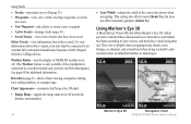
Mariner's Eye 3D
Navigation Chart
16
GPSMAP...tracks that have an XM subscription.) See page 60 for additional information. This view is helpful when navigating tricky shoals, reefs, bridges, or...
Owner's Manual - Page 23

... chart information in a 3D view. • Photos-provides satellite photo imagery in addition to chart
information.
The...Mariner's Eye 3D screen, select MENU > Chart Appearance. Press SELECT to the water.
Using Charts
Style-Selects how chart data is highlighted. 2. Blue indicates deep water, yellow is shallow water, and red is connected to Waypoints & Tracks, Other Vessels, and Data Bars...
Owner's Manual - Page 25
...GPSMAP 400/500 Series Owner's Manual 19
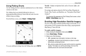
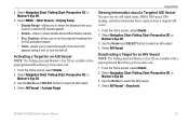
Using Fishing Charts
Use the Fishing chart for offshore deep-sea fishing. To enable satellite imagery: 1.
The Fishing chart uses detailed bathymetric data on a preprogrammed BlueChart g2 Vision SD card, and is shown on the map. • Land Only-standard chart information... & Tracks, Other Vessels, and Data Bars, see "Navigation Chart Menu" on...
Owner's Manual - Page 27

...Sonar screen to view the Navigation chart, Fishing chart, Mariner's Eye 3D, or Fish Eye 3D and sonar at a
glance. GPSMAP 400/500 Series Owner's Manual
21 For instructions on ...current graph. Perspective Overhead
Viewing Current-station Information
If current stations are available in your boat.
icon
Using Charts
Detailed Road and POI Data
BlueChart g2 Vision contains detailed road and ...
Owner's Manual - Page 30
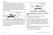
...GPSMAP 400/500 Series Owner's Manual The direction in which the target is turning, which is also based on the rate of turn information...data card.
1. Note: The Fishing chart and Mariner's Eye 3D are available with Course over Ground, Heading, and Rate of Turn
When course over ground and heading information... ground, heading, and rate of turn information are provided by an activated AIS target, the...
Owner's Manual - Page 31
... chart and Mariner's Eye 3D are available with a preprogrammed BlueChart g2 Vision data card.
1....GPS speed, GPS heading, and other information that appears using a trail, or turn the trail off. Select Navigation Chart, Fishing Chart, Perspective 3D, or
Mariner's Eye 3D. 3. Select Navigation Chart, Fishing Chart, Perspective 3D, or
Mariner's Eye 3D. 3. 2. Select AIS Vessel. GPSMAP...
Owner's Manual - Page 39
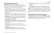
... on BlueChart g2 Vision-compatible Garmin GPS units. Navigating with a Garmin Autopilot
When you visualize your surroundings.
• Detailed Roads and POI data-provides a view of roads, restaurants, and other navigationally significant aerial photos to your unit. GPSMAP 400/500 Series Owner's Manual
33
In addition to detailed marine charting, BlueChart g2 Vision has...
Owner's Manual - Page 59
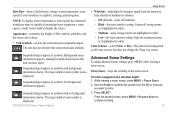
...speed, or both. Background sonar information appears, making the distinction between fish and structure easier.
Suspended targets appear as symbols. GPSMAP 400/500 Series Owner's Manual... background information shown. Advanced Sonar Settings
To adjust advanced sonar settings, press MENU while viewing a sonar screen. While viewing a sonar screen, press MENU > Pause Sonar. 2. Data Bars-show ...
Owner's Manual - Page 75
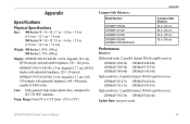
...;F to 131ºF (from -15ºC to IEC 529 IPX7 standards.
GPSMAP 431/431s GPSMAP 441/441s GPSMAP 531/531s GPSMAP 541/541s
High-sensitivity, 12 parallel channel, WAAS-capable receiver. GPSMAP 530/531/540/541: 5.0 in . GPSMAP 536/536s GPSMAP 546/546s
Update Rate: once per second
GPSMAP 400/500 Series Owner's Manual 69 diagonal (10.6 cm), QVGA display...
Owner's Manual - Page 76
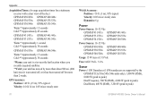
...times for a stationary receiver with a clear view of the sky.) GPSMAP 430/430s GPSMAP 440/440s GPSMAP 530/530s GPSMAP 535/535s GPSMAP 530/540s GPSMAP 535/545s
Warm:* Approximately 15 seconds Cold:** Approximately 45 seconds
GPSMAP 431/431s GPSMAP 441/441s GPSMAP 531/531s GPSMAP 541/541s
Warm:* Approximately... was turned off, or it has been turned off for more than 2 weeks. GPS Accuracy: Position:
Owner's Manual - Page 83

... 18 fishing 19 mariner's eye 3D 16 navigation 8 settings 12 cleaning the unit 74 Clear User Data 37 collision alarm 26, 49 colors, hazard 17 Color Scheme 53 Communications 44 Compass 34 compass rose 12 contact information, Garmin iv
course up 13 current stations 36 customizing chart settings 12
D
dashboard 34 Data Bars
fish eye...
Similar Questions

How Do I Go Into Simulation Mode On A Garmin Marine Gps Modle741xs
how do I use simulation mode on a garmin 741xs marine ver
how do I use simulation mode on a garmin 741xs marine ver
(Posted by Curthupp 6 years ago)

Data Bars At Top Of Main Screen
How do d get the data bars to show my current location
How do d get the data bars to show my current location
(Posted by rddries 9 years ago)

Flashing Depth Indicator
The debth indicator on my GPS/500 series flashes a debt that is not accurate. It appears to be stuck...
The debth indicator on my GPS/500 series flashes a debt that is not accurate. It appears to be stuck...
(Posted by tim47299 10 years ago)

Flashing Question Mark
There is a constant flashing question mark appearing on the boat symbol. What does that mean?
There is a constant flashing question mark appearing on the boat symbol. What does that mean?
(Posted by oillaw 10 years ago)
Fish Finder
I have sent this unit back and they sent me a new one? but still cant get ubit to locate fish, it is...
I have sent this unit back and they sent me a new one? but still cant get ubit to locate fish, it is...
(Posted by glipsky 13 years ago)