
Manual - English
Page 7
... Cursor 35 Creating a Go To Route to a Saved User-Created Waypoint 35 Creating a Go To Route to a Place Waypoint 36 Creating a Go To Route to a Geocache Waypoint 37 Creating a Multileg Route 37 Activating a Multileg Route 38 Deleting a Multileg Route 39 Duplicating a Multileg Route 39 Viewing a Route's Vertical Profile 39 Cancelling a Route... a Trail 44 Activating a Backtrack Route 44 Places ...45 Searching for a Place Waypoint (base map 45 Searching for a Place Waypoint (Detail Map 45 Table of Contents Magellan Triton iii
... Cursor 35 Creating a Go To Route to a Saved User-Created Waypoint 35 Creating a Go To Route to a Place Waypoint 36 Creating a Go To Route to a Geocache Waypoint 37 Creating a Multileg Route 37 Activating a Multileg Route 38 Deleting a Multileg Route 39 Duplicating a Multileg Route 39 Viewing a Route's Vertical Profile 39 Cancelling a Route... a Trail 44 Activating a Backtrack Route 44 Places ...45 Searching for a Place Waypoint (base map 45 Searching for a Place Waypoint (Detail Map 45 Table of Contents Magellan Triton iii
Manual - English
Page 14
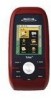
... a waypoint that has been saved to create waypoints and multileg routes that you can select from to select a saved geocache waypoint and use it as part of the Magellan Triton is used to the Magellan Triton. You can select the trail that can be saved by entering the coordinates for the corresponding function. The Trips...
... a waypoint that has been saved to create waypoints and multileg routes that you can select from to select a saved geocache waypoint and use it as part of the Magellan Triton is used to the Magellan Triton. You can select the trail that can be saved by entering the coordinates for the corresponding function. The Trips...

Manual - English
Page 15
...Magellan Triton for a particular activity; The Trips option will be available in a future update. The Profiles option is used . Accessing the Speedometer Option Menu 1. hiking, marine use again to follow your current journey. Navigation Screens The Triton...geocaching. The Geocache option allows you to add new geocache locations from the base map or an optional detailed map. The Media option is not available in the Magellan Triton. While viewing the Map screen, press ENTER. 2. Check the Magellan...functions and tools found in the Magellan Triton 200 or 300. The Trail option ...
...Magellan Triton for a particular activity; The Trips option will be available in a future update. The Profiles option is used . Accessing the Speedometer Option Menu 1. hiking, marine use again to follow your current journey. Navigation Screens The Triton...geocaching. The Geocache option allows you to add new geocache locations from the base map or an optional detailed map. The Media option is not available in the Magellan Triton. While viewing the Map screen, press ENTER. 2. Check the Magellan...functions and tools found in the Magellan Triton 200 or 300. The Trail option ...

Manual - English
Page 32
... a Profile 1. When all of the options have been set, use . 5. Sets the format for the profile and activate the profile. Profiles 24 Hiking, Marine and Geocaching. Select the profile you want to use of the keys. Sets the time that you can customize the profiles to fit your particular needs... sec Off, 5 min, 15 min, 60 min 12 Hour, 24 Hour Various On, Off Various Sets the default backlight level. Sets the Magellan Triton time for the screens change when daylight savings changes.) Select the language to be displayed. Select the time zone that the background colors for current...
... a Profile 1. When all of the options have been set, use . 5. Sets the format for the profile and activate the profile. Profiles 24 Hiking, Marine and Geocaching. Select the profile you want to use of the keys. Sets the time that you can customize the profiles to fit your particular needs... sec Off, 5 min, 15 min, 60 min 12 Hour, 24 Hour Various On, Off Various Sets the default backlight level. Sets the Magellan Triton time for the screens change when daylight savings changes.) Select the language to be displayed. Select the time zone that the background colors for current...

Manual - English
Page 33
... the Magellan Triton loses GPS signals and cannot compute a GPS fix. ALARM VOLUME Off, Low, Medium, Sets the volume level for the beeper. High BEEPER MODE Keys, Alarms, Keys & Sets beeper usage. WAYPOINT PROXIMITY Various Sets distance that the Magellan Triton will be displayed on the Map screen. ALARM TONE Beep, Ring Sets the type of geocache...
... the Magellan Triton loses GPS signals and cannot compute a GPS fix. ALARM VOLUME Off, Low, Medium, Sets the volume level for the beeper. High BEEPER MODE Keys, Alarms, Keys & Sets beeper usage. WAYPOINT PROXIMITY Various Sets distance that the Magellan Triton will be displayed on the Map screen. ALARM TONE Beep, Ring Sets the type of geocache...

Manual - English
Page 34
... screen consists of the optional detail maps. Select Create Waypoint. The Magellan Triton uses waypoints much the same as user-created and place waypoints in the chapter on geocaching, but you define. The Magellan Triton has three different classifications for geocaching. User-Created, Place and Geocache waypoints. User-created waypoints are waypoints you can use them when...
... screen consists of the optional detail maps. Select Create Waypoint. The Magellan Triton uses waypoints much the same as user-created and place waypoints in the chapter on geocaching, but you define. The Magellan Triton has three different classifications for geocaching. User-Created, Place and Geocache waypoints. User-created waypoints are waypoints you can use them when...

Manual - English
Page 40
...the VantagePoint software and then transfer the information into the Magellan Triton. Some geocaches will hide caches ("treasures") and record the latitude and longitude for other geocaching sites. For additional information on geocaching for the cache. If you are entering waypoint information..., or search for others to save the geocache waypoint. From the Map screen, press MENU. 2. Select Geocache. 4. The Geocache Waypoint Information page also includes Difficulty (1 through 5 with 5 being the most difficult), Terrain (1 though 5 with GPS users. Press the PAGE / GO TO ...
...the VantagePoint software and then transfer the information into the Magellan Triton. Some geocaches will hide caches ("treasures") and record the latitude and longitude for other geocaching sites. For additional information on geocaching for the cache. If you are entering waypoint information..., or search for others to save the geocache waypoint. From the Map screen, press MENU. 2. Select Geocache. 4. The Geocache Waypoint Information page also includes Difficulty (1 through 5 with 5 being the most difficult), Terrain (1 though 5 with GPS users. Press the PAGE / GO TO ...

Manual - English
Page 41
...Press ESC to exit. (Pressing ENTER will create a Go To route to make the changes. Change the order that waypoint.) Deleting a Saved Geocache Waypoint 1. Select the waypoint you want to the left of the waypoint name. 7. When the waypoint name is highlighted press ENTER. Select ....) 5. Select the order you want the waypoints listed, either by nearest, date added, or by name. Geocaching 33 The Geocache Waypoint Details screen is highlighted press ENTER. Select Geocache. 4. From the Map screen, press MENU. 2. To do a search, select Search and using the keyboard...
...Press ESC to exit. (Pressing ENTER will create a Go To route to make the changes. Change the order that waypoint.) Deleting a Saved Geocache Waypoint 1. Select the waypoint you want to the left of the waypoint name. 7. When the waypoint name is highlighted press ENTER. Select ....) 5. Select the order you want the waypoints listed, either by nearest, date added, or by name. Geocaching 33 The Geocache Waypoint Details screen is highlighted press ENTER. Select Geocache. 4. From the Map screen, press MENU. 2. To do a search, select Search and using the keyboard...

Manual - English
Page 42
... by nearest, date added, or by selecting the green checkmark. Select the green checkmark to display the Options page. 8. Geocaching 34 Duplicating a Saved Geocache Waypoint 1. When the waypoint name is duplicated and you want to duplicate from the list of the waypoint by selecting the ...highlighted press ENTER. Select the order you are displayed, if needed, or search for a geocache waypoint. (Select the Search field under the Select Waypoint header. Change the order that the geocache waypoints are returned to the left of the waypoint.) 5. Select the View icon to ...
... by nearest, date added, or by selecting the green checkmark. Select the green checkmark to display the Options page. 8. Geocaching 34 Duplicating a Saved Geocache Waypoint 1. When the waypoint name is duplicated and you want to duplicate from the list of the waypoint by selecting the ...highlighted press ENTER. Select the order you are displayed, if needed, or search for a geocache waypoint. (Select the Search field under the Select Waypoint header. Change the order that the geocache waypoints are returned to the left of the waypoint.) 5. Select the View icon to ...

Manual - English
Page 45
...waypoint. ((Select the Search field under the Select Waypoint header. Select the green checkmark to begin the route. Place: Select the map to a Geocache Waypoint 1. Select the category (and subcategory if required). With the Go To icon (arrow) highlighted press ENTER. 9. Select Route. 4. Current ...the pan cursor is shown with a preview of waypoints. 6. Creating a Multileg Route 1. Point on the point desired. Select Create. 3. Geocache: Select a waypoint from the list of the route shown. Routes 37 When the waypoint name is displayed, make any necessary edits and ...
...waypoint. ((Select the Search field under the Select Waypoint header. Select the green checkmark to begin the route. Place: Select the map to a Geocache Waypoint 1. Select the category (and subcategory if required). With the Go To icon (arrow) highlighted press ENTER. 9. Select Route. 4. Current ...the pan cursor is shown with a preview of waypoints. 6. Creating a Multileg Route 1. Point on the point desired. Select Create. 3. Geocache: Select a waypoint from the list of the route shown. Routes 37 When the waypoint name is displayed, make any necessary edits and ...
