User Manual
Page 1
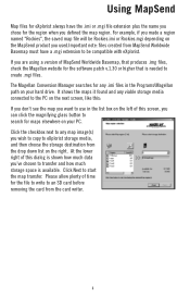
Magellan® eXplorist™ GPS Receiver Using MapSend™ This manual provides basic operation instructions for the MapSend line of Magellan software with your eXplorist GPS receiver.
Magellan® eXplorist™ GPS Receiver Using MapSend™ This manual provides basic operation instructions for the MapSend line of Magellan software with your eXplorist GPS receiver.
User Manual
Page 3
... an SD card (either by using an SD card reader/writer or transferring to manage multiple maps. Using MapSend What is the Magellan line of detailed digital maps for Magellan hand-held GPS receivers. MapSend maps will transform your hard drive using the MapSend software, and then transfer it easier to an SD card installed in the eXplorist) or the...
... an SD card (either by using an SD card reader/writer or transferring to manage multiple maps. Using MapSend What is the Magellan line of detailed digital maps for Magellan hand-held GPS receivers. MapSend maps will transform your hard drive using the MapSend software, and then transfer it easier to an SD card installed in the eXplorist) or the...
User Manual
Page 4
... ready to define a region and are covered in the software serial number for any other compatible Magellan GPS receivers. Next you will see this section. Using MapSend SD cards offer many advantages when working with SD cards you can save larger maps or more maps - For reference, a MapSend Topo map of the State of Washington will fit on the...
... ready to define a region and are covered in the software serial number for any other compatible Magellan GPS receivers. Next you will see this section. Using MapSend SD cards offer many advantages when working with SD cards you can save larger maps or more maps - For reference, a MapSend Topo map of the State of Washington will fit on the...
User Manual
Page 6
...storage space is needed to create .mgi files. Please allow plenty of MapSend Worldwide Basemap, that produces .img files, check the Magellan website for the software patch v.1.30 or higher that is available. Using MapSend Map files for eXplorist always have a .mgi extension to be Rockies.imi ...or Rockies.mgi depending on the MapSend product you used.Important note: files created ...
...storage space is needed to create .mgi files. Please allow plenty of MapSend Worldwide Basemap, that produces .img files, check the Magellan website for the software patch v.1.30 or higher that is available. Using MapSend Map files for eXplorist always have a .mgi extension to be Rockies.imi ...or Rockies.mgi depending on the MapSend product you used.Important note: files created ...