

Owner's Manual
Page 3
... compare the contents of this manual and learn the operating procedures for your chartplotter, contact Garmin Product Support or a professional installer. Before you for features such as GPSMAP 392/398/492/498 care information. See the CANet accessory installation instructions for reference. i If any...the GPSMAP 392/398/492/498 and step-by -step directions for choosing the Garmin® GPSMAP® 392/398/492/498. This manual uses the term Caution to configure your new navigation system, take time to create an unsurpassed portable GPS receiver. GPSMAP 392/398/492/498 ...
... compare the contents of this manual and learn the operating procedures for your chartplotter, contact Garmin Product Support or a professional installer. Before you for features such as GPSMAP 392/398/492/498 care information. See the CANet accessory installation instructions for reference. i If any...the GPSMAP 392/398/492/498 and step-by -step directions for choosing the Garmin® GPSMAP® 392/398/492/498. This manual uses the term Caution to configure your new navigation system, take time to create an unsurpassed portable GPS receiver. GPSMAP 392/398/492/498 ...
Owner's Manual
Page 29
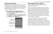
... or position report. DSC uses marine VHF radio and GPS technologies to "Connecting the Power/Data Cable" on the chartplotter. For connection information, refer to transmit and receive location information. The GPSMAP 392/398/492/498 requires input from a GPS to scroll. When the Coast Guard receives the Information ...without the need for a Map item: 1. On the Map Page, use the ROCKER to the Coast Guard. The rescuer can choose to navigate to the caller's location to assist, or forward the call or position report. An emergency DSC distress call allows a vessel in a single ...
... or position report. DSC uses marine VHF radio and GPS technologies to "Connecting the Power/Data Cable" on the chartplotter. For connection information, refer to transmit and receive location information. The GPSMAP 392/398/492/498 requires input from a GPS to scroll. When the Coast Guard receives the Information ...without the need for a Map item: 1. On the Map Page, use the ROCKER to the Coast Guard. The rescuer can choose to navigate to the caller's location to assist, or forward the call or position report. An emergency DSC distress call allows a vessel in a single ...
Owner's Manual
Page 33
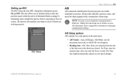
... > AIS AIS AIS (Automatic Identification System) provides area traffic situational awareness. Setting up DSC The DSC Setup tab turns DSC chartplotter information screen On and Off. The distress call simulator also helps to page 69 for practice before connecting to receive AIS information. Refer to check... the numeric time value you to simulate distress calls and position reports while the unit is helpful for information on changing communication settings. GPSMAP 392/398/492/498 Owner's Manual 25 Simulating calls is in the direction of 38400 to the real system.
... > AIS AIS AIS (Automatic Identification System) provides area traffic situational awareness. Setting up DSC The DSC Setup tab turns DSC chartplotter information screen On and Off. The distress call simulator also helps to page 69 for practice before connecting to receive AIS information. Refer to check... the numeric time value you to simulate distress calls and position reports while the unit is helpful for information on changing communication settings. GPSMAP 392/398/492/498 Owner's Manual 25 Simulating calls is in the direction of 38400 to the real system.
Owner's Manual
Page 113
...bridges, and navigational landmarks are available in 16 MB, 32 MB, 64 MB, 128 MB, and 256 MB sizes. USB Data Card Programmer-programs blank data cards at 44-0870-8501241. at 800-800-1020, or Garmin Europe at high speed through your GPSMAP 392/398/492/498 using a... highly detailed coastal roads and points of the GPSMAP 392/398/492/498. Optional Accessories The following optional accessories are compatible with you. To obtain replacement parts and optional accessories, contact your Fishfinder flush on chartplotters located elsewhere in the U.S.A. MapSource Software CD-...
...bridges, and navigational landmarks are available in 16 MB, 32 MB, 64 MB, 128 MB, and 256 MB sizes. USB Data Card Programmer-programs blank data cards at 44-0870-8501241. at 800-800-1020, or Garmin Europe at high speed through your GPSMAP 392/398/492/498 using a... highly detailed coastal roads and points of the GPSMAP 392/398/492/498. Optional Accessories The following optional accessories are compatible with you. To obtain replacement parts and optional accessories, contact your Fishfinder flush on chartplotters located elsewhere in the U.S.A. MapSource Software CD-...

