
Owner's Manual
Page 4
...3 Adjusting the Backlight 4 Interface Keys 5 Entering Data and Selecting Options 6 Using the Map Pointer 7 Creating and Using Waypoints 8 Man OverBoard (MOB 10 Reviewing and Editing Waypoints 11 Navigating to a Destination 12 Creating and Using Routes 17... Main Menu 37 GPS Tab 37 Tide Tab 40 Trip Tab 44 Celes (Celestial) Tab 45 Points Tab 46 Route Tab 51 Track Tab 57 DSC Tab 59 Card Tab 59 Msgs Tab... 60 Pages Tab 61 Map Tab 61 Hiway (Highway) Tab 64 Temp (Temperature) Tab 64 Sonar Tab 64 Systm (System) Tab 65 Alarm Tab 70 ii GPSMAP 392/398/492/498...
...3 Adjusting the Backlight 4 Interface Keys 5 Entering Data and Selecting Options 6 Using the Map Pointer 7 Creating and Using Waypoints 8 Man OverBoard (MOB 10 Reviewing and Editing Waypoints 11 Navigating to a Destination 12 Creating and Using Routes 17... Main Menu 37 GPS Tab 37 Tide Tab 40 Trip Tab 44 Celes (Celestial) Tab 45 Points Tab 46 Route Tab 51 Track Tab 57 DSC Tab 59 Card Tab 59 Msgs Tab... 60 Pages Tab 61 Map Tab 61 Hiway (Highway) Tab 64 Temp (Temperature) Tab 64 Sonar Tab 64 Systm (System) Tab 65 Alarm Tab 70 ii GPSMAP 392/398/492/498...

Owner's Manual
Page 5
...Installing the GPSMAP 492/498 External GPS Antenna..... 87 Mounting the GPSMAP 392/398/492/498 88 Installing the Transducer 90 Connecting the Power/Data Cable 92 Interfacing 93 Installing and Removing Data Cards 94 ...Satellite Information 95 INTRODUCTION > TABLE OF CONTENTS What is WAAS/EGNOS 96 What is a Maritime Mobile Service Identity (MMSI 97 How ARE MMSI assignments obtained 97 Navigation...
...Installing the GPSMAP 492/498 External GPS Antenna..... 87 Mounting the GPSMAP 392/398/492/498 88 Installing the Transducer 90 Connecting the Power/Data Cable 92 Interfacing 93 Installing and Removing Data Cards 94 ...Satellite Information 95 INTRODUCTION > TABLE OF CONTENTS What is WAAS/EGNOS 96 What is a Maritime Mobile Service Identity (MMSI 97 How ARE MMSI assignments obtained 97 Navigation...
Owner's Manual
Page 29
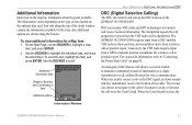
...64257;eld, and press ENTER. For connection information, refer to "Connecting the Power/Data Cable" on the GPSMAP 392/398/492/498. When the Coast Guard receives the Information Window GPSMAP 392/398/492/498 Owner's Manual 21 To view additional information for the item. Additional information tabs ...Information Each item on the optional data card. On the Map Page, use the ROCKER to transmit and receive location information. DSC uses marine VHF radio and GPS technologies to highlight a map item, and press ENTER. 2. The rescuer can choose to navigate to the caller's location to...
...64257;eld, and press ENTER. For connection information, refer to "Connecting the Power/Data Cable" on the GPSMAP 392/398/492/498. When the Coast Guard receives the Information Window GPSMAP 392/398/492/498 Owner's Manual 21 To view additional information for the item. Additional information tabs ...Information Each item on the optional data card. On the Map Page, use the ROCKER to transmit and receive location information. DSC uses marine VHF radio and GPS technologies to highlight a map item, and press ENTER. 2. The rescuer can choose to navigate to the caller's location to...
Owner's Manual
Page 38
...fically relate to the Map Page. 30 GPSMAP 392/398/492/498 Owner's Manual Features include integrated mapping, 2D or mariner's eye perspective, tide and current data, improved IALA symbols, navaids, marinas, boat ramps, roads, and more . Press and hold DATA/CNFG. Both units accept preprogrammed data cards and are menu driven. To exit, press...
...fically relate to the Map Page. 30 GPSMAP 392/398/492/498 Owner's Manual Features include integrated mapping, 2D or mariner's eye perspective, tide and current data, improved IALA symbols, navaids, marinas, boat ramps, roads, and more . Press and hold DATA/CNFG. Both units accept preprogrammed data cards and are menu driven. To exit, press...
Owner's Manual
Page 43
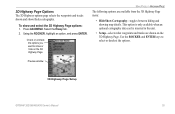
... when an optional cartography data card is inserted in the unit. • Setup-selects what waypoints and tracks are available from the 3D Highway Page menu: • Hide/Show Cartography-toggles between hiding and showing map details. Press ADJ/MENU. Preview window 3D Highway Page Setup GPSMAP 392/398/492/498 Owner's Manual 35
... when an optional cartography data card is inserted in the unit. • Setup-selects what waypoints and tracks are available from the 3D Highway Page menu: • Hide/Show Cartography-toggles between hiding and showing map details. Press ADJ/MENU. Preview window 3D Highway Page Setup GPSMAP 392/398/492/498 Owner's Manual 35
Owner's Manual
Page 67
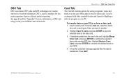
...A Transfer Complete message appears after the data is saved to a data card, it with other compatible units and Garmin's MapSource software program on your PC to or from the card to the unit, highlight Merge From Card, and press ENTER to overwrite all ...data is transferred. Insert the data card. MAIN MENU > DSC AND CARD TAB Card Tab The Card tab contains options for two major operation: distress calls and position reporting. GPSMAP 392/398/492/498 Owner's Manual 59 If transferring data from a data card: 1. DSC Tab DSC uses marine VHF radio and GPS technologies to a data card...
...A Transfer Complete message appears after the data is saved to a data card, it with other compatible units and Garmin's MapSource software program on your PC to or from the card to the unit, highlight Merge From Card, and press ENTER to overwrite all ...data is transferred. Insert the data card. MAIN MENU > DSC AND CARD TAB Card Tab The Card tab contains options for two major operation: distress calls and position reporting. GPSMAP 392/398/492/498 Owner's Manual 59 If transferring data from a data card: 1. DSC Tab DSC uses marine VHF radio and GPS technologies to a data card...
Owner's Manual
Page 71
... the ROCKER to the map. 4. NOTE: The Advanced Map information is described by name and can be hidden if you have a data card with additional map data, such as BlueChart g2, installed in the unit. GPSMAP 392/398/492/498 Owner's Manual 63 The Advanced option box shows a list of the optional BlueChart/ MapSource... data loaded on the Map Page when a check mark appears in the box adjacent to scroll up, down, left of the name of a map. To...
... the ROCKER to the map. 4. NOTE: The Advanced Map information is described by name and can be hidden if you have a data card with additional map data, such as BlueChart g2, installed in the unit. GPSMAP 392/398/492/498 Owner's Manual 63 The Advanced option box shows a list of the optional BlueChart/ MapSource... data loaded on the Map Page when a check mark appears in the box adjacent to scroll up, down, left of the name of a map. To...
Owner's Manual
Page 73
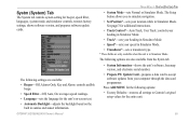
GPSMAP 392/398/492/498 Owner's Manual MAIN MENU > SYSTM (SYSTEM) TAB • System Mode-sets Normal or Simulator Mode. See page 3 for the unit's on-screen text. • Automatic ... from your location while in Simulator Mode. The following options: • Factory Defaults-restores all settings to simulate navigation. • Set Position*-sets your computer through the data card programmer. The Setup button allows you to Garmin's original setup values for beeper, speed filter, languages, system mode, and simulator controls, restores factory settings...
GPSMAP 392/398/492/498 Owner's Manual MAIN MENU > SYSTM (SYSTEM) TAB • System Mode-sets Normal or Simulator Mode. See page 3 for the unit's on-screen text. • Automatic ... from your location while in Simulator Mode. The following options: • Factory Defaults-restores all settings to simulate navigation. • Set Position*-sets your computer through the data card programmer. The Setup button allows you to Garmin's original setup values for beeper, speed filter, languages, system mode, and simulator controls, restores factory settings...
Owner's Manual
Page 97
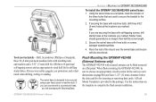
... inserting or removing data cards. If OK you use a screw with machine bolts, drill three 5/32" (5 mm) holes at the locations you risk damaging the Mounting Base. If securing the base with a countersunk head, you marked. DO NOT OVERTIGHTEN. 4. When flush mounting the GPSMAP 492/498, be secured using...> MOUNTING THE GPSMAP 392/398/492/498 To install the GPSMAP 392/398/492/498 swivel base: 1. Place the rest of the three holes that are securing the base with the short knob. Use the instructions on page 86) and leave 1.25" (32 mm) clearance below the data card slot for drilling...
... inserting or removing data cards. If OK you use a screw with machine bolts, drill three 5/32" (5 mm) holes at the locations you risk damaging the Mounting Base. If securing the base with a countersunk head, you marked. DO NOT OVERTIGHTEN. 4. When flush mounting the GPSMAP 492/498, be secured using...> MOUNTING THE GPSMAP 392/398/492/498 To install the GPSMAP 392/398/492/498 swivel base: 1. Place the rest of the three holes that are securing the base with the short knob. Use the instructions on page 86) and leave 1.25" (32 mm) clearance below the data card slot for drilling...
Owner's Manual
Page 102
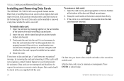
... at the bottom right of the unit. If you insert a data card, the unit takes a few seconds to read , a summary screen appears. APPENDIX > INSTALLING AND REMOVING DATA CARDS Installing and Removing Data Cards The GPSMAP 392/398/492/498 uses optional Garmin marine BlueChart g2 and MapSource data cards to show digital charts and maps on the two handles at the...
... at the bottom right of the unit. If you insert a data card, the unit takes a few seconds to read , a summary screen appears. APPENDIX > INSTALLING AND REMOVING DATA CARDS Installing and Removing Data Cards The GPSMAP 392/398/492/498 uses optional Garmin marine BlueChart g2 and MapSource data cards to show digital charts and maps on the two handles at the...
Owner's Manual
Page 108
... amount of user-set in your dealer or Garmin Product Support if the problem persists. APPENDIX > MESSAGES Messages and Alarms The GPSMAP 392/398/492/498 uses an on data card is deeper than the unit can read. Accuracy Alarm-the GPS accuracy has fallen outside of the Drift Alarm ...value. 100 GPSMAP 392/398/492/498 Owner's Manual Approaching [Waypoint Name]-you have the...
... amount of user-set in your dealer or Garmin Product Support if the problem persists. APPENDIX > MESSAGES Messages and Alarms The GPSMAP 392/398/492/498 uses an on data card is deeper than the unit can read. Accuracy Alarm-the GPS accuracy has fallen outside of the Drift Alarm ...value. 100 GPSMAP 392/398/492/498 Owner's Manual Approaching [Waypoint Name]-you have the...
Owner's Manual
Page 109
... indicated. Route Truncated-uploaded route from a data card that Area-no further data can be saved. Sonar Failed, Unit Needs Repair-there is data to fit. Invalid MMSI-enter a Valid...use for that does not contain the specified type of data. Contact your dealer or Garmin Product Support to a location with the unit. Lost Satellite Reception-...navigation. APPENDIX > MESSAGES Proximity Alarm-you are nearing a proximity waypoint. Route Full-you attempted to add more than 300 points to transfer user data from another proximity waypoint. GPSMAP 392/398/492/498...
... indicated. Route Truncated-uploaded route from a data card that Area-no further data can be saved. Sonar Failed, Unit Needs Repair-there is data to fit. Invalid MMSI-enter a Valid...use for that does not contain the specified type of data. Contact your dealer or Garmin Product Support to a location with the unit. Lost Satellite Reception-...navigation. APPENDIX > MESSAGES Proximity Alarm-you are nearing a proximity waypoint. Route Full-you attempted to add more than 300 points to transfer user data from another proximity waypoint. GPSMAP 392/398/492/498...
Owner's Manual
Page 110
.../498 Owner's Manual Track Memory is Full, Can't Create Track-the track log memory is on . If the transducer cable is removed while the unit is full. APPENDIX > MESSAGES Sonar Service Incompatible-(only applied to the GPSMAP 392/492) the external sonar device you entered a waypoint name that already exists in the Data Card...
.../498 Owner's Manual Track Memory is Full, Can't Create Track-the track log memory is on . If the transducer cable is removed while the unit is full. APPENDIX > MESSAGES Sonar Service Incompatible-(only applied to the GPSMAP 392/492) the external sonar device you entered a waypoint name that already exists in the Data Card...
Owner's Manual
Page 113
... ports, marinas, bridges, and navigational landmarks are also included on chartplotters located elsewhere in the U.S.A. at 800-800-1020, or Garmin Europe at high speed through your GPSMAP 392/398/492/498 using a standard AC house current. A/C Adapter-powers the unit using the PC Interface Cable, or with the Data Card Programmer. PC Interface Cable with...
... ports, marinas, bridges, and navigational landmarks are also included on chartplotters located elsewhere in the U.S.A. at 800-800-1020, or Garmin Europe at high speed through your GPSMAP 392/398/492/498 using a standard AC house current. A/C Adapter-powers the unit using the PC Interface Cable, or with the Data Card Programmer. PC Interface Cable with...
Owner's Manual
Page 117
...105 accuracy 37 accuracy circle 62 active route page 36 options 36 additional information 21 advanced map card 63 alarms anchor drag 70 arrival 71 battery 70 clock 70 DSC 25 fish 71 off... communication tab 68 compass page 32 conventions i course line 62 course up 62 GPSMAP 392/398/492/498 Owner's Manual D data cards 94 data entry 6 date/time 95 daylight saving time 68 delete DSC directory item 23 ...frequency 200 kHz 72 50 kHz 72 G gain 75 gain setting 74 garmin data transfer 68 go to 13 distress call 24 position report 24 GPS tab 37 options 39 H hard bottom 84 heading line 62 Highway Page,...
...105 accuracy 37 accuracy circle 62 active route page 36 options 36 additional information 21 advanced map card 63 alarms anchor drag 70 arrival 71 battery 70 clock 70 DSC 25 fish 71 off... communication tab 68 compass page 32 conventions i course line 62 course up 62 GPSMAP 392/398/492/498 Owner's Manual D data cards 94 data entry 6 date/time 95 daylight saving time 68 delete DSC directory item 23 ...frequency 200 kHz 72 50 kHz 72 G gain 75 gain setting 74 garmin data transfer 68 go to 13 distress call 24 position report 24 GPS tab 37 options 39 H hard bottom 84 heading line 62 Highway Page,...


