
Owner's Manual
Page 9
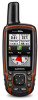
...GPSMAP 64s and GPSMAP 64st. 1 Go to a location where the elevation or barometric pressure is known. 2 Select PAGE > Elevation Plot > MENU > Calibrate Altimeter. 3 Follow the on -screen instructions to find and download geocaches to find a geocache, you can verify some geocaches at www.garmin.com. Downloading Geocaches 1 Connect your current location, GPS accuracy...All Waypoints: Deletes all trip data. You can send and receive data when paired with the GPSMAP 64s and GPSMAP 64st. Reset Trip Data: Resets all saved waypoints. Restoring Default Page Settings 1 Open a page ...
...GPSMAP 64s and GPSMAP 64st. 1 Go to a location where the elevation or barometric pressure is known. 2 Select PAGE > Elevation Plot > MENU > Calibrate Altimeter. 3 Follow the on -screen instructions to find and download geocaches to find a geocache, you can verify some geocaches at www.garmin.com. Downloading Geocaches 1 Connect your current location, GPS accuracy...All Waypoints: Deletes all trip data. You can send and receive data when paired with the GPSMAP 64s and GPSMAP 64st. Reset Trip Data: Resets all saved waypoints. Restoring Default Page Settings 1 Open a page ...

Owner's Manual
Page 10
... email or social media, allowing them to view your live data on the GPSMAP 64s and GPSMAP 64st. Use Satellite System: Allows you to control your GPSMAP 64s or GPSMAP 64st device. For more accuracy. 1 Select Waypoint Manager. 2 Select a waypoint. 3 Select MENU > Average Location. 4 Move to install Garmin Connect™ Mobile or BaseCamp Mobile on your VIRB camera from Device...
... email or social media, allowing them to view your live data on the GPSMAP 64s and GPSMAP 64st. Use Satellite System: Allows you to control your GPSMAP 64s or GPSMAP 64st device. For more accuracy. 1 Select Waypoint Manager. 2 Select a waypoint. 3 Select MENU > Average Location. 4 Move to install Garmin Connect™ Mobile or BaseCamp Mobile on your VIRB camera from Device...


