
Installation Instructions
Page 10
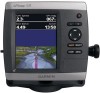
... QVGA display with adjustable brightness, 640 × 480 pixels, capable of 4,096 colors. Case: Fully gasketed, high-impact plastic alloy, waterproof to eliminate the degradation. 4. If the sonar signal suddenly is lost . If the signal does not improve, you recently acquired ...525/535/545/555 (s): Differential-ready 12 parallel channel WAAS-capable receiver GPSMAP 421/431/441/451 (s) GPSMAP 521/531/541/551 (s): High-sensitivity 14 parallel channel WAAS-capable receiver. Update Rate: 1/second, continuous GPS Accuracy: Position: diagonal (12.7 cm), Full VGA display with ...
... QVGA display with adjustable brightness, 640 × 480 pixels, capable of 4,096 colors. Case: Fully gasketed, high-impact plastic alloy, waterproof to eliminate the degradation. 4. If the sonar signal suddenly is lost . If the signal does not improve, you recently acquired ...525/535/545/555 (s): Differential-ready 12 parallel channel WAAS-capable receiver GPSMAP 421/431/441/451 (s) GPSMAP 521/531/541/551 (s): High-sensitivity 14 parallel channel WAAS-capable receiver. Update Rate: 1/second, continuous GPS Accuracy: Position: diagonal (12.7 cm), Full VGA display with ...

Quick Reference Guide
Page 2
...Adjusting the Display Settings To adjust the backlight: 1. Press and release the Power key. 2. Select Color Mode. 3. MARK-Press to adjust the backlight and the day and night modes. POWER/ BACKLIGHT RANGE...POWER/BACKLIGHT-Press and hold the Power key. A trailing line on the unit, the GPS receiver must collect satellite data and establish the current location. or its subsidiaries May 2009 190-...MENU to view the Home screen. Acquiring GPS Satellite Signals When you pan past the edge of the sonar, to be recorded. © 2009 Garmin Ltd. When the unit acquires satellite signals...
...Adjusting the Display Settings To adjust the backlight: 1. Press and release the Power key. 2. Select Color Mode. 3. MARK-Press to adjust the backlight and the day and night modes. POWER/ BACKLIGHT RANGE...POWER/BACKLIGHT-Press and hold the Power key. A trailing line on the unit, the GPS receiver must collect satellite data and establish the current location. or its subsidiaries May 2009 190-...MENU to view the Home screen. Acquiring GPS Satellite Signals When you pan past the edge of the sonar, to be recorded. © 2009 Garmin Ltd. When the unit acquires satellite signals...

Owner's Manual
Page 83
... 17 Color Scheme 53 Communications 44 Compass 34 compass rose 12 contact information, Garmin iv course up 13 current stations 36 customizing chart settings 12 D dashboard 34 Data Bars fish eye 3D chart 18 Navigation chart 9 perspective 3D chart 16 sonar 53 data transfer 37 Declaration of Conformity iv delete a waypoint ... 64 frequency 54 Fuel Capacity 48 fuel gauges 35 full screen, sonar 50 fuse 70 G gain 54 Garmin Data Transfer 44 gauges, fuel 35 go to 27 GPS 5, 41, 70 Grid (North) 42 guide to 27 H Hazard Colors 17 heading 42 Heading Line 14 Head Up 13 GPSMAP 400/500 Series Owner's Manual 77
... 17 Color Scheme 53 Communications 44 Compass 34 compass rose 12 contact information, Garmin iv course up 13 current stations 36 customizing chart settings 12 D dashboard 34 Data Bars fish eye 3D chart 18 Navigation chart 9 perspective 3D chart 16 sonar 53 data transfer 37 Declaration of Conformity iv delete a waypoint ... 64 frequency 54 Fuel Capacity 48 fuel gauges 35 full screen, sonar 50 fuse 70 G gain 54 Garmin Data Transfer 44 gauges, fuel 35 go to 27 GPS 5, 41, 70 Grid (North) 42 guide to 27 H Hazard Colors 17 heading 42 Heading Line 14 Head Up 13 GPSMAP 400/500 Series Owner's Manual 77


