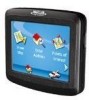
Magellan RoadMate 1200 Support Question
Magellan RoadMate 1200 Support Question
Find answers below for this question about Magellan RoadMate 1200 - Automotive GPS Receiver.Need a Magellan RoadMate 1200 manual? We have 12 online manuals for this item!
Question posted by azkaje on August 15th, 2013
How To Put Free Maps On Magellan Roadmate 1200
The person who posted this question about this Magellan product did not include a detailed explanation. Please use the "Request More Information" button to the right if more details would help you to answer this question.
Current Answers
Related Magellan RoadMate 1200 Manual Pages
Triton User Manual Addendum - English, French, Spanish - Page 1

... defined by pressing the MENU button. To access area calculation, press ENTER while viewing the Map screen. Press ESC when you are ready to save the track to the Triton, press ENTER...your current location. Pause and Resume Active Track. Triton User Manual Addendum
This addendum applies to Triton GPS receivers that have a software version that you can now access the Main Menu on any of the ...
Triton User Manual Addendum - English, French, Spanish - Page 2

... datum, you activate a route with User Grid set as the map datum. Additionally, if you to E.
When setting a custom position, the GPS portion of the entire route. Press ENTER. But in a Multileg... Route. Select "Go to Next" or "Go to Previous" to go there instead of the receiver is disabled and...
Manual - English - Page 2
...GPS satellites made by any means, electronic or mechanical, including photocopying and recording, for navigating. Please do not try and change in accordance with the Department of this guide may severely degrade performance or damage the receiver... permission of the GPS network. Government, which you in any form or by the U.S. IMPORTANT SAFETY WARNINGS
The Magellan Triton is a navigation...
Manual - English - Page 5
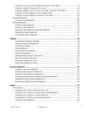
Table of Contents
Overview ...1 Features of the Magellan Triton 1 Specifications ...3
Fundamentals ...4 Turning the Triton on 4 Turning the Triton off 4 Setting the...the Large Data, Compass or Satellite Status Screen 12 Accessing the Map Screen Contextual Menu 13 Accessing the Compass or Speedometer Screen Contextual Menu 13
Map Screen ...13 Current Location Screen 13 Large Data Screen 14 ...
Manual - English - Page 6
... 29 Page Selection ...29
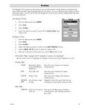
Profiles ...30 Activating a Profile 30 Editing a Profile 30 Information Page (assigns which navigation screens are displayed 30 Display Page 30 Map Page ...30 Sensors Page (Magellan Triton 500 31 Alarms Page ...31
Waypoints ...32 Waypoint Detail Screen Overview 32 Creating Waypoints 33 Creating a Current Location Waypoint from the...
Manual - English - Page 7
... 33 Creating a Waypoint from a Point on the Map Using the Triton Menu 34 Creating a Custom Waypoint from the Map Screen 34 Creating a Custom Waypoint Using the Triton ... 39 Setting Connectivity 39 Getting Software Version Information 40 Viewing Copyright Information 40 Personalizing Magellan Triton 40 Performing Diagnostic Checks 40
Geocache Waypoints ...42 Creating a Geocache Waypoint 42...
Manual - English - Page 8
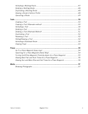
... 52 Reversing a Trail 52 Hiding/Showing a Trail 52 Activating a Backtrack Route 53 Clearing Track 53
Places ...54 Go To a Place Waypoint (base map 54 Searching for a Place Waypoint (Detail Map 54 Turning On/Off the Waypoint Proximity Alarm for a Place Waypoint 55 Viewing Best Fish and Hunt Times for a Place Waypoint 55...
Manual - English - Page 9

..., as well as they become available. The SiRFstarIII™ GPS chipset and an integrated multidirectional antenna offer superior GPS accuracy. The Magellan Triton is also WAAS and EGNOS-capable, taking advantage of the Magellan Triton GPS receiver.
Routes and tracks - Access optional detail maps for improved accuracy.
3-axis electronic compass (Triton 500 only) -
Built-in Europe...
Manual - English - Page 11

WAAS/EGNOS, < 7 meters (15 feet) - GPS only English, French, German, Dutch, Danish, Swedish, Spanish, Italian, Portuguese, ...Map
Size Weight Display Data Storage Antenna Keypad Operating Range
Rubber armored impact-resistant plastic, water-resistant seal, IPX-7 Built-in multidirectional patch Nine direct-access keys 14° to 140°F (-10° to 60°C)
PERFORMANCE
Receiver...
Manual - English - Page 14

..., and Trips. The Create Menu has the same options as part of the Magellan Triton is used to the Magellan Triton. This saves battery life if you to your present location, by selecting a point on the map or by the Magellan Triton. Selecting one of these are used to activate. Accessing the Main Menu...
Manual - English - Page 15

... was cleared) as a route that can be accessed by entering the coordinates of the base maps and detail maps (if any optional detail maps are available from your present position, by selecting a point on updates to your Magellan Triton. The Maps option displays a list of a known geocache. Use Settings to additional functions. While viewing the...
Manual - English - Page 17
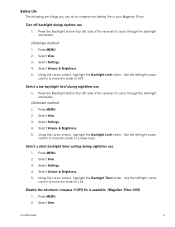
... MENU. 2. Select Settings. 4. Use the left side of the receiver) to 15s. Fundamentals
9 Select Settings. 4. Use the left side of the receiver) to a lower level. Select Settings. 4. Using the cursor control, highlight the Backlight Level slider. Disable the electronic compass if GPS fix is available. (Magellan Triton 500)
1. Select Volume & Brightness. 5. Select View. Select...
Manual - English - Page 27

...
Battery Level
Time of Day
GPS Signal Strength
North Indicator
Data Fields
Map Scale
Pan Mode
Map Legend
Present Position Cursor (Points in the direction of waypoints saved in the receiver. Red dot points towards your receiver. Default icon shown. User can access the commonly used screen in the receiver.)
Start Flag (Indicates the starting point...
Manual - English - Page 37
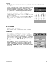
... and right arrows to change pages use the PAGE / GO TO button to select them from the GPS satellite. These tabs are used to enter dates for the Magellan Triton since the date is highlighted you will work as well. With the desired month displayed, select ...display is highlighted, press the down arrow to be entered. (If the day portion of the calendar is automatically received from ;
Manual - English - Page 38
.... Select Profiles. 4. When all of measure for distance measurements. Sets the unit of measure for elevation measurements. (Magellan Triton 500 only) Sets the unit of the options have been set up three profiles; Map Page
ORIENTATION North Up, Course Up, Sets top of measure for the screens change depending upon the profile...
Manual - English - Page 39
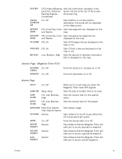
... to as you when the Magellan Triton loses GPS signals. Low, Medium, High Sets the amount of the screen
Bearing Degrees,
while panning.
Sets the volume level for the beeper.
Sets distance to be off course before the off .
Sets distance that is displayed on the map. Sensors Page (Magellan Triton 500)
ELECTRONIC COMPASS...
Manual - English - Page 40
...maps.
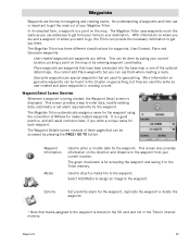
With information on where you are waypoints you define. User-created waypoints are and a waypoint of three pages that media assigned to the waypoint is for the waypoint. Geocache waypoints are used the same as you use addresses to get from your Magellan.... Options
Set proximity alarm for geocaching. The Magellan Triton automatically assigns a name for the waypoint ...
Manual - English - Page 46
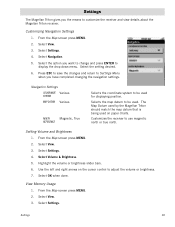
Select Settings. Customizing Navigation Settings
1. Selects the map datum to customize the receiver and view details about the Magellan Triton receiver. Customizes the receiver to
display the drop down menu. From the Map screen press MENU. 2. Use the left and right arrows on paper charts. Select View. 3.
Press ESC to save the changes and return to Settings...
Manual - English - Page 50

...probably select current location. From the Map screen, press MENU.
2. Geocache information includes Difficulty (1 through 5 with 5 being the most difficult), Terrain (1 though 5 with GPS users. Editing a Saved Geocache Waypoint..., adding it into your Magellan Triton either by creating a geocache waypoint or by saving the geocache file from Current Location, Point on Map or Coordinates. (If you...
Manual - English - Page 61
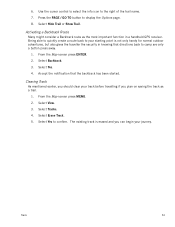
... Activating a Backtrack Route
Many might consider a Backtrack route as a trail.
1. Select Yes. 4. Select View. 3.
From the Map screen press ENTER. 2. Accept the notification that directions back to camp are only a button press away.
1. Select Tracks. 4. ... gives the traveller the security in a handheld GPS receiver. Use the cursor control to select the info icon to your journey.
Similar Questions

I Found A Magellan Roadmate 1200. Is It Possible To View Maps W/o An Sd Card?
I found a Magellan RoadMate 1200. Is it possible to view maps w/o an SD card?
I found a Magellan RoadMate 1200. Is it possible to view maps w/o an SD card?
(Posted by horseflybite9 1 year ago)

How To Get Free Magellan Roadmate 1470 Map Updates
(Posted by reinpra 10 years ago)

How To Update Magellan Roadmate 1200 For Free
(Posted by mayrcyn 10 years ago)

Where Can I Get A Free Map Update For Magellan Roadmate 1400 Gps
(Posted by Anonymous-73813 11 years ago)

Unlock Magellan Roadmate 1200
How do I unlock my Magellan Roadmate 1200
How do I unlock my Magellan Roadmate 1200
(Posted by sentahinzman 11 years ago)