
Garmin eTrex 20 Support Question
Garmin eTrex 20 Support Question
Find answers below for this question about Garmin eTrex 20.Need a Garmin eTrex 20 manual? We have 2 online manuals for this item!
Question posted by kathimiles on January 7th, 2012
Count Down Distance
I just got an etrex 20 for Christmas. I loaded some geocaches in and started. My map draws the line to the geocache and gets shorter as I walk towards it. Isn't it suppose to countdown the distance? Thank you!
Current Answers

Related Garmin eTrex 20 Manual Pages
Owner's Manual - Page 1

eTrex®
owner's manual
for use with models 10, 20, 30
Owner's Manual - Page 3

... a Destination..........16 Map 16 Compass 17 Elevation Plot 19 Trip Computer 20
eTrex Owner's Manual
Table of Contents
Geocaches 21 Downloading Geocaches 21 Filtering the Geocache List..........21 Navigating to a Geocache............22 Logging the Attempt 22 chirp 23
Applications 24 Sharing Data 24 Setting a Proximity Alarm 24 Calculating the Size of Contents
Getting Started 5 Device...
Owner's Manual - Page 7

Getting Started
2. notice Alkaline batteries lose a significant amount of some batteries. Select Alkaline, Lithium,...turn the D-ring clockwise.
4.
Use NiMH or lithium batteries for the device (-4°F to 158°F, or -20 to remove the cover.
3. eTrex Owner's Manual
7 Battery Information
‹ warning The temperature rating for best results.
1. Alkaline batteries can use ...
Owner's Manual - Page 11

... and City Navigator® detailed maps. For more information, go to . Waypoints, Routes, and Tracks
Finding a Location by Name Depending on the maps loaded on the eTrex 20 and eTrex 30, such as restaurants or ...1. Select Where To? > menu >
Search Near.
2.
Select a category.
3. Where To?
eTrex Owner's Manual
11 menu to find a destination to navigate to http://buy.garmin.com or contact ...
Owner's Manual - Page 14

...If you move with the device turned on the map indicates your track.
3. Complete an action:
&#..., Do Not Show or Record, Show On Map.
Select an option:
• To record tracks...Auto.
• To record tracks at a specified distance, select Distance.
14
• To record tracks at a ...; Enter a time or distance, and select Done.
As you select Record, Show On Map, a line on , a track log...
Owner's Manual - Page 17

...map, and the bar at the top of the map. Calibrating the Compass
Notice Calibrate the electronic compass outdoors. • Select a location on the eTrex 20 and eTrex 30.
Before you can use the map...device, you plan to the destination.
3.
If you must purchase and load City Navigator maps. Navigation
Compass
The eTrex 30 has a 3-axis, electronic compass. To improve heading accuracy, do ...
Owner's Manual - Page 20

Select Elevation Plot > menu > Calibrate Altimeter.
3.
Go to zero.
To customize the trip computer, see page 28.
20
eTrex Owner's Manual Resetting the Trip Data For accurate information, reset the trip information before beginning a trip. Navigation
Calibrating the Barometric Altimeter You can manually calibrate ...
Owner's Manual - Page 24

... when you enter a proximity alarm area, the device sounds a tone (eTrex 20/30).
24
eTrex Owner's Manual When you are within 10 feet (3 m) of a particular location.
1. Your device can share waypoints, geocaches, routes, and tracks. Select Send or Receive. 3. Applications
Applications
Sharing Data
The eTrex 30 can share data wirelessly, you must be within a specified...
Owner's Manual - Page 26

Select an option. Opening the Stopwatch
Select Stopwatch. Turning Off GPS Select Satellite > menu > Use With GPS Off.
26
eTrex Owner's Manual Select Satellite > menu.
2. Select the clock numbers to set the device to turn on and sounds the alarm.
...bar of the screen.
3. Satellite Page
The satellite page shows your current track toward the top of that satellite (eTrex 20/30).
Owner's Manual - Page 30

... System/European Geostationary Navigation Overlay Service), or Demo Mode (GPS off . Customizing Your Device
Editing a Profile Name 1. ...map data, such as street names.
• Battery Type-allows you to select the type of time before the backlight turns off ). Select Delete > Yes. Select Edit Name. 4.
Note: To adjust the backlight brightness, see page 40.
• Colors (eTrex 20...
Owner's Manual - Page 33

... Setup > Units.
2.
You can customize units of the track line on the map.
Customizing Your Device
Time Settings
Select Setup > Time.
•... user setting.
• Color (eTrex 20/30)-changes the color of measure for distance and speed, elevation, and pressure.
1.
Select a measurement type.
3. eTrex Owner's Manual
33 Tracks are using a map or chart that specifies a different position...
Owner's Manual - Page 35

... elevation changes over a distance.
◦◦ Barometric Pressure-records barometric pressure over a period of time.
◦◦ Ambient Pressure-records ambient pressure changes over a period of time.
• Calibrate Altimeter-page 20. • Barometer Mode
◦◦ Variable Elevation-allows the barometer to display the geocache list by names or codes. Therefore, the...
Owner's Manual - Page 37

... or a fishing chart:
◦◦ Nautical-displays various map features in different colors so that the marine POIs are within a specified distance of marine navigation aids on the eTrex 20 and eTrex 30. The nautical chart reflects the drawing scheme of paper charts.
◦◦ Fishing-(requires marine maps) displays a detailed view of bottom contours and depth...
Owner's Manual - Page 41

...‹ caution Contact your local waste disposal department to properly recycle the batteries.
eTrex Owner's Manual
41 Maximizing Battery Life You can rupture at high temperatures. Alkaline batteries... NiMH)
Battery Life Up to 25 hours
Operating From -4°F to 158°F temperature (-20°C to 70°C)
range
About the Batteries
‹ warning The temperature rating for the...
Owner's Manual - Page 55

... 30 routes 13 tracks 15 waypoints 9 display backlight timeout 30 screen capture 30 settings 30 downloading geocaches 21 software 40 driving routes 37
E editing
profiles 30 routes 12 waypoints 9
eTrex Owner's Manual
elevation plot 19, 20 barometric altimeter 20 of a track 15
F file types 43 finding
addresses 12 near your location 11 fishing times...
Owner's Manual - Page 56

... 8
N navigating 16
driving routes 17 to a geocache 22 to waypoints 9 with bearing pointer 18 with course pointer 19 north up 31
O orientation, map 31
P pages 39
adding 39 removing 39 position ...20 restoring default settings 39 routes 12-13 active route 13 avoidance 37 creating 12 deleting 13 editing 13 navigating 13 settings 36
S satellite signals 8, 26, 47,
49, 52 system settings 30 turning off GPS...
Quick Start Manual - Page 4

... receipt, or a
photocopy, in the batteries is turned on the GPS position. Hold (page 2). 5. Select Setup > System > Battery
Type. 6. Select Alkaline, Lithium, or
Rechargeable NiMH.
Adjusting the Backlight
Note: The backlight brightness may need a clear view of screen backlighting
eTrex 20/30 Quick Start Manual 2.
Extensive use of the sky to acquire satellite signals...
Quick Start Manual - Page 5

..., such as cars, buildings, or overhead power lines. Select a profile.
To improve heading accuracy, do not stand near objects that optimize your settings and views can significantly reduce battery life.
1. eTrex 20/30 Quick Start Manual
5 can be different when you are using the device for geocaching and for navigating on how you record and...
Quick Start Manual - Page 7
... the map indicates your final destination.
1.
Repeat steps 2-4 until the route is a recording of your path.
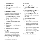
Select Route Planner > Create Route > Select First Point.
2. Recording Track Logs 1. If you to save the route. Select Where To?. 2. Select a category. 3. Select Use. 5. Tracks
A track is
complete. 6. Select Setup > Tracks > Track
Log.
2.
eTrex 20/30 Quick Start...
Quick Start Manual - Page 8

.... 4.
Select Map.
Navigating with a magenta line.
5.
Navigating to a Destination
You can navigate to zoom in and out of the map. Select Go. The map page opens with your location on , a track log is created.
The position icon represents your route marked with the Bearing Pointer The eTrex 30 has a 3-axis, electronic compass.
8
eTrex 20/30 Quick Start Manual...
Similar Questions

Storage Problem On Gps Etrex 10
When I try to store anything on my eTrex 10, I get this message appear on the screen. "There is not ...
When I try to store anything on my eTrex 10, I get this message appear on the screen. "There is not ...
(Posted by derekhill108 8 years ago)
How To Change Tones Of Etrex 20 When Approaching Geocaches
(Posted by meadddabd 9 years ago)


Does My Garmin Etrex 20 Search For Geocaches Closest To My Current Location?
(Posted by NoorAkiddne 9 years ago)
