
Garmin eTrex 20 Support Question
Garmin eTrex 20 Support Question
Find answers below for this question about Garmin eTrex 20.Need a Garmin eTrex 20 manual? We have 2 online manuals for this item!
Question posted by jonjan1 on January 11th, 2013
Coordance
How do I enter english coordance e.g sx 55180 - 72082 into my etrex 20
Current Answers
Related Garmin eTrex 20 Manual Pages
Owner's Manual - Page 1

eTrex®
owner's manual
for use with models 10, 20, 30
Owner's Manual - Page 3

...Destination..........16 Map 16 Compass 17 Elevation Plot 19 Trip Computer 20
eTrex Owner's Manual
Table of Contents
Geocaches 21 Downloading Geocaches 21 Filtering... a Proximity Alarm 24 Calculating the Size of Contents
Getting Started 5 Device Overview 5 Using the eTrex Keys 6 Battery Information 7 Turning the Device On or Off.........8 Satellite Signals 8 Registering Your Device...
Owner's Manual - Page 7

... batteries, observing polarity. Replace the battery cover, and turn the D-ring clockwise.
4. eTrex Owner's Manual
7
Therefore, use alkaline, NiMH, or lithium batteries. Use NiMH or lithium batteries for the device (-4&#...176;F to 158°F, or -20 to remove the cover.
3. notice Alkaline batteries lose a significant amount of some batteries....
Owner's Manual - Page 11

... are available in all Where To? Enter all or part of interest, such as restaurants or marine services. Select Where To? > menu >
Search Near.
2. eTrex Owner's Manual
11 Additional Maps You...Waypoints, Routes, and Tracks
Finding a Location by Name Depending on the maps loaded on the eTrex 20 and eTrex 30, such as restaurants, hotels, and auto services.
1. Detailed maps may contain additional ...
Owner's Manual - Page 17

... the map to navigate to your vehicle.
1. Navigation
Compass
The eTrex 30 has a 3-axis, electronic compass. Follow the turns in... Calibrating the Compass
Notice Calibrate the electronic compass outdoors. eTrex Owner's Manual
17 If you plan to use a ...Driving route navigation is using the automotive profile, the compass displays GPS heading, not magnetic heading.
TIP: When the device is only...
Owner's Manual - Page 20

... correct barometric pressure.
1. Go to zero.
Follow the on-screen instructions.
Select Elevation Plot > menu > Calibrate Altimeter.
3.
To customize the trip computer, see page 28.
20
eTrex Owner's Manual All of the trip computer values are set to a location where the elevation or barometric pressure is known.
2. Resetting the Trip Data For...
Owner's Manual - Page 24

... another compatible device. Sending and Receiving Data Wirelessly Before you can share information wirelessly. Applications
Applications
Sharing Data
The eTrex 30 can share data wirelessly, you enter a proximity alarm area, the device sounds a tone (eTrex 20/30).
24
eTrex Owner's Manual Select Proximity Alarms.
2. Select a location.
5.
Select Use.
6. Select Send or Receive. 3.
Owner's Manual - Page 26

...The satellite page shows your current track toward the top of that satellite (eTrex 20/30). If necessary, select Multicolor to assign a specific color to the satellite in the view...be oriented with your current location, GPS accuracy, satellite locations, and signal strength. Turning Off GPS Select Satellite > menu > Use With GPS Off.
26
eTrex Owner's Manual If necessary, select ...
Owner's Manual - Page 30

.... 2. Note: To adjust the backlight brightness, see page 40.
• Colors (eTrex 20/30)-sets the colors that display in Night and Day mode.
◦◦ Mode-sets a light background (Day), a dark background
30
eTrex Owner's Manual Customizing Your Device
Editing a Profile Name 1. Enter the new name. 5. Select Setup > Profiles. 2. Select Done. Select a profile...
Owner's Manual - Page 33

... Automatic to select the time zone for distance and speed, elevation, and pressure.
1. eTrex Owner's Manual
33 Select Setup > Units.
2. Customizing Your Device
Time Settings
Select Setup... setting.
• Color (eTrex 20/30)-changes the color of the track line on your tracks.
• Auto Archive-selects an automatic archive method to organize your GPS position. Select a measurement type...
Owner's Manual - Page 35

...; Ambient Pressure-records ambient pressure changes over a period of time.
• Calibrate Altimeter-page 20. Geocaching Settings
Select Setup > Geocaches.
• Geocache List-allows you to weather.
• Pressure Trending
◦◦ Save When Power On- eTrex Owner's Manual
35 This can be useful when you are moving.
◦◦ Fixed Elevation...
Owner's Manual - Page 37

...; Distance-routes you to the next point on the route when you are more readable.
eTrex Owner's Manual
37 The nautical chart reflects the drawing scheme of paper charts.
◦◦...allows you want to avoid. Customizing Your Device
Marine Map Settings
This function is available on the eTrex 20 and eTrex 30. Select Setup > Marine.
• Marine Chart Mode-allows you to select a nautical ...
Owner's Manual - Page 41

...lithium, or precharged NiMH)
Battery Life Up to 25 hours
Operating From -4°F to 158°F temperature (-20°C to 70°C)
range
About the Batteries
‹ warning The temperature rating for the device (page 41... disposal department to properly recycle the batteries. eTrex Owner's Manual
41
Do not use lithium batteries when operating the device in below-freezing conditions.
Owner's Manual - Page 43

... Turn the D-ring counter-clockwise, and pull up , as instructed in the battery compartment.
➊➋
eTrex Owner's Manual
43 Slide the card holder ➊ toward the bottom of the device and lift up to ... GPX geocache files
Device Information
Installing a microSD Card The eTrex 20 and eTrex 30 can use microSD cards for more information.
1. Remove the batteries or battery.
3.
Owner's Manual - Page 54

...the type 7 storage 7 warnings 7 BirdsEye satellite imagery 11 BlueChart g2 maps 11
54
C calculator 25 calendar 25 calibrating
altimeter 20 compass 18 caring for the device 42 long-term storage 42 chirp 23 City Navigator maps 17 compass 17 calibrating 18 navigating 18... cable 44 wireless accessories 46 course pointer 19 creating routes 12 waypoints 9 customizing data fields 28
eTrex Owner's Manual
Owner's Manual - Page 55

...routes 37
E editing
profiles 30 routes 12 waypoints 9
eTrex Owner's Manual
elevation plot 19, 20 barometric altimeter 20 of a track 15
F file types 43 finding
...addresses 12 near your location 11 fishing times 25 fitness options 46
G geocaches 21, 35
downloading 21 filter list 21 logging attempt 22 navigating to 22 settings 35 GPS...
Owner's Manual - Page 56

...14, 32 registering your device 8 resetting
all settings 52 data 38 device 52 elevation plot 20 restoring default settings 39 routes 12-13 active route 13 avoidance 37 creating 12 deleting 13...settings 36
S satellite signals 8, 26, 47,
49, 52 system settings 30 turning off GPS 26, 27
saving tracks 15
sharing data 24 Sight N' Go 10 software
updating 40 version... 33 tones 31
56
eTrex Owner's Manual
Quick Start Manual - Page 4

... screen backlighting
eTrex 20/30 Quick Start Manual 2. Insert the batteries, observing polarity.
3. Replace the battery cover, and turn the D-ring clockwise.
4.
When the GPS bars on the GPS position. The... when the remaining capacity in a safe place.
Hold (page 2). 5.
For more information about GPS, go to http://my.garmin.com. • Keep the original sales receipt, or a
photocopy...
Quick Start Manual - Page 7
...
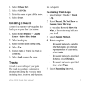
for each point. If you to save the route. Select All POIs. 3. Enter the name or part of your final destination.
1. Tracks
A track is
complete. 6. Select Record, Do Not Show or Record, Show On Map. Select Recording Interval. Select Use. 5. eTrex 20/30 Quick Start Manual
7 Select Where To?. 2.
Select Done. Select a category...
Quick Start Manual - Page 8

...icon represents your route marked with the Bearing Pointer The eTrex 30 has a 3-axis, electronic compass.
8
eTrex 20/30 Quick Start Manual Tip: To customize the map view...Using the Most Often interval provides the most track detail, but fills up the device memory quicker. • Enter a time or distance, and select Done.
Select Map.
Navigating with a magenta line.
5. Select Go.
As...
Similar Questions

Storage Problem On Gps Etrex 10
When I try to store anything on my eTrex 10, I get this message appear on the screen. "There is not ...
When I try to store anything on my eTrex 10, I get this message appear on the screen. "There is not ...
(Posted by derekhill108 8 years ago)

Garmin Edge 500 Wont Go Into Mass Storage Mode
(Posted by Peser 10 years ago)

