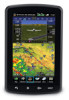
Garmin aera 796 Support Question
Garmin aera 796 Support Question
Find answers below for this question about Garmin aera 796.Need a Garmin aera 796 manual? We have 2 online manuals for this item!
Question posted by retredevent on January 6th, 2014
Garmin 796 Cannot Unlock Database
The person who posted this question about this Garmin product did not include a detailed explanation. Please use the "Request More Information" button to the right if more details would help you to answer this question.
Current Answers
Related Garmin aera 796 Manual Pages
Pilot's Guide - Page 5
...; are registered trademarks of System Software version 0002.0 or later. aera™ is a trademark of Garmin Ltd. NavData™ is a trademark of Jeppesen, Inc. Copyright © 2011 Garmin Ltd. SiriusXM® is a registered trademark of Garmin. Tel: 913/397.8200 Fax: 913/397.8282
Garmin AT, Inc., 2345 Turner Road SE, Salem, OR 97302, U.S.A.
All...
Pilot's Guide - Page 6
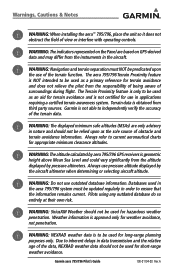
... significantly from the altitude displayed by aera 795/796 GPS receivers is obtained from third party sources. WARNING: The displayed minimum safe altitudes (MSAs) are based on the Panel are only advisory in nature and should not be used in the aircraft. Always use outdated database information. Garmin aera 795/796 Pilot's Guide
190-01194-00 Rev...
Pilot's Guide - Page 7
....
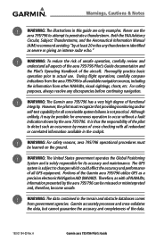
During flight operations, carefully compare indications from the aera 795/796 to occur without a fault indication shown by means of the Garmin aera 795/796 utilize GPS as a precision electronic NAVigation AID (NAVAID). Although unlikely, it may be possible for erroneous operation to all aspects of the aera 795/796 Pilot's Guide documentation and the Pilot's Operating Handbook...
Pilot's Guide - Page 9
... should alleviate the condition.
A
Garmin aera 795/796 Pilot's Guide
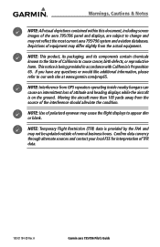
NOTE: Interference from the source of attitude and heading displays while the aircraft is on the ground. Depictions of the aera 795/796 panel and displays, are subject to change and may not reflect the most current aera 795/796 system and aviation databases. Warnings, Cautions & Notes
NOTE...
Pilot's Guide - Page 13
A
Garmin aera 795/796 Pilot's Guide
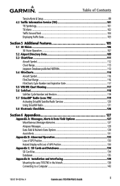
iii Table of Contents
Terrain Alerts & Setup...99 4.3 Traffic Information Service... B: Abnormal Operation 133 Loss of GPS Position...133 Hazard Display with Loss of GPS Position 133
Appendix C: SD Cards and Databases 134 SD Card Use...134 Databases...135
Appendix D: Installation and Interfacing 139 Mounting the aera 795/796 in the Aircraft 139 Connecting to...
Pilot's Guide - Page 19
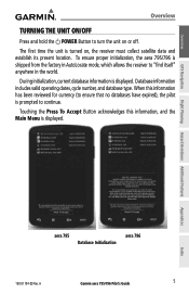
... is displayed. Touching the Press To Accept Button acknowledges this information has been reviewed for currency (to ensure that no databases have expired), the pilot is turned on or off. A
Garmin aera 795/796 Pilot's Guide
5
The first time the unit is prompted to continue. When this information, and the Main Menu is displayed...
Pilot's Guide - Page 27
....
Appendices
Index
190-01194-00 Rev. A
Garmin aera 795/796 Pilot's Guide
13
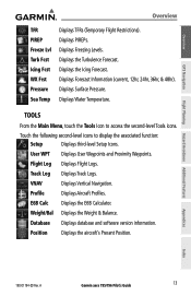
Database Displays database and software version information. Displays Forecast Information (current...Displays the Turbulence Forecast.
Displays Freezing Levels.
Displays PIREPs. Overview
GPS Navigation
Flight Planning Hazard Avoidance Additional Features
Overview
TFR PIREP Freeze Lvl...
Pilot's Guide - Page 55

...-Enter the descent rate.
• Altitude-Enter the desired reference waypoint altitude.
A
Garmin aera 795/796 Pilot's Guide
41
Index To set a target location at a reference waypoint, enter... Waypoint' to use field elevation for airports in the Jeppesen database or 'MSL' to enable/disable VNAV alert messages.
Overview
GPS Navigation
Configuring a VNAV profile: 1) From the Main Menu,...
Pilot's Guide - Page 58

...'Both').
2.5 WAYPOINTS
Waypoints are predetermined geographical positions (internal database) or pilotentered positions, and are described as FL450 for 45... are drawn in green. Appendices
Index
44
Garmin aera 795/796 Pilot's Guide
190-01194-00 Rev. A...the route number. Overview
GPS Navigation
Additional Features Hazard Avoidance Flight Planning
GPS Navigation
AIRWAYS
Low Altitude...
Pilot's Guide - Page 79

... flight plans with up to 300 waypoints each can be created and stored in the aera 795/796. When storing flight plans with a sequence of the published approach is available in memory.
If the database is displayed. A
Garmin aera 795/796 Pilot's Guide
65 Whenever an approach is turned off. The active flight plan is erased...
Pilot's Guide - Page 91

... when being vectored to Final symbol appears beside the first approach waypoint in the database (final approach fix [FAF]).
Loading the approach cancels the Direct-to and initiates... aera 795/796 creates an extension of the final approach course using a bold magenta line. The aera 795/796 provides no guidance to the FAF.
A
Garmin aera 795/796 Pilot's Guide
77
Overview
GPS ...
Pilot's Guide - Page 99

...
GPS ...an airport, a color-coded flag is only displayed within the installed aviation database service area. TAFs may contain some of the same code as needed.
They...for reporting weather observations. Touching the Map Feature Button will display additional information. A
Garmin aera 795/796 Pilot's Guide
85
METAR and TAF data can also contain information on precipitation amounts...
Pilot's Guide - Page 109

...Garmin aera 795/796 Pilot's Guide
95
Index b) Touch the desired second-level weather icon. 2) Press the Menu Icon. 3) Touch the 'Weather Legend' menu option. 4) If desired, touch the buttons until the desired legend is always "ahead" of terrain and obstructions relative to the aircraft position and altitude with reference to a database...). Overview
GPS Navigation
Hazard Avoidance
Viewing ...
Pilot's Guide - Page 110

...to be available in yellow are further than the Caution Elevation. Appendices
Index
96
Garmin aera 795/796 Pilot's Guide
190-01194-00 Rev. Alert windows appear to the surrounding terrain...altitude of the aircraft. therefore, the areas in the terrain and obstacle database. Aircraft GPS altitude is 1,000 feet; GPS-MSL altitude accuracy is affected by the Terrain function: the Map View...
Pilot's Guide - Page 120

... view to avoid terrain or obstacles. A
Terrain alerts are displayed in the obstacle database (if present). Terrain is integrated within 3D Vision to provide visual and auditory alerts... Loss of the GPS signal, will cause 3D Vision to the projected flight path. Appendices
Index
106
Garmin aera 795/796 Pilot's Guide
190-01194-00 Rev. Overview
GPS Navigation
Additional Features ...
Pilot's Guide - Page 141
....
A
Garmin aera 795/796 Pilot's Guide
127
Appendices
Index
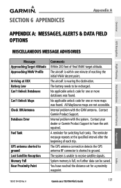
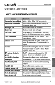
The GPS antenna connection detects the GPS antenna RF connector is unable to ground. The system is shorted to receive satellite signals. System memory is nearing the destination.
The reminder message repeats at XXX Battery Low Can't Unlock Databases
Can't Unlock Maps
Check XM Antenna
Database Error
Fuel Tank
GPS antenna...
Pilot's Guide - Page 151
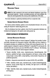
...by visiting the 'flyGarmin' website (fly.garmin.com). After the databases have been updated, check that provides location and facility information for thousands of the data. A
Garmin aera 795/796 Pilot's Guide
137
Appendices
Index The update program is updated periodically and has no expiration date. Worldwide Terrain
Appendix C
Overview
GPS Navigation
Flight Planning Hazard Avoidance...
Pilot's Guide - Page 158
... interface does not have an FAA installation airworthiness approval. Overview
GPS Navigation
Additional Features Hazard Avoidance Flight Planning
Appendix D
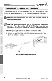
CONNECTING TO A GARMIN VHF COMM RADIO
The aera 795/796 can also output frequency data to a Garmin aviation radio. Currently the two models supported are encountered, disconnect the aera 795/796 from the SL 30/40 tuning interface.
Quick Reference Guide - Page 4
... hereby grants permission to download a single copy of any revision hereto is strictly prohibited.
Garmin International, Inc., 1200 East 151st Street, Olathe, Kansas 66062, U.S.A. Garmin®, FliteCharts®, SafeTaxi®, and MapSource® are registered trademarks of Garmin Ltd. aera™ is a trademark of System Software version 0002.0 or later.
These trademarks may...
Quick Reference Guide - Page 49
...
Database Error
Fuel Tank
GPS antenna shorted to ground Lost Satellite Reception Memory Full Near Proximity Point
Next DTK XXX Proximity Memory Full Proximity Radius Overlaps Route Already Exists Route Memory Full
Comments Within 200 feet of final VNAV target altitude. You have the unit repaired. B
Garmin aera 795/796 Quick Reference Guide
39 Contact Garmin...
Similar Questions


Data Base Lockout
when I turn on the 796 it says cannot unlock databases. I just updated the database and never had th...
when I turn on the 796 it says cannot unlock databases. I just updated the database and never had th...
(Posted by formaned 10 years ago)

Cannot Unlock Database
Recently purchased a Garmin 796. Updated the database online through the Garmin website. After the u...
Recently purchased a Garmin 796. Updated the database online through the Garmin website. After the u...
(Posted by jefflittle1272 11 years ago)