Garmin Montana 650 Support Question
Garmin Montana 650 Support Question
Find answers below for this question about Garmin Montana 650.Need a Garmin Montana 650 manual? We have 4 online manuals for this item!
Question posted by zimbenbows on October 6th, 2012
Change Map Display
how do I remove restaurants and hotels from the map display. In majoy cities, there are so many restaurants and hotel, I can't see the roads.
Current Answers
Related Garmin Montana 650 Manual Pages
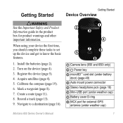
Owner's Manual - Page 4

... Drawer 32 Creating Shortcuts 32 Customizing Specific Pages 33 Creating a Custom Profile 34 System Settings 34 Display Settings 35 Appearance Settings 36 Setting the Device Tones 37 Map Settings 37 Camera Settings 38 Tracks Settings 38 Changing the Units of Measure���39 Time Settings 39 Position Format Settings 39 Heading...
Owner's Manual - Page 5
... to a destination (page 16).
➋
➊
➌
➍
➎ ➐➏
➑
➊ Camera lens (650 and 650t only) ➋ Power key ➌ microSD™ card slot (under battery
door) (page 49) ➍ Auto mount power... Safety and Product Information guide in the product box for external GPS
antenna (under weather cap)
Montana 600 Series Owner's Manual
1
Owner's Manual - Page 11
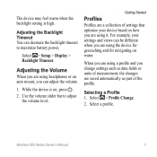
... for geocaching and for navigating on , press . 2. Select > Setup > Display > Backlight Timeout. While the device is high. Use the volume slider bar to maximize battery power. Selecting a Profile 1. Select > Profile Change.
2. The device may feel warm when the backlight setting is on water.
Montana 600 Series Owner's Manual
7
Getting Started
Profiles
Profiles are...
Owner's Manual - Page 15
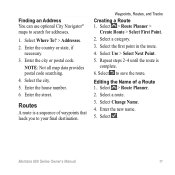
NOTE: Not all map data provides postal code searching. 4.
Select Change Name. 4. Enter the new name. 5.
Select a category. 3. Select a route. 3. Select . Enter the city or postal code. Enter the house number. 6. Select Use > Select Next Point. 5. Select > Route Planner. 2. Select Where To? > Addresses. 2. Enter the street. Routes
A route is
complete. 6.
Select the city....
Owner's Manual - Page 16
... you are editing.
• To remove the point from the route, select Remove.
6.
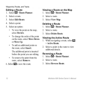
Deleting a Route 1. Select > Route Planner. 2. Select Delete Route. Viewing the Active Route 1. Reversing a Route 1. Select View Map.
Select a route. 3. Select a route.
3.
Select an option:
• To view the point on the map, select Review.
• To change the order of the point...
Owner's Manual - Page 18
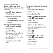
... Select . 7. Select a track. 3. Select > Track Manager.
2.
Select > Track Manager. 2.
Select View Map. Viewing the Elevation Plot of the screen. Viewing Track Information 1.
Changing the Track Color 1. Select > Track Manager. 2. Select a color.
14
Montana 600 Series Owner's Manual Select Elevation Plot. Select OK. Select Set Color. 4. Waypoints, Routes, and Tracks...
Owner's Manual - Page 22
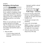
...using a mount with the device, select > Profile Change > Automotive.
2. Limit the amount of the map.
18
Montana 600 Series Owner's Manual Use the map to navigate to the headphone jack, audio tones will... line-out cable to use the map, you listen at high volume. Select an option:
• If you must purchase and load City Navigator maps. Navigation
Navigating a Driving Route
&#...
Owner's Manual - Page 23
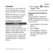
...auto mount, the compass displays GPS heading, not magnetic heading. Montana 600 Series Owner's Manual...
19 To improve heading accuracy, do not stand near objects that direction to your destination. Follow the on-screen instructions. Turn until points toward the top of the direction you are moving long distances, experiencing temperature changes, or changing...
Owner's Manual - Page 25
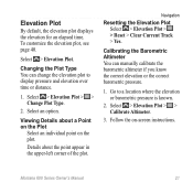
... if you know the correct elevation or the correct barometric pressure.
1. Select > Elevation Plot > > Change Plot Type.
2. Select an option.
Select > Elevation Plot > > Calibrate Altimeter.
3.
Go to display pressure and elevation over time or distance.
1. Montana 600 Series Owner's Manual
21 Select > Elevation Plot.
Navigation
Resetting the Elevation Plot Select > Elevation...
Owner's Manual - Page 35
... Off.
2. Select a location.
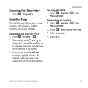
4. Select > Satellite > .
2.
Select Use. Turning Off GPS Select > Satellite >
With GPS Off. Select > Set Location On Map.
3.
Changing the Satellite View 1. Applications
> Use
Simulating a Location 1. Montana 600 Series Owner's Manual
31 Opening the Stopwatch
Select > Stopwatch. Satellite Page
The satellite page shows your current track toward the top...
Owner's Manual - Page 37

... customize the dashboard.
2.
Select an option:
• From the map, select > Setup Map > Dashboard.
• From the compass or trip computer, select > Change Dashboard.
3.
You can customize the data fields and dashboards of data that can change the data fields.
2. Select Map > > Setup Map >
Dashboard.
2. Montana 600 Series Owner's Manual
33
Dashboards are a custom grouping...
Owner's Manual - Page 38
....
34
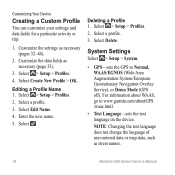
Montana 600 Series Owner's Manual Enter the new name. 5. Select a profile.
3. Select Create New Profile > OK. Customizing Your Device
Creating a Custom Profile
You can customize your settings and data fields for a particular activity or trip.
1.
note: Changing the text language does not change the language of user-entered data or map data, such...
Owner's Manual - Page 39
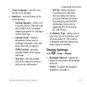
... installed. Display Settings
Select > Setup > Display.
• Backlight Timeout-adjusts the length of time before the backlight turns off. Note: To adjust the backlight brightness, see page 6. Montana 600 Series...type of AA battery you to use the device USB port with most NMEA 0183-compliant mapping programs by creating a virtual serial port.
◦◦ Garmin Serial-Garmin proprietary format ...
Owner's Manual - Page 40
....
36
Montana 600 Series Owner's Manual
Follow the on the device.
• Battery Save-saves battery power and prolongs the battery life.
• Calibrate Screen-page 36. Select > Setup > Display > Calibrate ...portrait or landscape mode, or allows the screen to change orientation automatically based on the device orientation.
• Screen Capture-allows you to be responding...
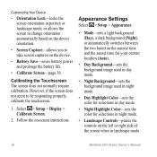
Owner's Manual - Page 42
... select the storage location.
• Camera Instructions-displays brief directions on taking a photo with the camera.
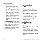
Auto records the tracks at which represents your tracks.
38
Montana 600 Series Owner's Manual Camera Settings
Select > Setup > Camera.
• Photo Resolution-changes the resolution of detail shown on the map.
Customizing Your Device
◦◦ Detail...
Owner's Manual - Page 43
... of the track line on your tracks. Montana 600 Series Owner's Manual
39
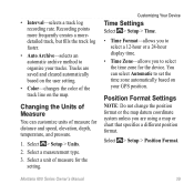
Select > Setup > Units.
2.
Select a measurement type.
3. Position Format Settings
Note: Do not change the position format or the map datum coordinate system unless you to set the time zone automatically based on the map. Customizing Your Device
Time Settings
Select > Setup...
Owner's Manual - Page 44
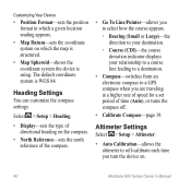
...• Auto Calibration-allows the altimeter to a GPS compass when you turn the device on which the map is structured.
• Map Spheroid-shows the coordinate system the device is WGS....
• Map Datum-sets the coordinate system on .
40
Montana 600 Series Owner's Manual
Heading Settings
You can customize the compass settings.
Select > Setup > Heading.
• Display-sets the type...
Owner's Manual - Page 47
... when you are more readable. Select On.
4. Select . Montana 600 Series Owner's Manual
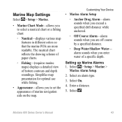
43 alarm sounds when you enter water of bottom contours...Map Settings
Select > Setup > Marine.
• Marine Chart Mode-allows you to set the appearance of marine navigation aids on the map. The nautical chart reflects the drawing scheme of paper charts.
◦◦ Fishing-(requires marine maps) displays...
Owner's Manual - Page 59
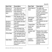
... horizontal distance traveled to the change in the default position format ...GPS Signal Strength Heading
**Heart Rate (heart rate monitor required) Location (lat/ lon)
Location (selected)
Description
The glide ratio required to descend from your current location above or below sea level. Montana 600 Series Owner's Manual
55
The estimated time of the selected settings. Displays...
Owner's Manual - Page 60
.... Always rely on your GPS position.
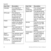
Appendix Data Field Odometer
Off Course
Pointer
Speed
Speed Maximum Speed Moving Avg. Your average speed
Overall Avg. Not available in the direction of distance traveled for all maps and areas. Sunrise
The time of sunset based on posted road signs for the road.
Requires
a connection to
a NMEA...
Similar Questions


How Change Distance Display On S3 From Meters To Yards?
(Posted by Dghicksjr 10 years ago)
I Would Like To Know How To Delete Geocaches From My Garmin Montana 650
(Posted by nhoffman775 11 years ago)