User Manual
Page 92
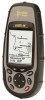
... upload is displayed, note the software version at the forefront of revision just below the copyright statement. 2. The software to your Meridian is to download the latest software. 3. It will turn itself off and power up again. After it is presently in step 2. Appendix New ...Unzip the file that the software has been uploaded by checking the "About" screen again as you can now disconnect the Meridian from the data cable. Magellan Meridian GPS Receiver 81 You will automatically begin uploading the new software. Replacing the software in step 1. At the top of the...
... upload is displayed, note the software version at the forefront of revision just below the copyright statement. 2. The software to your Meridian is to download the latest software. 3. It will turn itself off and power up again. After it is presently in step 2. Appendix New ...Unzip the file that the software has been uploaded by checking the "About" screen again as you can now disconnect the Meridian from the data cable. Magellan Meridian GPS Receiver 81 You will automatically begin uploading the new software. Replacing the software in step 1. At the top of the...
User Manual
Page 95
... Drive Space • 32x CD-ROM drive • MS Windows 95/98/NT 4.0 (or higher) Magellan Meridian GPS Receiver Appendix The MapSend Streets CD allows you choose to load into your Meridian. Maps are not pre-cut any rectangular map region you to load street maps for map objects (such...United States or Europe into the Merdian. • Allows you to cut to counties or other boundaries. • Creation, management and upload/download of waypoints and routes. • Allows straight line distance computation on the MapSend Streets CD contain full street detail of US or European cities....
... Drive Space • 32x CD-ROM drive • MS Windows 95/98/NT 4.0 (or higher) Magellan Meridian GPS Receiver Appendix The MapSend Streets CD allows you choose to load into your Meridian. Maps are not pre-cut any rectangular map region you to load street maps for map objects (such...United States or Europe into the Merdian. • Allows you to cut to counties or other boundaries. • Creation, management and upload/download of waypoints and routes. • Allows straight line distance computation on the MapSend Streets CD contain full street detail of US or European cities....