
Operating Instructions
Page 40
....txt): Address Book and Memo Pad only. • Tab delimited (.tab, .tsv, .txt): Address Book and Memo Pad only. • CSV (Lotus Organizer 2.x/97 Mapping): Address Book only. • Date Book archive (.dba). • Address Book archive (.aba). • To Do List archive (.tda). • Memo Pad archive (.mpa...computer applications such as spreadsheets and databases, or if you want to import data from another device, you can transfer the data to your iQue handheld without having to key it into Palm™ Desktop software, and then perform a HotSync® operation to transfer the data to ...
....txt): Address Book and Memo Pad only. • Tab delimited (.tab, .tsv, .txt): Address Book and Memo Pad only. • CSV (Lotus Organizer 2.x/97 Mapping): Address Book only. • Date Book archive (.dba). • Address Book archive (.aba). • To Do List archive (.tda). • Memo Pad archive (.mpa...computer applications such as spreadsheets and databases, or if you want to import data from another device, you can transfer the data to your iQue handheld without having to key it into Palm™ Desktop software, and then perform a HotSync® operation to transfer the data to ...

Operating Instructions
Page 130
For the latest free software updates (excluding map data) throughout the life of your Garmin products, visit the Garmin web site at www.garmin.com. ® Copyright 2004 Garmin Ltd. Unit 5, The Quadrangle, Abbey Park Industrial Estate, Romsey, SO51, 9DL, U.K. Garmin (Europe) Ltd. Garmin Corporation No. 68, Jangshu 2nd Road, Shijr, Taipei County, Taiwan www.garmin.com Part Number 190-00327-00 Rev. B or its subsidiaries Garmin International, Inc. 1200 E. 151st Street, Olathe, KS 66062, U.S.A.
For the latest free software updates (excluding map data) throughout the life of your Garmin products, visit the Garmin web site at www.garmin.com. ® Copyright 2004 Garmin Ltd. Unit 5, The Quadrangle, Abbey Park Industrial Estate, Romsey, SO51, 9DL, U.K. Garmin (Europe) Ltd. Garmin Corporation No. 68, Jangshu 2nd Road, Shijr, Taipei County, Taiwan www.garmin.com Part Number 190-00327-00 Rev. B or its subsidiaries Garmin International, Inc. 1200 E. 151st Street, Olathe, KS 66062, U.S.A.

Que Applications Guide
Page 7
...any discrepancies before continuing navigation. WARNING: This product, its packaging, and its accuracy and maintenance. Only of this product prudently. Although the Garmin iQue 3200 is subject to our web site at a reasonable cost. v When in actual use, carefully compare indications from other NAVAIDs, visual sightings...electronic chart is an aid to navigation and is being provided in product literature and copyright messages displayed to some degree. MAP DATA INFORMATION: One of the goals of all GPS equipment. This is particularly true outside the United States, where complete ...
...any discrepancies before continuing navigation. WARNING: This product, its packaging, and its accuracy and maintenance. Only of this product prudently. Although the Garmin iQue 3200 is subject to our web site at a reasonable cost. v When in actual use, carefully compare indications from other NAVAIDs, visual sightings...electronic chart is an aid to navigation and is being provided in product literature and copyright messages displayed to some degree. MAP DATA INFORMATION: One of the goals of all GPS equipment. This is particularly true outside the United States, where complete ...

Que Applications Guide
Page 11
... 8 Using the QueMap Application Selector Icons 10 Using Preferences for QueMap 12 Location Formats and Map Datums 13 QueFind 14 Using QueFind 14 Selecting Cities 16 Finding an Address 17 Finding an Intersection 19 Finding Points of Interest 20 Using Waypoints ...
... 8 Using the QueMap Application Selector Icons 10 Using Preferences for QueMap 12 Location Formats and Map Datums 13 QueFind 14 Using QueFind 14 Selecting Cities 16 Finding an Address 17 Finding an Intersection 19 Finding Points of Interest 20 Using Waypoints ...

Que Applications Guide
Page 12
... 42 QueSun & Moon 44 Using QueSun & Moon 44 QueHunt & Fish 45 Using QueHunt & Fish 45 Downloading Map Data 46-47 Map Install 46 Using Map Install to Download Map Data 46 MapSource 47 Using MapSource® to Download Map Data 47 Appendix 48-52 Specifications 48 WAAS and DGPS 50 What is WAAS... 50 What is Differential GPS (DGPS 50 Map Datums and Location Formats 51 What are Map Datums and which should I use 51 What is a Location Format and which should I use 51 Location Coordinates 52 Editing or ...
... 42 QueSun & Moon 44 Using QueSun & Moon 44 QueHunt & Fish 45 Using QueHunt & Fish 45 Downloading Map Data 46-47 Map Install 46 Using Map Install to Download Map Data 46 MapSource 47 Using MapSource® to Download Map Data 47 Appendix 48-52 Specifications 48 WAAS and DGPS 50 What is WAAS... 50 What is Differential GPS (DGPS 50 Map Datums and Location Formats 51 What are Map Datums and which should I use 51 What is a Location Format and which should I use 51 Location Coordinates 52 Editing or ...
Que Applications Guide
Page 13
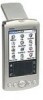
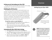
... must be shortened by re-initializing. The initialization time can begin using the map to point to the general area are currently located (see the "Establishing a New Location" section of the iQue 3200 so it may take as long as 15 minutes. Have a clear view of options. Rotate the antenna...needed. Then tap Units to open with certain buttons on the back of this guide). Setting up and Customizing your iQue 3200 You may customize your iQue 3200 to fit your iQue 3200 GPS Antenna in the On Position Pull the antenna out and rotate up to the On position. When the unit...
... must be shortened by re-initializing. The initialization time can begin using the map to point to the general area are currently located (see the "Establishing a New Location" section of the iQue 3200 so it may take as long as 15 minutes. Have a clear view of options. Rotate the antenna...needed. Then tap Units to open with certain buttons on the back of this guide). Setting up and Customizing your iQue 3200 You may customize your iQue 3200 to fit your iQue 3200 GPS Antenna in the On Position Pull the antenna out and rotate up to the On position. When the unit...

Que Applications Guide
Page 19
... Elevation" page. 2. Tap the New Elevation option to complete initialization. Tap either Automatic or Use Map. 2. Entering a New Elevation The GPS Receiver can use the stylus to pan the map to your current general location and tap to enter the new elevation. 3. Que Applications QueGPS New Location...establish a New Location: 1. If you have moved more than 600 miles from your original location. If you choose Use Map, use the map to mark your approximate location by pressing Use Map. Use the Graffiti® 2 input area to place a new location arrow there. 3. Tap the New ...
... Elevation" page. 2. Tap the New Elevation option to complete initialization. Tap either Automatic or Use Map. 2. Entering a New Elevation The GPS Receiver can use the stylus to pan the map to your current general location and tap to enter the new elevation. 3. Que Applications QueGPS New Location...establish a New Location: 1. If you have moved more than 600 miles from your original location. If you choose Use Map, use the map to mark your approximate location by pressing Use Map. Use the Graffiti® 2 input area to place a new location arrow there. 3. Tap the New ...

Que Applications Guide
Page 20
... black arrow. From this page you stop. When in the "Track Up" mode, a north reference arrow appears at the top left corner to display the 'Map Page. When the Track Log feature is active, your path of movement is the primary screen of the QueMap application. Viewing the... Map Page The Map Page is indicated by a dotted Track line. Use QueMap to: • Determine your current location and view your current location. Or: Use the Applications Launcher ...
... black arrow. From this page you stop. When in the "Track Up" mode, a north reference arrow appears at the top left corner to display the 'Map Page. When the Track Log feature is active, your path of movement is the primary screen of the QueMap application. Viewing the... Map Page The Map Page is indicated by a dotted Track line. Use QueMap to: • Determine your current location and view your current location. Or: Use the Applications Launcher ...

Que Applications Guide
Page 21
.... Any point on the front of this guide. See "Using Preferences for the difference in the "Downloading Map Data" section of the unit to increase and decrease the scale in the map toolbar. Detailed maps can automatically compensate for QueMap". If that location is selected, drag the stylus across the screen to show...
.... Any point on the front of this guide. See "Using Preferences for the difference in the "Downloading Map Data" section of the unit to increase and decrease the scale in the map toolbar. Detailed maps can automatically compensate for QueMap". If that location is selected, drag the stylus across the screen to show...

Que Applications Guide
Page 22
...Display Format icon on the map toolbar to display the 'Mark Waypoint' entry window for your current location (Position Arrow) or a 'New Waypoint' entry window for the Map Pointer. Map Point Information Full Map only Map with Navigation and Data Fields showing Map with a name describing the... location if identified as an item in the map data or as an item in the map data or a position coordinates (i.e. Tap...
...Display Format icon on the map toolbar to display the 'Mark Waypoint' entry window for your current location (Position Arrow) or a 'New Waypoint' entry window for the Map Pointer. Map Point Information Full Map only Map with Navigation and Data Fields showing Map with a name describing the... location if identified as an item in the map data or as an item in the map data or a position coordinates (i.e. Tap...

Que Applications Guide
Page 23
...Area Selector 11 Tap the View Area icon to allow the stylus to drag the map and to mark map items with the map pointer (Panning Arrow). Select a point adjacent to the area you want and the map will be enlarged when you lift the stylus from the screen. Liftthestylusto complete, ...arrow toscroll throughtheentirelist of scales. Place the stylus anywhere on the map with the stylus and exposes the part of the map previously out of map scales. Note that scale. Tap the Position Arrow icon (vehicle pointer) to center the map on your location. When in North Up mode. Tap the Pan...
...Area Selector 11 Tap the View Area icon to allow the stylus to drag the map and to mark map items with the map pointer (Panning Arrow). Select a point adjacent to the area you want and the map will be enlarged when you lift the stylus from the screen. Liftthestylusto complete, ...arrow toscroll throughtheentirelist of scales. Place the stylus anywhere on the map with the stylus and exposes the part of the map previously out of map scales. Note that scale. Tap the Position Arrow icon (vehicle pointer) to center the map on your location. When in North Up mode. Tap the Pan...

Que Applications Guide
Page 24
...button to operate the QueMap application with its operation, you become more information about Heading, Course, and Bearing lines, consult the Garmin web site at which map items display. • Control the display of the preferences available. From the QueMap application, tap Menu icon . 2. As you... may desire to customize the application to fit your needs. Que Applications QueMap Map Preferences Pages are accessed by controlling how items are displayed. • Set the maximum Zoom scale at www.garmin.com/aboutGPS/. These pages provide an overview of multiple...
...button to operate the QueMap application with its operation, you become more information about Heading, Course, and Bearing lines, consult the Garmin web site at which map items display. • Control the display of the preferences available. From the QueMap application, tap Menu icon . 2. As you... may desire to customize the application to fit your needs. Que Applications QueMap Map Preferences Pages are accessed by controlling how items are displayed. • Set the maximum Zoom scale at www.garmin.com/aboutGPS/. These pages provide an overview of multiple...

Que Applications Guide
Page 25
...a Secure Digital (SD) or Multimedia Card (MMC). Tap the symbol before "Maps". 2. Tap Location to use formats and datums can be set to display selected detailed maps stored in the iQue or on paper maps that you plan to use in conjunction with GPS navigation. Que Applications QueMap Location... Preferences Location Formats Map Datums 13 You can display position coordinates using specific ...
...a Secure Digital (SD) or Multimedia Card (MMC). Tap the symbol before "Maps". 2. Tap Location to use formats and datums can be set to display selected detailed maps stored in the iQue or on paper maps that you plan to use in conjunction with GPS navigation. Que Applications QueMap Location... Preferences Location Formats Map Datums 13 You can display position coordinates using specific ...

Que Applications Guide
Page 26
... application for a route. bers. • Find items to find items. 14 Use the QueFind application to: • Use existing lists of map data items such as Waypoints, Cities, and Points of Interest to find desired destinations and navigate to find an Address Book item, etc... QueFind icon . Using QueFind The QueFind Application displays lists of geographic points in the map database and downloaded detailed maps. Tap this to them using the QueRoutes application. • Find items contained in the map data and in the Address Book. • View details about items, such as ...
... application for a route. bers. • Find items to find items. 14 Use the QueFind application to: • Use existing lists of map data items such as Waypoints, Cities, and Points of Interest to find desired destinations and navigate to find an Address Book item, etc... QueFind icon . Using QueFind The QueFind Application displays lists of geographic points in the map database and downloaded detailed maps. Tap this to them using the QueRoutes application. • Find items contained in the map data and in the Address Book. • View details about items, such as ...

Que Applications Guide
Page 27
... is present on the map page, Near Map Pointer is available to allow you have selected a category from the display of the page in the "Name" or "Containing" field. 4. When the list ... a route to search around the current route 3. Once you to display an information page that provides a map showing the item location, the distance from a QueFind Category: 1. You may choose a search method for items near the map pointer. Search Methods when navigating a route Enter a distance range to this item. 7. Que Applications Search Method...
... is present on the map page, Near Map Pointer is available to allow you have selected a category from the display of the page in the "Name" or "Containing" field. 4. When the list ... a route to search around the current route 3. Once you to display an information page that provides a map showing the item location, the distance from a QueFind Category: 1. You may choose a search method for items near the map pointer. Search Methods when navigating a route Enter a distance range to this item. 7. Que Applications Search Method...

Que Applications Guide
Page 28
... or By Name options. You can shorten your current location, the city name along with search methods menu displayed City Details Info Page City Details Map Page 16 Selecting Cities To select a city from your search list by entering the name of the city at the top of the city (if... that provides a map showing the city location on the map page, Nearest Map Pointer is present on the map, the distance from the Cities List: 1. Que Applications QueFind Cities List with state and country information. The New...
... or By Name options. You can shorten your current location, the city name along with search methods menu displayed City Details Info Page City Details Map Page 16 Selecting Cities To select a city from your search list by entering the name of the city at the top of the city (if... that provides a map showing the city location on the map page, Nearest Map Pointer is present on the map, the distance from the Cities List: 1. Que Applications QueFind Cities List with state and country information. The New...

Que Applications Guide
Page 30
...® 2 input area to begin entry of the address you have made your selections, tap OK to return to display options for Best Matches Address Map Page 4. Likewise if the street portion of the street is "E. Tap the Prefix/Suffix button to the QueFind Addresses page. 5. If there is...
...® 2 input area to begin entry of the address you have made your selections, tap OK to return to display options for Best Matches Address Map Page 4. Likewise if the street portion of the street is "E. Tap the Prefix/Suffix button to the QueFind Addresses page. 5. If there is...

Que Applications Guide
Page 31
... of the street. tap the city name and tap Use All. Likewise if the street portion of Matches for Entry Intersection Detail Information Page and Map Page 19 When fields are entered and selected using only the body of the address, enter them now. Tap the desired entry from the...
... of the street. tap the city name and tap Use All. Likewise if the street portion of Matches for Entry Intersection Detail Information Page and Map Page 19 When fields are entered and selected using only the body of the address, enter them now. Tap the desired entry from the...

Que Applications Guide
Page 32
...current location. With the list displayed, highlight a single Point of Interest: 1. Tap Details to display an information page showing a location map and detailed information about map options. 2. Tap the QueFind icon to display the refined list. 5. Consult your search. Tap the desired subject to ... Interest The amount of information available in that item is divided into smaller categories to refine your Dealer or the Garmin web site (www.garmin.com) for information about the item. 7. These types of displaying items by name or only those near your search by...
...current location. With the list displayed, highlight a single Point of Interest: 1. Tap Details to display an information page showing a location map and detailed information about map options. 2. Tap the QueFind icon to display the refined list. 5. Consult your search. Tap the desired subject to ... Interest The amount of information available in that item is divided into smaller categories to refine your Dealer or the Garmin web site (www.garmin.com) for information about the item. 7. These types of displaying items by name or only those near your search by...

Que Applications Guide
Page 34
... arrow is displayed with added information. Waypoint Address Edit Dialog: Allows you to the Address Book, tap OK. Address Location Map for saving a location as a waypoint Waypoint Address View Dialog with the waypoint automatically named as "Waypoint". (Each subsequently marked waypoint will be named "...3", etc.) 3. The 'Mark Waypoint' dialog box is not displayed or the location on the map, marked by the arrow, will be saved as a waypoint: 1. Use the stylus to one more descriptive of the map. To mark your location. 4. You can use the Graffiti® 2 input area ...
... arrow is displayed with added information. Waypoint Address Edit Dialog: Allows you to the Address Book, tap OK. Address Location Map for saving a location as a waypoint Waypoint Address View Dialog with the waypoint automatically named as "Waypoint". (Each subsequently marked waypoint will be named "...3", etc.) 3. The 'Mark Waypoint' dialog box is not displayed or the location on the map, marked by the arrow, will be saved as a waypoint: 1. Use the stylus to one more descriptive of the map. To mark your location. 4. You can use the Graffiti® 2 input area ...