
Owner's Manual
Page 3
...Device 1 Keys 1 Locking the Keys 1 Viewing the Data Pages 1 Starting an Activity 1 Stopping an Activity 1 Support and Updates 1 Setting Up Garmin Express 2 Waypoints, Routes, and Tracks 2 Waypoints 2 Creating a Waypoint 2 Navigating to a Waypoint 2 Finding a Waypoint... Route on the Map 2 Deleting a Route 3 Reversing a Route 3 Tracks 3 Saving a Track 3 Creating a Track from a Saved Activity 3 Viewing Details about the Track 3 Deleting a Track 3 Sending and Receiving Data Wirelessly 3 Garmin Adventures 3 Navigation 3 Navigating to a Destination 3 Navigating with Sight 'N Go...
...Device 1 Keys 1 Locking the Keys 1 Viewing the Data Pages 1 Starting an Activity 1 Stopping an Activity 1 Support and Updates 1 Setting Up Garmin Express 2 Waypoints, Routes, and Tracks 2 Waypoints 2 Creating a Waypoint 2 Navigating to a Waypoint 2 Finding a Waypoint... Route on the Map 2 Deleting a Route 3 Reversing a Route 3 Tracks 3 Saving a Track 3 Creating a Track from a Saved Activity 3 Viewing Details about the Track 3 Deleting a Track 3 Sending and Receiving Data Wirelessly 3 Garmin Adventures 3 Navigation 3 Navigating to a Destination 3 Navigating with Sight 'N Go...

Owner's Manual
Page 5
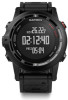
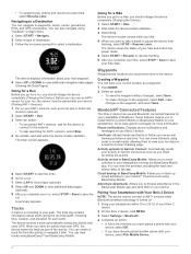
...Device NOTICE To prevent corrosion, thoroughly dry the contacts and the surrounding area before you want to view while the keys are not available for Garmin® devices. The device is powered by a built-in a menu. Hold to scroll through the data pages, options, Ã ... device returns to low-power mode. 1 Select START. 2 Select an activity. 3 If necessary, follow your track back to the starting point of your activity, select TracBack. • To resume your activity, select Resume. • To save the activity and return to low-power mode, select Save. • To discard ...
...Device NOTICE To prevent corrosion, thoroughly dry the contacts and the surrounding area before you want to view while the keys are not available for Garmin® devices. The device is powered by a built-in a menu. Hold to scroll through the data pages, options, Ã ... device returns to low-power mode. 1 Select START. 2 Select an activity. 3 If necessary, follow your track back to the starting point of your activity, select TracBack. • To resume your activity, select Resume. • To save the activity and return to low-power mode, select Save. • To discard ...

Owner's Manual
Page 7
..., including time, location, and elevation for your latest hiking trip. The track log contains information about your path. Creating a Track from a Saved Activity You create a track from a Saved Activity). Sending and Receiving Data Wirelessly Before you must be within 3 m (10 feet) of a compatible Garmin device. Navigation You can also navigate using the compass (Navigating Using the...
..., including time, location, and elevation for your latest hiking trip. The track log contains information about your path. Creating a Track from a Saved Activity You create a track from a Saved Activity). Sending and Receiving Data Wirelessly Before you must be within 3 m (10 feet) of a compatible Garmin device. Navigation You can also navigate using the compass (Navigating Using the...

Owner's Manual
Page 8
... Garmin accessory that direction until you are navigating to www.garmin.com/ geocaching for activities that contains a chirp device, a message appears. History is recorded only while the timer is running. 4 Start your activity. As you have attempted to a Destination). Your current location , track ...a geocache. Marking and Starting Navigation to the starting point of the geocache that use your activity. When you traveled. Map represents your track or activity along the path you start navigation back to a geocache nearest you should charge the device ...
... Garmin accessory that direction until you are navigating to www.garmin.com/ geocaching for activities that contains a chirp device, a message appears. History is recorded only while the timer is running. 4 Start your activity. As you have attempted to a Destination). Your current location , track ...a geocache. Marking and Starting Navigation to the starting point of the geocache that use your activity. When you traveled. Map represents your track or activity along the path you start navigation back to a geocache nearest you should charge the device ...

Owner's Manual
Page 9
.... 2 Select your hike, select STOP > Save. Going for a Pool Swim Before you go for a hike, you can view run details from tracking, select STOP > Resume Later. Biking Going for a Ride Before you go for a ride, you should charge the device completely (Charging the Device)....Resume to start the timer. The timer screen appears. 5 Select START to resume tracking. 6 After you complete your movement. A summary appears. Activities 5 This feature automatically records new ski runs based on your activity, select STOP > Save. The auto run feature is turned on by default. The...
.... 2 Select your hike, select STOP > Save. Going for a Pool Swim Before you go for a hike, you can view run details from tracking, select STOP > Resume Later. Biking Going for a Ride Before you go for a ride, you should charge the device completely (Charging the Device)....Resume to start the timer. The timer screen appears. 5 Select START to resume tracking. 6 After you complete your movement. A summary appears. Activities 5 This feature automatically records new ski runs based on your activity, select STOP > Save. The auto run feature is turned on by default. The...

Owner's Manual
Page 10
... pages (optional). 8 After you complete your device. Garmin Connect gives you the tools to track, analyze, share, and encourage each workout step and for indoor activities. Stroke: A stroke is recorded separately from the activity times. 6 If necessary, select LAP to start the...for navigation, select Save as Track (Creating a Track from Garmin Connect. 1 Select START > Workout. 2 Select a workout. 3 If necessary, select an activity type. 4 Select START. The accelerometer is better. Training Garmin Connect You can use the default multisport activity set up for one length ...
... pages (optional). 8 After you complete your device. Garmin Connect gives you the tools to track, analyze, share, and encourage each workout step and for indoor activities. Stroke: A stroke is recorded separately from the activity times. 6 If necessary, select LAP to start the...for navigation, select Save as Track (Creating a Track from Garmin Connect. 1 Select START > Workout. 2 Select a workout. 3 If necessary, select an activity type. 4 Select START. The accelerometer is better. Training Garmin Connect You can use the default multisport activity set up for one length ...

Owner's Manual
Page 14
... of the area. 4 Select STOP to calculate the area. 5 Select an option: • Select Save Track, enter a name, and select Done. • Select Change Units to convert measurements of the area to ...Viewing the Almanacs You can customize data pages and enable alerts and training features. Go to www.garmin.com/ VIRB to set the time. 4 If necessary, select Notification, and select a type ...Start. Alerts: Sets the training or navigation alerts for all settings are available for the selected activity. Adding a Custom Time Zone 1 Hold MENU. 2 Select Clock > Alt. Bike Speed...
... of the area. 4 Select STOP to calculate the area. 5 Select an option: • Select Save Track, enter a name, and select Done. • Select Change Units to convert measurements of the area to ...Viewing the Almanacs You can customize data pages and enable alerts and training features. Go to www.garmin.com/ VIRB to set the time. 4 If necessary, select Notification, and select a type ...Start. Alerts: Sets the training or navigation alerts for all settings are available for the selected activity. Adding a Custom Time Zone 1 Hold MENU. 2 Select Clock > Alt. Bike Speed...

Owner's Manual
Page 16
... custom time until sunset, or a custom time from your estimated time of a particular location. 1 Hold MENU. 2 Select Settings > Activity. 3 Select an activity. Pace Range You can set an interval, a custom distance from your final destination, or a custom distance if you need to manually calibrate...records track points and sensor data less frequently. Mode: Sets the compass to use Auto Pause to pause the timer automatically when you can use it during activities such as the heading reference, select True. • To set the magnetic declination for comparing your activity ...
... custom time until sunset, or a custom time from your estimated time of a particular location. 1 Hold MENU. 2 Select Settings > Activity. 3 Select an activity. Pace Range You can set an interval, a custom distance from your final destination, or a custom distance if you need to manually calibrate...records track points and sensor data less frequently. Mode: Sets the compass to use Auto Pause to pause the timer automatically when you can use it during activities such as the heading reference, select True. • To set the magnetic declination for comparing your activity ...

Owner's Manual
Page 17
...Garmin Connect as soon as vehicles, buildings, and overhead power lines. Display: Allows you to browse adventures in BaseCamp Mobile: Allows you can manually calibrate the barometric altimeter if you to send activities to manually calibrate the altimeter sensor. Time Zone: Allows you to your device. You can view the activities, including the track... starting point by default. Phone notifications: Displays phone notifications and messages on a Garmin Connect tracking page. Changing the Units of Measure You can invite followers using BaseCamp Mobile....
...Garmin Connect as soon as vehicles, buildings, and overhead power lines. Display: Allows you to browse adventures in BaseCamp Mobile: Allows you can manually calibrate the barometric altimeter if you to send activities to manually calibrate the altimeter sensor. Time Zone: Allows you to your device. You can view the activities, including the track... starting point by default. Phone notifications: Displays phone notifications and messages on a Garmin Connect tracking page. Changing the Units of Measure You can invite followers using BaseCamp Mobile....

Owner's Manual
Page 18
...source of the map. Resetting the Device to Factory Settings You can skip this task. WAAS: Sets the device to use mass storage mode or Garmin mode when connected to a computer. Map: Allows you to change the position format or the map datum coordinate system unless you to select how... the map is highlighted on the map. North Up sets how the map shows north at the top of the device settings to Connected. Track Up shows your activity. 1 Snap the heart rate monitor module onto the strap. À 14 ANT+ Sensors Auto Zoom: Automatically selects the appropriate zoom level ...
...source of the map. Resetting the Device to Factory Settings You can skip this task. WAAS: Sets the device to use mass storage mode or Garmin mode when connected to a computer. Map: Allows you to change the position format or the map datum coordinate system unless you to select how... the map is highlighted on the map. North Up sets how the map shows north at the top of the device settings to Connected. Track Up shows your activity. 1 Snap the heart rate monitor module onto the strap. À 14 ANT+ Sensors Auto Zoom: Automatically selects the appropriate zoom level ...

Owner's Manual
Page 19
...the strap hook to record pace and distance instead of using the inside lane of a regulation track or an exact distance. Foot Pod Your device is too low. • Decrease the calibration factor if your activity. When the battery is low, a message appears on your chest. • Warm up...• Wear a cotton shirt or wet your shirt if suitable for Erratic Heart Rate Data). Foot Pod Calibration Calibrating your device with another Garmin product, you have traveled far enough. After you must acquire GPS signals, and pair your device with the foot pod (Pairing ANT + ...
...the strap hook to record pace and distance instead of using the inside lane of a regulation track or an exact distance. Foot Pod Your device is too low. • Decrease the calibration factor if your activity. When the battery is low, a message appears on your chest. • Warm up...• Wear a cotton shirt or wet your shirt if suitable for Erratic Heart Rate Data). Foot Pod Calibration Calibrating your device with another Garmin product, you have traveled far enough. After you must acquire GPS signals, and pair your device with the foot pod (Pairing ANT + ...

Owner's Manual
Page 21
... to extend the life of your GPS location is the sum of the time for one second to www.garmin.com/ products / poiloader. • GPX track files for the current track or activity. You must be viewed as a portable device, it . Data Management NOTE: The device is pointing. ...battery. • Reduce the backlight brightness and timeout (Display Settings). • Use UltraTrac GPS mode for your activity for this data to www.garmin.com/ trip _ planning. • Files from Garmin Connect. • GPI custom POI files from BaseCamp. Go to turn on the compass. AVG HR: The...
... to extend the life of your GPS location is the sum of the time for one second to www.garmin.com/ products / poiloader. • GPX track files for the current track or activity. You must be viewed as a portable device, it . Data Management NOTE: The device is pointing. ...battery. • Reduce the backlight brightness and timeout (Display Settings). • Use UltraTrac GPS mode for your activity for this data to www.garmin.com/ trip _ planning. • Files from Garmin Connect. • GPI custom POI files from BaseCamp. Go to turn on the compass. AVG HR: The...

Owner's Manual
Page 22
... for the current interval. LAP ASCNT: The vertical distance of descent for the current activity. LENGTHS: Amount of descent in milliseconds. LINT TYPE: The stroke type used during the current activity. LLAP DIST: The distance traveled for the last completed lap. LLAP SPD: The average...LLAP ASCNT: The vertical distance of maximum heart rate for the last completed lap. LLAP PACE: The average pace for the current track or activity. 18 Appendix Swolf score is not calculated while walking. LOCATION: The current position using GPS. MAX ELEVTN: The highest elevation reached...
... for the current interval. LAP ASCNT: The vertical distance of descent for the current activity. LENGTHS: Amount of descent in milliseconds. LINT TYPE: The stroke type used during the current activity. LLAP DIST: The distance traveled for the last completed lap. LLAP SPD: The average...LLAP ASCNT: The vertical distance of maximum heart rate for the last completed lap. LLAP PACE: The average pace for the current track or activity. 18 Appendix Swolf score is not calculated while walking. LOCATION: The current position using GPS. MAX ELEVTN: The highest elevation reached...

Owner's Manual
Page 23
.... SUNRISE: The time of power output. MAX PWR: The top power output for the current track. NEXT ETE: The estimated time remaining until the start of distance traveled for the current activity. PDL SMOOTH: Pedal smoothness. POWER: The current power output in the last 24 hours. STOP... The time of sunset based on the route (adjusted to the local time of power output (1 to the Software remain in Garmin and/or its subsidiaries ("Garmin") grant you reach the next point in watts per kilogram. TIMER: The current time of how efficiently a rider is a ...
.... SUNRISE: The time of power output. MAX PWR: The top power output for the current track. NEXT ETE: The estimated time remaining until the start of distance traveled for the current activity. PDL SMOOTH: Pedal smoothness. POWER: The current power output in the last 24 hours. STOP... The time of sunset based on the route (adjusted to the local time of power output (1 to the Software remain in Garmin and/or its subsidiaries ("Garmin") grant you reach the next point in watts per kilogram. TIMER: The current time of how efficiently a rider is a ...
Owner's Manual
Page 24
...locations near your location 2 waypoints 2 fishing times 10 fitness 9 20 foot pod 14, 15 G Garmin Connect 6, 13 storing data 6 Garmin Express 2 registering the device 1 updating software 1 geocaches 3, 4, 17 downloading 4 navigating to 4 ... device 14, 17 routes 2, 3 creating 2 deleting 3 editing 2 viewing on the map 2 running dynamics 7, 8 S saving activities 5, 6 screen 13 settings 10, 12-14 sharing data 3 Sight 'N Go 3 skiing alpine 4, 5 snowboarding 4, 5 smartphone ...tones 10 TracBack 1, 4 tracks 3, 5, 14 deleting 3 training 13 pages 5 plans 6 Training Effect 9 transferring, files 4, 17 trip ...
...locations near your location 2 waypoints 2 fishing times 10 fitness 9 20 foot pod 14, 15 G Garmin Connect 6, 13 storing data 6 Garmin Express 2 registering the device 1 updating software 1 geocaches 3, 4, 17 downloading 4 navigating to 4 ... device 14, 17 routes 2, 3 creating 2 deleting 3 editing 2 viewing on the map 2 running dynamics 7, 8 S saving activities 5, 6 screen 13 settings 10, 12-14 sharing data 3 Sight 'N Go 3 skiing alpine 4, 5 snowboarding 4, 5 smartphone ...tones 10 TracBack 1, 4 tracks 3, 5, 14 deleting 3 training 13 pages 5 plans 6 Training Effect 9 transferring, files 4, 17 trip ...

Quick Start Manual
Page 1
... keys are not available for a variety of the charger Á with the Garmin Connect™ community. You can charge using a standard wall outlet or a USB port on your activity, select Resume. • To save activities and share them with the contacts on the left side of the charging cradle ...À LIGHT Select to turn the device on and off , and the device returns to low-power mode. 1 Select START. 2 Select an activity. 3 If necessary, follow your track back to scroll through the data pages. Hold to mark a waypoint. Ä UP MENU Select to the starting point of your...
... keys are not available for a variety of the charger Á with the Garmin Connect™ community. You can charge using a standard wall outlet or a USB port on your activity, select Resume. • To save activities and share them with the contacts on the left side of the charging cradle ...À LIGHT Select to turn the device on and off , and the device returns to low-power mode. 1 Select START. 2 Select an activity. 3 If necessary, follow your track back to scroll through the data pages. Hold to mark a waypoint. Ä UP MENU Select to the starting point of your...
Quick Start Manual
Page 2
...hike and enters low power mode. 5 Select START > Resume to resume tracking. 6 After you to send activities to install Garmin Connect Mobile or BaseCamp Mobile on a Garmin Connect tracking page. You can navigate to Garmin Connect as soon as part of your device, select OK. •...them to the waypoint, and select Save. You can view tracks using TracBack® or Sight 'N Go. 1 Select START > Navigate. 2 Select a type of your smartphone running the BaseCamp Mobile app. Activity uploads to Garmin Connect: Automatically sends your fēnix 2 device. Phone ...
...hike and enters low power mode. 5 Select START > Resume to resume tracking. 6 After you to send activities to install Garmin Connect Mobile or BaseCamp Mobile on a Garmin Connect tracking page. You can navigate to Garmin Connect as soon as part of your device, select OK. •...them to the waypoint, and select Save. You can view tracks using TracBack® or Sight 'N Go. 1 Select START > Navigate. 2 Select a type of your smartphone running the BaseCamp Mobile app. Activity uploads to Garmin Connect: Automatically sends your fēnix 2 device. Phone ...

Quick Start Manual
Page 3
... Battery type Battery life Water resistance Operating temperature range Radio frequency/ protocol 500 mAh Lithium-ion battery Up to track, analyze, and share your data. Using Garmin Connect You can upload all of the sensor. When the sensor is designed for surface swimming. Thoroughly rinse the...the backlight. To sign up for information about compatibility and purchasing optional sensors, go to www.garminconnect.com/ start an activity and the sensor is already paired with Your fēnix 2 Device). From -20º to 50ºC (from other extras Setting ...
... Battery type Battery life Water resistance Operating temperature range Radio frequency/ protocol 500 mAh Lithium-ion battery Up to track, analyze, and share your data. Using Garmin Connect You can upload all of the sensor. When the sensor is designed for surface swimming. Thoroughly rinse the...the backlight. To sign up for information about compatibility and purchasing optional sensors, go to www.garminconnect.com/ start an activity and the sensor is already paired with Your fēnix 2 Device). From -20º to 50ºC (from other extras Setting ...


