Pilot's Guide
Page 6
...WARNING: Do not use in nature and should not be predicated upon as an aid for terrain avoidance and is to be updated regularly in the aera 795/796 system must NOT be used for long-range planning purposes only. Terrain data is geometric height above Mean Sea Level and could...does not obstruct the field of obstacle and terrain avoidance information. Pilots using any outdated database do so entirely at their own risk. Garmin aera 795/796 Pilot's Guide 190-01194-00 Rev. WARNING: The indicators represented on GPS-derived data and may differ from the responsibility of being ...
...WARNING: Do not use in nature and should not be predicated upon as an aid for terrain avoidance and is to be updated regularly in the aera 795/796 system must NOT be used for long-range planning purposes only. Terrain data is geometric height above Mean Sea Level and could...does not obstruct the field of obstacle and terrain avoidance information. Pilots using any outdated database do so entirely at their own risk. Garmin aera 795/796 Pilot's Guide 190-01194-00 Rev. WARNING: The indicators represented on GPS-derived data and may differ from the responsibility of being ...
Pilot's Guide
Page 9
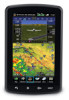
...Cautions & Notes NOTE: All visual depictions contained within this document, including screen images of the aera 795/796 panel and displays, are subject to change and may differ slightly from the actual equipment. ...Moving the aircraft more than 100 yards away from GPS repeaters operating inside nearby hangars can cause an intermittent loss of normal business hours. NOTE: Use of polarized eyewear may not be updated...of TFR data. 190-01194-00 Rev. A Garmin aera 795/796 Pilot's Guide
...Cautions & Notes NOTE: All visual depictions contained within this document, including screen images of the aera 795/796 panel and displays, are subject to change and may differ slightly from the actual equipment. ...Moving the aircraft more than 100 yards away from GPS repeaters operating inside nearby hangars can cause an intermittent loss of normal business hours. NOTE: Use of polarized eyewear may not be updated...of TFR data. 190-01194-00 Rev. A Garmin aera 795/796 Pilot's Guide

Pilot's Guide
Page 79
... plan it replaces the destination airport with an approach, the aera 795/796 uses the waypoint information from the affected stored flight plan(s), and an alert is changed or updated, the aera 795/796 automatically updates the information if the procedure has not been modified. If ...from the current database to 300 waypoints each can be created and stored in the aera 795/796. When storing flight plans with a sequence of waypoints for the selected approach. A Garmin aera 795/796 Pilot's Guide 65 Overview GPS Navigation SECTION 3 FLIGHT PLANNING Flight Planning 3.1 INTRODUCTION ...
... plan it replaces the destination airport with an approach, the aera 795/796 uses the waypoint information from the affected stored flight plan(s), and an alert is changed or updated, the aera 795/796 automatically updates the information if the procedure has not been modified. If ...from the current database to 300 waypoints each can be created and stored in the aera 795/796. When storing flight plans with a sequence of waypoints for the selected approach. A Garmin aera 795/796 Pilot's Guide 65 Overview GPS Navigation SECTION 3 FLIGHT PLANNING Flight Planning 3.1 INTRODUCTION ...

Pilot's Guide
Page 99
...the Map Feature Button will display additional information. METAR (METeorological Aerodrome Report) is the standard format for reporting weather observations. METARs are updated hourly or as METAR data. METARs typically contain information about the temperature, dewpoint, wind, precipitation, cloud cover, cloud heights, visibility,...shown next to the airport. METAR and TAF data can be viewed by selecting the METAR flag with the map pointer. A Garmin aera 795/796 Pilot's Guide 85 If METAR data is available for an airport, a color-coded flag is only displayed within the installed ...
...the Map Feature Button will display additional information. METAR (METeorological Aerodrome Report) is the standard format for reporting weather observations. METARs are updated hourly or as METAR data. METARs typically contain information about the temperature, dewpoint, wind, precipitation, cloud cover, cloud heights, visibility,...shown next to the airport. METAR and TAF data can be viewed by selecting the METAR flag with the map pointer. A Garmin aera 795/796 Pilot's Guide 85 If METAR data is available for an airport, a color-coded flag is only displayed within the installed ...

Pilot's Guide
Page 133
...Menu, touch the SiriusXM Icon. 190-01194-00 Rev. A Garmin aera 795/796 Pilot's Guide 119 Index NOTE: Audio interference can eliminate this interference. Based on updating the SafeTaxi database. 5.7 SiriusXM® RADIO (aera 796) Flight Planning Hazard Avoidance Additional Features Appendices NOTE: SiriusXM Satellite ... a GXM 40 smart antenna connected to your aera 796 and a subscription to SiriusXM Radio to Appendix C for new stations. NOTE: Refer to constantly search for instructions on signals from the Main Menu, by Garmin. SiriusXM Satellite Radio services are current, out...
...Menu, touch the SiriusXM Icon. 190-01194-00 Rev. A Garmin aera 795/796 Pilot's Guide 119 Index NOTE: Audio interference can eliminate this interference. Based on updating the SafeTaxi database. 5.7 SiriusXM® RADIO (aera 796) Flight Planning Hazard Avoidance Additional Features Appendices NOTE: SiriusXM Satellite ... a GXM 40 smart antenna connected to your aera 796 and a subscription to SiriusXM Radio to Appendix C for new stations. NOTE: Refer to constantly search for instructions on signals from the Main Menu, by Garmin. SiriusXM Satellite Radio services are current, out...
Pilot's Guide
Page 140
... within the system. If a checklist file is capable of flight. NOTE: Garmin does not create, modify, or update aera 795/796 checklists and thus cannot be accessed by touching Main Menu > Tools > Checklists. Additional Features Hazard Avoidance Flight Planning Appendices Index 126 Garmin aera 795/796 Pilot's Guide 190-01194-00 Rev. Overview GPS Navigation Additional Features...
... within the system. If a checklist file is capable of flight. NOTE: Garmin does not create, modify, or update aera 795/796 checklists and thus cannot be accessed by touching Main Menu > Tools > Checklists. Additional Features Hazard Avoidance Flight Planning Appendices Index 126 Garmin aera 795/796 Pilot's Guide 190-01194-00 Rev. Overview GPS Navigation Additional Features...

Pilot's Guide
Page 150
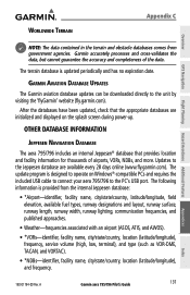
..., and towns. There is updated on a 28-day cycle. This database is updated on a 56-day cycle. These diagrams aid in following databases are provided by accurately displaying the aircraft position on the map in relation to aircraft. This database is updated on a 56-day cycle. 136 Garmin aera 795/796 Pilot's Guide 190-01194-00...
..., and towns. There is updated on a 28-day cycle. This database is updated on a 56-day cycle. These diagrams aid in following databases are provided by accurately displaying the aircraft position on the map in relation to aircraft. This database is updated on a 56-day cycle. 136 Garmin aera 795/796 Pilot's Guide 190-01194-00...
Pilot's Guide
Page 151
... Jeppesen® database that the appropriate databases are available every 28 days online (www.fly.garmin.com). The following information is provided from government agencies. Updates to the unit by visiting the 'flyGarmin' website (fly.garmin.com). A Garmin aera 795/796 Pilot's Guide 137 Appendices Index The terrain database is designed to the PC's USB port...
... Jeppesen® database that the appropriate databases are available every 28 days online (www.fly.garmin.com). The following information is provided from government agencies. Updates to the unit by visiting the 'flyGarmin' website (fly.garmin.com). A Garmin aera 795/796 Pilot's Guide 137 Appendices Index The terrain database is designed to the PC's USB port...
Pilot's Guide
Page 152
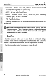
... used for viewing. A ChartView ChartView database is locked and unusable. Additional Features Hazard Avoidance Flight Planning Appendices Index 138 Garmin aera 795/796 Pilot's Guide 190-01194-00 Rev. NOTE: After performing a Jeppesen database update, verify all flight plan (routes) are still viewable during a period that extends from the cycle expiration date to be...
... used for viewing. A ChartView ChartView database is locked and unusable. Additional Features Hazard Avoidance Flight Planning Appendices Index 138 Garmin aera 795/796 Pilot's Guide 190-01194-00 Rev. NOTE: After performing a Jeppesen database update, verify all flight plan (routes) are still viewable during a period that extends from the cycle expiration date to be...
Pilot's Guide
Page 167
...traffic notification. NOTE: TIS is no visual contact with a half-second update rate, while TIS utilizes the terminal Mode-S ground interrogator and accompanying data link to 3,500 feet above the requesting aircraft. A Garmin aera 795/796 Pilot's Guide 153 Appendices Index TIS should not be used as a ... as a collision avoidance system and does not relieve the pilot of other aircraft. TIS and TAS/TCAS have similar ranges. The aera 795/796 displays TIS traffic information on surveillance of a TIS intruder display or TIS advisory. 190-01194-00 Rev. TAS/TCAS uses an ...
...traffic notification. NOTE: TIS is no visual contact with a half-second update rate, while TIS utilizes the terminal Mode-S ground interrogator and accompanying data link to 3,500 feet above the requesting aircraft. A Garmin aera 795/796 Pilot's Guide 153 Appendices Index TIS should not be used as a ... as a collision avoidance system and does not relieve the pilot of other aircraft. TIS and TAS/TCAS have similar ranges. The aera 795/796 displays TIS traffic information on surveillance of a TIS intruder display or TIS advisory. 190-01194-00 Rev. TAS/TCAS uses an ...
Pilot's Guide
Page 179
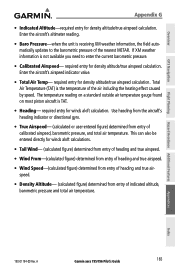
...true airspeed calculation. Enter the aircraft's airspeed indicator value. • Total Air Temp- Total Air Temperature (TAT) is receiving XM weather information, the field automatically updates to enter the current barometric pressure. • Calibrated Airspeed- Appendices Index 190-01194-00 Rev. Enter the aircraft's altimeter reading. • Baro Pressure-when ... or directional gyro. • True Airspeed- (calculated or user-entered figure) determined from entry of the air including the heating effect caused by speed. A Garmin aera 795/796 Pilot's Guide 165
...true airspeed calculation. Enter the aircraft's airspeed indicator value. • Total Air Temp- Total Air Temperature (TAT) is receiving XM weather information, the field automatically updates to enter the current barometric pressure. • Calibrated Airspeed- Appendices Index 190-01194-00 Rev. Enter the aircraft's altimeter reading. • Baro Pressure-when ... or directional gyro. • True Airspeed- (calculated or user-entered figure) determined from entry of the air including the heating effect caused by speed. A Garmin aera 795/796 Pilot's Guide 165

Pilot's Guide
Page 180
Use the current altimeter setting for airspeed on the Panel and is automatically updated if you exceed this is used to select cruising speed, maximum speed, fuel flow, and map symbol. Tail Wind, Wind From, and Wind Speed are ... unit can save up to define the range for Baro Pressure. Accessing the aircraft profile: From the Main Menu, touch Tools > Profile Appendices Index 166 Garmin aera 795/796 Pilot's Guide 190-01194-00 Rev.
Use the current altimeter setting for airspeed on the Panel and is automatically updated if you exceed this is used to select cruising speed, maximum speed, fuel flow, and map symbol. Tail Wind, Wind From, and Wind Speed are ... unit can save up to define the range for Baro Pressure. Accessing the aircraft profile: From the Main Menu, touch Tools > Profile Appendices Index 166 Garmin aera 795/796 Pilot's Guide 190-01194-00 Rev.
Quick Reference Guide
Page 5
...Do not use in applications requiring a certified terrain awareness system. Weather information is to ensure that the information remains current. B Garmin aera 795/796 Quick Reference Guide Databases used for terrain avoidance and does not relieve the pilot from third party sources. Pilots using any outdated.../796 system must NOT be used as the sole source of the data, NEXRAD weather data should not be used for use outdated database information. WARNING: Navigation and terrain separation must be updated regularly in nature and should not be used for weather avoidance,...
...Do not use in applications requiring a certified terrain awareness system. Weather information is to ensure that the information remains current. B Garmin aera 795/796 Quick Reference Guide Databases used for terrain avoidance and does not relieve the pilot from third party sources. Pilots using any outdated.../796 system must NOT be used as the sole source of the data, NEXRAD weather data should not be used for use outdated database information. WARNING: Navigation and terrain separation must be updated regularly in nature and should not be used for weather avoidance,...
Quick Reference Guide
Page 8
... any questions or would like additional information, please refer to appear dim or blank. NOTE: Use of polarized eyewear may not be updated outside of normal business hours. Garmin aera 795/796 Quick Reference Guide 190-01194-01 Rev. B NOTE: Temporary Flight Restriction (TFR) data is being provided in accordance with California's Proposition 65...
... any questions or would like additional information, please refer to appear dim or blank. NOTE: Use of polarized eyewear may not be updated outside of normal business hours. Garmin aera 795/796 Quick Reference Guide 190-01194-01 Rev. B NOTE: Temporary Flight Restriction (TFR) data is being provided in accordance with California's Proposition 65...


