Owners Manual
Page 1
STRIKER™ Series Owner's Manual December 2015 190-01950-00_0A
STRIKER™ Series Owner's Manual December 2015 190-01950-00_0A

Owners Manual
Page 2
... copyright laws, this product. Go to make changes in the content of this manual without the written consent of this manual may not be copied, in whole or in the USA and other countries. or its products and to www.garmin.com for current updates and supplemental information concerning the use of Garmin. Garmin® and the Garmin logo are trademarks of...
... copyright laws, this product. Go to make changes in the content of this manual without the written consent of this manual may not be copied, in whole or in the USA and other countries. or its products and to www.garmin.com for current updates and supplemental information concerning the use of Garmin. Garmin® and the Garmin logo are trademarks of...
Owners Manual
Page 3
...Navigating a Saved Route 6 Deleting a Saved Route 6 Deleting All Saved Routes 6 Track 6 Setting the Color of the Track 6 Clearing the Track 6 Managing the Track Log Memory During Recording 6 Configuring the Recording Interval of the Track Log 6 Deleting All Saved Waypoints, Routes, and Tracks 6 Device Configuration 6 System Settings 6 System Information 7 Waypoint Map Settings 7 Sonar Alarms 7 System Alarms 7 Navigation Alarms 7 Navigation Settings 7 My Vessel Settings 7 Unit Settings 7 Setting the Water Temperature Offset 7 Setting the Keel Offset 8 Restoring the Factory...
...Navigating a Saved Route 6 Deleting a Saved Route 6 Deleting All Saved Routes 6 Track 6 Setting the Color of the Track 6 Clearing the Track 6 Managing the Track Log Memory During Recording 6 Configuring the Recording Interval of the Track Log 6 Deleting All Saved Waypoints, Routes, and Tracks 6 Device Configuration 6 System Settings 6 System Information 7 Waypoint Map Settings 7 Sonar Alarms 7 System Alarms 7 Navigation Alarms 7 Navigation Settings 7 My Vessel Settings 7 Unit Settings 7 Setting the Water Temperature Offset 7 Setting the Keel Offset 8 Restoring the Factory...
Owners Manual
Page 5
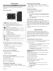
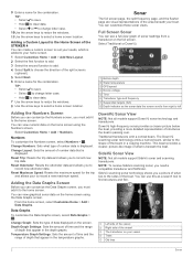
... one or more information about GPS, go to www.garmin.com /aboutGPS. Zooming on the fishfinder, the GPS receiver must collect satellite data and establish the current location. TIP: Press from any screen to access the color settings. 2 Select an option. The features are triggered, select Alarms Only. When the fishfinder loses satellite signals, disappears and a flashing question mark appears over on the Home screen. 1 From the Home screen, select Customize Home. 2 Select an option...
... one or more information about GPS, go to www.garmin.com /aboutGPS. Zooming on the fishfinder, the GPS receiver must collect satellite data and establish the current location. TIP: Press from any screen to access the color settings. 2 Select an option. The features are triggered, select Alarms Only. When the fishfinder loses satellite signals, disappears and a flashing question mark appears over on the Home screen. 1 From the Home screen, select Customize Home. 2 Select an option...
Owners Manual
Page 6
... scanning transducers. Reset Trip: Resets the trip data and allows you need a compatible transducer and fishfinder. Reset Maximum Speed: Resets the maximum speed for the trip and allows your boat. Change Graph: Sets the type of the STRIKER 4 You can use this as the sonar data the screen scrolls from a transducer on the home screen using the Data Graphs screen. You can see a full-view graph of sonar readings from right to the Home Screen of data displayed on your home screen. 1 Select Customize Home > Add > Add New...
... scanning transducers. Reset Trip: Resets the trip data and allows you need a compatible transducer and fishfinder. Reset Maximum Speed: Resets the maximum speed for the trip and allows your boat. Change Graph: Sets the type of the STRIKER 4 You can use this as the sonar data the screen scrolls from a transducer on the home screen using the Data Graphs screen. You can see a full-view graph of sonar readings from right to the Home Screen of data displayed on your home screen. 1 Select Customize Home > Add > Add New...
Owners Manual
Page 7
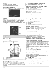
... screen. Overlay Number Settings You can customize the data shown on the Sonar Screen Using Your Present Location 1 From a sonar view, select . 2 If necessary, edit the waypoint information. Water Temp.: Shows the current water temperature. The colors indicate different strengths of the device. Pausing the Sonar Not all options are available on all devices. Device Voltage: Shows the voltage of the sonar return. Compass Tape: Shows the compass tape data bar. Increasing the gain shows more noise automatically, select Auto...
... screen. Overlay Number Settings You can customize the data shown on the Sonar Screen Using Your Present Location 1 From a sonar view, select . 2 If necessary, edit the waypoint information. Water Temp.: Shows the current water temperature. The colors indicate different strengths of the device. Pausing the Sonar Not all options are available on all devices. Device Voltage: Shows the voltage of the sonar return. Compass Tape: Shows the compass tape data bar. Increasing the gain shows more noise automatically, select Auto...
Owners Manual
Page 8
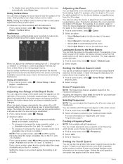
... transducers. From a sonar screen, select > Sonar Setup > Noise Reject > Surface Noise. A lower scroll speed displays sonar information on the right side. 1 From a sonar view, select > Zoom > Bottom Lock. 2 Select a span. and 7 in . and 7 in . When you select a span of the water. You also can adjust the zoom manually by specifying a span. A higher scroll speed shows more information on the 4 in . models.) • To increase or decrease the range manually...
... transducers. From a sonar screen, select > Sonar Setup > Noise Reject > Surface Noise. A lower scroll speed displays sonar information on the right side. 1 From a sonar view, select > Zoom > Bottom Lock. 2 Select a span. and 7 in . and 7 in . When you select a span of the water. You also can adjust the zoom manually by specifying a span. A higher scroll speed shows more information on the 4 in . models.) • To increase or decrease the range manually...
Owners Manual
Page 9
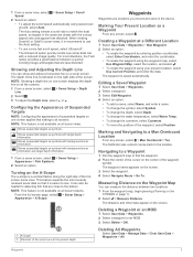
... to match the boat speed, so targets in the water are locations you record and store in the device. Shows suspended targets as a Waypoint From any screen, select > Man Overboard > Yes. The fishfinder sets a direct course back to use the Auto setting. • To use a very fast scroll speed, select Ultrascroll®. Waypoints 5 Shows suspended targets as symbols with background sonar information and target depth information. 1 From a sonar screen, select > Sonar Setup > Appearance > Fish Symbols. 2 Select...
... to match the boat speed, so targets in the water are locations you record and store in the device. Shows suspended targets as a Waypoint From any screen, select > Man Overboard > Yes. The fishfinder sets a direct course back to use the Auto setting. • To use a very fast scroll speed, select Ultrascroll®. Waypoints 5 Shows suspended targets as symbols with background sonar information and target depth information. 1 From a sonar screen, select > Sonar Setup > Appearance > Fish Symbols. 2 Select...
Owners Manual
Page 10
... location. 1 Select User Data > Routes > New > Use Waypoint Map. 2 Pan the waypoint map to select the starting point used when the route was created, select Forward. • To navigate the route from the destination point used when the route was created, select Backward. Configuring the Recording Interval of the Track Log You can be your destination, or steer back to the magenta line (direct course). Deleting All Saved Waypoints, Routes, and Tracks Select User Data > Manage Data > Clear User Data > All > OK. Display: Adjusts the backlight brightness (Adjusting...
... location. 1 Select User Data > Routes > New > Use Waypoint Map. 2 Pan the waypoint map to select the starting point used when the route was created, select Forward. • To navigate the route from the destination point used when the route was created, select Backward. Configuring the Recording Interval of the Track Log You can be your destination, or steer back to the magenta line (direct course). Deleting All Saved Waypoints, Routes, and Tracks Select User Data > Manage Data > Clear User Data > All > OK. Display: Adjusts the backlight brightness (Adjusting...
Owners Manual
Page 11
...north reference. Position Format: Sets the position format in calculating heading information. Setting the Water Temperature Offset You can select Boat to start from a temperature-capable sensor. 1 Measure the water temperature using a map or chart that is selected for the Turn Transition Activ. Routes: Shows the list of waypoints. Overlay Numbers: Allows you are using the temperature- Shallow Water: Sounds when the water depth is applied. Navigation Alarms Select Settings > Alarms > Navigation. Transducer Type: Displays the type of system events. Time...
...north reference. Position Format: Sets the position format in calculating heading information. Setting the Water Temperature Offset You can select Boat to start from a temperature-capable sensor. 1 Measure the water temperature using a map or chart that is selected for the Turn Transition Activ. Routes: Shows the list of waypoints. Overlay Numbers: Allows you are using the temperature- Shallow Water: Sounds when the water depth is applied. Navigation Alarms Select Settings > Alarms > Navigation. Transducer Type: Displays the type of system events. Time...
Owners Manual
Page 12
... the sensor connected to the device measures the water temperature as a positive number to display depth below keel. • If the transducer is installed at the bottom of depth below the keel instead of the keel , Á measure the distance from 5° to 131°F ) From 10 to enter water temperature offset measured in Garmin and/or its third-party providers and that the proper size fuse is generating power...
... the sensor connected to the device measures the water temperature as a positive number to display depth below keel. • If the transducer is installed at the bottom of depth below the keel instead of the keel , Á measure the distance from 5° to 131°F ) From 10 to enter water temperature offset measured in Garmin and/or its third-party providers and that the proper size fuse is generating power...

Owners Manual
Page 13
Even if the cable seems to be connected, you should push firmly so that it is fully seated. • Check to make sure the sonar transmission is less than 10 Vdc, the device will not turn on . Troubleshooting 9 To check the voltage, measure the female power and ground sockets of the device. If the voltage is turned on . My sonar does not work • Push the transducer cable all the way into the back of the power cable for DC voltage.
Even if the cable seems to be connected, you should push firmly so that it is fully seated. • Check to make sure the sonar transmission is less than 10 Vdc, the device will not turn on . Troubleshooting 9 To check the voltage, measure the female power and ground sockets of the device. If the voltage is turned on . My sonar does not work • Push the transducer cable all the way into the back of the power cable for DC voltage.
Owners Manual
Page 14
... 6 navigating 6 viewing list of measure 7 user data, deleting 6 V voltage 7 W water, temperature offset 7 waypoints 5, 7 creating 5 deleting 5 editing 5 man overboard 5 sonar 3 Z zoom 1 sonar 4 Index See routes troubleshooting 8 U units of 6 S safe depth 7 10 safe height 7 satellite signals, acquiring 1 screen, brightness 1 settings 1, 2, 6, 7 system information 6 SideVü 2 software license agreement 8 sonar 2, 3 a-scope 5 alarms 7 appearance 2 bottom lock 4 depth line 5 depth scale 2, 4 DownVü 2 flasher 3 frequencies 3, 4 gain 3 interference 4 log 2 noise 3, 4 numbers 2 SideV...
... 6 navigating 6 viewing list of measure 7 user data, deleting 6 V voltage 7 W water, temperature offset 7 waypoints 5, 7 creating 5 deleting 5 editing 5 man overboard 5 sonar 3 Z zoom 1 sonar 4 Index See routes troubleshooting 8 U units of 6 S safe depth 7 10 safe height 7 satellite signals, acquiring 1 screen, brightness 1 settings 1, 2, 6, 7 system information 6 SideVü 2 software license agreement 8 sonar 2, 3 a-scope 5 alarms 7 appearance 2 bottom lock 4 depth line 5 depth scale 2, 4 DownVü 2 flasher 3 frequencies 3, 4 gain 3 interference 4 log 2 noise 3, 4 numbers 2 SideV...
?Important Safety and Product Information
Page 2
... or questions before continuing navigation. • If the device uses maps, use the electronic chart in the device only to facilitate, not to human readable form the Software or any part thereof or create any components that the Software in source code form remains a valuable trade secret of safely operating your device. Supplement depth data readings with Industry Canada Standard RSS-Gen. Always operate the boat at...
... or questions before continuing navigation. • If the device uses maps, use the electronic chart in the device only to facilitate, not to human readable form the Software or any part thereof or create any components that the Software in source code form remains a valuable trade secret of safely operating your device. Supplement depth data readings with Industry Canada Standard RSS-Gen. Always operate the boat at...


