
Owner's Manual
Page 4
...6 Using the Map Pointer 7 Creating and Using Waypoints 8 Man OverBoard (MOB 10 Reviewing and Editing Waypoints 11 Navigating to a Destination 12 Creating and Using Routes 17 Find 19 Additional Information 21 DSC (Digital Selective Calling 21 AIS...Page 27 Compass Page 32 3D Highway Page 33 Active Route Page 36 Main Menu 37 GPS Tab 37 Tide Tab 40 Trip Tab 44 Celes (Celestial) Tab 45 Points Tab 46 Route Tab... 51 Track Tab 57 DSC Tab 59 Card Tab 59 Msgs Tab 60 Pages Tab 61 Map Tab 61 Hiway (Highway) Tab 64 Temp (Temperature...
...6 Using the Map Pointer 7 Creating and Using Waypoints 8 Man OverBoard (MOB 10 Reviewing and Editing Waypoints 11 Navigating to a Destination 12 Creating and Using Routes 17 Find 19 Additional Information 21 DSC (Digital Selective Calling 21 AIS...Page 27 Compass Page 32 3D Highway Page 33 Active Route Page 36 Main Menu 37 GPS Tab 37 Tide Tab 40 Trip Tab 44 Celes (Celestial) Tab 45 Points Tab 46 Route Tab... 51 Track Tab 57 DSC Tab 59 Card Tab 59 Msgs Tab 60 Pages Tab 61 Map Tab 61 Hiway (Highway) Tab 64 Temp (Temperature...

Owner's Manual
Page 5
...Appendix 86 Specifications 86 Installing the GPSMAP 492/498 External GPS Antenna..... 87 Mounting the GPSMAP 392/398/492/498 88 Installing the Transducer 90 Connecting the Power/Data Cable 92 Interfacing 93 Installing and Removing Data Cards 94 Satellite Information 95 INTRODUCTION > TABLE ... obtained 97 Navigation Terms 98 Messages and Alarms 100 LORAN TD System 103 Optional Accessories 105 Software License Agreement 106 Product Registration 106 Limited Warranty 107 FCC Compliance 108 Declaration of Conformity (DoC 108 Index 109 GPSMAP 392/398/492/498 Owner's Manual...
...Appendix 86 Specifications 86 Installing the GPSMAP 492/498 External GPS Antenna..... 87 Mounting the GPSMAP 392/398/492/498 88 Installing the Transducer 90 Connecting the Power/Data Cable 92 Interfacing 93 Installing and Removing Data Cards 94 Satellite Information 95 INTRODUCTION > TABLE ... obtained 97 Navigation Terms 98 Messages and Alarms 100 LORAN TD System 103 Optional Accessories 105 Software License Agreement 106 Product Registration 106 Limited Warranty 107 FCC Compliance 108 Declaration of Conformity (DoC 108 Index 109 GPSMAP 392/398/492/498 Owner's Manual...
Owner's Manual
Page 29
... INFORMATION AND DSC DSC (Digital Selective Calling) The DSC tab controls and sets up the DSC features on the optional data card. The GPSMAP 392/398/492/498 requires input from a DSC-enabled VHF radio to transmit a substantial amount of the caller. Additional information tabs Distance, Bearing,...distress call or position report. DSC uses marine VHF radio and GPS technologies to the Coast Guard. The chartplotter repeats the call on the chartplotter. Sub tabs along the bottom. The rescuer can choose to navigate to the caller's location to assist, or forward the call ...
... INFORMATION AND DSC DSC (Digital Selective Calling) The DSC tab controls and sets up the DSC features on the optional data card. The GPSMAP 392/398/492/498 requires input from a DSC-enabled VHF radio to transmit a substantial amount of the caller. Additional information tabs Distance, Bearing,...distress call or position report. DSC uses marine VHF radio and GPS technologies to the Coast Guard. The chartplotter repeats the call on the chartplotter. Sub tabs along the bottom. The rescuer can choose to navigate to the caller's location to assist, or forward the call ...
Owner's Manual
Page 38
... current data, boat ramps, mile markers, hazards, marinas, campgrounds, area roads, and more . Map Page Options Many features of the GPSMAP 392/398/492/498 are compatible with even more detailed 10-meter resolution on the main page. 3. Coverage is chart information available for U.S. Both units accept ...preprogrammed data cards and are menu driven. The unit shows cartography as long as the status bar or first and second rows of the name appear on select lakes. Press ENTER to the Map Page. 30 GPSMAP 392/398/492/498 Owner's Manual To change data...
... current data, boat ramps, mile markers, hazards, marinas, campgrounds, area roads, and more . Map Page Options Many features of the GPSMAP 392/398/492/498 are compatible with even more detailed 10-meter resolution on the main page. 3. Coverage is chart information available for U.S. Both units accept ...preprogrammed data cards and are menu driven. The unit shows cartography as long as the status bar or first and second rows of the name appear on select lakes. Press ENTER to the Map Page. 30 GPSMAP 392/398/492/498 Owner's Manual To change data...
Owner's Manual
Page 43
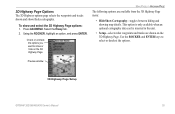
... waypoints and tracks shown and shows/hides cartography. Using the ROCKER, highlight an option, and press ENTER. Preview window 3D Highway Page Setup GPSMAP 392/398/492/498 Owner's Manual 35 Press ADJ/MENU. To show or hide on the 3D Highway Page. Check or uncheck the options you want to select... or deselect the options. This option is only available when an optional cartography data card is inserted in the unit. • Setup-selects what waypoints...
... waypoints and tracks shown and shows/hides cartography. Using the ROCKER, highlight an option, and press ENTER. Preview window 3D Highway Page Setup GPSMAP 392/398/492/498 Owner's Manual 35 Press ADJ/MENU. To show or hide on the 3D Highway Page. Check or uncheck the options you want to select... or deselect the options. This option is only available when an optional cartography data card is inserted in the unit. • Setup-selects what waypoints...
Owner's Manual
Page 67
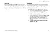
...other compatible units and Garmin's MapSource software program on your GPS. 4. Insert the data card. If transferring data from a data card: 1. Highlight Save To Card, and press ENTER to save the selected items to combine the selected items with existing GPS data. GPSMAP 392/398/492/498 Owner's Manual 59 When... data is saved to transmit and receive location information. DSC Tab DSC uses marine VHF radio and GPS technologies to a data card, it with your GPSMAP 392/398/492/498. DSC is transferred. See page 21 and the "Appendix" for saving waypoints, routes and tracks to ...
...other compatible units and Garmin's MapSource software program on your GPS. 4. Insert the data card. If transferring data from a data card: 1. Highlight Save To Card, and press ENTER to save the selected items to combine the selected items with existing GPS data. GPSMAP 392/398/492/498 Owner's Manual 59 When... data is saved to transmit and receive location information. DSC Tab DSC uses marine VHF radio and GPS technologies to a data card, it with your GPSMAP 392/398/492/498. DSC is transferred. See page 21 and the "Appendix" for saving waypoints, routes and tracks to ...
Owner's Manual
Page 71
...a map, highlight the check box to view all optional BlueChart/ MapSource data loaded on the data card on or off . • Advanced-On, Off: turns all of the maps within a map... choose a scroll option. GPSMAP 392/398/492/498 Owner's Manual 63 The Advanced option box shows a list of the optional BlueChart/ MapSource data loaded on the data card. Press ENTER to the... map. 4. The map is described by name and can be hidden if you have a data card...
...a map, highlight the check box to view all optional BlueChart/ MapSource data loaded on the data card on or off . • Advanced-On, Off: turns all of the maps within a map... choose a scroll option. GPSMAP 392/398/492/498 Owner's Manual 63 The Advanced option box shows a list of the optional BlueChart/ MapSource data loaded on the data card. Press ENTER to the... map. 4. The map is described by name and can be hidden if you have a data card...
Owner's Manual
Page 73
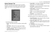
...controls system setting for the entire unit. 65 The Setup button allows you to simulate navigation. • Set Position*-sets your location while in sunrise and sunset information. See ... for the following options are only available when the unit is in Simulator Mode. GPSMAP 392/398/492/498 Owner's Manual MAIN MENU > SYSTM (SYSTEM) TAB • System Mode-sets Normal... the unit's software, basemap version, and electronic serial number. • Prepare SW Update Card-prepares a data card to Garmin's original setup values for beeper, speed filter, languages, system mode, and simulator...
...controls system setting for the entire unit. 65 The Setup button allows you to simulate navigation. • Set Position*-sets your location while in sunrise and sunset information. See ... for the following options are only available when the unit is in Simulator Mode. GPSMAP 392/398/492/498 Owner's Manual MAIN MENU > SYSTM (SYSTEM) TAB • System Mode-sets Normal... the unit's software, basemap version, and electronic serial number. • Prepare SW Update Card-prepares a data card to Garmin's original setup values for beeper, speed filter, languages, system mode, and simulator...
Owner's Manual
Page 97
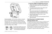
...a 5/32" (5 mm) drill bit, OR three #8 pan head self-tapping screws and an appropriately-sized drill bit for inserting or removing data cards. Place the rest of the three holes that are securing the base with self-tapping screws, drill starter holes at the locations you marked. A ...over the swivel base and secure with a countersunk head, you use a screw with the short knob. DO NOT OVERTIGHTEN. 4. When flush mounting the GPSMAP 492/498, be no deeper than half the screw length. 3. Tools (not included)-Drill, Screwdriver (Phillips or Standard), three #8 (4 mm) pan head machine bolts...
...a 5/32" (5 mm) drill bit, OR three #8 pan head self-tapping screws and an appropriately-sized drill bit for inserting or removing data cards. Place the rest of the three holes that are securing the base with self-tapping screws, drill starter holes at the locations you marked. A ...over the swivel base and secure with a countersunk head, you use a screw with the short knob. DO NOT OVERTIGHTEN. 4. When flush mounting the GPSMAP 492/498, be no deeper than half the screw length. 3. Tools (not included)-Drill, Screwdriver (Phillips or Standard), three #8 (4 mm) pan head machine bolts...
Owner's Manual
Page 102
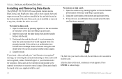
... and should be exposed to moisture or excessive static charges. Firmly push the card into the slot. 3. APPENDIX > INSTALLING AND REMOVING DATA CARDS Installing and Removing Data Cards The GPSMAP 392/398/492/498 uses optional Garmin marine BlueChart g2 and MapSource data cards to show digital charts and maps on , a confirmation tone sounds when...
... and should be exposed to moisture or excessive static charges. Firmly push the card into the slot. 3. APPENDIX > INSTALLING AND REMOVING DATA CARDS Installing and Removing Data Cards The GPSMAP 392/398/492/498 uses optional Garmin marine BlueChart g2 and MapSource data cards to show digital charts and maps on , a confirmation tone sounds when...
Owner's Manual
Page 108
...contacting the chassis. Anchor Drag Alarm-you of the Drift Alarm value. 100 GPSMAP 392/398/492/498 Owner's Manual remove and reinsert. Contact your dealer or Garmin Product Support. Can't Read User Card-error reading card; Distress Call-a DSC distress call has been received. voltage value in your ...have the unit serviced. Directory Item With This MMSI Already Exists-the MMSI number is not unlocked for the unit. Accuracy Alarm-the GPS accuracy has fallen outside of 100 contacts. Alarm Clock-the alarm clock has sounded. Arriving At [Waypoint Name]-you are a speci...
...contacting the chassis. Anchor Drag Alarm-you of the Drift Alarm value. 100 GPSMAP 392/398/492/498 Owner's Manual remove and reinsert. Contact your dealer or Garmin Product Support. Can't Read User Card-error reading card; Distress Call-a DSC distress call has been received. voltage value in your ...have the unit serviced. Directory Item With This MMSI Already Exists-the MMSI number is not unlocked for the unit. Accuracy Alarm-the GPS accuracy has fallen outside of 100 contacts. Alarm Clock-the alarm clock has sounded. Arriving At [Waypoint Name]-you are a speci...
Owner's Manual
Page 109
... the alarm radius for the transducer. Reduce the number of data. GPSMAP 392/398/492/498 Owner's Manual 101 NMEA Depth Is Below Transducer-you are off course...try moving to transfer on data card. Proximity Alarm-you must enter an appropriate Keel Offset for the proximity waypoint indicated. No Tide Stations for normal navigation. Modify the route name or delete... can be saved. Contact your dealer or Garmin Product Support to a route. This alarm does not show a message banner. Route Truncated-uploaded route from a data card that already exists in memory. Adjust the...
... the alarm radius for the transducer. Reduce the number of data. GPSMAP 392/398/492/498 Owner's Manual 101 NMEA Depth Is Below Transducer-you are off course...try moving to transfer on data card. Proximity Alarm-you must enter an appropriate Keel Offset for the proximity waypoint indicated. No Tide Stations for normal navigation. Modify the route name or delete... can be saved. Contact your dealer or Garmin Product Support to a route. This alarm does not show a message banner. Route Truncated-uploaded route from a data card that already exists in memory. Adjust the...
Owner's Manual
Page 110
...log points were deleted to make space for the most recent data. Delete unwanted waypoints to make space for new entries. 102 GPSMAP 392/398/492/498 Owner's Manual Modify the track name or delete the existing track. Transducer Disconnected, Sonar Turned Off-there is full and track ..., below, inside, or outside the specified value(s). This only appears when the track recording setting is on . User Card Not Found, Please Insert Card-attempted to transfer user data without deleting old data to create memory space. Modify the waypoint name or delete the existing waypoint. ...
...log points were deleted to make space for the most recent data. Delete unwanted waypoints to make space for new entries. 102 GPSMAP 392/398/492/498 Owner's Manual Modify the track name or delete the existing track. Transducer Disconnected, Sonar Turned Off-there is full and track ..., below, inside, or outside the specified value(s). This only appears when the track recording setting is on . User Card Not Found, Please Insert Card-attempted to transfer user data without deleting old data to create memory space. Modify the waypoint name or delete the existing waypoint. ...
Owner's Manual
Page 113
... flush on the other end. Download streetlevel map detail, points of ports, marinas, bridges, and navigational landmarks are compatible with you to a data card, either Garmin BlueChart or Fishing Hot Spots map data. A/C Adapter-powers the unit using the PC Interface Cable, or...MapSource CD-ROMs to connect your Garmin Dealer, Garmin Product Support in the U.S.A. USB Data Card Programmer-programs blank data cards at 44-0870-8501241. Pre-Programmed Data Cards-data cards pre-programmed with Vehicle Power Adapter-connects the GPSMAP 392/398/492/498 to release the Fishfi...
... flush on the other end. Download streetlevel map detail, points of ports, marinas, bridges, and navigational landmarks are compatible with you to a data card, either Garmin BlueChart or Fishing Hot Spots map data. A/C Adapter-powers the unit using the PC Interface Cable, or...MapSource CD-ROMs to connect your Garmin Dealer, Garmin Product Support in the U.S.A. USB Data Card Programmer-programs blank data cards at 44-0870-8501241. Pre-Programmed Data Cards-data cards pre-programmed with Vehicle Power Adapter-connects the GPSMAP 392/398/492/498 to release the Fishfi...
Owner's Manual
Page 117
...accessories 105 accuracy 37 accuracy circle 62 active route page 36 options 36 additional information 21 advanced map card 63 alarms anchor drag 70 arrival 71 battery 70 clock 70 DSC 25 fish 71 off...77 communication tab 68 compass page 32 conventions i course line 62 course up 62 GPSMAP 392/398/492/498 Owner's Manual D data cards 94 data entry 6 date/time 95 daylight saving time 68 delete DSC directory item... 200 kHz 72 50 kHz 72 G gain 75 gain setting 74 garmin data transfer 68 go to 13 distress call 24 position report 24 GPS tab 37 options 39 H hard bottom 84 heading line 62 Highway Page...
...accessories 105 accuracy 37 accuracy circle 62 active route page 36 options 36 additional information 21 advanced map card 63 alarms anchor drag 70 arrival 71 battery 70 clock 70 DSC 25 fish 71 off...77 communication tab 68 compass page 32 conventions i course line 62 course up 62 GPSMAP 392/398/492/498 Owner's Manual D data cards 94 data entry 6 date/time 95 daylight saving time 68 delete DSC directory item... 200 kHz 72 50 kHz 72 G gain 75 gain setting 74 garmin data transfer 68 go to 13 distress call 24 position report 24 GPS tab 37 options 39 H hard bottom 84 heading line 62 Highway Page...

Owner's Manual
Page 118
... 97 Mark key 5 measure distance 31 Menu key 5 merge from card 59 messages 100 MMSI 22, 97 MOB 10 N narrow beam 72 NAV/MOB Key 5, 12 navaids 63 navigating 12 distress call 24 Go To 13 position report 24 routes 18 ... 95 satellite sky view 95 scroll speed 80 selecting options 6 shallow/deep water alarm 71 simulator mode 3 software update card 65 soft bottom 84 sonar 72 depth line 76 understanding 72 whiteline 76 Sonar Page 74 adjustment menu 75 sonar tab ...tab 65 T temperature 82 temperature graph 77 temperature scale 64 temperature tab 63 thermoclines 83 GPSMAP 392/398/492/498 Owner's Manual
... 97 Mark key 5 measure distance 31 Menu key 5 merge from card 59 messages 100 MMSI 22, 97 MOB 10 N narrow beam 72 NAV/MOB Key 5, 12 navaids 63 navigating 12 distress call 24 Go To 13 position report 24 routes 18 ... 95 satellite sky view 95 scroll speed 80 selecting options 6 shallow/deep water alarm 71 simulator mode 3 software update card 65 soft bottom 84 sonar 72 depth line 76 understanding 72 whiteline 76 Sonar Page 74 adjustment menu 75 sonar tab ...tab 65 T temperature 82 temperature graph 77 temperature scale 64 temperature tab 63 thermoclines 83 GPSMAP 392/398/492/498 Owner's Manual


