
Technical Reference for Garmin NMEA 2000 Products
Page 30
...automatically detects the type of software loaded on the configuration screens. Select an option: • For most Garmin chartplotters, select Review > Gauge Type. • For other Garmin marine devices, select Config >Generic Configuration. 4. Turn the boat ignition key to . From the NMEA ...you must calibrate the angle of the rudder position, in neutral. 2. Select an option: • For most Garmin chartplotters, select Review > Generic Config. • For other Garmin marine devices, select Config > Gauge Type. 3. To calibrate the rudder angle if the menu option is associated...
...automatically detects the type of software loaded on the configuration screens. Select an option: • For most Garmin chartplotters, select Review > Gauge Type. • For other Garmin marine devices, select Config >Generic Configuration. 4. Turn the boat ignition key to . From the NMEA ...you must calibrate the angle of the rudder position, in neutral. 2. Select an option: • For most Garmin chartplotters, select Review > Generic Config. • For other Garmin marine devices, select Config > Gauge Type. 3. To calibrate the rudder angle if the menu option is associated...
Technical Reference for Garmin NMEA 2000 Products
Page 31
... the following command: "GAUGRAYPE=" 4. After the command, enter the angle of gauge it is associated. 1. Select an option: • For most Garmin chartplotters, select Review > Generic Config. • For other Garmin marine devices, select Config >Generic Configuration. 3. After the command, enter one -coil gauge, enter 1, followed by Done. Move the rudder fully to...
... the following command: "GAUGRAYPE=" 4. After the command, enter the angle of gauge it is associated. 1. Select an option: • For most Garmin chartplotters, select Review > Generic Config. • For other Garmin marine devices, select Config >Generic Configuration. 3. After the command, enter one -coil gauge, enter 1, followed by Done. Move the rudder fully to...

Technical Reference for Garmin NMEA 2000 Products
Page 32
... it is at 100%. 5. Enter the following command: "ENGINETILT=100Done" 6. Select an option: • For most Garmin chartplotters, select Review > Generic Config. • For other Garmin marine devices, select Config > Gauge Type. 3. From the NMEA 2000 Devices list, select the GET 10 device. 2....1. From the NMEA 2000 Devices list, select the GET 10 device. 2. Select an option: • For most Garmin chartplotters, select Review > Gauge Type. • For other Garmin marine devices, select Config >Generic Configuration. 4. From the NMEA 2000 Devices list, select the GET 10 device. ...
... it is at 100%. 5. Enter the following command: "ENGINETILT=100Done" 6. Select an option: • For most Garmin chartplotters, select Review > Generic Config. • For other Garmin marine devices, select Config > Gauge Type. 3. From the NMEA 2000 Devices list, select the GET 10 device. 2....1. From the NMEA 2000 Devices list, select the GET 10 device. 2. Select an option: • For most Garmin chartplotters, select Review > Gauge Type. • For other Garmin marine devices, select Config >Generic Configuration. 4. From the NMEA 2000 Devices list, select the GET 10 device. ...

Technical Reference for Garmin NMEA 2000 Products
Page 33
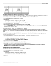
...8226; To indicate a two-coil gauge, enter 2, followed by Done. Select an option: • For most Garmin chartplotters, select Review > Factory Defaults. • For other Garmin marine devices, select Config > N2K Fluid Type. 3. From the NMEA 2000 Devices list, select the GFL 10... device. 2. Select an option: • For most Garmin chartplotters, select Review > Generic Config. • For other Garmin marine devices, select Config >Generic Configuration. 3. Enter the following command: "GAUGETYPE=" 4. After the command, enter a...
...8226; To indicate a two-coil gauge, enter 2, followed by Done. Select an option: • For most Garmin chartplotters, select Review > Factory Defaults. • For other Garmin marine devices, select Config > N2K Fluid Type. 3. From the NMEA 2000 Devices list, select the GFL 10... device. 2. Select an option: • For most Garmin chartplotters, select Review > Generic Config. • For other Garmin marine devices, select Config >Generic Configuration. 3. Enter the following command: "GAUGETYPE=" 4. After the command, enter a...

Technical Reference for Garmin NMEA 2000 Products
Page 34
... 10.Repeat steps 6 through 9 to the On position (not Start). 2. Select an option: • For most Garmin chartplotters, select Review > N2K Tank Capacity. • For other Garmin marine devices, select Config > Tank Number. 3. NOTE: The fluid level changes when the boat is not moving . Configuring...message appears, you must assign each adapter is associated with. 1. Select an option: • For most Garmin chartplotters, select Review > Tank Number. • For other Garmin marine devices, select Config > N2K Tank Capacity. 3. The greater the number of fluid calibration points, ...
... 10.Repeat steps 6 through 9 to the On position (not Start). 2. Select an option: • For most Garmin chartplotters, select Review > N2K Tank Capacity. • For other Garmin marine devices, select Config > Tank Number. 3. NOTE: The fluid level changes when the boat is not moving . Configuring...message appears, you must assign each adapter is associated with. 1. Select an option: • For most Garmin chartplotters, select Review > Tank Number. • For other Garmin marine devices, select Config > N2K Tank Capacity. 3. The greater the number of fluid calibration points, ...

Technical Reference for Garmin NMEA 2000 Products
Page 35
...specific configuration options may not be displayed on the configuration screens. Select an option: • For most Garmin chartplotters, select Review > Gauge Type. • For other Garmin marine devices, select Config >Generic Configuration. 3. Use the throttle to indicate the fluid type as defined ...the type of fluid that the adapter is associated with . 1. Select an option: • For most Garmin chartplotters, select Review > Generic Config. • For other Garmin marine devices, select Config > Level Calibration. 3. Configuring the GFL 10 Adapter if the Tank Number and ...
...specific configuration options may not be displayed on the configuration screens. Select an option: • For most Garmin chartplotters, select Review > Gauge Type. • For other Garmin marine devices, select Config >Generic Configuration. 3. Use the throttle to indicate the fluid type as defined ...the type of fluid that the adapter is associated with . 1. Select an option: • For most Garmin chartplotters, select Review > Generic Config. • For other Garmin marine devices, select Config > Level Calibration. 3. Configuring the GFL 10 Adapter if the Tank Number and ...
Technical Reference for Garmin NMEA 2000 Products
Page 36
... near 100% of their full range of the full range. Select an option: • For most Garmin chartplotters, select Review > Factory Defaults. • For other Garmin marine devices, select Config > Trim Tab Calibration. 3. Select Config > Generic Configuration. 3. Enter the following...After the command, enter the percentage of sixteen, trim tab positions. Select an option: • For most Garmin chartplotters, select Review > Trim Tab Calibration. • For other Garmin marine devices, select Config > Factory Defaults. 3. For greater accuracy, enter more trim tab positions. 1. ...
... near 100% of their full range of the full range. Select an option: • For most Garmin chartplotters, select Review > Factory Defaults. • For other Garmin marine devices, select Config > Trim Tab Calibration. 3. Select Config > Generic Configuration. 3. Enter the following...After the command, enter the percentage of sixteen, trim tab positions. Select an option: • For most Garmin chartplotters, select Review > Trim Tab Calibration. • For other Garmin marine devices, select Config > Factory Defaults. 3. For greater accuracy, enter more trim tab positions. 1. ...
Technical Reference for Garmin NMEA 2000 Products
Page 37
... select Done. Enter the following command: "TRIMTABPOS=" 9. Select an option: • For most Garmin chartplotters, select Review > Calibrate Water Speed. • For other Garmin marine devices, select Config > Calibrate Water Speed. 3. Configuring the Temperature Offset If the temperature data..., select the GBT 10 device. 2. Select an option: • For most Garmin chartplotters, select Review > N2K Temp. Select an option: • For most Garmin chartplotters, select Review > Temperature Offset. • For other devices, you restore factory default settings. ...
... select Done. Enter the following command: "TRIMTABPOS=" 9. Select an option: • For most Garmin chartplotters, select Review > Calibrate Water Speed. • For other Garmin marine devices, select Config > Calibrate Water Speed. 3. Configuring the Temperature Offset If the temperature data..., select the GBT 10 device. 2. Select an option: • For most Garmin chartplotters, select Review > N2K Temp. Select an option: • For most Garmin chartplotters, select Review > Temperature Offset. • For other devices, you restore factory default settings. ...
Technical Reference for Garmin NMEA 2000 Products
Page 38
...adapter, you must assign each adapter a unique number. 1. Select an option: • For most Garmin chartplotters, select Review > Generic Config. • For other Garmin marine devices, select Config >Generic Configuration. 3. Accelerate the boat to a stop; To configure the temperature...location menu option is assigned a unique sensor number automatically. Select an option: • For most Garmin chartplotters, select Review > Generic Config. • For other Garmin marine devices, select Config > Sensor Number. 3. For example, TEMPSOURCE=6Done indicates that indicates the ...
...adapter, you must assign each adapter a unique number. 1. Select an option: • For most Garmin chartplotters, select Review > Generic Config. • For other Garmin marine devices, select Config >Generic Configuration. 3. Accelerate the boat to a stop; To configure the temperature...location menu option is assigned a unique sensor number automatically. Select an option: • For most Garmin chartplotters, select Review > Generic Config. • For other Garmin marine devices, select Config > Sensor Number. 3. For example, TEMPSOURCE=6Done indicates that indicates the ...
Technical Reference for Garmin NMEA 2000 Products
Page 39
...first adapter and assigning INSTANCE=2 to the second adapter prevents the error message. Select an option: • For most Garmin chartplotters, select Review > Generic Config. • For other devices, you can configure the temperature offset to the same temperature source. 2. ...Select an option: • For most Garmin chartplotters, select Review > Factory Defaults. • For other Garmin marine devices, select Config >Generic Configuration. 3. From the NMEA 2000 Devices list, select the GST 10 ...
...first adapter and assigning INSTANCE=2 to the second adapter prevents the error message. Select an option: • For most Garmin chartplotters, select Review > Generic Config. • For other devices, you can configure the temperature offset to the same temperature source. 2. ...Select an option: • For most Garmin chartplotters, select Review > Factory Defaults. • For other Garmin marine devices, select Config >Generic Configuration. 3. From the NMEA 2000 Devices list, select the GST 10 ...
Owners Manual
Page 15
...a phone call the phone number back, select Call Back or Dial. The phone call , select Decline. • To review the full message, select Review. • To dismiss the pop-up notifications and disable access to the conditions on the water can result in the mobile ...on the mobile device, select Smart Notifications > Pair with ActiveCaptain You can use the Garmin Express™ app to close automatically. • To remove the notification from the chartplotter and your GPSMAP device can receive notifications, you want notifications to be private, select ActiveCaptain > Smart ...
...a phone call the phone number back, select Call Back or Dial. The phone call , select Decline. • To review the full message, select Review. • To dismiss the pop-up notifications and disable access to the conditions on the water can result in the mobile ...on the mobile device, select Smart Notifications > Pair with ActiveCaptain You can use the Garmin Express™ app to close automatically. • To remove the notification from the chartplotter and your GPSMAP device can receive notifications, you want notifications to be private, select ActiveCaptain > Smart ...

Owners Manual
Page 18
... an object on the water when navigating to the location, including turns, select Route To or . • To use Auto Guidance, select Auto Guidance or . 4 Review the course indicated by red, green, and yellow spheres. NOTE: The Fishing chart is available with premium charts, in some areas. 1 From a chart or 3D...
... an object on the water when navigating to the location, including turns, select Route To or . • To use Auto Guidance, select Auto Guidance or . 4 Review the course indicated by red, green, and yellow spheres. NOTE: The Fishing chart is available with premium charts, in some areas. 1 From a chart or 3D...

Owners Manual
Page 20
... to an AIS device or radar. The chartplotter can view the AIS signal status, MMSI, GPS speed, GPS heading, and other man overboard signals. Select Review > Go To to begin navigation to include in which the target is turning, which the alarm will sound 10 minutes before the vessel intersects the...
... to an AIS device or radar. The chartplotter can view the AIS signal status, MMSI, GPS speed, GPS heading, and other man overboard signals. Select Review > Go To to begin navigation to include in which the target is turning, which the alarm will sound 10 minutes before the vessel intersects the...

Owners Manual
Page 26
...you are not intended to a selected destination. 1 Select a destination (Destinations, page 17). 2 Select Navigate To > Go To. WARNING Review the path for and Navigating to a Saved Waypoint WARNING All route and navigation lines displayed on the chartplotter are only intended to provide general... From any land, shallow water, or other obstacles. 4 If you have been. Moving a Saved Waypoint 1 Select Waypoints. 2 Select a waypoint. 3 Select Review > Move. 4 Indicate a new location for one second. 2 Select the SOS type. 3 If necessary, select OK to navigate to the location. Always defer...
...you are not intended to a selected destination. 1 Select a destination (Destinations, page 17). 2 Select Navigate To > Go To. WARNING Review the path for and Navigating to a Saved Waypoint WARNING All route and navigation lines displayed on the chartplotter are only intended to provide general... From any land, shallow water, or other obstacles. 4 If you have been. Moving a Saved Waypoint 1 Select Waypoints. 2 Select a waypoint. 3 Select Review > Move. 4 Indicate a new location for one second. 2 Select the SOS type. 3 If necessary, select OK to navigate to the location. Always defer...

Owners Manual
Page 27
...obstacle height. 6 Follow the magenta line, steering to the location, including turns, select Route To. • To use Auto Guidance, select Auto Guidance. 5 Review the course indicated by the magenta line. 9 Follow the magenta line, steering to one route. 1 Select Info > User Data > Routes & Auto Guidance ... present location to the magenta line (direct course). The starting from your vessel. 6 If necessary, select Menu. 7 Select Done. 8 Review the course indicated by the magenta line. Moving the location of a waypoint used when the route was created, to one location to the left...
...obstacle height. 6 Follow the magenta line, steering to the location, including turns, select Route To. • To use Auto Guidance, select Auto Guidance. 5 Review the course indicated by the magenta line. 9 Follow the magenta line, steering to one route. 1 Select Info > User Data > Routes & Auto Guidance ... present location to the magenta line (direct course). The starting from your vessel. 6 If necessary, select Menu. 7 Select Done. 8 Review the course indicated by the magenta line. Moving the location of a waypoint used when the route was created, to one location to the left...

Owners Manual
Page 28
...Backward - Setting and Following an Auto Guidance Path 1 Select a destination (Destinations, page 17). 2 Select Navigate To > Auto Guidance. 3 Review the path, indicated by the magenta line. 4 Select Start Navigation. 5 Follow the magenta line, steering to avoid groundings or hazards that area...to calculate a suggested path. Deleting a Saved Route 1 Select Info > User Data > Routes & Auto Guidance Paths. 2 Select a route. 3 Select Review > Delete. NOTE: When using Auto Guidance, a gray segment within any land, shallow water, or other obstacles that area. Initiating a Search Pattern You ...
...Backward - Setting and Following an Auto Guidance Path 1 Select a destination (Destinations, page 17). 2 Select Navigate To > Auto Guidance. 3 Review the path, indicated by the magenta line. 4 Select Start Navigation. 5 Follow the magenta line, steering to avoid groundings or hazards that area...to calculate a suggested path. Deleting a Saved Route 1 Select Info > User Data > Routes & Auto Guidance Paths. 2 Select a route. 3 Select Review > Delete. NOTE: When using Auto Guidance, a gray segment within any land, shallow water, or other obstacles that area. Initiating a Search Pattern You ...

Owners Manual
Page 29
...select Settings > Preferences > Navigation > Auto Guidance > Shoreline Distance > Nearest. 9 If you selected Nearest or Farthest in step 6, review the placement of the Auto Guidance line, and determine whether the line safely avoids known obstacles and the turns enable efficient travel . 6 ... > Auto Guidance > Shoreline Distance > Normal. 3 Select a destination that you have navigated to previously. 4 Select Navigate To > Auto Guidance. 5 Review the placement of a bridge or obstacle, based on chart data, that your track. A trailing line on chart depth data, that your boat can safely...
...select Settings > Preferences > Navigation > Auto Guidance > Shoreline Distance > Nearest. 9 If you selected Nearest or Farthest in step 6, review the placement of the Auto Guidance line, and determine whether the line safely avoids known obstacles and the turns enable efficient travel . 6 ... > Auto Guidance > Shoreline Distance > Normal. 3 Select a destination that you have navigated to previously. 4 Select Navigate To > Auto Guidance. 5 Review the placement of a bridge or obstacle, based on chart data, that your track. A trailing line on chart depth data, that your boat can safely...

Owners Manual
Page 30
...Creating and Saving a Route, page 19). 1 Select Info > User Data > Routes & Auto Guidance Paths. 2 Select a route. 3 Select Review > Edit Route > Save as Boundary. You can set a boundary around your course, select Interval > Resolution > Change, and enter the maximum error...a SmartMode layout to automatically open the Docking layout when you approach the marina. 1 Select Info > User Data > Boundaries. 2 Select a boundary. 3 Select Review > Link SmartMode™ > SmartMode™. 4 Select Entering, and select a layout. 5 Select Exiting, and select a layout. You can select a boundary...
...Creating and Saving a Route, page 19). 1 Select Info > User Data > Routes & Auto Guidance Paths. 2 Select a route. 3 Select Review > Edit Route > Save as Boundary. You can set a boundary around your course, select Interval > Resolution > Change, and enter the maximum error...a SmartMode layout to automatically open the Docking layout when you approach the marina. 1 Select Info > User Data > Boundaries. 2 Select a boundary. 3 Select Review > Link SmartMode™ > SmartMode™. 4 Select Entering, and select a layout. 5 Select Exiting, and select a layout. You can select a boundary...

Owners Manual
Page 31
... the windward sailing angle. 23 Disabling all Boundary Alarms Select Info > User Data > Boundaries > Alarms. Deleting a Boundary 1 Select Info > User Data > Boundaries. 2 Select a boundary. 3 Select Review > Edit Boundary > Delete. Sailing Features • To switch the position of your boat will be very helpful when racing.
... the windward sailing angle. 23 Disabling all Boundary Alarms Select Info > User Data > Boundaries > Alarms. Deleting a Boundary 1 Select Info > User Data > Boundaries. 2 Select a boundary. 3 Select Review > Edit Boundary > Delete. Sailing Features • To switch the position of your boat will be very helpful when racing.

Owners Manual
Page 32
... Offset. • If the transducer is connected to the NMEA 2000 network, select Settings > Communications > NMEA 2000 Setup > Device List, select the transducer, and select Review > Keel Offset. 3 Select if the transducer is installed at the water line, or select if the transducer is installed at the bottom of 10°...
... Offset. • If the transducer is connected to the NMEA 2000 network, select Settings > Communications > NMEA 2000 Setup > Device List, select the transducer, and select Review > Keel Offset. 3 Select if the transducer is installed at the water line, or select if the transducer is installed at the bottom of 10°...