
Owner's Manual
Page 4
... Date 18 Viewing Information for a Different Tide or Current Station ..... 18 Viewing Almanac Information from the Navigation Chart ........ 18 Warning Manager 18 Viewing Messages 18 Sorting and Filtering Messages 18 Saving Messages to a Memory Card 18 Clearing all of the Messages ...the Weather Chart 19 Viewing Precipitation Information 19 Precipitation Views 19 Storm Cell and Lightning Information 19 Hurricane Information 20 Weather Warnings and Weather Bulletins 20 Forecast Information 20 Viewing Forecast Information for Another Time Period ...... 20 Weather Fronts and Pressure ...
... Date 18 Viewing Information for a Different Tide or Current Station ..... 18 Viewing Almanac Information from the Navigation Chart ........ 18 Warning Manager 18 Viewing Messages 18 Sorting and Filtering Messages 18 Saving Messages to a Memory Card 18 Clearing all of the Messages ...the Weather Chart 19 Viewing Precipitation Information 19 Precipitation Views 19 Storm Cell and Lightning Information 19 Hurricane Information 20 Weather Warnings and Weather Bulletins 20 Forecast Information 20 Viewing Forecast Information for Another Time Period ...... 20 Weather Fronts and Pressure ...

Owner's Manual
Page 7
... is selected from the Home screen, one display can show the Navigation chart and another compatible Garmin chartplotter or a computer. 1 Open the door À on each display. Introduction 1 Locking...them together into a station. Stations and Station Layouts When multiple displays are representations of the GPSMAP 8000 series devices. À Power key Á Automatic backlight sensor  Touchscreen ...the label facing away from the Home screen, each display in the product box for product warnings and other points of interest. Using the Touchscreen • Tap the screen...
... is selected from the Home screen, one display can show the Navigation chart and another compatible Garmin chartplotter or a computer. 1 Open the door À on each display. Introduction 1 Locking...them together into a station. Stations and Station Layouts When multiple displays are representations of the GPSMAP 8000 series devices. À Power key Á Automatic backlight sensor  Touchscreen ...the label facing away from the Home screen, each display in the product box for product warnings and other points of interest. Using the Touchscreen • Tap the screen...

Owner's Manual
Page 17
... per sounder return, and so on for more consistent in shallow water. • To show data from a 200 kHz sonar signal, select 200 kHz. Radar WARNING The marine radar transmits microwave energy that is useful mainly for deeper waters and to deliver shallow-water-like target separation at extremely deep depths...
... per sounder return, and so on for more consistent in shallow water. • To show data from a 200 kHz sonar signal, select 200 kHz. Radar WARNING The marine radar transmits microwave energy that is useful mainly for deeper waters and to deliver shallow-water-like target separation at extremely deep depths...
Owner's Manual
Page 24
...Tides. You can view information about a current station for the present date and time. The center of the Messages Select Info > Warning Manager > Clear Warning Manager. By default, the chartplotter shows celestial information for a specific date and time, including the current speed and level of the ...date shown, select Next Day. • If available, to sort or filter the message list. Sorting and Filtering Messages 1 Select Info > Warning Manager > Sort/Filter. 2 Select an option to view information for the day before the date shown, select Previous Day. Saving Messages to ...
...Tides. You can view information about a current station for the present date and time. The center of the Messages Select Info > Warning Manager > Clear Warning Manager. By default, the chartplotter shows celestial information for a specific date and time, including the current speed and level of the ...date shown, select Next Day. • If available, to sort or filter the message list. Sorting and Filtering Messages 1 Select Info > Warning Manager > Sort/Filter. 2 Select an option to view information for the day before the date shown, select Previous Day. Saving Messages to ...

Owner's Manual
Page 25
... for your satellite weather and radio equipment. Storm Cell and Lightning Information Storm cell icons on the screen. SiriusXM™ WARNING The weather information provided through this product is selected, the receiver must have a compatible satellite weather receiver. To use XM... From the precipitation weather chart, select Menu > Weather Menu. Cloud Cover: Shows cloud cover data. Each line represents 15 minutes. Garmin will most likely be relied upon exclusively. NOTE: Any weather feature can alternate between them using a stretched aspect ratio, select Aspect ...
... for your satellite weather and radio equipment. Storm Cell and Lightning Information Storm cell icons on the screen. SiriusXM™ WARNING The weather information provided through this product is selected, the receiver must have a compatible satellite weather receiver. To use XM... From the precipitation weather chart, select Menu > Weather Menu. Cloud Cover: Shows cloud cover data. Each line represents 15 minutes. Garmin will most likely be relied upon exclusively. NOTE: Any weather feature can alternate between them using a stretched aspect ratio, select Aspect ...

Owner's Manual
Page 26
... Menu > Change Weather > Forecast. 2 Select an option: Viewing Sea Conditions The Sea Conditions chart shows information about the warning or bulletin, select the shaded area. Color Marine Weather Weather Subcategories Group Light Blue Flash Flood Dark Blue Flood Areal Flood... blowing snow, sleet, freezing rain, freezing drizzle) Forecast Information The Forecast chart shows city forecasts, marine forecasts, warnings, hurricane warnings, METARS, county warnings, weather fronts and pressure centers, surface pressure, and WX buoys. Surface Winds Surface wind vectors appear on the...
... Menu > Change Weather > Forecast. 2 Select an option: Viewing Sea Conditions The Sea Conditions chart shows information about the warning or bulletin, select the shaded area. Color Marine Weather Weather Subcategories Group Light Blue Flash Flood Dark Blue Flood Areal Flood... blowing snow, sleet, freezing rain, freezing drizzle) Forecast Information The Forecast chart shows city forecasts, marine forecasts, warnings, hurricane warnings, METARS, county warnings, weather fronts and pressure centers, surface pressure, and WX buoys. Surface Winds Surface wind vectors appear on the...

Owner's Manual
Page 27
.... 3 Select On. 4 Repeat steps 2 and 3 to view forecast information. 1 From a weather chart, select a location on the left of cloud tops, lightning, WX buoys, county warnings, and hurricane warnings. Viewing Fishing Information The weather Fishing chart shows present water temperature, present surface pressure conditions, and fishing forecasts. Pressure readings can help to 48...
.... 3 Select On. 4 Repeat steps 2 and 3 to view forecast information. 1 From a weather chart, select a location on the left of cloud tops, lightning, WX buoys, county warnings, and hurricane warnings. Viewing Fishing Information The weather Fishing chart shows present water temperature, present surface pressure conditions, and fishing forecasts. Pressure readings can help to 48...

Owner's Manual
Page 29
... 3 through a narrow waterway (page 23). As a result, the chartplotter may not reposition the Auto Guidance line, unless the destination selected requires navigation through those areas, a warning message appears. Auto Guidance maintains a wide clearance from shore, you are relative, not absolute. Communications Settings NMEA 0183 Settings Select Settings > Communications > NMEA 0183 Setup...
... 3 through a narrow waterway (page 23). As a result, the chartplotter may not reposition the Auto Guidance line, unless the destination selected requires navigation through those areas, a warning message appears. Auto Guidance maintains a wide clearance from shore, you are relative, not absolute. Communications Settings NMEA 0183 Settings Select Settings > Communications > NMEA 0183 Setup...
Owner's Manual
Page 35
... 17 individual routine calling 16 video 18 configuring 19 source 18, 19 voltage 24 volume, adjusting 22 VRM 13 adjusting 13 measuring 13 showing 13 W warning manager 18 messages 18 water speed 25 temperature log 18 temperature offset 25 waypoints 8 copying 26 creating 8, 21 deleting 8 editing 8 man overboard 8 navigating to 8 radar...
... 17 individual routine calling 16 video 18 configuring 19 source 18, 19 voltage 24 volume, adjusting 22 VRM 13 adjusting 13 measuring 13 showing 13 W warning manager 18 messages 18 water speed 25 temperature log 18 temperature offset 25 waypoints 8 copying 26 creating 8, 21 deleting 8 editing 8 man overboard 8 navigating to 8 radar...

Quick Start Manual
Page 2
... dangerous objects. Navigation Navigating to avoid land, shallow water, and other points of the GPSMAP 8000 series devices. 2 Select an option. Use visual sightings, and steer to a ... the device. TIP: Press from the door. 3 Press the card in the product box for product warnings and other obstacles that screen. • Press to adjust the backlight and lock the touchscreen...can use blank memory cards to transfer data such as waypoints, routes, and tracks to another compatible Garmin chartplotter or a computer. 1 Open the door À on the memory card reader. À...
... dangerous objects. Navigation Navigating to avoid land, shallow water, and other points of the GPSMAP 8000 series devices. 2 Select an option. Use visual sightings, and steer to a ... the device. TIP: Press from the door. 3 Press the card in the product box for product warnings and other obstacles that screen. • Press to adjust the backlight and lock the touchscreen...can use blank memory cards to transfer data such as waypoints, routes, and tracks to another compatible Garmin chartplotter or a computer. 1 Open the door À on the memory card reader. À...

Installation Instructions
Page 1
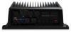
... in place as indicated in the product box for product warnings and other devices and GPSMAP 8500 systems on the opposite side of the surface. The GPSMAP 8500 is a highly customizable marine navigation and information system. The GPSMAP 8500 can be controlled by fire or overheating... holder. These instructions will cover the mounting and wiring of the primary GPSMAP 8500 device. GPSMAP® 8500 Installation Instructions The GPSMAP 8500 is the brain of a GPSMAP 8500 system and it connects to http: / / my .garmin .com. • Keep the original sales receipt, or a photocopy,...
... in place as indicated in the product box for product warnings and other devices and GPSMAP 8500 systems on the opposite side of the surface. The GPSMAP 8500 is a highly customizable marine navigation and information system. The GPSMAP 8500 can be controlled by fire or overheating... holder. These instructions will cover the mounting and wiring of the primary GPSMAP 8500 device. GPSMAP® 8500 Installation Instructions The GPSMAP 8500 is the brain of a GPSMAP 8500 system and it connects to http: / / my .garmin .com. • Keep the original sales receipt, or a photocopy,...

Installation Instructions
Page 4
...Considerations This device should test the DVI-D cable by turning the locking ring clockwise. Connecting to Power WARNING When connecting the power cable, do not remove the in the product specifications. Item À &#... Connect the red wire to the positive (+) battery terminal, and connect the black wire to the negative (-) battery terminal. 3 Install the locking ring and o-ring on... modified using a Garmin Marine Network cable and a DVI-D cable. ◦ A GMM or other compatible Garmin devices to work together as a station. When planning stations on the GPSMAP 8500 using the ...
...Considerations This device should test the DVI-D cable by turning the locking ring clockwise. Connecting to Power WARNING When connecting the power cable, do not remove the in the product specifications. Item À &#... Connect the red wire to the positive (+) battery terminal, and connect the black wire to the negative (-) battery terminal. 3 Install the locking ring and o-ring on... modified using a Garmin Marine Network cable and a DVI-D cable. ◦ A GMM or other compatible Garmin devices to work together as a station. When planning stations on the GPSMAP 8500 using the ...

Installation Instructions
Page 11
... devices on the Garmin Marine Network. Connecting the Card Reader to the Garmin Marine Network The card reader is shared with Garmin chartplotters prior to the GPSMAP 8000 Series and GPSMAP 8500. power usage...the positive (+) battery terminal, and connect the black wire to the negative (-) battery terminal. 3 Install the locking ring and o-ring on the Garmin Marine Network using a Garmin Marine Network cable. current draw at 12 ...Max. Card Reader Connections Connecting to Power WARNING When connecting the power cable, do not remove the in the product specifications.
... devices on the Garmin Marine Network. Connecting the Card Reader to the Garmin Marine Network The card reader is shared with Garmin chartplotters prior to the GPSMAP 8000 Series and GPSMAP 8500. power usage...the positive (+) battery terminal, and connect the black wire to the negative (-) battery terminal. 3 Install the locking ring and o-ring on the Garmin Marine Network using a Garmin Marine Network cable. current draw at 12 ...Max. Card Reader Connections Connecting to Power WARNING When connecting the power cable, do not remove the in the product specifications.