
Owner's Manual
Page 4
... Date 18 Viewing Information for a Different Tide or Current Station ..... 18 Viewing Almanac Information from the Navigation Chart ........ 18 Warning Manager 18 Viewing Messages 18 Sorting and Filtering Messages 18 Saving Messages to a Memory Card 18 Clearing all of the Messages ...the Weather Chart 19 Viewing Precipitation Information 19 Precipitation Views 19 Storm Cell and Lightning Information 19 Hurricane Information 20 Weather Warnings and Weather Bulletins 20 Forecast Information 20 Viewing Forecast Information for Another Time Period ...... 20 Weather Fronts and Pressure ...
... Date 18 Viewing Information for a Different Tide or Current Station ..... 18 Viewing Almanac Information from the Navigation Chart ........ 18 Warning Manager 18 Viewing Messages 18 Sorting and Filtering Messages 18 Saving Messages to a Memory Card 18 Clearing all of the Messages ...the Weather Chart 19 Viewing Precipitation Information 19 Precipitation Views 19 Storm Cell and Lightning Information 19 Hurricane Information 20 Weather Warnings and Weather Bulletins 20 Forecast Information 20 Viewing Forecast Information for Another Time Period ...... 20 Weather Fronts and Pressure ...

Owner's Manual
Page 7
... station appears on that display. When you change the layout of a page in one display can show the Navigation chart and another compatible Garmin chartplotter or a computer. 1 Open the door À on the page, select Overlays, and select an option. You can customize the... all displays in until it clicks. 4 Close the card reader door. Introduction WARNING See the Important Safety and Product Information guide in the product box for product warnings and other points of interest. GPSMAP 8000 Series Front View The location of the Home screen. Tips and Shortcuts •...
... station appears on that display. When you change the layout of a page in one display can show the Navigation chart and another compatible Garmin chartplotter or a computer. 1 Open the door À on the page, select Overlays, and select an option. You can customize the... all displays in until it clicks. 4 Close the card reader door. Introduction WARNING See the Important Safety and Product Information guide in the product box for product warnings and other points of interest. GPSMAP 8000 Series Front View The location of the Home screen. Tips and Shortcuts •...

Owner's Manual
Page 17
..., the targets blend together, and if the value is a vertical flasher along the right side of the fullscreen sonar view. You can reduce noise. Radar WARNING The marine radar transmits microwave energy that is especially helpful when you are the most recently received sonar data so that shows instantaneously the range...
..., the targets blend together, and if the value is a vertical flasher along the right side of the fullscreen sonar view. You can reduce noise. Radar WARNING The marine radar transmits microwave energy that is especially helpful when you are the most recently received sonar data so that shows instantaneously the range...
Owner's Manual
Page 24
...To simultaneously display four RCA video inputs, select Quad Video. 18 Tide, Current, and Celestial Information Sorting and Filtering Messages 1 Select Info > Warning Manager > Sort/Filter. 2 Select an option to Card. Not all choices listed are available on all of time. • To set ... Information Tide Station Information You can view video, you to view variations over a shorter period of the Messages Select Info > Warning Manager > Clear Warning Manager. Clearing all models. • To display video for a specific date and time, including the tide height, and when...
...To simultaneously display four RCA video inputs, select Quad Video. 18 Tide, Current, and Celestial Information Sorting and Filtering Messages 1 Select Info > Warning Manager > Sort/Filter. 2 Select an option to Card. Not all choices listed are available on all of time. • To set ... Information Tide Station Information You can view video, you to view variations over a shorter period of the Messages Select Info > Warning Manager > Clear Warning Manager. Clearing all models. • To display video for a specific date and time, including the tide height, and when...

Owner's Manual
Page 25
...adjust the screen brightness, select the brightness arrows. • To adjust the screen contrast, select the contrast arrows. SiriusXM™ WARNING The weather information provided through this product is selected, the receiver must receive new data before weather data or a different feature appears...the source that provides the information changes. Lightning strikes are represented by the connected video device, and it on various Garmin devices, including the Navigation chart on a compatible chartplotter. The video cannot be responsible for your satellite weather and radio...
...adjust the screen brightness, select the brightness arrows. • To adjust the screen contrast, select the contrast arrows. SiriusXM™ WARNING The weather information provided through this product is selected, the receiver must receive new data before weather data or a different feature appears...the source that provides the information changes. Lightning strikes are represented by the connected video device, and it on various Garmin devices, including the Navigation chart on a compatible chartplotter. The video cannot be responsible for your satellite weather and radio...

Owner's Manual
Page 26
..., blowing snow, sleet, freezing rain, freezing drizzle) Forecast Information The Forecast chart shows city forecasts, marine forecasts, warnings, hurricane warnings, METARS, county warnings, weather fronts and pressure centers, surface pressure, and WX buoys. Weather bulletins may consist of a hurricane , a...option: Viewing Sea Conditions The Sea Conditions chart shows information about the warning or bulletin, select the shaded area. Weather Warnings and Weather Bulletins When a marine weather warning, weather watch, weather advisory, weather bulletin, or other weather statement ...
..., blowing snow, sleet, freezing rain, freezing drizzle) Forecast Information The Forecast chart shows city forecasts, marine forecasts, warnings, hurricane warnings, METARS, county warnings, weather fronts and pressure centers, surface pressure, and WX buoys. Weather bulletins may consist of a hurricane , a...option: Viewing Sea Conditions The Sea Conditions chart shows information about the warning or bulletin, select the shaded area. Weather Warnings and Weather Bulletins When a marine weather warning, weather watch, weather advisory, weather bulletin, or other weather statement ...

Owner's Manual
Page 27
... Forecast or again. Different colors indicate different wave heights, as pressure isobars and pressure centers. The direction of cloud tops, lightning, WX buoys, county warnings, and hurricane warnings. Viewing Fishing Information The weather Fishing chart shows present water temperature, present surface pressure conditions, and fishing forecasts. Surface Pressure and Water Temperature Data...
... Forecast or again. Different colors indicate different wave heights, as pressure isobars and pressure centers. The direction of cloud tops, lightning, WX buoys, county warnings, and hurricane warnings. Viewing Fishing Information The weather Fishing chart shows present water temperature, present surface pressure conditions, and fishing forecasts. Surface Pressure and Water Temperature Data...

Owner's Manual
Page 29
... distance from obstacles in your boat can assess the placement of the Auto Guidance line using a map or chart that require navigation through those areas, a warning message appears. Port Type: See page 24. Select Settings > Preferences > Navigation. Auto Guidance: Sets the measurements for transmission of the autopilot when navigating a route or...
... distance from obstacles in your boat can assess the placement of the Auto Guidance line using a map or chart that require navigation through those areas, a warning message appears. Port Type: See page 24. Select Settings > Preferences > Navigation. Auto Guidance: Sets the measurements for transmission of the autopilot when navigating a route or...
Owner's Manual
Page 35
... 17 individual routine calling 16 video 18 configuring 19 source 18, 19 voltage 24 volume, adjusting 22 VRM 13 adjusting 13 measuring 13 showing 13 W warning manager 18 messages 18 water speed 25 temperature log 18 temperature offset 25 waypoints 8 copying 26 creating 8, 21 deleting 8 editing 8 man overboard 8 navigating to 8 radar...
... 17 individual routine calling 16 video 18 configuring 19 source 18, 19 voltage 24 volume, adjusting 22 VRM 13 adjusting 13 measuring 13 showing 13 W warning manager 18 messages 18 water speed 25 temperature log 18 temperature offset 25 waypoints 8 copying 26 creating 8, 21 deleting 8 editing 8 man overboard 8 navigating to 8 radar...

Quick Start Manual
Page 2
...to a Point on the Chart CAUTION The Auto Guidance feature is available with premium charts, in the product box for product warnings and other points of the GPSMAP 8000 series devices. 2 Select an option. TIP: Press from any main screen to access additional settings about ...Color Mode. 2 Insert the memory card Á with premium charts, in . Marking Your Present Location as waypoints, routes, and tracks to another compatible Garmin chartplotter or a computer. 1 Open the door À on the memory card reader. À Power key Á Automatic backlight sensor  Touchscreen...
...to a Point on the Chart CAUTION The Auto Guidance feature is available with premium charts, in the product box for product warnings and other points of the GPSMAP 8000 series devices. 2 Select an option. TIP: Press from any main screen to access additional settings about ...Color Mode. 2 Insert the memory card Á with premium charts, in . Marking Your Present Location as waypoints, routes, and tracks to another compatible Garmin chartplotter or a computer. 1 Open the door À on the memory card reader. À Power key Á Automatic backlight sensor  Touchscreen...

Installation Instructions
Page 1
...the layout of your boat. Understanding the Components The GPSMAP 8500 system can be set up in the product box for product warnings and other devices and GPSMAP 8500 systems on your boat. GPSMAP® 8500 Installation Instructions The GPSMAP 8500 is on the opposite side of the surface... be controlled by a connected GMM™ monitor, a connected GRID™ input device, or combination of a GPSMAP 8500 system and it connects to www.garmin.com/ support and click Contact Support for your boat. Registering Your Device Help us better support you can be in...
...the layout of your boat. Understanding the Components The GPSMAP 8500 system can be set up in the product box for product warnings and other devices and GPSMAP 8500 systems on your boat. GPSMAP® 8500 Installation Instructions The GPSMAP 8500 is on the opposite side of the surface... be controlled by a connected GMM™ monitor, a connected GRID™ input device, or combination of a GPSMAP 8500 system and it connects to www.garmin.com/ support and click Contact Support for your boat. Registering Your Device Help us better support you can be in...

Installation Instructions
Page 4
...When planning stations on your GMM and third-party display for use the Garmin provided DVI- Connecting to control the GPSMAP 8500 must be in place as indicated in a station. • Although...the device. 2 Connect the red wire to the positive (+) battery terminal, and connect the black wire to mirror the primary display. Consult the instructions provided with the device for more information....connections of the possible two connected GMM devices. ◦ The GMM used to Power WARNING When connecting the power cable, do not remove the in conjunction with touchscreen control, ...
...When planning stations on your GMM and third-party display for use the Garmin provided DVI- Connecting to control the GPSMAP 8500 must be in place as indicated in a station. • Although...the device. 2 Connect the red wire to the positive (+) battery terminal, and connect the black wire to mirror the primary display. Consult the instructions provided with the device for more information....connections of the possible two connected GMM devices. ◦ The GMM used to Power WARNING When connecting the power cable, do not remove the in conjunction with touchscreen control, ...

Installation Instructions
Page 11
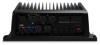
Card Reader Connections Connecting to Power WARNING When connecting the power cable, do not remove ...(origin to destination) BWC: Bearing and distance to the GPSMAP 8000 Series and GPSMAP 8500. Connecting the Card Reader to the Garmin Marine Network The card reader is shared with Garmin chartplotters prior to waypoint GGA: Global positioning system fix data...source and to the device. 2 Connect the red wire to the positive (+) battery terminal, and connect the black wire to 55°C) Material Aluminum Power Specifications Measurement Input power Fuse Max. current draw at 12 Vdc Max...
Card Reader Connections Connecting to Power WARNING When connecting the power cable, do not remove ...(origin to destination) BWC: Bearing and distance to the GPSMAP 8000 Series and GPSMAP 8500. Connecting the Card Reader to the Garmin Marine Network The card reader is shared with Garmin chartplotters prior to waypoint GGA: Global positioning system fix data...source and to the device. 2 Connect the red wire to the positive (+) battery terminal, and connect the black wire to 55°C) Material Aluminum Power Specifications Measurement Input power Fuse Max. current draw at 12 Vdc Max...