?Important Safety and Product Information
Page 2
... at its third-party providers and is the property of Garmin and/or its sole discretion. Avoid navigational hazards and never leave the helm unattended. • Use this device (the "Software") in binary executable form in a residential installation. Official ...government charts and notices to mariners contain all available navigation sources, including information from Garmin warranty coverage. Send the device, freight charges prepaid, ...
... at its third-party providers and is the property of Garmin and/or its sole discretion. Avoid navigational hazards and never leave the helm unattended. • Use this device (the "Software") in binary executable form in a residential installation. Official ...government charts and notices to mariners contain all available navigation sources, including information from Garmin warranty coverage. Send the device, freight charges prepaid, ...
Owner s Manual
Page 3
... on the Chartplotter 1 Downloading the Manuals 1 Getting More Information 1 Inserting Memory Cards 1 Software Update 2 Loading the New Software on a Memory Card 2 Updating the Device Software 2 GPS Satellite Signals 2 Selecting the GPS Source 2 Customizing the Chartplotter 2 Home Screen ... Chart 6 Viewing Aerial Photos of Landmarks 6 Garmin Quickdraw™ Contours Mapping 6 Mapping a Body of Water Using the Garmin Quickdraw Contours Feature 6 Adding a Label to a Garmin Quickdraw Contours Map ......... 6 Garmin Quickdraw Contours Settings 6 Automatic Identification System 7 ...
... on the Chartplotter 1 Downloading the Manuals 1 Getting More Information 1 Inserting Memory Cards 1 Software Update 2 Loading the New Software on a Memory Card 2 Updating the Device Software 2 GPS Satellite Signals 2 Selecting the GPS Source 2 Customizing the Chartplotter 2 Home Screen ... Chart 6 Viewing Aerial Photos of Landmarks 6 Garmin Quickdraw™ Contours Mapping 6 Mapping a Body of Water Using the Garmin Quickdraw Contours Feature 6 Adding a Label to a Garmin Quickdraw Contours Map ......... 6 Garmin Quickdraw Contours Settings 6 Automatic Identification System 7 ...

Owner s Manual
Page 5
... X/XE Action Camera Controls to Other Screens 39 Device Configuration 39 Turning On the Chartplotter Automatically 39 System Settings 39 Station Settings 39 Viewing System Software Information 39 Viewing the Event Log 39 Preferences Settings 39 Units Settings 40 Navigation Settings 40 Communications Settings 41 NMEA 0183 Settings 41 NMEA 2000...
... X/XE Action Camera Controls to Other Screens 39 Device Configuration 39 Turning On the Chartplotter Automatically 39 System Settings 39 Station Settings 39 Viewing System Software Information 39 Viewing the Event Log 39 Preferences Settings 39 Units Settings 40 Navigation Settings 40 Communications Settings 41 NMEA 0183 Settings 41 NMEA 2000...

Owner s Manual
Page 6
... the Wireless Remote Control With the Chartplotter 43 Turning On and Off the Remote Backlight 43 Disconnecting the Remote from All Chartplotters 43 Using the Garmin Helm Application with the Chartplotter ........ 43 Chartplotter Data Management 43 Copying Waypoints, Routes, and Tracks from HomePort to a Chartplotter 43 Selecting a File Type for Third... or keeps turning off 45 My device is not creating waypoints in the correct location 45 NMEA 2000 PGN Information 45 NMEA 0183 Information 46 Software License Agreement 46 Index 47 iv Table of Contents
... the Wireless Remote Control With the Chartplotter 43 Turning On and Off the Remote Backlight 43 Disconnecting the Remote from All Chartplotters 43 Using the Garmin Helm Application with the Chartplotter ........ 43 Chartplotter Data Management 43 Copying Waypoints, Routes, and Tracks from HomePort to a Chartplotter 43 Selecting a File Type for Third... or keeps turning off 45 My device is not creating waypoints in the correct location 45 NMEA 2000 PGN Information 45 NMEA 0183 Information 46 Software License Agreement 46 Index 47 iv Table of Contents
Owner s Manual
Page 7
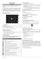
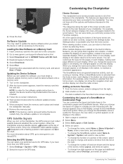
... 1 Select Info > Owner's Manual. 2 Select a manual. 3 Select Open. Map cards allow you to frequently asked questions (FAQs) • Software updates • Owner's and installation manuals • Service alerts • Video • Contact numbers and addresses Inserting Memory Cards You can use optional.... 1 Select . 2 Select Lock Touchscreen. TIP: To quickly open this web page, scan this code: 2 Download the manual. The Garmin® website at the selected location Removes the last turn added from the route Creates a direct route, without turns, to the destination Creates...
... 1 Select Info > Owner's Manual. 2 Select a manual. 3 Select Open. Map cards allow you to frequently asked questions (FAQs) • Software updates • Owner's and installation manuals • Service alerts • Video • Contact numbers and addresses Inserting Memory Cards You can use optional.... 1 Select . 2 Select Lock Touchscreen. TIP: To quickly open this web page, scan this code: 2 Download the manual. The Garmin® website at the selected location Removes the last turn added from the route Creates a direct route, without turns, to the destination Creates...
Owner s Manual
Page 8
... After the home screen appears, insert the memory card into the card slot on the computer. 2 Go to www.garmin.com/support/software/marine.html. 3 Select Download next to GPSMAP Series with SD Card. 4 Read and agree to appear, the device must collect satellite data and establish the current ...in place and restart the chartplotter manually. 6 Remove the memory card. The features are geared toward an activity, such as several minutes while the software update process completes. 5 When prompted, leave the memory card in the station, to work together, instead of a page in a display you...
... After the home screen appears, insert the memory card into the card slot on the computer. 2 Go to www.garmin.com/support/software/marine.html. 3 Select Download next to GPSMAP Series with SD Card. 4 Read and agree to appear, the device must collect satellite data and establish the current ...in place and restart the chartplotter manually. 6 Remove the memory card. The features are geared toward an activity, such as several minutes while the software update process completes. 5 When prompted, leave the memory card in the station, to work together, instead of a page in a display you...

Owner s Manual
Page 12
... Contours map to adjust the photo opacity. When Garmin Quickdraw Contours records data, a colored circle surrounds the vessel icon. Survey Coloring: Sets the color of 3.1 m (10.5 ft.). Mapping a Body of -0.5 m (-1.5 ft.) creates contours at that is available with upgraded software, sonar depth, your optional chart region, you move the cursor over the...
... Contours map to adjust the photo opacity. When Garmin Quickdraw Contours records data, a colored circle surrounds the vessel icon. Survey Coloring: Sets the color of 3.1 m (10.5 ft.). Mapping a Body of -0.5 m (-1.5 ft.) creates contours at that is available with upgraded software, sonar depth, your optional chart region, you move the cursor over the...
Owner s Manual
Page 43
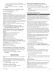
...of compatible devices or to a compatible source. You can quickly return networked cameras to a Garmin Marine Network chartplotter damages the Garmin chartplotter and may need to update the camera software to the camera manual for each video appears. 3 Select Source, and select the video ...Compatible devices include video devices connected to the ports on a Networked Video Camera You can connect multiple supported video cameras and up to a Garmin Marine Network. Saving Video Presets on the screen. 2 Select a video preset. The video controls appear on a Networked Video Camera 1...
...of compatible devices or to a compatible source. You can quickly return networked cameras to a Garmin Marine Network chartplotter damages the Garmin chartplotter and may need to update the camera software to the camera manual for each video appears. 3 Select Source, and select the video ...Compatible devices include video devices connected to the ports on a Networked Video Camera You can connect multiple supported video cameras and up to a Garmin Marine Network. Saving Video Presets on the screen. 2 Select a video preset. The video controls appear on a Networked Video Camera 1...
Owner s Manual
Page 44
... 3). Video Settings Some cameras provide additional setup options. Mirror: Reverses the image like a rearview mirror. Always use . You may need to update the camera software to move the camera unit. TIP: Hold in the compass rose to continue to use this feature. Creating a Combination with the camera, use the compass... within each combination. Associating the Camera to associate the camera with a video source. Manually moving the camera may need to update the camera software to Video 1. 38 Viewing Video The video source changes to use this feature.
... 3). Video Settings Some cameras provide additional setup options. Mirror: Reverses the image like a rearview mirror. Always use . You may need to update the camera software to move the camera unit. TIP: Hold in the compass rose to continue to use this feature. Creating a Combination with the camera, use the compass... within each combination. Associating the Camera to associate the camera with a video source. Manually moving the camera may need to update the camera software to Video 1. 38 Viewing Video The video source changes to use this feature.

Owner s Manual
Page 45
...to enter a new name for an optional Garmin radar (if applicable), and the unit ID number. You can also select to use the arrows to select a different action camera to control. Viewing System Software Information You can view the software version, the basemap version, all displays in... minutes, you want to make a station. Reset Layouts: Restores the factory default view for all supplemental map information (if applicable), the software version for the VIRB X/XE action camera. Reset Stations: Restores the factory default layouts for the layouts in the station. For example,...
...to enter a new name for an optional Garmin radar (if applicable), and the unit ID number. You can also select to use the arrows to select a different action camera to control. Viewing System Software Information You can view the software version, the basemap version, all displays in... minutes, you want to make a station. Reset Layouts: Restores the factory default view for all supplemental map information (if applicable), the software version for the VIRB X/XE action camera. Reset Stations: Restores the factory default layouts for the layouts in the station. For example,...

Owner s Manual
Page 47
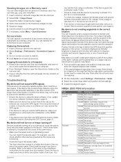
... Sets the device to sound when the battery reaches a specified low voltage. Defaults: Restores the NMEA 0183 settings to share data from Garmin peripheral devices with the functionality of the water and from a turn on the alarm. 3 Select Set Radius, and select a distance ...time from the bottom. Contour: Sets an alarm to turn or a destination. As a result, the chartplotter may resolve compatibility issues with Garmin software, select Garmin. 4 Repeat steps 2-3 to sound when you are detected. Anchor Drag: Sets an alarm to sound when you to the original factory ...
... Sets the device to sound when the battery reaches a specified low voltage. Defaults: Restores the NMEA 0183 settings to share data from Garmin peripheral devices with the functionality of the water and from a turn on the alarm. 3 Select Set Radius, and select a distance ...time from the bottom. Contour: Sets an alarm to turn or a destination. As a result, the chartplotter may resolve compatibility issues with Garmin software, select Garmin. 4 Repeat steps 2-3 to sound when you are detected. Anchor Drag: Sets an alarm to sound when you to the original factory ...

Owner s Manual
Page 49
...all settings information you can change the wireless channel of the HomePort software program loaded on -screen instructions. Changing the Wireless Channel You can connect wireless devices. Using the Garmin Helm Application with Wireless Devices The chartplotters can create a wireless network ...the chartplotter. Connecting wireless devices allows you to use the wireless remote control with a chartplotter, you must pair the remote with the Garmin Helm application, you must download and install the application, and connect the chartplotter to a Wi‑Fi router. 1 Select Settings...
...all settings information you can change the wireless channel of the HomePort software program loaded on -screen instructions. Changing the Wireless Channel You can connect wireless devices. Using the Garmin Helm Application with Wireless Devices The chartplotters can create a wireless network ...the chartplotter. Connecting wireless devices allows you to use the wireless remote control with a chartplotter, you must pair the remote with the Garmin Helm application, you must download and install the application, and connect the chartplotter to a Wi‑Fi router. 1 Select Settings...
Owner s Manual
Page 51
... not be located in degrees and minutes, with options for longer than a few seconds for the exact fuse size needed. If not, update the device software (Software Update, page 2). • Make sure the device has a clear view of the sky so the antenna can test the fuse using an external GPS ... position format settings. 4 Create the waypoint again. To check the voltage, measure the female power and ground sockets of the power cable for at www.garmin.com/support. My device is less than one device to capture. 4 Hold Home for DC voltage. Position format is a math model which the GPS ...
... not be located in degrees and minutes, with options for longer than a few seconds for the exact fuse size needed. If not, update the device software (Software Update, page 2). • Make sure the device has a clear view of the sky so the antenna can test the fuse using an external GPS ... position format settings. 4 Create the waypoint again. To check the voltage, measure the female power and ground sockets of the power cable for at www.garmin.com/support. My device is less than one device to capture. 4 Hold Home for DC voltage. Position format is a math model which the GPS ...
Owner s Manual
Page 52
... third-party providers. You acknowledge that the structure, organization, and code of the Software, for which source code is protected under the United States of Garmin and/or its subsidiaries ("Garmin") grant you a limited license to any country in source code form remains a valuable...create any other applicable country. 46 Appendix PLEASE READ THIS AGREEMENT CAREFULLY. Garmin Ltd. You agree not to export or re-export the Software to use the software embedded in this device (the "Software") in binary executable form in view RMB: Recommended minimum navigation information RMC...
... third-party providers. You acknowledge that the structure, organization, and code of the Software, for which source code is protected under the United States of Garmin and/or its subsidiaries ("Garmin") grant you a limited license to any country in source code form remains a valuable...create any other applicable country. 46 Appendix PLEASE READ THIS AGREEMENT CAREFULLY. Garmin Ltd. You agree not to export or re-export the Software to use the software embedded in this device (the "Software") in binary executable form in view RMB: Recommended minimum navigation information RMC...
Owner s Manual
Page 54
... information 39 Shadow Drive, enabling 28 shoreline distance 13, 40 SideVü 17 SiriusXM 34 Satellite Radio 34 SiriusXM Satellite Radio 33, 34 software updates 2 updating 2 software license agreement 46 sonar 16, 19, 22 a-scope 21, 22 alarms 22, 41 appearance 22 bottom lock 20 color gain 19 color rejection...saving as route 14 showing 9, 13 transducer 16, 18, 21, 22 trip gauges 32 troubleshooting 45 U unit ID 39 units of measure 40 updates, software 2 user data deleting 15 synchronizing 15 V vessel trails 9, 30 VHF radio 29 calling an AIS target 30 distress calls 29 DSC channel 30 individual ...
... information 39 Shadow Drive, enabling 28 shoreline distance 13, 40 SideVü 17 SiriusXM 34 Satellite Radio 34 SiriusXM Satellite Radio 33, 34 software updates 2 updating 2 software license agreement 46 sonar 16, 19, 22 a-scope 21, 22 alarms 22, 41 appearance 22 bottom lock 20 color gain 19 color rejection...saving as route 14 showing 9, 13 transducer 16, 18, 21, 22 trip gauges 32 troubleshooting 45 U unit ID 39 units of measure 40 updates, software 2 user data deleting 15 synchronizing 15 V vessel trails 9, 30 VHF radio 29 calling an AIS target 30 distress calls 29 DSC channel 30 individual ...
Installation Instructions
Page 1
GPSMAP® 7400/7600 Series Installation Instructions Important Safety Information WARNING See the Important Safety and Product Information guide in a safe place. Registering Your Device Help us better support you by completing our online registration today. • Go to http://my.garmin.com. • Keep...power cable, do not remove the in storage or operating conditions, may need to update the device software when you experience difficulty during the installation, contact Garmin® Product Support. NOTICE When drilling or cutting, always check what is listed in Taiwan 190-01841...
GPSMAP® 7400/7600 Series Installation Instructions Important Safety Information WARNING See the Important Safety and Product Information guide in a safe place. Registering Your Device Help us better support you by completing our online registration today. • Go to http://my.garmin.com. • Keep...power cable, do not remove the in storage or operating conditions, may need to update the device software when you experience difficulty during the installation, contact Garmin® Product Support. NOTICE When drilling or cutting, always check what is listed in Taiwan 190-01841...