Owner s Manual
Page 11
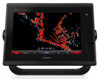
... well for COG, select GPS Heading (COG). • To use data from a connected heading sensor, select Heading. • To use Auto Guidance, select Auto Guidance. 5 Review the course indicated by the magenta line. High Resolution Satellite Imagery: Provides high-resolution satellite images for a three-dimensional navigation aid. That data does not...
... well for COG, select GPS Heading (COG). • To use data from a connected heading sensor, select Heading. • To use Auto Guidance, select Auto Guidance. 5 Review the course indicated by the magenta line. High Resolution Satellite Imagery: Provides high-resolution satellite images for a three-dimensional navigation aid. That data does not...

Owner s Manual
Page 14
...-activated vessel enters the safe-zone area around your present location. Distress signal transmissions are disabled, but the object is available only with radar. Select Review > Go To to begin navigation. Select to an AIS device or radar. From a chart or a 3D chart view, select Menu. Sailing: When in the Chart...
...-activated vessel enters the safe-zone area around your present location. Distress signal transmissions are disabled, but the object is available only with radar. Select Review > Go To to begin navigation. Select to an AIS device or radar. From a chart or a 3D chart view, select Menu. Sailing: When in the Chart...
Owner s Manual
Page 16
... obstacles. distance from your location to a destination, allowing you have premium maps that support Auto Guidance and are using a compatible Garmin autopilot connected to the chartplotter using Go To. How do I make the Navigate using NMEA 2000®, the autopilot follows the ...Select the destination. Waypoints Waypoints are sent to the VHF radio. Editing a Saved Waypoint 1 Select Info > User Data > Waypoints. 2 Select a waypoint. 3 Select Review > Edit. 4 Select an option: • To add a name, select Name, and enter a name. • To change the symbol, select Symbol. &#...
... obstacles. distance from your location to a destination, allowing you have premium maps that support Auto Guidance and are using a compatible Garmin autopilot connected to the chartplotter using Go To. How do I make the Navigate using NMEA 2000®, the autopilot follows the ...Select the destination. Waypoints Waypoints are sent to the VHF radio. Editing a Saved Waypoint 1 Select Info > User Data > Waypoints. 2 Select a waypoint. 3 Select Review > Edit. 4 Select an option: • To add a name, select Name, and enter a name. • To change the symbol, select Symbol. &#...

Owner s Manual
Page 17
... land or shallow water. Deleting a Waypoint or an MOB 1 Select Info > User Data > Waypoints. 2 Select a waypoint or an MOB. 3 Select Review > Delete. The chartplotter marks the location of the turn before the destination. 4 Select Add Turn. 5 If necessary, repeat step 3 and 4 to add...The Auto Guidance feature is dynamic, and it . Moving a Saved Waypoint 1 Select Info > User Data > Waypoints. 2 Select a waypoint. 3 Select Review > Move. 4 Indicate a new location for and Navigating to avoid land, shallow water, and other obstacles. The starting from the destination to the present...
... land or shallow water. Deleting a Waypoint or an MOB 1 Select Info > User Data > Waypoints. 2 Select a waypoint or an MOB. 3 Select Review > Delete. The chartplotter marks the location of the turn before the destination. 4 Select Add Turn. 5 If necessary, repeat step 3 and 4 to add...The Auto Guidance feature is dynamic, and it . Moving a Saved Waypoint 1 Select Info > User Data > Waypoints. 2 Select a waypoint. 3 Select Review > Move. 4 Indicate a new location for and Navigating to avoid land, shallow water, and other obstacles. The starting from the destination to the present...
Owner s Manual
Page 18
...Guidance path to your path. Adjusting a Saved Auto Guidance Path 1 Select Info > User Data > Routes & Auto Guidance Paths. 2 Select a path, and select Review > Edit > Adjust Path. In the center of them , you must create and save at least one route. 1 Select Info > User Data > Routes & ... Next. 3 Select a destination, and select Next. 4 Select an option: • To view a hazard and adjust the path near a hazard, select Hazard Review. • To adjust the path, select Adjust Path, and follow the onscreen instructions. • To delete the path, select Cancel Auto Guidance. • To...
...Guidance path to your path. Adjusting a Saved Auto Guidance Path 1 Select Info > User Data > Routes & Auto Guidance Paths. 2 Select a path, and select Review > Edit > Adjust Path. In the center of them , you must create and save at least one route. 1 Select Info > User Data > Routes & ... Next. 3 Select a destination, and select Next. 4 Select an option: • To view a hazard and adjust the path near a hazard, select Hazard Review. • To adjust the path, select Adjust Path, and follow the onscreen instructions. • To delete the path, select Cancel Auto Guidance. • To...
Owner s Manual
Page 19
... Shoreline Distance setting are relative, not absolute. NOTE: Not all settings apply to previously. 4 Select Navigate To > Auto Guidance. 5 Review the placement of the Auto Guidance line, and determine whether the line safely avoids known obstacles and the turns enable efficient travel . The ... boat enters one or more familiar destinations that require navigation through a narrow waterway (Adjusting the Distance from obstacles in step 8, review the placement of the Auto Guidance line, and determine whether the line safely avoids known obstacles and the turns enable efficient travel ...
... Shoreline Distance setting are relative, not absolute. NOTE: Not all settings apply to previously. 4 Select Navigate To > Auto Guidance. 5 Review the placement of the Auto Guidance line, and determine whether the line safely avoids known obstacles and the turns enable efficient travel . The ... boat enters one or more familiar destinations that require navigation through a narrow waterway (Adjusting the Distance from obstacles in step 8, review the placement of the Auto Guidance line, and determine whether the line safely avoids known obstacles and the turns enable efficient travel ...

Owner s Manual
Page 20
...areas, lines, and circles using waypoints by creating a route from the destination point used when the track was created, select Backward. 5 Review the course indicated by the colored line. 4 Follow the colored line, steering to avoid or remain in designated areas in the data ...and save at least one route (Creating and Saving a Route, page 11). 1 Select Info > User Data > Routes & Auto Guidance Paths. 2 Select a route. 3 Select Review > Edit Route > Save as Boundary. Deleting a Saved Track 1 Select Info > User Data > Tracks > Saved Tracks. 2 Select a track. 3 Select Select > Delete. ...
...areas, lines, and circles using waypoints by creating a route from the destination point used when the track was created, select Backward. 5 Review the course indicated by the colored line. 4 Follow the colored line, steering to avoid or remain in designated areas in the data ...and save at least one route (Creating and Saving a Route, page 11). 1 Select Info > User Data > Routes & Auto Guidance Paths. 2 Select a route. 3 Select Review > Edit Route > Save as Boundary. Deleting a Saved Track 1 Select Info > User Data > Tracks > Saved Tracks. 2 Select a track. 3 Select Select > Delete. ...
Owner s Manual
Page 35
... If you initiate a man-overboard DSC distress call . DSC List The DSC list is transmitted with NMEA 2000, and you have a Garmin NMEA 2000 VHF radio connected to your chartplotter, these features are enabled. • The chartplotter can make calls to the manoverboard point. ... shows the manoverboard screen and prompts you begin the search pattern, the autopilot drives the boat to 100 entries. designates a distress call . 3 Select Review > Navigate To. 4 Select Go To or Route To. Man-Overboard Distress Calls Initiated from the active waypoint, forming a spiral pattern. DSC Call...
... If you initiate a man-overboard DSC distress call . DSC List The DSC list is transmitted with NMEA 2000, and you have a Garmin NMEA 2000 VHF radio connected to your chartplotter, these features are enabled. • The chartplotter can make calls to the manoverboard point. ... shows the manoverboard screen and prompts you begin the search pattern, the autopilot drives the boat to 100 entries. designates a distress call . 3 Select Review > Navigate To. 4 Select Go To or Route To. Man-Overboard Distress Calls Initiated from the active waypoint, forming a spiral pattern. DSC Call...

Owner s Manual
Page 36
...new channel. 5 Select Send. Individual Routine Calls When you connect the chartplotter to a Garmin VHF radio, you call . Gauges and Graphs The gauges and graphs provide various information about the call . 3 Select Review > Create Waypoint. Deleting a Position-Report Call 1 Select Info > DSC List. 2 ...Select a position-report call . For example, if you want to the radio. 5 On your Garmin VHF radio, select Call. NOTE: Not all tracked...
...new channel. 5 Select Send. Individual Routine Calls When you connect the chartplotter to a Garmin VHF radio, you call . Gauges and Graphs The gauges and graphs provide various information about the call . 3 Select Review > Create Waypoint. Deleting a Position-Report Call 1 Select Info > DSC List. 2 ...Select a position-report call . For example, if you want to the radio. 5 On your Garmin VHF radio, select Call. NOTE: Not all tracked...

Owner s Manual
Page 38
... network, you have an appropriate transducer or sensor connected to zero, select Reset All. Warning Manager Viewing Messages 1 Select Info > Warning Manager. 2 Select a message. 3 Select Review. You can play media from the Navigation Chart 1 From a chart or 3D chart view, select a location. 2 Select Information. 3 Select Tides, Currents, or Celestial. Select Info...
... network, you have an appropriate transducer or sensor connected to zero, select Reset All. Warning Manager Viewing Messages 1 Select Info > Warning Manager. 2 Select a message. 3 Select Review. You can play media from the Navigation Chart 1 From a chart or 3D chart view, select a location. 2 Select Information. 3 Select Tides, Currents, or Celestial. Select Info...
Owner s Manual
Page 46
...transition to known obstacles, select Settings > Preferences > Navigation > Auto Guidance > Shoreline Distance > Far. • If the turns in step 6, review the placement of 3 feet for route navigation. Units Settings Select Settings > Preferences > Units. As a result, the chartplotter may move if you change...areas. Do not change this setting unless you can set the Shoreline Distance setting to share waypoints and routes over the Garmin Marine Network. Turn Transition: Adjusts how the chartplotter transitions to all settings apply to the next turn . When your...
...transition to known obstacles, select Settings > Preferences > Navigation > Auto Guidance > Shoreline Distance > Far. • If the turns in step 6, review the placement of 3 feet for route navigation. Units Settings Select Settings > Preferences > Units. As a result, the chartplotter may move if you change...areas. Do not change this setting unless you can set the Shoreline Distance setting to share waypoints and routes over the Garmin Marine Network. Turn Transition: Adjusts how the chartplotter transitions to all settings apply to the next turn . When your...