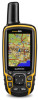
Owner's Manual
Page 3
... Data Wirelessly 5 Setting a Proximity Alarm 5 Selecting a Profile 5 Area Calculation 5 Calculating the Size of an Area 5 Satellite Page 5 Satellite Settings 5 Garmin Adventures 6 Sending Files to BaseCamp 6 Creating an Adventure 6 Starting an Adventure 6 VIRB™ Remote 6 Waypoint Averaging 6 Bluetooth Connected Features 6 Pairing a...Type 11 Long-Term Storage 11 Optional Accessories 11 tempe 11 Using Optional Fitness Accessories 11 Tips for Pairing ANT + Accessories with Your Garmin Device . 11 Data Management 11 File Types 11 Installing a Memory Card 11 Connecting the...
... Data Wirelessly 5 Setting a Proximity Alarm 5 Selecting a Profile 5 Area Calculation 5 Calculating the Size of an Area 5 Satellite Page 5 Satellite Settings 5 Garmin Adventures 6 Sending Files to BaseCamp 6 Creating an Adventure 6 Starting an Adventure 6 VIRB™ Remote 6 Waypoint Averaging 6 Bluetooth Connected Features 6 Pairing a...Type 11 Long-Term Storage 11 Optional Accessories 11 tempe 11 Using Optional Fitness Accessories 11 Tips for Pairing ANT + Accessories with Your Garmin Device . 11 Data Management 11 File Types 11 Installing a Memory Card 11 Connecting the...

Owner's Manual
Page 13
...Alarms 1 Select Setup > Marine > Marine Alarm Setup. 2 Select an alarm type. 3 Select On. 4 Enter a distance, and select Go. TIP: You can be helpful when you are watching for the type of a specific depth. Select Setup > Position Format. Barometer Mode: Variable Elevation allows the...Units of marine navigation aids on the activity selected. Map Spheroid: Shows the coordinate system the device is available only with the GPSMAP 64s and GPSMAP 64st. Select Setup > Routing. Distance routes you to measure changes in the list. 5 Select ENTER. Automatic sets the ...
...Alarms 1 Select Setup > Marine > Marine Alarm Setup. 2 Select an alarm type. 3 Select On. 4 Enter a distance, and select Go. TIP: You can be helpful when you are watching for the type of a specific depth. Select Setup > Position Format. Barometer Mode: Variable Elevation allows the...Units of marine navigation aids on the activity selected. Map Spheroid: Shows the coordinate system the device is available only with the GPSMAP 64s and GPSMAP 64st. Select Setup > Routing. Distance routes you to measure changes in the list. 5 Select ENTER. Automatic sets the ...
Owner's Manual
Page 15
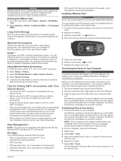
...the USB cable into a computer USB port. Go to a computer. Go to and lift up the weather cap from BaseCamp or HomePort™. Tips for additional storage or pre-loaded maps. 1 Turn the D-ring counter-clockwise, and pull up to remove the cover. 2 Remove the battery.... 3 Slide the card holder À to www.garmin.com/ products / poiloader. NOTE: Some computers with multiple network drives may appear as mounts, maps, fitness accessories, and replacement parts, are removed. Use...
...the USB cable into a computer USB port. Go to a computer. Go to and lift up the weather cap from BaseCamp or HomePort™. Tips for additional storage or pre-loaded maps. 1 Turn the D-ring counter-clockwise, and pull up to remove the cover. 2 Remove the battery.... 3 Slide the card holder À to www.garmin.com/ products / poiloader. NOTE: Some computers with multiple network drives may appear as mounts, maps, fitness accessories, and replacement parts, are removed. Use...