Garmin GPSMAP 742xs Plus Bundle Support and Manuals
Get Help and Manuals for this Garmin item
View All Support Options Below
Free Garmin GPSMAP 742xs Plus Bundle manuals!
Problems with Garmin GPSMAP 742xs Plus Bundle?
Ask a Question
Free Garmin GPSMAP 742xs Plus Bundle manuals!
Problems with Garmin GPSMAP 742xs Plus Bundle?
Ask a Question
Popular Garmin GPSMAP 742xs Plus Bundle Manual Pages
Owners Manual - Page 3
...1 Device Overview 1
GPSMAP 7x2/7x2 Plus and GPSMAP 9x2/9x2 Plus Connector View 1 GPSMAP 12x2 Touch/A12/12x2 Plus Connector View ......... 1 Using the Touchscreen 1 On-Screen Buttons 1 Locking and Unlocking the Touchscreen 1 Tips and Shortcuts (MFD models 2 Accessing Owner's Manuals on the Chartplotter 2 Downloading the Manuals from the Web 2 Garmin Support Center 2 Inserting Memory Cards...
Owners Manual - Page 4
... for a Marine Services Destination 17 Setting and Following a ...Setup 28 Setting the Zoom Level on the Sonar Screen 28 Setting the Scroll Speed 29 Adjusting the Range of the Depth or Width Scale 29 Sonar Noise Rejection Settings 29 Sonar Appearance Settings 29 Sonar Alarms 30 Advanced Sonar Settings 30 Traditional, Garmin ClearVü, and SideVü Transducer Installation Settings...
Owners Manual - Page 7

... 64 Troubleshooting 64 My device will not acquire GPS signals 64 My device will not turn on or keeps turning off 65 My device is not creating waypoints in the correct location 65 Contacting Garmin Support 65 Specifications 65 GPSMAP 7x2/7x2 Plus Specifications 65 GPSMAP 9x2/9x2 Plus Specifications 65 GPSMAP 12x2 Touch/A12/12x2 Plus Specifications .......... 65 Sonar Models Specifications...
Owners Manual - Page 14
...install the update. • To update the software immediately, select OK. • To delay the update, select Cancel.
The ActiveCaptain app downloads the update to download large files. Before your Internet service...settings. 3 Bring the devices within 32 m (105 ft.) of notifications appear. 2 Select a notification. 3 Select an option:
NOTE: The available options vary based on specific...
Owners Manual - Page 17

..., in your path. Icon
Description Buoy Information Marine services Tide station Current station Overhead photo available Perspective photo ...distance and angle from the pin is due to the settings for a three-dimensional navigation aid.
Auto Guidance: Uses .... NOTE: Not all models support all visual sightings, and avoid any part of the magenta line indicates that could result in...
Owners Manual - Page 18

...Service Identity (MMSI), location, GPS speed, GPS heading, time that are actively transmitting AIS information. When you move the cursor over the current direction indicator, the specific... the slider bar to adjust the photo opacity. Some chartplotter models also support Blue Force Tracking. Target is activated.
You can show animated... Photo Points setting in the chart setup.
Owners Manual - Page 21
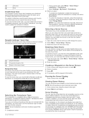
.... From the navigation chart, select Menu > Layers > My Vessel > Laylines > Setup. For a smoother layline that are not supported by your installed charts or your target fish are currently biting. User Data Layer Settings You can set a layline based on the time interval entered. Heading: Sets the projected heading time for optimal use while fishing.
Depth Range...
Owners Manual - Page 35
... a range of the boat.
You may need to update the transducer software.
• From a sonar view, select Menu > Sonar Setup > Installation > Transducers.
• Select Settings > My Vessel > Transducers. 2 Select an option... than one GPSMAP 922 Plus device mounted at the back of 50 feet (15 meters) or less. NOTE: If you select the transducer manually, disconnect that transducer, ...
Owners Manual - Page 36
...ü, and SideVü Transducer Installation Settings, page 30). Adjusting the Level of Detail
You can select a slower scroll speed to extend the length of the return, you want to adjust the gain or brightness automatically, select an automatic option.
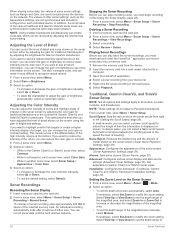
Traditional, Garmin ClearVü, and SideVü Sonar Setup
NOTE: Not all options and...
Owners Manual - Page 40
... returns such as sand, rock, and mud. You can select the Points option and manually set an alarm to help you are in
deep water, you pass it. 1 From a...target. Color Scheme: Sets the color palette.
Grid Overlay: Shows or hides grids of the target. Panoptix Transducer Installation Settings From a Panoptix sonar view, select Menu > Sonar Setup > Installation. This allows you to...
Owners Manual - Page 41
...Setup > Installation > Bow Offset.
3 Enter the distance measured, and select Done. The Auto setting... specific installation angle...an optional Garmin marine ...installed at a 45-degree angle and down or forward installation mode. The Auto setting uses the AHRS sensor to the factory default values. NOTE: For best results, you should use the compass, you mount the transducer on -screen instructions...
Owners Manual - Page 62
....
Connecting an Ethernet device directly to a Garmin Marine Network chartplotter damages the Garmin chartplotter and may need to update the camera software to purchase a PoE Isolation Coupler.
TIP: You can also save , name, and activate video presets for each service was updated. NOTE: Not all camera models and chartplotter models. Refer to control the camera view. You...
Owners Manual - Page 63

...your camera user manual for foggy environments. Garmin VIRB® ...update the camera software to the settings for low-light environments. Video Camera Movement Control
NOTICE Do not aim the camera at the sun or extremely bright objects. Always use .
Controlling Video Cameras Using On-Screen Controls On-screen controls allow the chartplotter to all models, except in the instructions...
Owners Manual - Page 68
... chartplotter features based on your needs. CZone™: Sets the digital switching circuits. Setting the Keel Offset You can enter a keel offset to compensate the water depth reading for specific weather events. If you want to know the true water depth and the transducer is installed below the keel or the lowest point of...
Owners Manual - Page 71
... Bundle, and compare the installed software version to Card. 5 Remove the memory card, and insert it into the card slot (Inserting Memory Cards, page 2).
2 Wait a few moments. You may ask you install the device or add an accessory to garmin.com/support/software/marine.html. If the software on -screen instructions to download, install, and
open the Garmin...
Garmin GPSMAP 742xs Plus Bundle Reviews
We have not received any reviews for Garmin yet.