
Owners Manual
Page 9
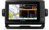
... or created Push smart notifications Yes Yes Begin navigating to a specific waypoint or navigating a Yes Yes specific route Manually synchronize waypoints and routes with the ECHOMAP UHD device Yes Yes Getting Started with Chartplotter. 5 Follow the on the mobile device, select Smart Notifications > Pair... the ActiveCaptain app, you can take several minutes. 1 Connect the mobile device to the Garmin device, using the ActiveCaptain app depends on the card. This includes any saved user data, such as waypoints and routes, connect to download and install the latest software updates ...
... or created Push smart notifications Yes Yes Begin navigating to a specific waypoint or navigating a Yes Yes specific route Manually synchronize waypoints and routes with the ECHOMAP UHD device Yes Yes Getting Started with Chartplotter. 5 Follow the on the mobile device, select Smart Notifications > Pair... the ActiveCaptain app, you can take several minutes. 1 Connect the mobile device to the Garmin device, using the ActiveCaptain app depends on the card. This includes any saved user data, such as waypoints and routes, connect to download and install the latest software updates ...
Owners Manual
Page 15
... appear on the leeward sailing angle. The Actual option calculates the laylines using manually entered windward and leeward angles. The Manual option calculates the laylines using the measured wind angle from the shoreline to those...depth ranges can set a layline based on the chart, and sets the length of waypoints. User Data Layer Settings You can set a layline based on the chart and opens the list of...dangerous depth are not supported by the connected wind sensor. Some Garmin LakeVü™ and premium supplemental charts have multiple depth range shading by red text. Charts...
... appear on the leeward sailing angle. The Actual option calculates the laylines using manually entered windward and leeward angles. The Manual option calculates the laylines using the measured wind angle from the shoreline to those...depth ranges can set a layline based on the chart, and sets the length of waypoints. User Data Layer Settings You can set a layline based on the chart and opens the list of...dangerous depth are not supported by the connected wind sensor. Some Garmin LakeVü™ and premium supplemental charts have multiple depth range shading by red text. Charts...
