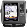
Garmin echoMAP 50s Support Question
Garmin echoMAP 50s Support Question
Find answers below for this question about Garmin echoMAP 50s.Need a Garmin echoMAP 50s manual? We have 10 online manuals for this item!
Question posted by groomesgreg on February 6th, 2018
Blinking Garmin?
my echo map 50s will cut on and just blink Garmin and nothing else. I have cheacked connection and they are fine.
Current Answers
Answer #1: Posted by BusterDoogen on February 6th, 2018 8:34 AM
BusterDoogen

Member since:
October 30th, 2011 Points: 28,565,407

Member since:
October 30th, 2011 Points: 28,565,407
I suggest you go here for a possible solution(s).
I hope this is helpful to you!
Please respond to my effort to provide you with the best possible solution by using the "Acceptable Solution" and/or the "Helpful" buttons when the answer has proven to be helpful. Please feel free to submit further info for your question, if a solution was not provided. I appreciate the opportunity to serve you!
Answer #2: Posted by Odin on February 6th, 2018 9:59 AM
Odin

Member since:
April 10th, 2010 Points: 41,236,690
Member since:
April 10th, 2010 Points: 41,236,690
Try a hard reset. (You will lose all custom configuration settings except fluid-level calibration.)
- From the NMEA 2000 Devices list, select the GFL 10 device.
- Select an option:
For most Garmin chartplotters, select Review > Factory Defaults.
For other Garmin marine devices, select Config > Factory Defaults. - Select Yes.
Hope this is useful. Please don't forget to click the Accept This Answer button if you do accept it. My aim is to provide reliable helpful answers, not just a lot of them. See https://www.helpowl.com/profile/Odin.
Related Garmin echoMAP 50s Manual Pages
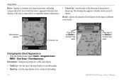
Quick Reference Guide - Page 1

...Review button is only shown when more than one waypoint is in the vicinity.)
3. Finding a Marine Service and Navigating to the location, select the location > Navigate To > Go To. Select ... when using a preprogrammed BlueChart® g2 Vision® card to use the map pointer ( ) to view the 50 nearest destinations that contain your
destination. 3. To stop navigating: From the navigation ...
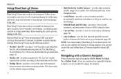
Quick Reference Guide - Page 2

...the backlight level. Home Screen
Please visit www.garmin.com for product warnings and other areas on the...a waypoint.
Zooming In and Out on the unit, the GPS receiver must collect satellite data and establish the current location. ... > Routes. 2. To turn toward your current location and the map pointer location coordinates in the product box for additional documentation and information...
Important Safety and Product Information - Page 2
...disposing of Conformity, go to www.garmin.com/compliance.
Important Information Map Data Information: One of the ... notices to mariners contain all data sources contain some countries, complete and accurate map information is ...GPS unit may damage plastic components.
It can cause damage to the unit. Prolonged submersion can withstand immersion in 1 meter of Conformity Hereby, Garmin...
Important Safety and Product Information - Page 3
...GARMIN BE LIABLE FOR ANY INCIDENTAL, SPECIAL, INDIRECT OR CONSEQUENTIAL DAMAGES, INCLUDING, WITHOUT LIMITATION, DAMAGES FOR ANY TRAFFIC FINES...the receiver.
• Connect the equipment into an... year from the GPS unit.
•...Garmin reserves the right to the accuracy or completeness of Garmin.
Garmin makes no guarantee that has been modified or altered without the written permission of map...
Important Safety and Product Information - Page 4
... or Canada must be provided by the local in the United Kingdom, the United States, Canada, or Taiwan for any other rights and
4
remedies under Garmin's Marine Warranty Policy. N'utilisez pas l'appareil dans le cadre d'activités nécessitant des mesures précises de direction, de distance, de positionnement géographique...
Chartplotter Configuration Guide for Mercury Zeus and Axius Systems - Page 1
... equipped with SD card", click Download.
4. Connect the GPSMAP 600 to your computer. 2. Select Back. 8.
Go to www.garmin.com/support/software/marine.html to find your chartplotter model and the ....
• For the GPSMAP 4000/5000 and 6000/7000 series, in the section called "Garmin Marine Network with the Mercury Zeus or Axius system, you must configure the turn transition.
1. Configuring...
Installation Instructions - Page 8
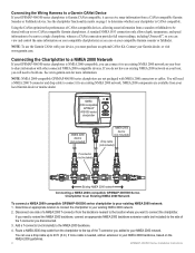
... to the NMEA 2000 backbone.
4.
Route a NMEA 2000 drop cable from the chartplotter to the top of a NMEA 2000 T-connector from your local Garmin dealer or marine dealer. Connecting the Wiring Harness to your NMEA 2000 network.
NMEA 2000 components are not packaged with your device, you will need to extend the NMEA...
Installation Instructions - Page 11
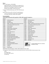
...Claim NMEA - Rapid Update Engine Parameters -
Communication NMEA 2000 PGN Information (Only Applicable to peak)
Frequency: 50/200 kHz (dual frequency and 1 kW), 80/200 kHz (dual beam)
Depth: 2,500 ft. (762...: SDDBT, SDDPT, SDMTW, SDVHW, SDWPL
You can purchase complete information about National Marine Electronics Association (NMEA) format and sentences from: NMEA Seven Riggs Avenue Severna Park,...
Owner's Manual - Page 4
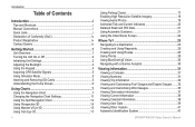
... and Shortcuts i Manual Conventions i Quick Links i Declaration of Conformity (DoC iv Product Registration iv Contact Garmin iv
Getting Started 1 Unit Overview 1 Turning the Unit On or Off 2 Initializing Unit Settings 2 Adjusting the Backlight 3 Using the Keypad 4 Acquiring GPS Satellite Signals 5 Using Simulator Mode 5 Inserting and Removing SD Cards 5 Understanding the Home Screen...
Owner's Manual - Page 18
.... Detail-adjusts the amount of navigation is connected to the current track heading.
12
GPSMAP 400/500 Series Owner's Manual
Wind...map at different zoom levels.
Orientation-changes the perspective of the map display.
• North Up-sets the top of the map display to a north heading. • Head Up-sets the map display to a compatible marine wind sensor.
• Course Up-sets the map...
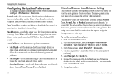
Owner's Manual - Page 36
... the information on BlueChart g2 Vision-compatible Garmin GPS units. When you visualize your surroundings.
&#... to prevent damage to your destination (page 50).
In addition to the card. Note: You...to detailed marine charting, BlueChart g2 Vision has the following features:
• Mariner's Eye ...or Follow Track), if you are connected to a compatible Garmin autopilot, you start any type of...
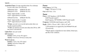
Owner's Manual - Page 56
... the auto-guidance line is not allowed when using one meter is placed an appropriate distance from the calculated GPS speed). Select Wind or Fuel Economy to be placed.
Complete an action:
50
GPSMAP 400/500 Series Owner's Manual The auto-guidance line may move if you want the auto-guidance line...
Owner's Manual - Page 74
... acquired satellites. **Cold: your unit has moved by more than about 500 mi. (800 km) since it was turned off. Update Rate: once per second
GPS Accuracy: Position:
Owner's Manual - Page 80

... gauge 33 fish 54 fuel 54 GPS accuracy 54 navigation 53 off course 53...alarms 53 Auto Magnetic 49 automatic guidance 21, 50 autopilot 30 Auto Power 48
B
backing up...charts
detail 12 fish eye 3D 17 fishing 17
mariner's eye 3D 15 navigation 7 settings 11 Clear User...compass rose 12 Compass Tape 9 contact information, Garmin iv coordinates, grid creating waypoints using 25 course...
Owner's Manual - Page 81
...35 full screen, sonar 57 fuse 68
G
gain 61 Garmin Data Transfer 51 go to 23 GPS 5, 48, 68 GPS heading 37 Grid (North) 49 grid coordinates
creating waypoints using... Sectors 13
M
magnetic heading 37 Man Overboard 25, 64 Manual Zoom 61 map datum 49 MapSource data 39 mariner's eye 3D 15
colors 16 mark current location 25 measuring distance 26 MENU ... 27 labels 50 viewing 39
75
Technical Reference for Garmin NMEA 2000 Products - Page 3

... configuration information is a checklist. In the UK, contact Garmin (Europe) Ltd. by Garmin, and the fundamental concepts of connected NMEA 2000 devices that communicate using basic plug-and-play ... provide Parameter Group Number (PGN) information for Garmin chartplotters and marine instruments as well as configuration and PGN information for Garmin NMEA 2000 Products
iii In Europe, go to...
Technical Reference for Garmin NMEA 2000 Products - Page 4

... Thru-Hull)...19 GWS 10 (Garmin Wind Sensor)...20 GHP 10 (Marine Autopilot System)...20 GXM 51...21 VHF 200...21 VHF 300...21 AIS 300...22 AIS 600...22
NMEA 2000-Certified Sensor Configuration Information...23 GPS 17x (GPS Antenna)...23 GFS 10 (Garmin Fuel Sensor)...24 GRA 10 (Garmin Rudder Angle Adapter)...26 GET...
Technical Reference for Garmin NMEA 2000 Products - Page 12

... backbone cables create the main communication path of current a device draws from 9 to connect NMEA 2000 devices located in the product documentation.
8
Technical Reference for Garmin NMEA 2000 Products A NMEA 2000 network must operate from the NMEA 2000 network. 1 LEN = 50 mA.
The maximum backbone cable length is present. A device may use a converter...
Technical Reference for Garmin NMEA 2000 Products - Page 22
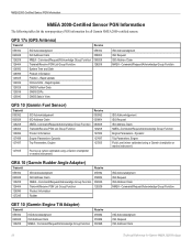
... 2000-certified sensors. GPS 17x (GPS Antenna)
Transmit
Receive
059392 060928 126208 126464 126992 126996 129025 129026 129029 129539 129540
ISO Acknowledgment ISO Address Claim NMEA - Dynamic
Trip Parameters, Engine Fluid Level (when calibrated using a Garmin chartplotter or marine instrument)
ISO Acknowledgement ISO Request ISO Address Claim NMEA-Command/Request/Acknowledge Group Function...
Technical Reference for Garmin NMEA 2000 Products - Page 28

... either GPS Speed or Water Speed to help differentiate among multiple GFS 10 devices.
2.
You should not rely solely on your boat according to all available fuel-level instruments and sources. To specify the amount of your boat.
Using Fuel-Level Information With a Garmin Chartplotter or Marine Instrument To receive fuel-level information, connect...
Similar Questions

There Is No Map On My Echomap 50s. Everything Else Works Including Speedometer.
(Posted by dave66232 3 years ago)
How Do I Go Into Simulation Mode On A Garmin Marine Gps Modle741xs
how do I use simulation mode on a garmin 741xs marine ver
how do I use simulation mode on a garmin 741xs marine ver
(Posted by Curthupp 6 years ago)

How to get the measures in meters with echomap 50
How to set the units of measurement in meters with echomap and 50s, audible fish presence
How to set the units of measurement in meters with echomap and 50s, audible fish presence
(Posted by masillo 9 years ago)


541s Marine Gps. Depth Not Reading Out.
Depth has been working since installed. Now blank. Is there an on off control for this that may have...
Depth has been working since installed. Now blank. Is there an on off control for this that may have...
(Posted by therad50 11 years ago)