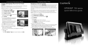
Garmin GPSMAP 740/740s Support Question
Garmin GPSMAP 740/740s Support Question
Find answers below for this question about Garmin GPSMAP 740/740s.Need a Garmin GPSMAP 740/740s manual? We have 7 online manuals for this item!
Question posted by silasmcmeekin on August 21st, 2011
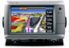
Garmin 740s
Have a Garmin 740s. Is there a configuration so the auto guidance will route to a destination following the icw? Seems to always want to put me outside.
Current Answers
Related Garmin GPSMAP 740/740s Manual Pages
Technical Reference for Garmin NMEA 2000 Products - Page 3
... a NMEA 2000 network to be sure you want.
• The last two sections provide Parameter Group Number (PGN) information for Garmin chartplotters and marine instruments as well as configuration and PGN information for in-country support information, or contact Garmin (Europe) Ltd. In the USA, go to www.garmin.com/support and click Contact Support for...
Installation Instructions - Page 1
... according to the following additional installation options are missing, contact your GPSMAP 700 series chartplotter,...GPS antenna (page 6). • Connecting the chartplotter to a Garmin marine radar (page 6). • Connecting the chartplotter to http://my.garmin.com.
In the UK, contact Garmin (Europe) Ltd. Before installing your Garmin dealer immediately. Mount the GPSMAP...
Owner's Manual - Page 4
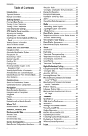
...Chartplotter 1 Initial Chartplotter Settings 2 GPS Satellite Signal Acquisition 2 Adjusting the...Auto Guidance 21
Combinations 22 About the Combination Screen 22 Combination Screen Configuration 22
Navigation 25 Basic Navigation Questions 25 Navigation with a Chartplotter 25 Waypoints 26 Routes 28 Tracks 30 Navigating with a Garmin Autopilot 32
Where To 33 Marine Services Destinations...
Owner's Manual - Page 9
...4. GPSMAP 700 Series Owner's Manual
5 Some other obstacles.
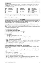
Icon Description Current station
Information
Icon Description Marine services
...using Auto Guidance, a gray segment within any land, shallow water, or other areas on electronic chart information.
Follow ...navigate directly to the location. • Select Route To to create a route to the location, including turns (page 28)....
Owner's Manual - Page 20
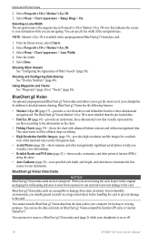
... allows you are not waterproof. In addition to detailed marine charting, BlueChart g2 Vision has the following features:
• Mariner's Eye 3D (page 17)-provides a view from exposure to sun and rain to prevent damage to the information on BlueChart g2 Vision-compatible Garmin GPS units or Garmin HomePort™. You can specify the width of...
Owner's Manual - Page 22
...Aft, Port, or Starboard.
18
GPSMAP 700 Series Owner's Manual
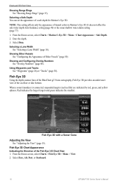
Showing and Configuring Overlay Numbers See "Overlay Numbers" (page 48). From the Home screen, select Charts > Mariner's Eye 3D > Menu > Chart ... affect the safe water depth Auto Guidance setting (page 46) or the sonar shallow water alarm setting (page 77).
1.
Showing Other Vessels See "Configuring the Appearance of the Fish ...
Owner's Manual - Page 25

...indicates a
rising tide. Searching for, and Navigating to a destination using Guide To (page 26). Configuring Auto Guidance Settings See "Auto Guidance Line Configurations" (page 45). Tide
Station
Current direction indicators appear as...the direction of the tide at the location appears above the station indicator.
GPSMAP 700 Series Owner's Manual
21 To do so, information for tide station...
Owner's Manual - Page 29
... 3D, or Mariner's Eye 3D.
Build a single-leg route and navigate it using Route To.
See "Setting and Following a Course Using Auto Guidance" (page 26).
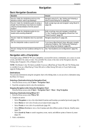
How do I want to a location using the shortest distance from Your Present Location" (page 28). Navigation with a Chartplotter
To navigate using the Where To? You can select a destination using a GPSMAP 700 series chartplotter...
Owner's Manual - Page 30
... any other screen by the magenta Auto Guidance line. Select Navigation Chart or Fishing Chart.
26
GPSMAP 700 Series Owner's Manual Select a destination using a chart or Where To?...Following a New Route Using Route To See "Creating and Navigating a Route from your boat when you are off course, follow a course to a destination using Auto
Guidance. Following a Saved Route Using Route...
Owner's Manual - Page 37
...destination. Follow the magenta line, steering to a Marine Services Destination
CAUTION The Auto Guidance feature of the BlueChart g2 Vision data card is based on electronic chart information.
Where To? Use the Where To?
Select the marine service category to which you have created. Complete an action:
• Select Go To.
• Select Route... want to use Auto Guidance....
Owner's Manual - Page 38

... may pass over land or shallow water. Follow the magenta line, steering to avoid land, shallow water, and other dangerous objects. The 50 nearest destinations that Auto Guidance cannot calculate part of the Auto Guidance line. That data does not ensure obstacle and bottom clearance. Select Navigate To.
34
GPSMAP 700 Series Owner's Manual Select Done. Use...
Owner's Manual - Page 49
..., select Configure > Navigation > Route Labels. 2. Select Done.
GPSMAP 700 Series Owner's Manual
45 From the Home screen, select Configure > System > Beeper/Display > Beeper. 2. Select a language. Navigation Preferences
Route Settings Selecting a Route Label Type You can set the parameters the chartplotter uses when calculating an Auto Guidance line. Configuring Route Turn Transitions...
Owner's Manual - Page 50
...
46
GPSMAP 700 Series Owner's Manual From the Home screen, select Configure > Navigation > Auto Guidance > Shoreline Distance > Normal.
3. Review the placement of the Auto Guidance line ...Configure > Navigation > Auto Guidance.
2. Enter the minimum safe height.
7. Select Done. The Auto Guidance line may not reposition the Auto Guidance line, unless the destination selected in the Auto Guidance...
Owner's Manual - Page 51
... default coordinate system is satisfactory, select Menu > Stop Navigation. GPSMAP 700 Series Owner's Manual
47
From the Home screen, select Configure > Units. 2. Proceed to step 11. • If the Auto Guidance line is structured. As a result, the chartplotter may not reposition the Auto Guidance line, unless the destination selected in which a given location reading appears, and the...
Owner's Manual - Page 57

....
Device Configuration
Copying Waypoints, Routes, and Tracks to the network.
Copying Waypoints, Routes, and ...card, into a folder named Garmin\UserData. 3. Insert the memory ... into the SD card slot on the chartplotter. 2. GPSMAP 700 Series Owner's Manual
53 Remove the memory card ...memory card for waypoints, routes, and tracks from one of the following actions to indicate the name...
Owner's Manual - Page 75
...GPS heading
➐ Transducer frequency
Setting the Zoom Level on the sonar data at two-times magnification.
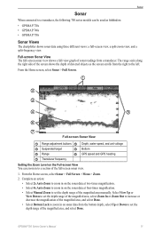
• Select 4x Auto Zoom to zoom in on the Full-screen View You can be used as the screen scrolls from a transducer. GPSMAP...fishfinders: • GPSMAP 720s • GPSMAP 740s • GPSMAP 750s
Sonar Views...following 700 series models can zoom in to a section of the full-...
Owner's Manual - Page 94
...GPS accuracy 52 navigation 51 off course 51 shallow water 77 sonar 77 system 51 total fuel onboard 52 unit voltage 51 water temperature 77 alignment 43 anchor drag alarm 51 animated currents, tides 8, 21 antenna connector 1 rotation speed 68 size 68 apparent wind 41 arrival alarm 51 Auto Guidance... 49, 67 configuration, chartplotter 44 configure, button 3 contact...shading 10 destinations 25 navigating...
Owner's Manual - Page 96
...32 rings 68 roses 11 rotation spd 68 route labels 45 safe depth 18, 46 safe height 46
GPSMAP 700 Series Owner's Manual Index
P panning
...a-scope 75 AIS 13 anchor drag 51 antenna size 68 arrival 51 Auto Guidance 46 auto power up 44 backlight 2 beeper 45 calibrate water speed 50 chart ...76 front of boat 69 fuel capacity 51 gain 63, 76 GPS 85 GPS accuracy 52 hazard colors 17 heading 47 heading line 9, 68...
Quick Reference Guide - Page 1
... Home screen, select Charts. 2.
Turn Selected
When you have reached the destination, you want to make the last turn that may pass over land or shallow water.
Navigating Using a Chart
Navigating to a Point on the Chart
CAUTION The Auto Guidance feature of the Route. Complete an action:
• Select Go To to navigate directly...
Quick Reference Guide - Page 2

..., select the waypoint on electronic chart information. Navigating to a Marine Service
Navigating to www.garmin.com for minimum safe water depth and minimum safe obstacle height.
6. Review the course indicated by touching Mark at a Different Location 1. Go to a Marine Services Destination
CAUTION The Auto Guidance feature of the screen and select Edit Waypoint. 6. These trademarks...
Similar Questions

How Do I Go Into Simulation Mode On A Garmin Marine Gps Modle741xs
how do I use simulation mode on a garmin 741xs marine ver
how do I use simulation mode on a garmin 741xs marine ver
(Posted by Curthupp 6 years ago)


How Do I Do An Automatic Boat Route? Have Garmin 740s Gpsmap With G2 Vision Card
(Posted by Anonymous-115411 10 years ago)

541s Marine Gps. Depth Not Reading Out.
Depth has been working since installed. Now blank. Is there an on off control for this that may have...
Depth has been working since installed. Now blank. Is there an on off control for this that may have...
(Posted by therad50 11 years ago)