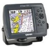
Garmin GPSMAP 172C Support Question
Garmin GPSMAP 172C Support Question
Find answers below for this question about Garmin GPSMAP 172C - Marine GPS Receiver.Need a Garmin GPSMAP 172C manual? We have 2 online manuals for this item!
Question posted by guggla on April 18th, 2012
Garmin 172c
what do I need, if I want to upload maps to my bluechart card to my Garmin 172c
Current Answers
Related Garmin GPSMAP 172C Manual Pages
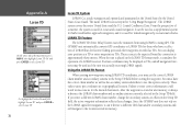
Owner's Manual - Page 3
... on choosing one of the product name) in case your product name needs service. The Garmin GPSMAP 172/172C models utilize the proven performance of your convenience. This manual covers instructions for your new navigation system, take the time to create an unsurpassed marine navigation chartplotter. Unit operation and specifications will be the same on...
Owner's Manual - Page 5
... to this unit only as a navigational aid. See www.garmin.com/prop65 for any discrepancies or questions before continuing navigation.
...TO LOCAL, STATE, OR FEDERAL LAWS. Virtually all information needed to navigate safely.
• Use this product, see ... charts and notices to mariners contain all data sources contain some countries, complete and accurate map information is either not ...
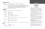
Owner's Manual - Page 7
...need:
Precision Performance • (172) 10 level grayscale FSTN display with backlighting • (172C) 256-color CSTN display with backlighting • 12-channel parallel receiver tracks and uses up to 50 waypoints each • Uploadable maps using Garmin's MapSource PC products and BlueChart Data Cards...electronic charting capability, the Garmin GPSMAP 172/172C is a powerful navigation ...
Owner's Manual - Page 8
...Adapter • Cigarette Lighter Adapter • BlueChart Marine Data Cards, MapSource CDs, USB Data Card Programmer, and Data Cards • GSD 20 Remote Sounder Module • GBR 23 Beacon Receiver for differential corrections
Introduction Packing List
vi
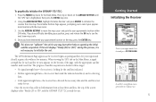
Before installing and getting started with remote antenna. Standard Package: • GPSMAP 172/172C Unit • GA 29 Remote External...
Owner's Manual - Page 15
...receiver from at least three satellites, the top of the screen displays either "Ready (2D or 3D)", and the GPSMAP 172/172C is not necessary to your approximate location within a few minutes. Use the ARROW KEYPAD to move the map... and should acquire a fix within 200 miles. The GPS Information Page appears as the receiver begins acquiring satellites for your approximate location on the Main...
Owner's Manual - Page 16
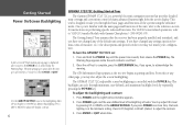
...then release the POWER key. The GPS Information Page appears as the receiver begins acquiring satellites. The GPSMAP 172/172C's adjustable screen backlighting is controlled with Garmin Chartplotters" (190-00241-03). Press...Module with the POWER key. The Getting Started Tour assumes that provides detailed map coverage and convenient control of measure, etc.), the descriptions and pictures in ...
Owner's Manual - Page 21
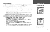
...GPSMAP 172/172C position in the simulator setup window and press ENTER. 4. The NAV/MOB key, located on to the fun part-going to select a pre-programmed tour route using the receiver's steering guidance and map... practice, you 're going to a destination. Going to a Destination
GPS is used throughout the GPSMAP 172/172C system to provide tab style options and functions. This also shows how ...
Owner's Manual - Page 40
...primarily for the name. 4. This can be determined by looking at the GPS tab on the Main Menu.
To mark your present position. To enter a...present position (or cursor or map item position) in order to select a map position or map item from the map display using three basic methods:
• ENTER/MARK key- Marking Your Present Position
The Garmin GPSMAP 172/172C's ENTER/MARK key lets you...
Owner's Manual - Page 63
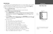
... Page
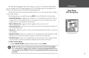
The GPSMAP 172/172C's Main Menu Page provides access to various waypoint, system, navigation and interface management, and setup menus in the GPSMAP 172/172C's system,...Garmin Chartplotters" (190-00241-03) for additional instructions changing settings and entering data. See pages 21.
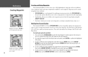
• Hiway - lets you want to the Menu tab list. Press QUIT to return to a data card.
• Map...
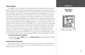
Owner's Manual - Page 64
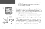
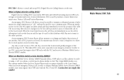
...settings. • Comm - the receiver is shown in the status field). As soon as the GPSMAP 172/172C has collected the necessary data from the best satellites in view to the receiver and whether or not they are ... bird's-eye view of the position of the sky view to help determine if any given moment. GPS Tab
Signal Strength Bars
Center dot - 90° 90° above the horizon
Inner ring- 45...
Owner's Manual - Page 65
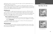
... and '2D or 3D Differential' appears in developmental service. When WAAS differential correction has been received for GPS satellites (numbers 32 or below), a 'D' appears in your area. There are no nearby ... are currently two WAAS satellites that can be limited by your GPSMAP 172/172C. To disable/enable WAAS capability:
1. From the GPS tab, press MENU, then use , but land/sea based users...
Owner's Manual - Page 67
...Map Page to initially help the receiver acquire more quickly.
allows the receiver to the unit and Garmin DGPS, RTCM In/NMEA Out, or Other DGPS is enable on the GPS...GPS is automatically disabled (WAAS Off). The SNR depends upon the mounting of the receiver...the receiver ...Reference Main Menu: GPS Tab Options
GPS Tab Options Menu
57... It is not possible for the GPS Info display only.
• ...
Owner's Manual - Page 73
...)? The 9-digit MMSI number acts like a phone. Garmin does not supply this number!
Once a DSC position is used by mariners to the Coast Guard when used in a Position Report and as who they are in an emergency situation. Any time a vessel receives a DSC call ," without the need a phone number to dial. Reference Main Menu...
Owner's Manual - Page 75
... a message displays when a Distress Call is connected to a VHF with DSC
output, you a Distress Call has been received, an alarm sounds (if enabled).
Position Reports are broadcasted to store incoming information received from another user's DSC capable VHF/GPS combination. Any DSC-equipped mariner (on sea or land) within range. When the Garmin GPSMAP 172/172C is received.
Owner's Manual - Page 77

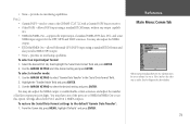
... like the MMSI numbers to enter the numbers/letters. 4. DSC Setup Garmin chartplotters have more than one GPS chartplotter.
Another way to access the New Directory Item window. This option...Adding a Directory Entry
DSC Setup "Simulate.." Press ENTER to accept the entry. If you want only DSC to highlight the first digit on the Arrow Keypad to that particular MMSI number. ...
Owner's Manual - Page 83
...NMEA output. • RTCM In/NMEA Out -
Use the ARROW KEYPAD to connect the GPSMAP 172/172C with a Garmin DGPS beacon receiver. • Other DGPS - Settings affects both Port 1 and Port 2 NMEA outputs. ...two Garmin units, be sure to always set to NMEA In/NMEA Out to use the other unit to 'Host' and use this option. provides no interfacing capabilities. allows Differential GPS (...
Owner's Manual - Page 88
... have a collection of LORAN fixes for ocean and coastal navigation.
The GPSMAP unit automatically converts GPS coordinates to using GPS. Or, highlight the Position Format field, highlight 'Loran TD' and ...thirty meters. From the perspective of a mariner, the system is placed in the LORAN TD format mode, it simulates the operation of a LORAN receiver. When the unit is used for "LOng...
Owner's Manual - Page 97
... x 3.7" D (122.5mm x 157.5mm x 92.5mm)
Weight:
1.0 lb 1oz.(.481Kg)
Display: (172C) 3.2" W x 3.2" H (81.28mm) CSTN (Color Super Twist Nematic) with adjustable CCFL (Cold Cathode ...Receiver:
Differential-ready 12 parallel channel WAAS capable receiver
Acquisition Times:
Warm:
Approx. 15 seconds
Cold:
Approx. 45 seconds
AutoLocate: Approx. 2 minutes
Update Rate: 1/second, continuous
GPS ...
Owner's Manual - Page 98
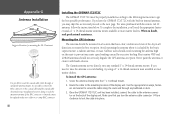
... the GPS antenna:
1. Use the appropriate tie-wraps, fasteners and sealant to avoid shading, try using a 1" x 14-thread extension mast available at most marine dealers.
To complete the installation, you turn the antenna cable connector 1/4 turn clockwise to the antenna connector on or crimp BNC connector.
88
Installing the GPSMAP 172/172C
The GPSMAP 172/172C...
Owner's Manual - Page 102
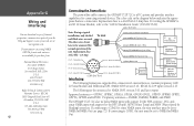
...connection of external devices: Garmin proprietary GSD 20 Sonar Module and Differential GPS, NMEA 0183 version 3.01, RTCM SC-104 input (version 2.0).
The GPSMAP 172/172C also includes NMEA input... our web site at
www.garmin.com. Appendix G
Wiring and Interfacing
You can download a copy of Garmin's proprietary communication protocol from :
National Marine Electronics Association (NMEA) Seven ...
Similar Questions

Can't Get My Garmin Map 172c To Show Maps From My Garmin Bluechart Card
(Posted by magicach 9 years ago)

Garmin Gps 172c Will Not Locate Satellites
(Posted by kapatgamus 10 years ago)

In Uk Where Repair Gps 172c Rom Failure
gps 172c was very slow to aquire sats; now every time power up map and gps steady but compass way of...
gps 172c was very slow to aquire sats; now every time power up map and gps steady but compass way of...
(Posted by davidriley100 11 years ago)

Does A Garmin Gpsmap 750s Need Its Own Power When Connected To A Nmea2000 Bus?
(Posted by 56stewart 11 years ago)

Gpsmap 3206 Looking For An Updated Data Card.
(Posted by laurence 12 years ago)