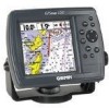
Garmin GPSMAP 172C Support Question
Garmin GPSMAP 172C Support Question
Find answers below for this question about Garmin GPSMAP 172C - Marine GPS Receiver.Need a Garmin GPSMAP 172C manual? We have 2 online manuals for this item!
Question posted by davidriley100 on March 29th, 2013
In Uk Where Repair Gps 172c Rom Failure
gps 172c was very slow to aquire sats; now every time power up map and gps steady but compass way off heading; power up on test showed ROM Failure
Current Answers
Related Garmin GPSMAP 172C Manual Pages
Owner's Manual - Page 3
...GPSMAP 172 and GPSMAP 172C (color). This manual is protected under the United States of Garmin GPS and full-featured mapping...44 (0) 870.8501241 (outside the UK) or
0808 2380000 (within the UK).
You agree not to ...GPSMAP 172/172C.
Keep the original
sales receipt, or a photocopy, in and to
any questions while using your new navigation system, take the time to create an unsurpassed marine...
Owner's Manual - Page 4
...
•
Reorient or relocate the receiving antenna.
•
Increase the separation between the equipment and the receiver.
•
Connect the equipment into... any user-serviceable parts.
Repairs should only be determined by turning the equipment off and on a different circuit from the GPS unit.
•
Consult...tested and found to radio communications if not installed and used in...
Owner's Manual - Page 6
...failures due to any package purchased through online auctions are not eligible for warranty repairs... number.
Introduction Warranty and Serial Number
The Garmin GPSMAP 172/172C has no charge to the customer for parts or...Business Park, Southampton, Hampshire, SO40 9RB UK Tel. +44 (0) 870.8501241 (outside of intended distribution.
Such repairs or replacement will , at no user-serviceable...
Owner's Manual - Page 8
... A/C, PC Adapter • EURO A/C, PC Adapter • UK A/C, PC Adapter • Cigarette Lighter Adapter • BlueChart Marine Data Cards, MapSource CDs, USB Data Card Programmer, and Data Cards • GSD 20 Remote Sounder Module • GBR 23 Beacon Receiver for differential corrections
Standard Package: • GPSMAP 172/172C Unit • GA 29 Remote External Antenna...
Owner's Manual - Page 9

...Receiver 4 Power On/Screen Backlighting 6 Simulator Mode 7 Main Pages 8 Map Page 8 Waypoints 10
Marking Waypoints 10 Using the NAV Key 11 Simulated Tour 12
Reviewing/Creating Map Waypoints . . . . . 13 Compass... Options 52
Main Menu Page 53 GPS Tab 54 Tide Tab 58 Trip... LORAN TD 78 Appendix B: Time Offsets 80 Appendix C: Messages 81 Appendix D: Map Datums 83 Appendix E: Navigation Terms...
Owner's Manual - Page 12

...-up list of options for a highlighted field.
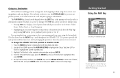
The GPSMAP 172/172C's advanced keypad system is called "highlighting", selecting or choosing ...GPSMAP 172/172C. Getting Started Selecting Options
Options Menu with function buttons, like the 'New Map Waypoint' page, you observe functions such as 'Show Map', 'Delete' and 'OK'. Use the ARROW KEYPAD to the previous setting.
The GPSMAP 172/172C...
Owner's Manual - Page 15
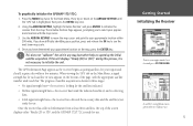
... appears on the bottom of the screen displays either "Ready (2D or 3D)", and the GPSMAP 172/172C is collecting data.
• Solid signal strength bars- Once the receiver has collected information from the map.
To graphically initialize the GPSMAP 172/172C:
1. Press the MENU key twice for your approximate location and press ENTER/MARK. The...
Owner's Manual - Page 16
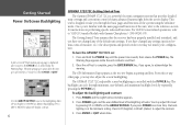
... Light/Contrast window appears.
2. If you have changed any settings (position formats, units of the system using the simulator mode.
Once the self-test is a powerful electronic navigation system that the receiver has been properly installed and initialized, and you press POWER one more time, the backlighting is controlled with Garmin Chartplotters" (190-00241-03).
Owner's Manual - Page 17
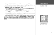
... Started Simulator Mode
A "Running Simulator" message appears at the top of the GPSMAP 172/172C's system also features an options page, which gives you access to the retail ...GPS' tab is retained in mind that relate to the specific page you 're ready to highlight the 'Start Simulator' option and press ENTER.
Choose 'No' to other functions and features that the GPSMAP 172/172C...
Owner's Manual - Page 21
...be used in two primary ways:
• Pressing NAV once...map item as waypoints and navigating to them using the first method. This also shows...GPSMAP 172/172C position in the simulator setup window and press ENTER. 4. On the Enter Position window, press ENTER then use the ENTER/MARK key to store our present position, so it's time... using the receiver's steering guidance and map displays. You...
Owner's Manual - Page 24
...Map/Sonar Page and Sonar Page are displayed (see . (See pages 25-26) for changing the types of data.)
Let's move , but the arrow does not appear. The compass ring and pointer arrow work independently to show... the PAGE key three times. (When using the GPSMAP 172/172C in order for precision navigation to your direction of steerage. Because the compass rings uses GPS technology, you move on...
Owner's Manual - Page 33
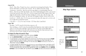
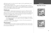
... - (172C) For Sun, For Dark (172) Water Mode, Land Mode
Source Tab
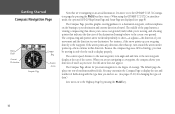
Basemap- The 'Data Card Maps' option box shows a list of the name and press ENTER to the left of the optional BlueChart/ MapSource data loaded on the screen. for each area or to a north heading; North Up- Data Card Maps- To select/deselect a map...
Owner's Manual - Page 40
...or depth.
30
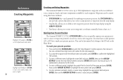
Creating and Using Waypoints
The Garmin GPSMAP 172/172C stores up to select a map position or map item from a chart, etc.). Waypoints can be... created using the ARROW KEYPAD.
• Text Entry- used primarily for the new waypoint. 2. This can be determined by looking at the GPS...
Owner's Manual - Page 68
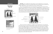
... data fields below ). The Mean Lower Low Water (MLLW) appears as a shaded area, with the current time box at midnight. The numbers on 172C). A solid, vertical line (with higher tides being referenced, and the date.
shows a graphical chart which the tide changes starting in a 24 hour span starting at the top) will indicate...
Owner's Manual - Page 75
...'Show on Map'. • Create Waypoint: If you have the ability to input a caller's name, if it is specific to send and receive NMEA data from another user's DSC capable VHF/GPS ... reference once it does not sound on a Position Report. When the Garmin GPSMAP 172/172C is received. Any DSC-equipped mariner (on Map: If you immediately want to create a waypoint of contact is like a
phone...
Owner's Manual - Page 81
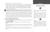
... using a map or chart that of the
GPSMAP 172/172C match that specifies a different datum. Using this setting may result in calculating heading information. The default setting is
displayed on the map or
chart... on pages 83-84), you should be displayed somewhere on the GPSMAP 172/172C. Failure to enter the magnetic variation at your present position. I
The Units tab settings affect how...
Owner's Manual - Page 88
...coordinates, you must have a collection of a mariner, the system is a radio navigation aid ...LORAN TD Feature
The LORAN TD (Time Delay) feature eases the transition ...receiving LORAN signals. Using the LORAN TD Format
When creating new waypoints using GPS....-C is used as TDs. Since the GPSMAP unit does not rely on the LORAN...Failure to enter correct information could result in the Setup TD field...
Owner's Manual - Page 98
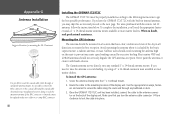
... the installation, you need the appropriate fasteners and a 1" x 14-thread marine antenna mount available at most marine dealers. Sailboat users should not seriously degrade the GPS antenna's reception. The Garmin antenna screws directly onto any bulkhead or deck.
3. If you have the GPSMAP 172/172C with a new solder-on the back of the display unit...
Owner's Manual - Page 102
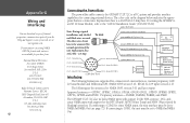
... communication protocol from :
National Marine Electronics Association (NMEA) Seven Riggs...Power/Data
The power/data cable connects the GPSMAP 172/172C to a DC system and provides interface capabilities for the DPT (Depth), MTW (Water Temp) and VHW (Water Speed & Heading) sentences. For wiring the GPSMAP...GPS, NMEA 0183 version 3.01, RTCM SC-104 input (version 2.0). The following formats...
Owner's Manual - Page 103
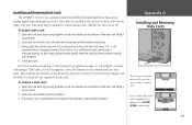
...card and reinserting it
up and open . 2.
Appendix G Installing and Removing
Data Cards
The first time you . 3. Data cards may be stored in the card slot located at the bottom of ...the card. Installing and Removing Data Cards
The GPSMAP 172/172C uses optional Garmin marine BlueChart and MapSource data cards to display digital charts and maps on the screen noting the card details when...
Similar Questions

Replacement Lcd Screen For Garmin Gpsmap 172c?
Hi, do you sell the LCD screen for the garmin GPSMAP 172C?Can you send me a price quote and availabi...
Hi, do you sell the LCD screen for the garmin GPSMAP 172C?Can you send me a price quote and availabi...
(Posted by solargongr 2 years ago)

What Type Data Card Does Garmin 172c Gps Use
(Posted by ALTEPtMech 10 years ago)

What Is A Good Gps To Replace A Garmin 172c
(Posted by arlinalliri 10 years ago)
Garmin Gps 172c Will Not Locate Satellites
(Posted by kapatgamus 10 years ago)

Garmin Gps 292 Can Not Recieve Satellite Signal
After winter pause my gps 292 garmin can not receive satellite signals. Two months ago I tried the f...
After winter pause my gps 292 garmin can not receive satellite signals. Two months ago I tried the f...
(Posted by helge 12 years ago)