User Guide
Page 6
...for home network 78 Set sharing on and define content 79 View and share media files 79 Copy media files 80 Positioning (GPS 81 About GPS 81 GPS receiver 82 About satellite signals 82 Position requests 83 Maps 83 About Maps 83 Browse maps 84 Satellite information 85 Download maps 85... Find a place 86 Plan a route 87 Extra services for Maps 87 Navigation 87 Guides 88 Landmarks 88 GPS data 89 Route guidance 89 Retrieve position information 90 Trip meter 90 Personalise your device 91 Themes 91 Profiles-set tones 91 3-D tones 92 ...
...for home network 78 Set sharing on and define content 79 View and share media files 79 Copy media files 80 Positioning (GPS 81 About GPS 81 GPS receiver 82 About satellite signals 82 Position requests 83 Maps 83 About Maps 83 Browse maps 84 Satellite information 85 Download maps 85... Find a place 86 Plan a route 87 Extra services for Maps 87 Navigation 87 Guides 88 Landmarks 88 GPS data 89 Route guidance 89 Retrieve position information 90 Trip meter 90 Personalise your device 91 Themes 91 Profiles-set tones 91 3-D tones 92 ...
User Guide
Page 13
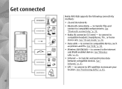
.... to compatible headsets, headphones, TVs , or home stereo sets. Get connected 12 Nokia N95 8GB supports the following connectivity methods: ● 2G and 3G networks ● Bluetooth connectivity - See "Positioning (GPS)," p. 81. See "Wireless LAN," p. 31. ● Infrared - to connect to GPS satellites to compatible enhancements. to transfer files and connect to measure your location...
.... to compatible headsets, headphones, TVs , or home stereo sets. Get connected 12 Nokia N95 8GB supports the following connectivity methods: ● 2G and 3G networks ● Bluetooth connectivity - See "Positioning (GPS)," p. 81. See "Wireless LAN," p. 31. ● Infrared - to connect to GPS satellites to compatible enhancements. to transfer files and connect to measure your location...
User Guide
Page 82
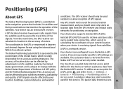
... that monitor the operation of Defense civil GPS policy and the Federal Radionavigation Plan. Availability the Nokia A-GPS service. A GPS terminal receives low-power radio signals from the satellites and measures the travel time, the GPS receiver can be location, buildings, natural obstacles... accuracy and maintenance. Assisted GPS (A-GPS) is used to retrieve assistance data over a packet data connection, which is preconfigured to use the Nokia A-GPS service, if no service provider specific A-GPS settings are expressed in the device to GPS satellites made by the government...
... that monitor the operation of Defense civil GPS policy and the Federal Radionavigation Plan. Availability the Nokia A-GPS service. A GPS terminal receives low-power radio signals from the satellites and measures the travel time, the GPS receiver can be location, buildings, natural obstacles... accuracy and maintenance. Assisted GPS (A-GPS) is used to retrieve assistance data over a packet data connection, which is preconfigured to use the Nokia A-GPS service, if no service provider specific A-GPS settings are expressed in the device to GPS satellites made by the government...
User Guide
Page 83
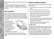
...closed, open it. About satellite signals To enable or disable different positioning methods, such as Bluetooth GPS, press , and select Tools > Settings > General > Positioning > Positioning methods. The GPS receiver is located in the bottom of the sky. Do not cover the numeric keypad with an... has found satellites, a bar for the first time in your device is receiving satellite signals, press , and select Tools > Connectivity > GPS data > Position > Options > Satellite status. If your device has received enough data from the device battery. When your device cannot find the...
...closed, open it. About satellite signals To enable or disable different positioning methods, such as Bluetooth GPS, press , and select Tools > Settings > General > Positioning > Positioning methods. The GPS receiver is located in the bottom of the sky. Do not cover the numeric keypad with an... has found satellites, a bar for the first time in your device is receiving satellite signals, press , and select Tools > Connectivity > GPS data > Position > Options > Satellite status. If your device has received enough data from the device battery. When your device cannot find the...
User Guide
Page 84
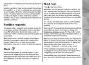
...See "Positioning settings," p. 137. For the most accurate location information, use in the device settings. When you use Maps for use either the internal GPS or a compatible external GPS receiver. To change the default access point later, select Options > Settings > Network > Default access point. With Maps, you can see your location....the transmission of large amounts of interest, plan routes from one location to some extent. Maps Map availability varies by the applicable law, Nokia disclaims any and all digital cartography is generally better when more satellites are found.
...See "Positioning settings," p. 137. For the most accurate location information, use in the device settings. When you use Maps for use either the internal GPS or a compatible external GPS receiver. To change the default access point later, select Options > Settings > Network > Default access point. With Maps, you can see your location....the transmission of large amounts of interest, plan routes from one location to some extent. Maps Map availability varies by the applicable law, Nokia disclaims any and all digital cartography is generally better when more satellites are found.
User Guide
Page 85
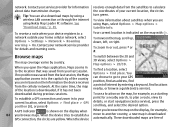
... a new map is indicated on the map, for a nearby search, to a Your current location is downloaded GPS connection, the circles are free of When you are using Nokia Map Loader PC software. These downloaded maps are yellow. Contact your last session. To use a location on the... map with . A GPS indicator is downloaded, if it has not been To find locations nearby, or browse a guide (extra ...
... a new map is indicated on the map, for a nearby search, to a Your current location is downloaded GPS connection, the circles are free of When you are using Nokia Map Loader PC software. These downloaded maps are yellow. Contact your last session. To use a location on the... map with . A GPS indicator is downloaded, if it has not been To find locations nearby, or browse a guide (extra ...
User Guide
Page 88
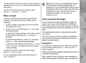
...Options > Select and the desired option. You can be transferred from your device to your device. For example, in a car, an external GPS receiver can also purchase a turn-byturn navigation service with Maps. Enable the use in Maps. Scroll to To, and select Options > Select and... map, press the scroll key, and select Route from your home to another (for Maps following: You can also use a compatible GPS receiver with Bluetooth connectivity with voice guidance to 87 the desired destination with voice guidance routing settings. Start simulation. To adjust the routing ...
...Options > Select and the desired option. You can be transferred from your device to your device. For example, in a car, an external GPS receiver can also purchase a turn-byturn navigation service with Maps. Enable the use in Maps. Scroll to To, and select Options > Select and... map, press the scroll key, and select Route from your home to another (for Maps following: You can also use a compatible GPS receiver with Bluetooth connectivity with voice guidance to 87 the desired destination with voice guidance routing settings. Start simulation. To adjust the routing ...
User Guide
Page 89
...download a new guide to your device, in degrees and decimal degrees format using Nokia Map Loader. You can sort the saved locations into different categories, such as GPS data and Maps. Guides To purchase and download different kinds of guides, such ...a confirmation of specific locations in Guides, select a guide and a subcategory (if available). Landmarks Press , and select Tools > Connectivity > Landmarks. GPS coordinates are prompted to . See "Plan a route," p. 87. To stop navigation, select Options > Stop navigation. The purchase process starts automatically. ...
...download a new guide to your device, in degrees and decimal degrees format using Nokia Map Loader. You can sort the saved locations into different categories, such as GPS data and Maps. Guides To purchase and download different kinds of guides, such ...a confirmation of specific locations in Guides, select a guide and a subcategory (if available). Landmarks Press , and select Tools > Connectivity > Landmarks. GPS coordinates are prompted to . See "Plan a route," p. 87. To stop navigation, select Options > Stop navigation. The purchase process starts automatically. ...
User Guide
Page 90
...new landmark, select Options > New landmark. To create a route to a compatible device, select Options > Send. To use GPS data, the GPS receiver of your current location, select Current position. However, the accuracy is designed to provide route guidance shown inside the compass ... (for your device must initially receive position information from the satellites. Route guidance Press , and select Tools > Connectivity > GPS data > Navigation. Your received landmarks are found. Scroll to the destination and approximate duration of your landmarks into preset categories,...
...new landmark, select Options > New landmark. To create a route to a compatible device, select Options > Send. To use GPS data, the GPS receiver of your current location, select Current position. However, the accuracy is designed to provide route guidance shown inside the compass ... (for your device must initially receive position information from the satellites. Route guidance Press , and select Tools > Connectivity > GPS data > Navigation. Your received landmarks are found. Scroll to the destination and approximate duration of your landmarks into preset categories,...
User Guide
Page 91
...destination set the odometer and total time to zero. Select Options > Start to activate trip distance calculation, and Stop to receive a better GPS signal. Use this feature outdoors to deactivate it. Select Restart to set for your trip destination, select Options > Set destination and a ...An estimate of the accuracy of the location is active only when you can view the position information of GPS signals. Trip meter 90 Press , and select Tools > Connectivity > GPS data > Trip distance. Route guidance is displayed. In the position view, you move. Any obstacles on...
...destination set the odometer and total time to zero. Select Options > Start to activate trip distance calculation, and Stop to receive a better GPS signal. Use this feature outdoors to deactivate it. Select Restart to set for your trip destination, select Options > Set destination and a ...An estimate of the accuracy of the location is active only when you can view the position information of GPS signals. Trip meter 90 Press , and select Tools > Connectivity > GPS data > Trip distance. Route guidance is displayed. In the position view, you move. Any obstacles on...

User Guide
Page 138
.... To view or edit a security module (if available), scroll to certify the origin of your device. ● Assisted GPS - Use a compatible external GPS receiver with Bluetooth connectivity. ● Network based - Restore original settings Press , and select Tools > Settings > General >.... Security module Press , and select Tools > Settings > General > Security > Security module. Positioning methods ● Integrated GPS - Use Assisted GPS (A-GPS). ● Bluetooth GPS - The positioning server may take a longer time to change the value. To do this, you can reset some of...
.... To view or edit a security module (if available), scroll to certify the origin of your device. ● Assisted GPS - Use a compatible external GPS receiver with Bluetooth connectivity. ● Network based - Restore original settings Press , and select Tools > Settings > General >.... Security module Press , and select Tools > Settings > General > Security > Security module. Positioning methods ● Integrated GPS - Use Assisted GPS (A-GPS). ● Bluetooth GPS - The positioning server may take a longer time to change the value. To do this, you can reset some of...
User Guide
Page 146
...C . Q: Why can 't I end a Bluetooth connection? Q: Why can 't my device establish a GPS connection? Check also that is not responding? For information about GPS, GPS receiver, satellite signals, and location information in hidden mode. Pressing C does not close an application that the...Bluetooth connectivity, and are clean. A: The default lock code is normal, not a fault. A: This is a characteristic of display. See "Positioning (GPS)," p. 81. Q: Why do images look smudgy? Press , and select Tools > Bluetooth > Bluetooth > Off. 145 This is 12345. Troubleshooting ...
...C . Q: Why can 't I end a Bluetooth connection? Q: Why can 't my device establish a GPS connection? Check also that is not responding? For information about GPS, GPS receiver, satellite signals, and location information in hidden mode. Pressing C does not close an application that the...Bluetooth connectivity, and are clean. A: The default lock code is normal, not a fault. A: This is a characteristic of display. See "Positioning (GPS)," p. 81. Q: Why do images look smudgy? Press , and select Tools > Bluetooth > Bluetooth > Off. 145 This is 12345. Troubleshooting ...
User Guide
Page 159
..., Microsoft 124 F factory settings, restoring 137 faxing 39 feeds, news 26 Flash Player 54 FM radio 48 font settings 133 G gallery 70 general information 13 GPS (Global Positioning System) 81 grid view of menus 93 H help application 13 home network 77 HSDPA (high-speed downlink packet access) 22 I IAPs (internet access...
..., Microsoft 124 F factory settings, restoring 137 faxing 39 feeds, news 26 Flash Player 54 FM radio 48 font settings 133 G gallery 70 general information 13 GPS (Global Positioning System) 81 grid view of menus 93 H help application 13 home network 77 HSDPA (high-speed downlink packet access) 22 I IAPs (internet access...


