
Owner's Manual
Page 4
... 6 Using the Map Pointer 7 Creating and Using Waypoints 8 Man OverBoard (MOB 10 Reviewing and Editing Waypoints 11 Navigating to a Destination 12 Creating and Using Routes 17 Find 19 Additional Information 21 DSC (Digital Selective Calling 21 AIS... Map Page 27 Compass Page 32 3D Highway Page 33 Active Route Page 36 Main Menu 37 GPS Tab 37 Tide Tab 40 Trip Tab 44 Celes (Celestial) Tab 45 Points Tab 46 Route ... Pages Tab 61 Map Tab 61 Hiway (Highway) Tab 64 Temp (Temperature) Tab 64 Sonar Tab 64 Systm (System) Tab 65 Alarm Tab 70 ii GPSMAP 392/398/492/498 Owner's Manual
... 6 Using the Map Pointer 7 Creating and Using Waypoints 8 Man OverBoard (MOB 10 Reviewing and Editing Waypoints 11 Navigating to a Destination 12 Creating and Using Routes 17 Find 19 Additional Information 21 DSC (Digital Selective Calling 21 AIS... Map Page 27 Compass Page 32 3D Highway Page 33 Active Route Page 36 Main Menu 37 GPS Tab 37 Tide Tab 40 Trip Tab 44 Celes (Celestial) Tab 45 Points Tab 46 Route ... Pages Tab 61 Map Tab 61 Hiway (Highway) Tab 64 Temp (Temperature) Tab 64 Sonar Tab 64 Systm (System) Tab 65 Alarm Tab 70 ii GPSMAP 392/398/492/498 Owner's Manual
Owner's Manual
Page 72
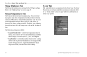
...; Log and Graph Scale-controls the temperature range for more information on page 33. Refer to the "Highway Page" section on sonar setup options. 64 GPSMAP 392/398/492/498 Owner's Manual The temperature log requires input from a temperature transducer/sensor or from a connected NMEA device that provides temperature data. Refer to the...
...; Log and Graph Scale-controls the temperature range for more information on page 33. Refer to the "Highway Page" section on sonar setup options. 64 GPSMAP 392/398/492/498 Owner's Manual The temperature log requires input from a temperature transducer/sensor or from a connected NMEA device that provides temperature data. Refer to the...
Owner's Manual
Page 113
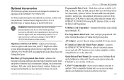
... MB, 64 MB, 128 MB, and 256 MB sizes. USB Data Card Programmer-programs blank data cards at 44-0870-8501241. WARNING: Garmin accessories have not been tested or approved for use with Garmin products. Full-color aerial photos of ports, marinas, bridges, and navigational landmarks are..., or other manufacturers have been designed and specifically tested for use with Garmin products. Press the side clips to release the Fishfinder so you . GPSMAP 392/398/492/498 Owner's Manual APPENDIX > OPTIONAL ACCESSORIES Programmable Data Cards-blank data cards are available in...
... MB, 64 MB, 128 MB, and 256 MB sizes. USB Data Card Programmer-programs blank data cards at 44-0870-8501241. WARNING: Garmin accessories have not been tested or approved for use with Garmin products. Full-color aerial photos of ports, marinas, bridges, and navigational landmarks are..., or other manufacturers have been designed and specifically tested for use with Garmin products. Press the side clips to release the Fishfinder so you . GPSMAP 392/398/492/498 Owner's Manual APPENDIX > OPTIONAL ACCESSORIES Programmable Data Cards-blank data cards are available in...
Owner's Manual
Page 117
... vi clock alarm 70 clutter 74 color 73 color bar 77 communication tab 68 compass page 32 conventions i course line 62 course up 62 GPSMAP 392/398/492/498 Owner's Manual D data cards 94 data entry 6 date/time 95 daylight saving time 68 delete DSC directory item 23 depth line 76 dilution...;sh symbols 74, 81 flasher page 84 frequency 200 kHz 72 50 kHz 72 G gain 75 gain setting 74 garmin data transfer 68 go to 13 distress call 24 position report 24 GPS tab 37 options 39 H hard bottom 84 heading line 62 Highway Page, 3D 33 options 35 highway tab...
... vi clock alarm 70 clutter 74 color 73 color bar 77 communication tab 68 compass page 32 conventions i course line 62 course up 62 GPSMAP 392/398/492/498 Owner's Manual D data cards 94 data entry 6 date/time 95 daylight saving time 68 delete DSC directory item 23 depth line 76 dilution...;sh symbols 74, 81 flasher page 84 frequency 200 kHz 72 50 kHz 72 G gain 75 gain setting 74 garmin data transfer 68 go to 13 distress call 24 position report 24 GPS tab 37 options 39 H hard bottom 84 heading line 62 Highway Page, 3D 33 options 35 highway tab...

Owner's Manual
Page 118
...97 MOB 10 N narrow beam 72 NAV/MOB Key 5, 12 navaids 63 navigating 12 distress call 24 Go To 13 position report 24 routes 18 TracBack 14 navigation terms 98 NMEA 70 north up 62 O off course alarm 71 orientation 62 ...soft bottom 84 sonar 72 depth line 76 understanding 72 whiteline 76 Sonar Page 74 adjustment menu 75 sonar tab 64 options 79 sound waves 72 specifications 86 speed filter 65 split when zoomed 77 storage vi... system information 65 system tab 65 T temperature 82 temperature graph 77 temperature scale 64 temperature tab 63 thermoclines 83 GPSMAP 392/398/492/498 Owner's Manual
...97 MOB 10 N narrow beam 72 NAV/MOB Key 5, 12 navaids 63 navigating 12 distress call 24 Go To 13 position report 24 routes 18 TracBack 14 navigation terms 98 NMEA 70 north up 62 O off course alarm 71 orientation 62 ...soft bottom 84 sonar 72 depth line 76 understanding 72 whiteline 76 Sonar Page 74 adjustment menu 75 sonar tab 64 options 79 sound waves 72 specifications 86 speed filter 65 split when zoomed 77 storage vi... system information 65 system tab 65 T temperature 82 temperature graph 77 temperature scale 64 temperature tab 63 thermoclines 83 GPSMAP 392/398/492/498 Owner's Manual